|
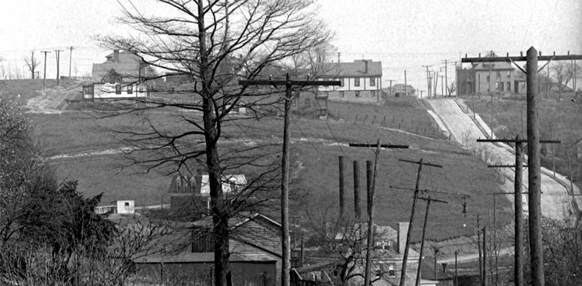
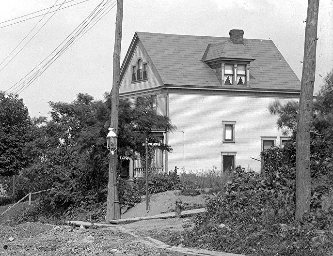
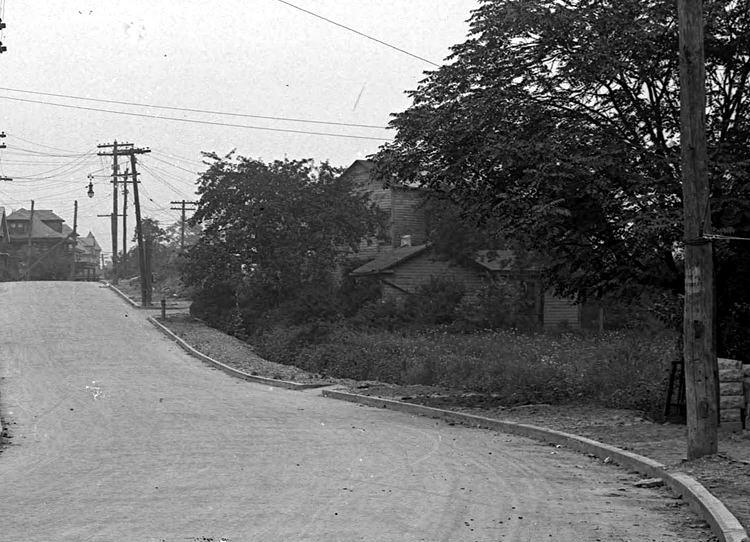
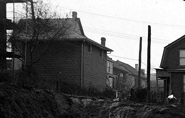
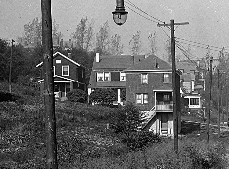
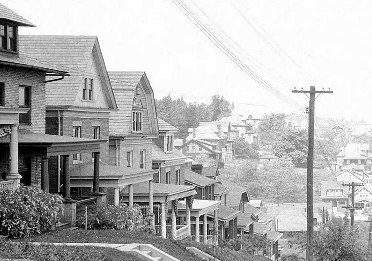
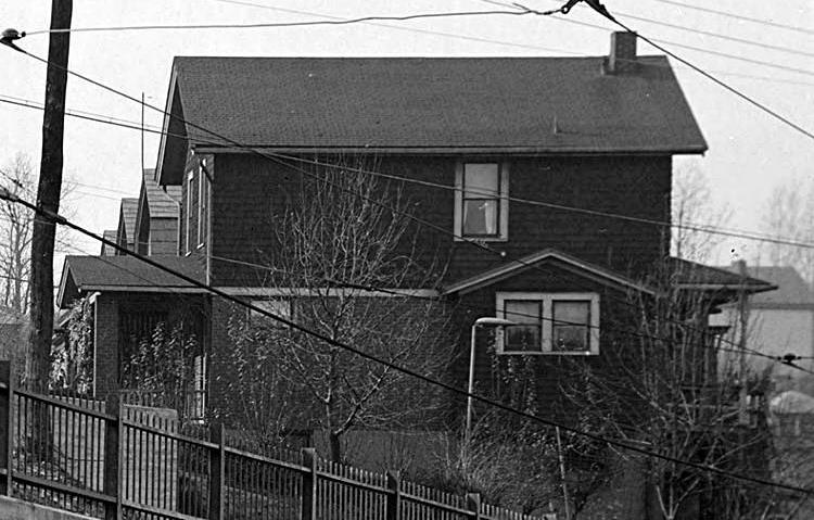
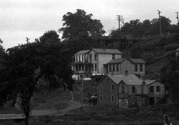
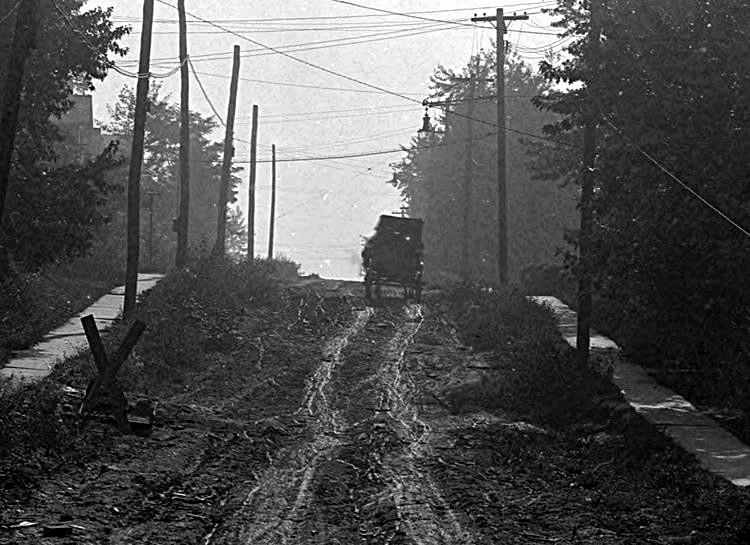
Homes stand in the distance on Winterhill
and Plainview Avenues, as seen from Wenzell Avenue in Beechview, in 1913.
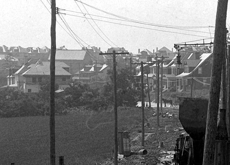
That's Brookline Boulevard (now Bodkin Street) going uphill to the right from
West Liberty Avenue to Pioneer Avenue.
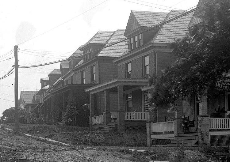
Residential development began to take
hold in Brookline in the early 1900s. The first housing plans were the
Fleming Place Plan, the Hughey Farms Plan and the Paul Place Plan. By the
1920s the neighborhood had grown considerably, and the need for better
infrastructure and roads led the city to embark upon a massive project
to upgrade it's outlying communities. Shown here are a random collection of
images showing street scenes throughout Brookline over the past
century.
♦ Brookline Random Street Scenes
(Aidyl to Freedom) ♦
Click on images
for larger pictures

A PAT bus traveling along Pioneer Avenue, near
Paul Place and Moore Park.

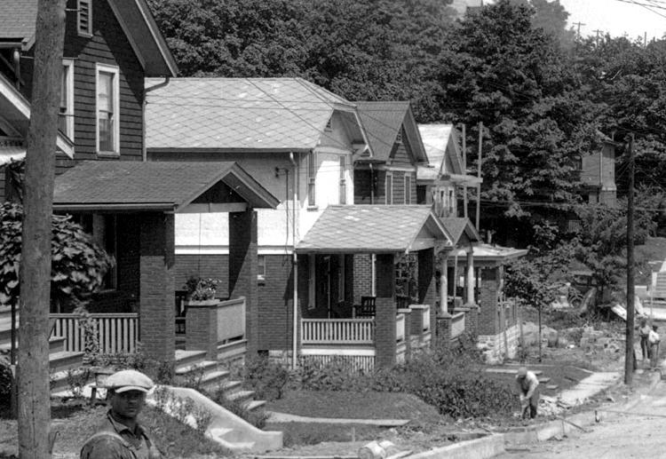
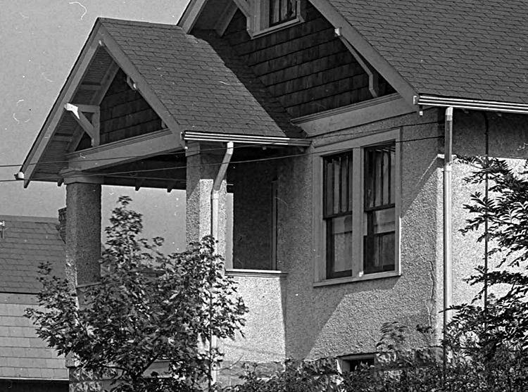
Gallion Avenue
A view of Gallion between Pioneer and Beaufort
Avenues (left), and a home at the corner of Gallion and Beaufort, in 1916.
The children to the left are standing in the Brookline Elementary School
garden.
 
Beaufort Avenue rising from Gallion towards
Berwin (left), and a home on the corner of Beaufort and Gallion, in 1916.
 
A Gallion Avenue home at the bottom of
Wedgemere Avenue, and the walkway, "The Short Cut," that goes through
to Berwin Avenue (left), and a view of Gallion Avenue (to the right), as seen
from Rossmore Avenue, in 1925.
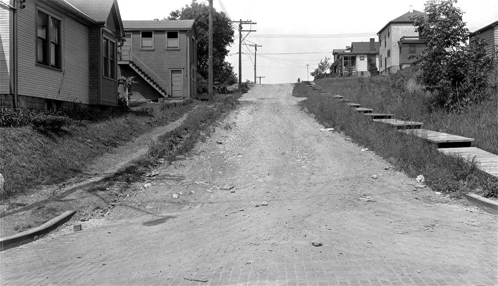
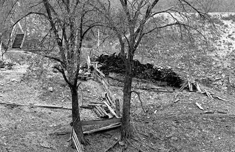
Glenbury Street

The city steps at the bottom of Glenbury
Avenue, shown here on June 12, 1970.
Greencrest Drive

New home construction along the 1500 block of
Greencrest Drive, shown here in the July 26, 1942 Post-Gazette.

Real estate ad published on
November 29, 1942 in the Post-Gazette.

1565 Greencrest Drive from a real estate
ad published on November 8, 1945 in the Post-Gazette.
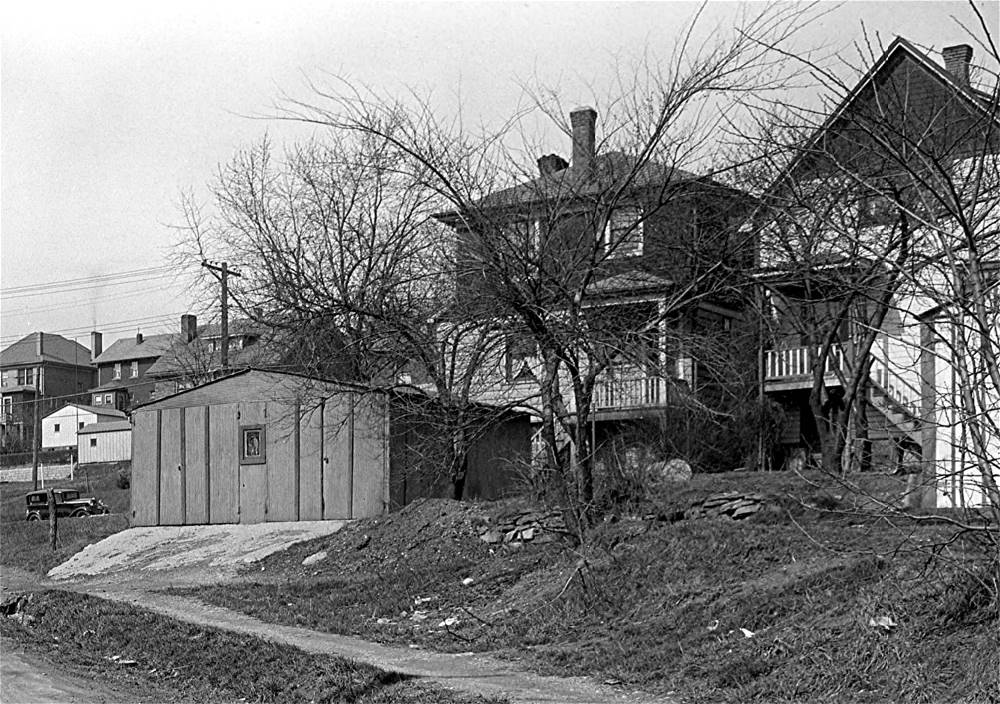
Harcor Drive

Pittsburgh Sun-Telegraph advertisement for the
"Honeymoon Bungalow" at 1701 Harcor Drive.

Kids gather outside 1738 Harcor Drive
(circa 1955). Nancy Joyce Fenton photo.
Hobson Street

Looking down Hobson Street, from Chelton
Avenue, on July 28, 1953.
Jacob Street

The home at 2016 Jacob Street under construction,
published on December 30, 1945 in the Post-Gazette.
Jillson Avenue
A view of Jillson Avenue and other streets in
the Fleming Place Plan, as seen from Vodelli Street in Beechview,
in 1921 (left), and a view of homes at the corner of Jillson and
Shawhan Avenue (right) in 1935.

The rear of homes along Jillson Avenue at
the intersection with Shawhan Avenue in July 1935.
 
Homes along Jillson Avenue in 1935.
 
The lower intersection of Jillson Avenue and
Brookline Boulevard in 1963 (left) and 1966.
Kenilworth Avenue
 
Homes along Kenilworth Avenue, both inside
the Boulevard Loop (left), and outside the loop (right), in 1935.
When the Boulevard was rerouted onto the trolley loop, Kenilworth Avenue
was cut in two.
There is also third section of Kenilworth Avenue along Pioneer
Avenue.

Some Kenilworth Avenue homes inside the
Boulevard Loop, off of Jillson Avenue, in 1915.
LaMarido Street

Mrs. Mildred Stewart of LaMarido Street
prepares for a drive in the snow (circa 1935).
Mrs. Mildred Stewart and Donald Glunt
on LaMarido Street in 1954.

Reverend Stewart and his son John on LaMarido
Street in 1954.
LaMarido Street in 1967.

LaMarido Street, looking down towards the
intersection with Hartranft Street, in 1978.
Lariat Way

The rear of homes along Woodbourne Avenue
between the intersection with Bay Ridge and Sussex Avenues (left)
on April 5, 1933. The alley behind the homes is Lariat Way.
 
Lariat Way looking towards Queensboro (left)
and Sussex Avenue on August 14, 1934.

The backyard and garage of Fred Doerzbacher,
the original Brookline Plumber, stands along Lariat Way on August 14, 1934.
Doerzbacher began the business out of this garage in 1905, and operated from
this location until the 1920s,
when the business moved to a new location along Brookline Boulevard.
Linial Avenue
 
Homes along Linial Avenue, near Timberland
Avenue, in 1909.
London Town Drive

Artist's conception of the London Towne
development - Pittsburgh Press - January 14, 1979.

Pittsburgh Press - August 12, 1979.
Press clippings, dating from January 1979 to
August 1986, regarding the London Town housing development in Brookline, located on
6.8 acres along Pioneer and Cadet Avenues.
Accompanying text provided the following
details:
The complex sits adjacent to the South Busway,
and also near the south end of the Liberty Tunnels, giving owners accessible
transportation to downtown Pittsburgh in a matter of minutes.
Developed by Concept Realty Enterprises, Inc.,
owned by Joseph F. Nascone and David Sullivan. At the time, the 70-unit townhouse
project was considered unique in that it was a planned unit development, but not a
condominium. All units were subdivided and sold “fee simple” with no common ownership.
Prices ranged from the mid-60,000 to the mid-70,000s.
London Towne is a series of three-story brick
buildings, with four distinct models. Each unit had electric heat pumps for heating
and air conditioning, measured from 1800 to 2100 square feet, and came with built-in
kitchens, carpeting, private patio or deck, one-or-two car garages, full basements
with optional finished family room and optional wood-burning fireplaces. All are
three bedrooms with 2 1/2 baths.
Infrastructure construction began in 1977.
The buildings were erected in three phases. The first phase included twenty-two
units, followed by a second phase of twenty-eight followed by a third one of twenty.
London Towne cost $5 million to build, with financing provided by Century Federal
Savings and Loan Association.
The London Towne Homeowners Association was
established to handle lawn care and exterior maintenance, with each owner paying a
monthly fee for the service.
The grand opening of Phase One was held in
August 1979, followed by Phase Two in August 1981. Phase Three construction began
in July 1983, at which time the price per unit had risen to between $82,500 and
$92,500. By August of 1986, Howard Hanna ads list only five units remaining to
be sold.
Interestingly, the 6.8 acres of land on which
the London Towne development sits was formerly owned, for over a century, by the
family of Catherine Lang. The Lang family were prominent in West Liberty Borough
and principal partners in the formation of the Brookline community.

Pittsburgh Press - August 27, 1981.

Pittsburgh Press - August 14, 1986.

Google Aerial view of the London Towne
development from 2022.
Mayville Avenue

Looking towards the home at 761 Mayville
Avenue in 1949, near the corner with LaMoine Street.

The corner of Mayville Avenue and Hartranft
Street in the 1970s.
Merrick Avenue

The afternoon sun casts long shadows along
Merrick Avenue on November 16, 2020.
The view is looking from Freedom Avenue towards Hobson Avenue.
Milan Avenue

The Kapsch family lived at 1114 Milan
Avenue. Joseph and Amelia Kapsch both immigrated from Austria and
settled in Brookline in 1906. They were farmers and the family was one of the
original twelve members
of Resurrection Parish. The picture shows some of the Kapsch children: Amelia,
Marie, Josephine,
Joseph and John, with their donkey in 1909. The family grew to eleven with the
addition of
Theodore, Leonard, Agnes, Lillian, Alfred and James. Agnes married Fred Daley
and
owned the Park Side Grill on Brookline Boulevard from 1948 to 1965.
The Kapsch family home at 1114 Milan Avenue
in 1911.
Northcrest Drive

Northcrest Drive, under construction in circa-1955,
looking towards Pioneer Avenue.
Norwich Avenue
The home at 905 Norwich Avenue (left) in 1927
during construction. and the foundation of 903 Norwich, soon to be
to the Tintelnot family. At right is the Tintelnot family vehicle, in front of their
home, in 1928.
Standing by the car is the brother and grandmother of Marion Tintelnot.

Mrs. Tintelnot sits on the front porch of her new
home at 903 Norwich Avenue, shortly after construction, in 1928.
 
The rear of Norwich Avenue homes, as seen from
Queensboro Avenue at Viaduct Way, on June 17, 1931 (left) and
the rear of Norwich Avenue homes, as seen from Queensboro and Fordham Avenues,
on May 5, 1933.

Children sled riding along Norwich Avenue,
near Queensboro Avenue, on March 12, 1934.

The Stengel brothers, James Gillespie and
other members of James Cowan's Boy Scout Troop collecting
scrap goods and other items for the war effort along Norwich Avenue in
1945.
Oakridge Street
 
The backyard of a Creedmoor Avenue home,
as seen from Oakridge Street (left), and a view
looking uphill towards the intersection with Creedmoor Avenue,
in 1919.

The home at 1644 Oakridge Street was one
of four homes built on the Oakridge extension in Brookdale.
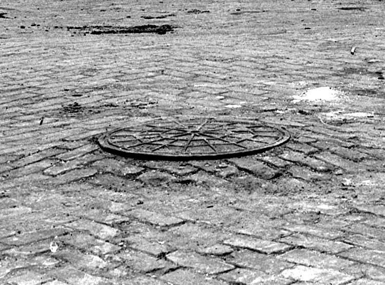 
A manhole cover at the Oakridge/Chelton
intersection (left), and a view of Oakridge Street
between Chelton Avenue and Creedmoor Avenue, in 1919.

The 1200 block of Oakridge
Street, looking towards Merrick from Breining Street, in 1963.
Pioneer Avenue

Homes along the 3100 block of Pioneer Avenue,
as seen from West Liberty Avenue, at the turn of the 20th century. The
large estate home to the left, owned by Senator J.E. Fulton, and the leftmost
of the four homes to the right were
torn down to build the Bell Telephone Building. The other three homes are still
standing at 3129, 3125 and 3121
Pioneer Avenue. The utility poles along West Liberty are visible to the
left.
 
Train cars on the loading platform at the
lower end of Pioneer Avenue in 1915.
 
Walking board sidewalks were commonplace
along Pioneer Avenue in 1916.
Homes across from the Woodbourne Avenue
intersection (left), and the home at the corner of Woodbourne, in 1916.
Homes across from the Berkshire Avenue
intersection (left), and the home at the corner of Berkshire, in 1916.
 
A Pioneer Avenue home (left), and a view of
the roadway between Kenilworth Avenue and Dorchester Avenue, in 1916.

A view of West Liberty Elementary School and
homes along Pioneer, Plainview and Woodward Avenues,
as seen from Shiras Avenue in Beechview, in 1921.
Views from Kenilworth Avenue showing the
McNeilly Road intersection (left), and the condition of the roadway between
Kenilworth and Waddington, in 1916. St. Pius parish church and BRC
school are today located where the trees stand.
 
The walkway between Berkshire and Woodbourne
in 1916 (left), and a home at the lower end of Pioneer Avenue in 1924.
 
A mailbox hangs on a telephone pole near
Fordham Avenue in 1921 (left), and a view from Ray Avenue looking
towards Metz Way in 1924. The square building on the left is Pioneer Avenue's
Little Store.
 
The Lang home on the lower end of Pioneer
Avenue, near the present-day intersection with Cadet Avenue (left), and a
view towards Capital Avenue and Dunster Street, in 1924. The Lang's were
prominent landowners in the early
days and owned much of the land along lower Pioneer Avenue, which was once
called Lang Avenue.

Pioneer Avenue between Ray Avenue and Bellbrook
Avenue, at the fire hydrant, in 1924.
Gayly Way is in the distance just beyond the automobile.
Looking from Chrylser Avenue towards Dunster Street
(left), and a home near the Ray Avenue steps, in 1924.
A view from Ray Avenue towards Dabney Way (left),
and homes between Ray Avenue and Bellbrook Avenue, in 1924.
A view from Ray Avenue towards Bellbrook Avenue
(left), and a train car at the loading platform on lower Pioneer, in 1924.
The home on the hillside is the Miller homestead, located along Richter Street
on the other side of the tracks.
 
A home near Capital Avenue (left), and a
truck making it's way down lower Pioneer Avenue, in 1924.
 
A view of lower Pioneer Avenue (left), and
a Marion steam shovel of the Booth and Flinn Company, in 1924.

Workers in the sewer trench near the top
of the Pioneer Avenue hill on February 28, 1924.
 
A view of the lumber yard next to the Sauter Place
homes below Pioneer Avenue (left), and the Miller homestead,
located near the lower end of Pioneer along Richter Street on the other side of
the P&WVRR train tracks. The
lumber yard and Sauter Place homes stand on the present-day location of the
Matthews Bronze complex.

Pioneer Avenue homes across from the
intersection with Rossmore Avenue in 1925.
 
The Miller homestead on Richter Street, on
the other side of the railroad tracks at the lower end of
Pioneer Avenue (left), and the busy intersection of Pioneer and Brookline
Boulevard, in 1924.

In this photo from April 1933, a baseball field
stands at the location that will, six years later, be the entrance
to Moore Park. West Liberty Elementary School stands at the top of Pioneer Avenue.
The Bob 'O Link Golf Driving Range was also located near this spot.

Looking down the 3100 block of Pioneer Avenue
from the corner with West Liberty Avenue, circa 1935.
The Bell Telephone building stands to the right and, to the left, is the Jones
Lyne Motor Company.

Pioneer Avenue circa 1935 at the intersection
with West Liberty Avenue in Dormont.
The Hunter estate at the intersection of
Brookline Boulevard and Pioneer (left), and a view from the boulevard to
Woodbourne Avenue, in 1935. Brookline Elementary School can be seen in the
photo on the right. The Hunter
family were prominent landowners in the early days. Bodkin Street was once known
as Hunter Avenue.
The Sunoco gas station at the intersection of
Brookline Boulevard and Pioneer Avenue, in 1935.
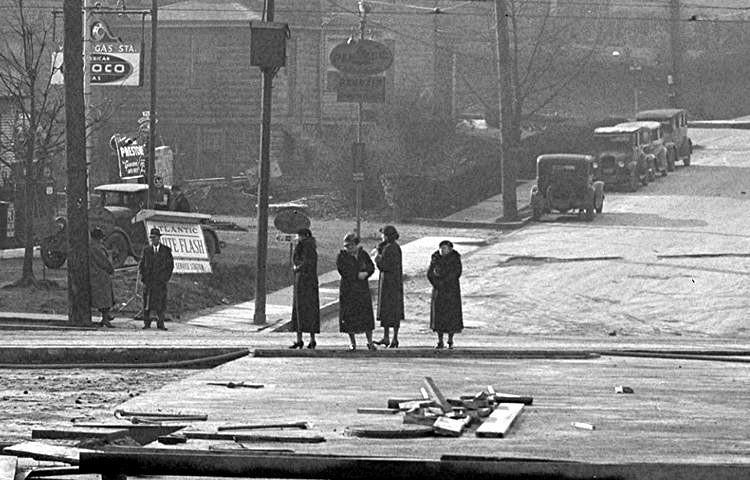 
Women wait to cross Brookline Boulevard at
Pioneer (left), and homes near the Jillson Avenue intersection, in 1935.

A view of Pioneer Avenue, near the
intersection with Brookline Boulevard, in June 1936.
 
Cars parked in the Moore Park lot (left) and
a roller on the field that will soon be the site of the playground, in 1938.
Moore Park was built between 1938 and 1940 by the Works Project Administration,
which was one of
President Franklin Roosevelt's New Deal initiatives. The WPA built several
parks in Pittsburgh.

The Texaco Station on the corner of
Brookline Bouleard and Pioneer Avenue in 1965.
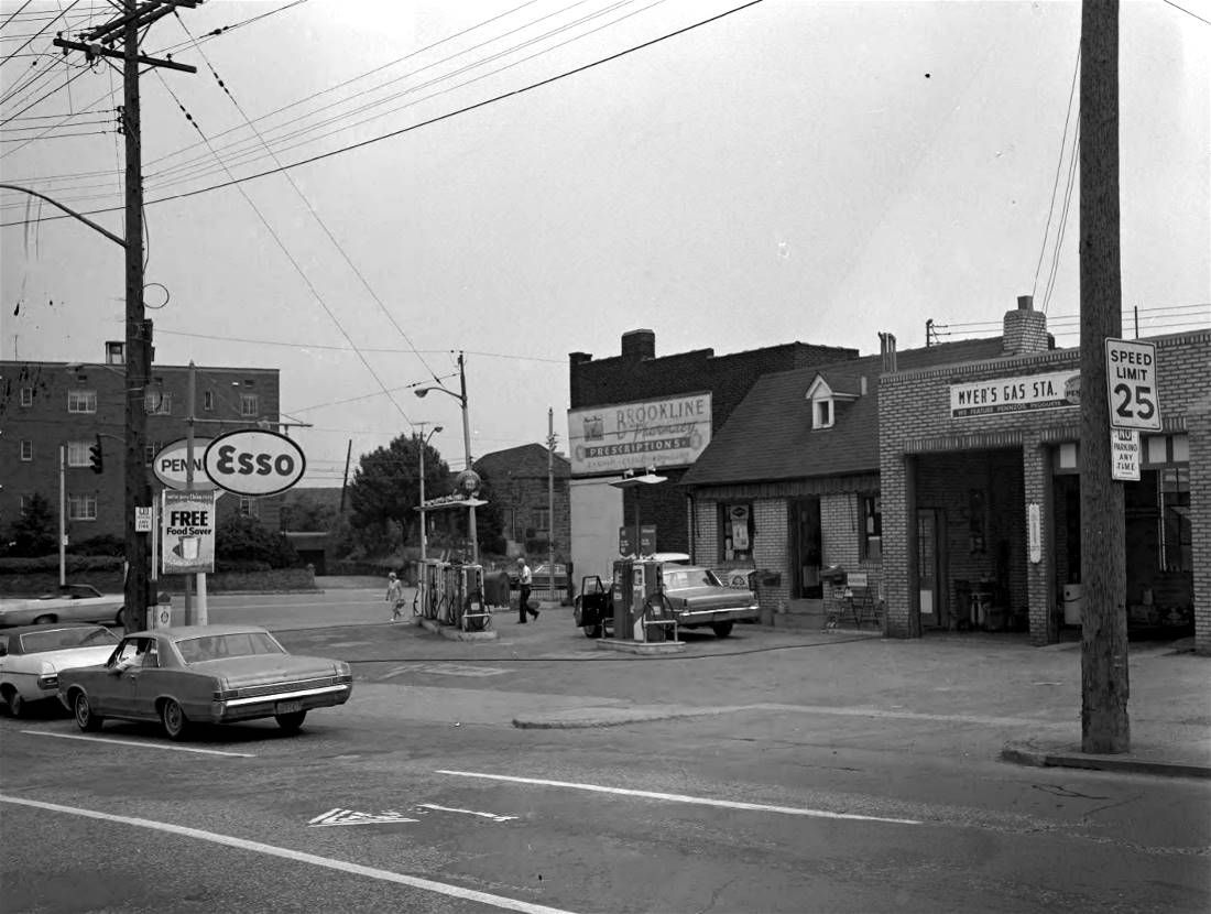 
Myer's Service Station, at the corner of Pioneer
Avenue and Brookline Boulevard, on June 20, 1970.

This is Miss DeCarlo, sitting on the porch at
1800 Pioneer Avenue, near her Italian Ice stand. Located just across
the street from the entrance to Moore Park, this was a popular stop for kids swimming or
playing at the park.

Road work on Pioneer Avenue, near the intersection
with Brookline Boulevard, on December 13, 2022.
Plainview Avenue

Engineers gather on Plainview Avenue in 1906
discussing designs for the construction of the King Place Plan, which
would consist of new homes along Plainview and Woodward Avenues, between Pioneer
and West Liberty Avenue.
The large white home below still stands along Woodward Avenue next to
the city steps at Ray Avenue.
 
Homes along Plainview Avenue near Capital
Avenue on May 16, 1932.

Mrs. Kalbaugh stands by her station wagon
on Plainview Avenue, near Stetson Street, in 1958.
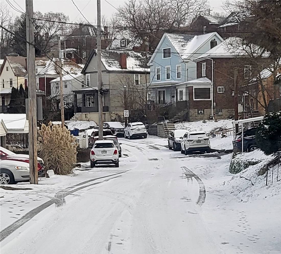
Icy road conditions along the 2000 block of
Plainview Avenue - December 18, 2022.
Queensboro Avenue
Homes along Queensboro Avenue, between Bayridge
Avenue and Woodbourne Avenue, in 1924.
Queensboro Avenue between Norwich and Fordham
Avenues in June 1931.
 
Queensboro Avenue looking downhill from Fordham
towards Norwich Avenue (left) and looking
uphill from Norwich towards Fordham on May 5, 1933.
 
Sewer line repair at the corner of Queensboro
Avenue and Berkshire Avenue (left) and looking up
the hill towards the intersection of Queensboro Avenue and Bayridge Avenue
in 1933.
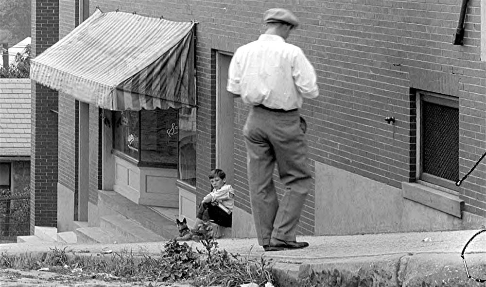 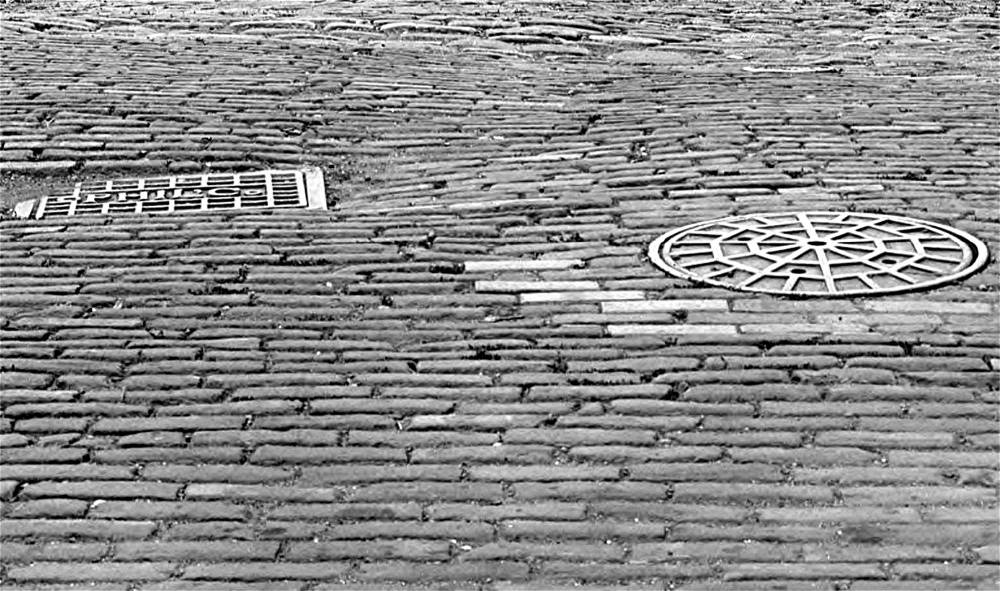
A young boy and his dog sit on the doorstep of
their Queensboro Avenue apartment (left) and manhole
covers at the intersection of Brookline Boulevard and Queensboro Avenue
in 1933.
 
The rear of two Queensboro Avenue homes
as seen from Lariat Way on August 14, 1934.

A young man sitting on the steps at
the intersection of Queensboro and Bay Ridge Avenue.
Reamer Street

Tommy Zucco, Rick Cozza, Lenny Zucco and Bill
Charlton playing baseball in their yard at 1501 Reamer Street
in the Summer of 1956. Behind them is the alleyway called East Roseville Street.
Rossmore Avenue
 
Homes between Wedgemere Avenue and Flatbush
Avenue (left), and a tree growing in the middle of the road, in 1925.
Rossmore Avenue as seen from Flatbush Avenue
(left), and a home between Pioneer and Wedgemere Avenue, in 1925.
 
Homes near the intersection with Pioneer
Avenue (left), and Glenarm Avenue (right), in 1925.

Homes along Rossmore Avenue, near the intersection
with Wedgemere Avenue, in 1925.
 
Homes at the intersection with Wedgemere
Avenue (left), and a view from Wedgemere towards Pioneer Avenue, in 1925.
 
A view of Rossmore Avenue, as seen from Flatbush
Avenue (left) and Pioneer Avenue (right), in 1925.
Homes along each side of Rossmore Avenue,
near the intersection with Flatbush Avenue, in 1925.
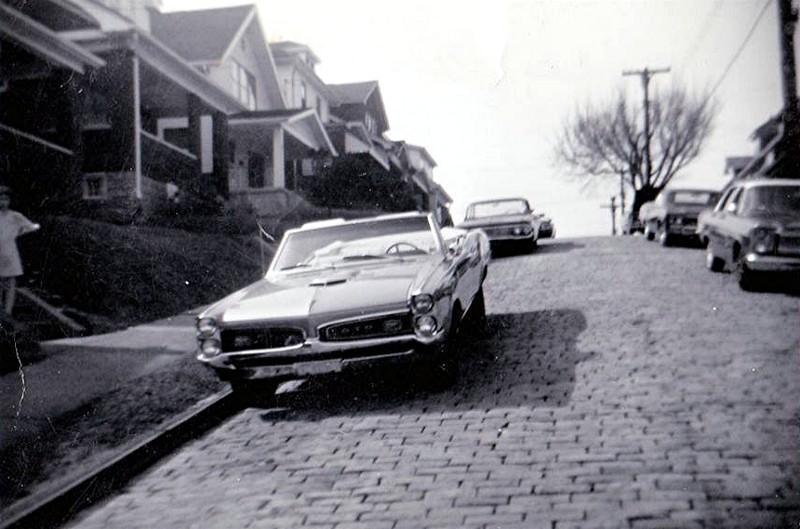
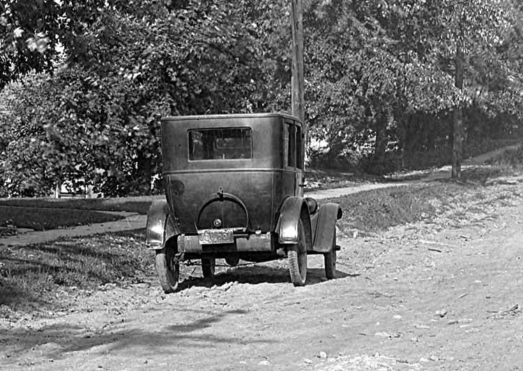
A Pontiac GTO convertible parked along the
800 block of Rossmore Avenue in 1967.
 
Homes near Rossmore Avenue in 1925. I haven't been
able to pinpoint their location.
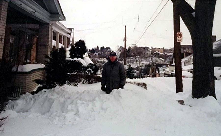
Bill Matthews outside his Rossmore Avenue
home after a heavy snowfall on Saint Patrick's Day in March 1993.
Sageman Avenue

The newly built home of the Mellett family
at the corner of Sageman and Sussex Avenues in September 1954.
Seaton Street

Pittsburgh Post-Gazette advertisement for the home
at 1807 Seaton Street - September 8, 1948.
Shawhan Avenue

A view of Shawhan Avenue homes, and Brookline
Elementary School, as seen from Vodelli Street in Beechview, in 1913.
The homes and streets in this photo make up the Fleming Place Plan, one of the
first housing developments in Brookline.
The home at the corner of Jillson and Shawhan
Avenues (left), and other Shawhan Avenue homes, in 1935.

The Pittsburgh Railways trolley right-of-way
at Shawhan Avenue on July 29, 1935.
Homes along Shawhan Avenue in 1935. Pioneer
Avenue homes are also visible in the photo on the left.
Homes along Shawhan Avenue in 1935. To the
left are homes at the intersection with Jillson Avenue.
To the right are homes along the Pittsburgh Railways trolley
right-of-way.

Residents of Shawhan Avenue gather to
celebrate the paving of their street. It was one of the last of the old
Brookline streets to be paved. This was the section of the street
between Jillson Avenue and Aidyl Avenue.
The ceremony took place on August 29, 1962, and was attended by Thomas Lamb
(19th Ward Legislator)
and a few of the longest residing homeowners on the street, Thomas Hughes,
Mr. and Mrs. Emanuel Kallas, and Mrs. Minnie Meier.
Stebbins Avenue

Stebbins Avenue, as seen from Harex Way,
heading uphill towards Woodbourne Avenue, on June 13, 1933.
Sussex Avenue

Construction workers laying a 56 inch sewer
main along Sussex Avenue, just north of Cedric Avenue, in June 1921
Kids playing atop garages along Sussex
Avenue, near Sageman Avenue (left), and a group of men
gathered along Sussex Avenue at the corner with Tariff Way, in April
1933.
Two views of the home at Sussex and Fordham
Street, looking south (left) and north, in April 1933.
Templeton Avenue

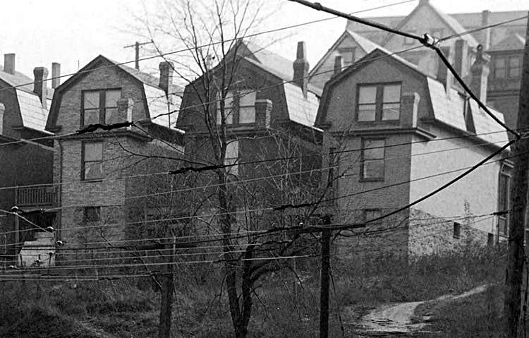
A view of new homes along Templeton Avenue, and
the Hughey estate, as seen from Wenzell Avenue in Beechview, in 1913.
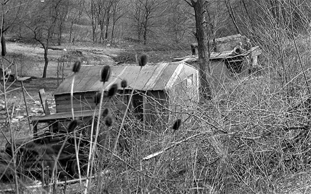
Timberland Avenue
 
Homes on Timberland Avenue, along Saw Mill
Run, in 1909, behind the present-day Red, White and Blue Thrift Store.
A wagon along Timberland Avenue (left), and
homes next to the Timberland Bridge, in 1909. The bridge connected
Timberland Avenue with homes along Cadet and Lineal Avenues on the other
side of the train tracks.
The Timberland Avenue Bridge and the road
leading down towards Saw Mill Run in 1909.
 
A home along Timberland Avenue (left), and
the attached family dairy buildings (right), in 1909.
A field close to Timberland Avenue, along
Saw Mill Run (left), and the Timberland Avenue Bridge, in 1909. The photo
on the right shows the Saw Mill Run valley, the dirt roadway and
the Pittsburgh and Castle Shannon Railroad line.
The P&WVRR tracks pass under the Timberland
Avenue Bridge in 1918 (left), and Timberland Avenue homes in 1925.
The second home from the left, 412 Timberland, under the bridge, was home to the
family of Joseph Merkel.
 
Helen Merkel, of 412 Timberland Avenue, shown
in 1929 and in the 1930s. The Merkel family
photos were submitted by Helen's granddaughter Carolyn Elliott.

The family of Joseph Merkel, at 412 Timberland
Avenue, circa 1929.
Trelona Way

These tool sheds, shown here on August
14, 1934, stood behind Engine House #57 along Trelona Way.
They were used by both the local firemen and the workers with the Bureau of
Highways and Sewers.
 
The Bureau of Highways and Sewers 6th Division
Brookline Headquarters located along
Trelona Way behind the Brookline firehouse in November 1935.
Viaduct Way

A view of Viaduct Way, the alley between Norwich
and Fordham Avenues, as seem from
the intersection with Queensboro Avenue, on June 17, 1931.
Waddington Avenue

A view of Waddington Avenue, from the
intersection with Pioneer Avenue, on June 17, 1931.
Wedgemere Avenue
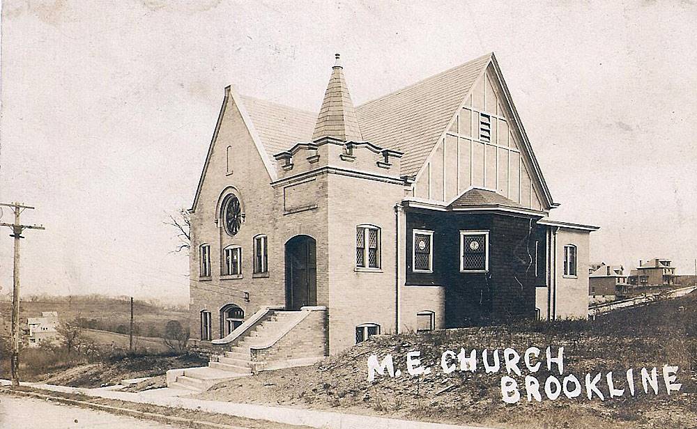 
The Brookline Methodist Church (left) in 1909,
at the corner of Wedgemere and Fitch Way, and an Independence Day
parade procession turns off Brookline Boulevard onto Wedgemere in 1916. At the
bottom of Wedgemere
was, from 1914 to the early-1920s, a park that was a popular place for community
gatherings.
 
Kids playing along Wedgemere Avenue (left),
and a view of the Rossmore Avenue intersection, in 1925.
Front porches of homes along Wedgemere
Avenue in 1925.
Homes along Wedgemere between Rossmore
and Gallion (left), and the intersection of Wedgemere and Rossmore, in 1925.

Worker from the Bureau of Traffic Planning
installs a No Parking sign at Wedgemere Avenue and Fitch Way - circa 1960.
Wenzell Avenue
 
A view of Wenzell Avenue, as seen from Pioneer
Avenue (left), and the Kerr family mansion near West Liberty, in 1909.
 
The intersection of West Liberty Avenue and
Wenzell in 1913 (left), and a wagon of the
South Hills Ice Company being repaired at Kerr's Wagon Repair shop, in 1915.
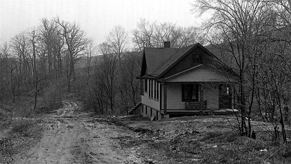
Whited Street

This is the home at 2306 Whited Street, the
third house up from Marloff Place. Shown here in 1941, the house
was constructed in 1939. It was the first home built along this section of
Whited. The plot of land
was purchased from the Marloff family, who owned the farm house in the distance
to the right.
Other homes followed as the Marloffs sold off lots for development.
A home that once stood at the bottom of Whited
Street, at 1700 Saw Mill Run Boulevard, where the Jack Maggs Agency
stands today. The home became the site of an Amoco gas station in the 1930s and
was torn down in the early-1950s.
This stately home once stood across the street from the large estate home shown
in the photo below.

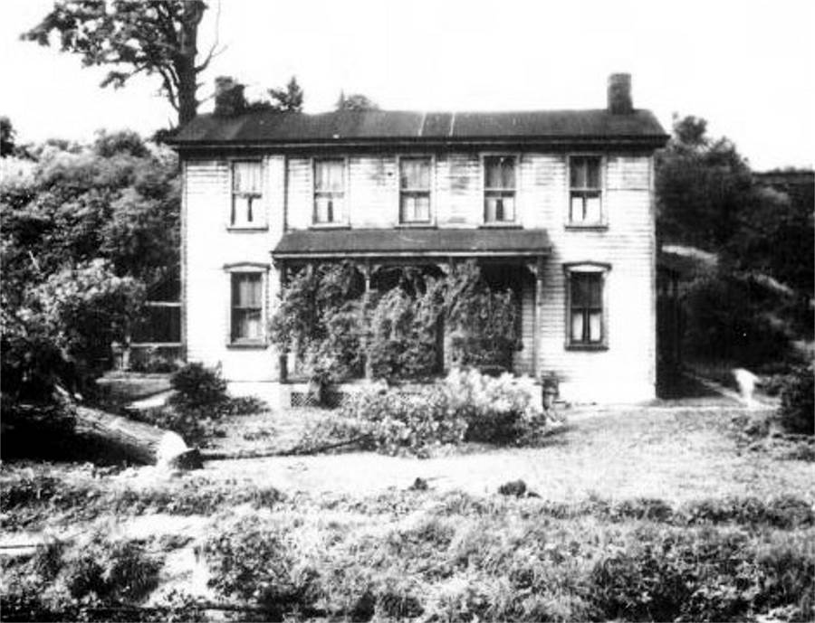
This stately home along Oak Street (1900
Whited Street), was built in the 1850s and still stands today. With the
railroad line directly behind it, the home was used for many years as a rest stop
for passengers. It was also a
place to rent carriages for funerals. For many years it was the home of the mother
of a renowned psychic.
Most recently it was used as a restaurant, Larry's Roadhouse. Presently it is under
reconstruction to be
used as a meeting and banquet hall. It is rumored that the over 160-year old
mansion is haunted.
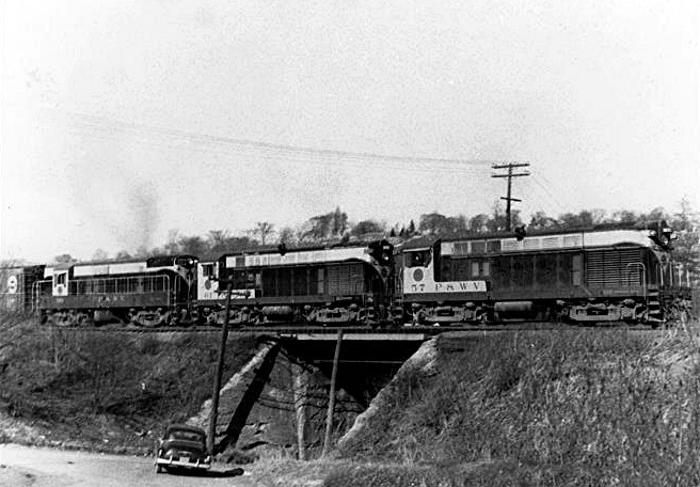
The corner of Whited and Jacob Streets on
March 16, 1957. A train from the Pittsburgh and West Virginia
Railroad is crossing the trestle, built in 1909, on it's way towards Castle
Shannon. In the early-1980s the
South Busway was built, and the bridge at Whited Street and South Bank
forever obscured this view.

Pittsburgh Press article, July 13, 1973,
reporting water main break along the lower end of Whited Street.
 
A utility pole down along Whited Street,
between Gallupe and Marloff Streets, on December 18, 2022.
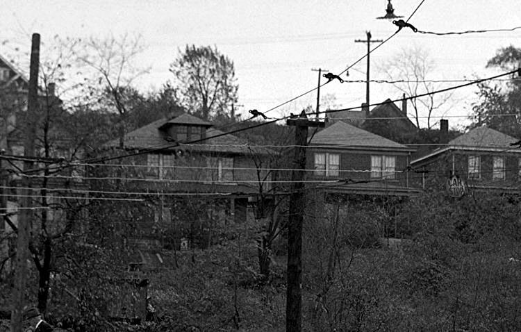
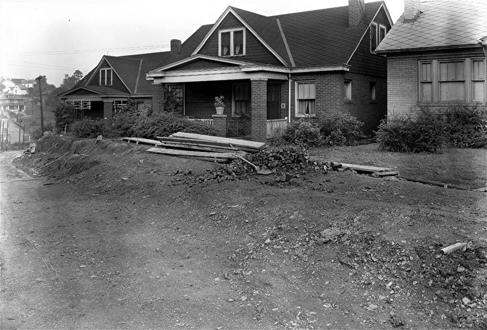
Winterhill Avenue

Homes at the corner of Winterhill Avenue
and Pioneer Avenue in 1935.
Woodbourne Avenue
Homes along Woodbourne Avenue, as seen
from Brookline Boulevard near Flatbush, in 1916.
 
The home at 624 Woodbourne, bordering Castlegate
Avenue, in 1919.
 
A view from Sussex Avenue towards Queensboro
Avenue (left), and Woodbourne Avenue homes near Sussex, in 1924.
Homes along Woodbourne Avenue near Oakridge
Street (left), and a view from Sussex to Oakridge, in 1924.
An automobile parked across from Freedom
Avenue (left), and a view of Woodbourne from Sussex to Pioneer, in 1924.
 
Children stand outside the home at 1403 Woodbourne
Avenue in 1924 (left) and 1934. On the right is young Bob Fornear.

A view of Woodbourne Avenue, from the
intersection with Freedom Avenue looking towards Oakridge Avenue, in 1924.
Homes along Woodbourne Avenue, near the intersection
with Oakridge Street in 1924.
Homes along Woodbourne Avenue, between Freedom
Avenue and Oakridge Street, in 1924.

A family in their horse and buggey approach
the intersection with Sussex Avenue in 1924.
 
Homes along Woodbourne Avenue, near the
intersection with Cedric Avenue (left) and Oakridge Street (right), in 1924.
 
The intersection of Woodbourne and Queensboro
Avenue (left), and homes between Sussex and Queensboro, in 1924.
 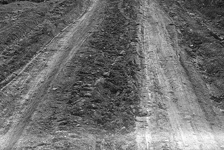
Road conditions along Woodbourne Avenue in 1924.
A sewer line had been run and the street would soon be paved in brick.
 
Woodbourne Avenue on October 28, 1929, looking both
directions from near the intersection with Stebbins Avenue.
The rear of homes along Woodbourne Avenue
near the intersections with Sussex Avenue on April 5, 1933.
 
Two views of the intersection of Woodbourne
and Sussex Avenues on April 5, 1933.

The rear of homes along Woodbourne Avenue
between the intersection with Bay Ridge and Sussex Avenues (left)
on April 5, 1933. The alley behind the homes is Lariat Way. To the right is the
rear of homes
from Sussex to Oakridge Avenues a year later on August 14, 1934.
Woodward Avenue
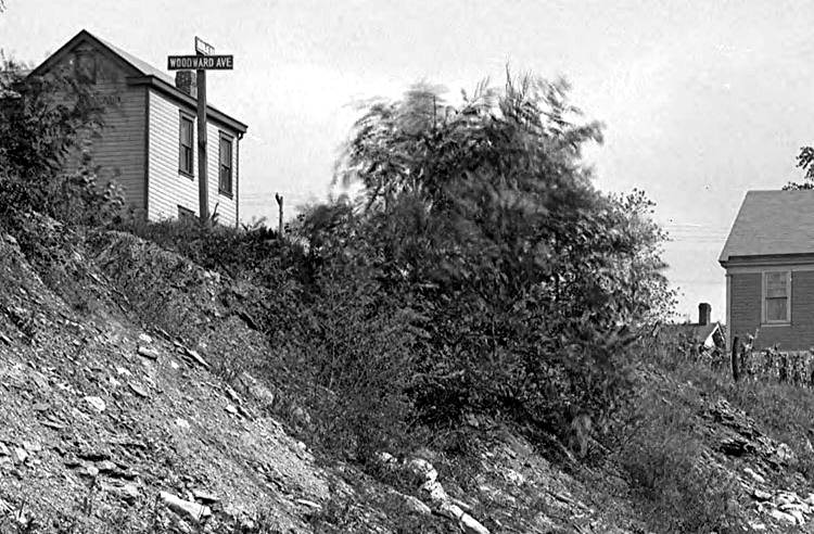 
A street sign stands at the intersection of
Woodward Avenue and Brookline Boulevard (Bodkin Street) in 1909 (left),
and homes along Woodward Avenue, as seen from West Liberty Avenue at Stetson
Street, in 1912.
 
Homes along Woodward Avenue, as seen from
Saranac Avenue in Beechview, in 1921 (left) and 1922.

The home at 2041 Woodward Avenue on May 16,
1932.

Looking east towards Capital Avenue from the
walkway outside 2041 Woodward Avenue on May 16, 1932.
 
Homes along the 1900 block of Woodward Avenue,
near Capitol Avenue - January 23, 1938.
 
Homes along the 1800/1900 block of Woodward Avenue,
near Stetson Street - January 23, 1938.
 
The home at 1817 Woodward Avenue
- circa 1945.
 
The home at 1817 Woodward Avenue
- circa 1945.

In the late 1800s and early 1900s, Brookline
had mining operations scattered throughout the valleys. There were several
mines along Edgebrook, McNeilly (Elwynn) and Saw Mill Run. This could be a
a mine along Elwynn Street, shown in 1910.
Brookline Random Street Scenes (Aidyl to Freedom) |


