|
The exact year that the small town of Reflectorville came into being is not known. The hamlet was located on Oak Hill between the lower end of Whited Street and Edgebrook Avenue, along Saw Mill Run Creek. Using real estate advertisements and old maps as a reference, we can assume that it was approximately 1890. This part of present-day Brookline was then situated in the northern tip of Baldwin Township, along the border of West Liberty Borough and Carrick Borough. Part of the Reflectorville area spread north of the border into the nearby boroughs, along the Saw Mill Run corridor. To the south was the neighboring township mining settlement of Fairhaven. Thomas Bailey And David Moon Much of the land that comprised Reflectorville was owned and developed by Thomas Flanner Bailey and David G. Moon, the president and treasurer of Pittsburgh's highly successful Bailey Reflector Company. Their business is the origin of the town's unique name. The Bailey Reflector Company was located in Pittsburgh, on Second Avenue, and manufactured ornamental oil, glass and kerosene silvered lighting fixtures and chandoliers that were popular in churches and commercial establishments throughout the United States. Bailey Reflectors also found a market for their products as far away as Japan. There was also a specialty shop in the community where men cleaned and repaired the carbide reflector headlights on the locomotives of the narrow gauge Pittsburgh and Castle Shannon Railroad and other small railroads in the area.
In the 1880s, with the mining industry venturing into the region south of Pittsburgh, the two businessmen acquired a substantial land tract along the Saw Mill Run corridor with the purpose of creating a residential development in the rural South Hills suburbs. Construction of Reflectorville began in 1890 and continued for the next thirty years. As Pittsburgh expanded through a series of annexations, the small town was eventually absorbed into the city limits. By that time, the men who had orchestrated the birth of Reflectorville had long since passed on. David Moon died in 1906, at age seventy-three. Thomas Bailey, aged seventy-seven, followed in 1915. The Bailey Reflector Company was sold by the Bailey family in June 1916. Housing For Mining And Railroad Families In the 1890s, coal mining was the primary enterprise along the Saw Mill Run corridor. There were several active Oak Mine shafts in operation. On either side of Reflectorville were the mine entrances along Hughey Road (Edgebrook) and Oak Street (Whited). The Oak Street Station was one of the largest in the valley and included a small rail yard. The vast majority of those who settled in Reflectorville were the families of the men who worked in the mines, along with a number of railroad employees.
On September 12, 1892, an ad was placed in the Pittsburgh Press for lots in Reflectorville. Just two and one half miles from downtown, these lots were ideally located along the Pittsburgh and Castle Shannon Railroad, which offered passenger service to and from the city. The advertisements proclaimed that lots in Reflectorville had excellent drainage and unsurpassed views of the Saw Mill Run valley. They also provided a clue pointing to the year to when construction of the village began, stating that since 1890 the number of homes built had risen from eight to seventy-two.
Reflectorville In 1896 Reflectorville first appeared on plot maps in 1896. The hamlet consisted of the housing tracts known as the Bailey and Moon #1, Bailey and Moon #2, Magaw/Goff and Zimmerman Plans. Bailey and Moon also had a third small tract of homes across the border in West Liberty and the Zimmerman Park Plan also stood slightly north of the border in Carrick. The layout of the Reflectorville streets in many ways mirrors the present-day road network. The exception was the streets along valley floor. These stood between the tracks of the West Side Belt Railroad and those of the Pittsburgh and Castle Shannon Railroad, running respectively on the western and eastern hillsides along the broad corridor. Where Saw Mill Run Boulevard runs today was a gridlike network of streets, including First, Second and Third Avenue. The present-day course Ballinger Street mirrored Third Avenue. Intersecting these roadways was the Township Road, or the Warrington Avenue Extension, which ran north towards West Liberty Avenue and Pittsburgh. To the south was the Library Road Extension that led to the town of Fairhaven.
Along Third Avenue was a small school house, called the Reflectorville Public School, for the children of the miners. At the corner of Elm Street (Zimmerman) and Walnut Street (Hallowell) stood a Methodist Church. This was the forerunner of the Brookline United Methodists, who in 1907 moved to a stone chapel located at Brookline Boulevard and Wedgemere Avenue. One can assume from the number of buildings shown that the area was served by a variety of merchants and markets that catered to the needs of the growing Reflectorville population. Part Of Overbrook Borough The town of Reflectorville continued to develop during the early years of the 20th Century. Nearby mining operations went on for another decade and the population more than doubled. By the time the shafts had been mined out, this tiny corner of Baldwin Township had evolved into a thriving community. In 1908, West Liberty Borough was annexed into the City of Pittsburgh. Reflectorville was now bordered to the north and west by the emerging neighborhood of Brookline. In 1912, there was a proposal put forth by officials from the town of Fairhaven to break away from Baldwin Township and form a new borough that would include Reflectorville, Fairhaven and Castle Shannon. The measure was put to a vote and failed due to objections from the residents of Castle Shannon, who prefered to form their own independent municipality. While the issue of creating a new borough remained in the news for the next several years, home construction in Reflectorville continued. When the Pittsburgh Railways Company established their high-speed traction line along the P&CSRR right-of-way, the quick and reliable public transporation brought a surge of development. In July 1918 petitions were circulated once more, this time throughout Fairhaven, Oakley, Oak Station, Reflectorville and Overbrook, asking that these villages incorporated into a borough to be known as Overbrook. Finally, in 1920, Reflectorville became the First Ward in the newly formed Borough of Overbrook, which extended from the city line at Edgebrook Avenue along the Saw Mill Run and Library Road corridors to the border of Castle Shannon. Added To Brookline Census Tract The most comprehensive developmental change to occur within the borders of the former town came in 1929, when Saw Mill Run Boulevard (PA State Route 51) was built. Many of the homes lying along the valley floor were razed to clear a path for the broad four-lane highway. The following year, in 1930, the Borough of Overbrook voted for annexation into the City of Pittsburgh. The adjacent Borough of Carrick had been annexed three years earlier, in 1927. After this southward expansion, Pittsburgh City Council instituted some territorial adjustments to the borders of these new municipal wards. The majority of Overbrook's First Ward (former Reflectorville), was added to the census tract of the Brookline community. This included all of the land east of Saw Mill Run Boulevard. The property to the west of Saw Mill Run Boulevard was assigned to the Carrick neighborhood. A Lasting Reminder Of Reflectorville It has been nearly a century since the small village of Reflectorville became a part of the distant past. The town's brief thirty year legacy will, however, be remembered in the naming of one of the bridges along Saw Mill Run. The Reflectorville Viaduct was originally constructed over Edgebrook Avenue in 1872 by the Pittsburgh and Castle Shannon Railroad. Reflectorville Station was a stop along the line. The bridge and car stop became part of the Pittsburgh Railways transit line in 1909.
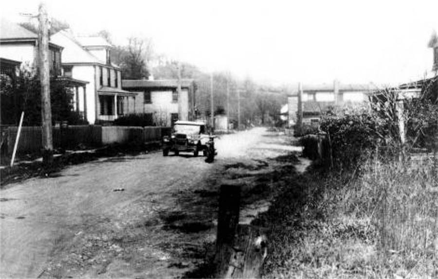
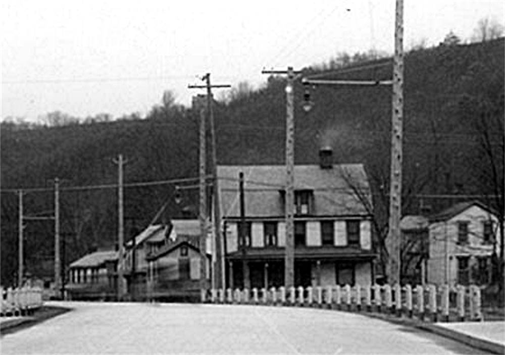
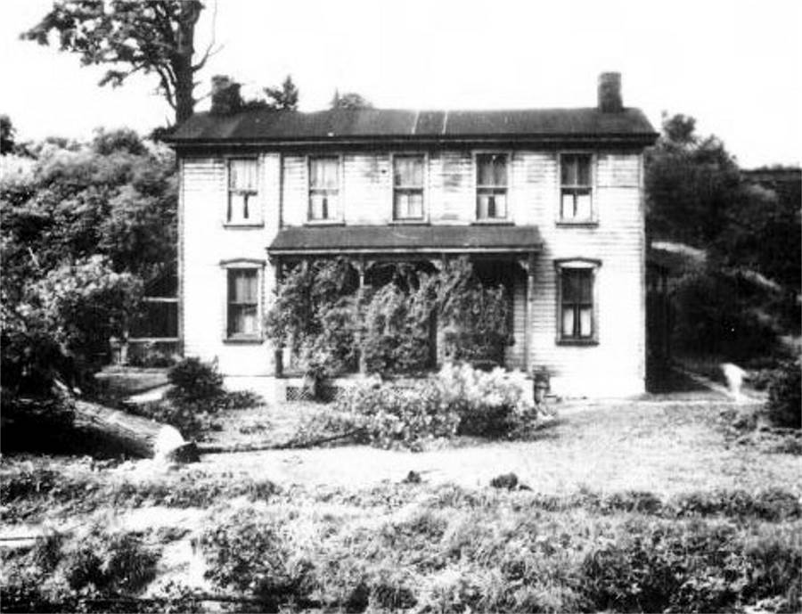
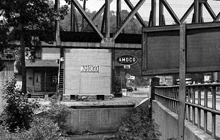
The bridge was replaced in 1929 and remained in service until decommissioned in 1993, with Reflectorville Station as a popular stop along the way. The bridge was rebuilt once more in 2004 for the modern light-rail transit line and is still referred to as the Reflectorville Bridge. The car stop was eliminated. Ironically, the bridge that memorializes the name Reflectorville, was always located just outside of the town's traditional borders, in the Borough of Carrick. Some Old Photos Showing The Reflectorville Area
Hopkins Plot Maps
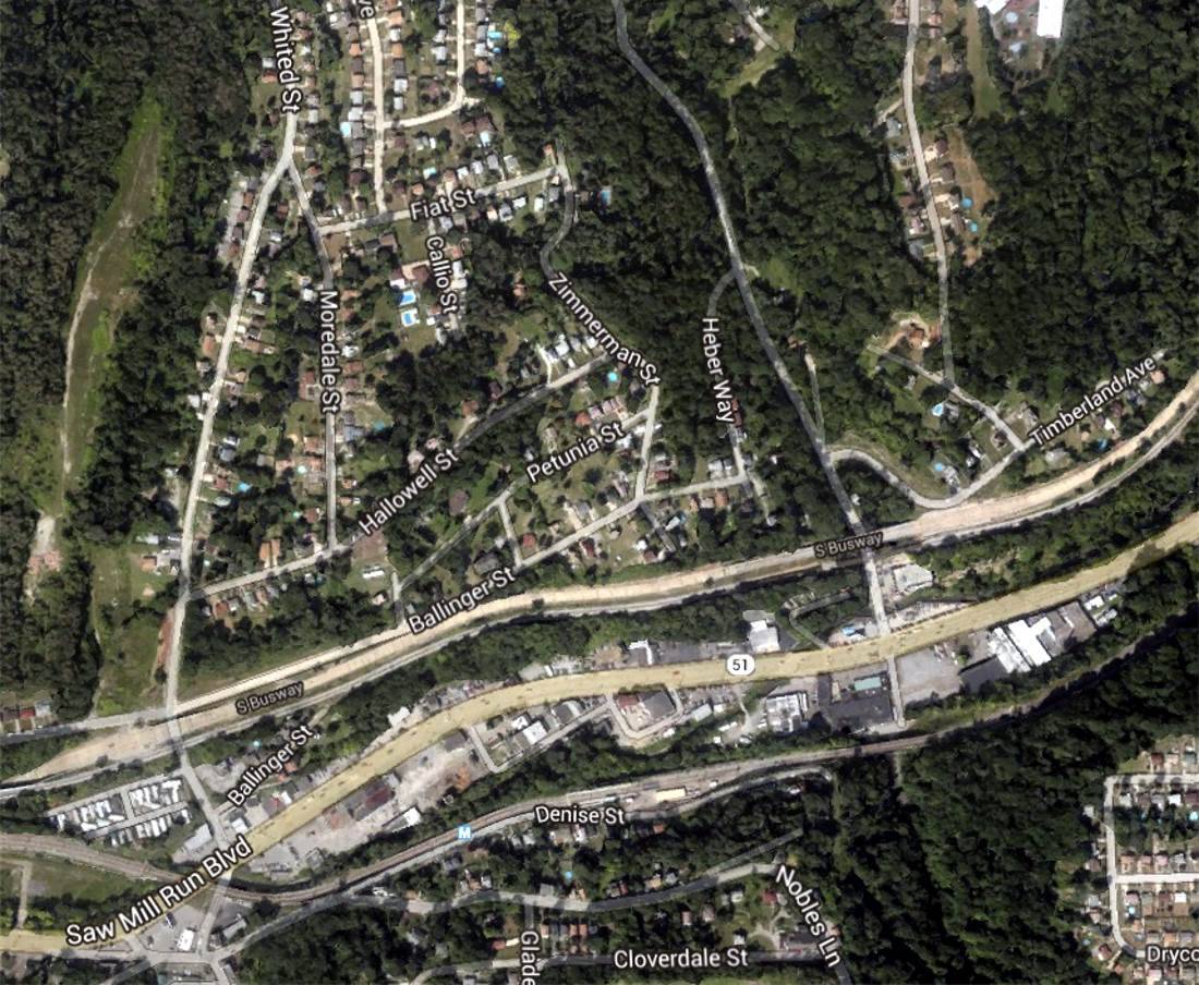
Google Aerial Image of the Former Town of Reflectorville in 2014
|