|
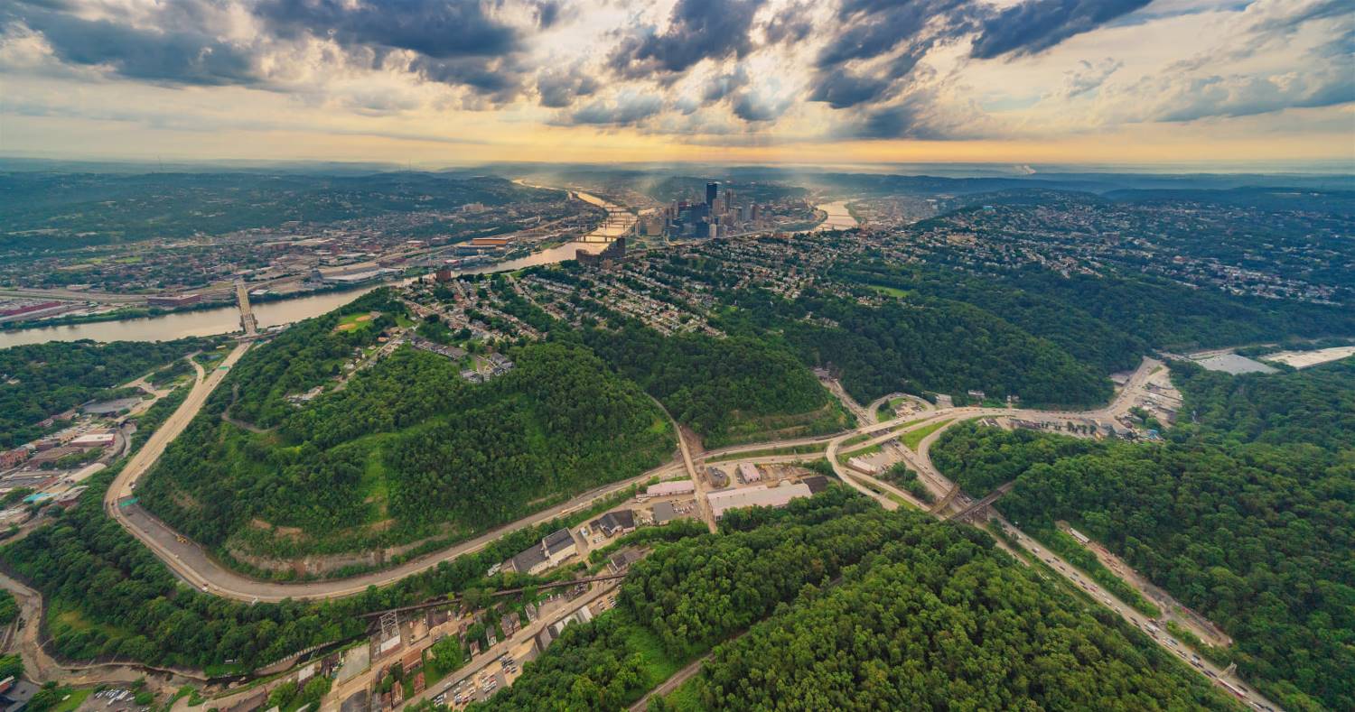
Click on images for larger photos Saw Mill Run Boulevard runs along the Saw Mill Run corridor, following the path of creek. It begins at the intersection of Clairton Boulevard and Stewart Avenue at the City of Pittsburgh boundary with Brentwood. The boulevard runs north through Overbrook and along the border with Carrick. It forms the eastern border of Brookline and Beechview as it passes the Liberty Tunnel/West Liberty Avenue intersection to the Fort Pitt Tunnel/Parkway West interchange. Originally connecting with Woodville Avenue as a traffic route to the West End, in the early-1950s, the boulevard merged with the new West End Bypass, a four-lane expressway that skirts the perimeter of Mount Washington and on to the West End interchange, at Carson Street and the West End Bridge. The bypass designated as part of both State Route 51 and US Route 19.
History of Saw Mill Run Boulevard
♦ Vintage Images Over The Years ♦ Last Updated: April 15, 2021
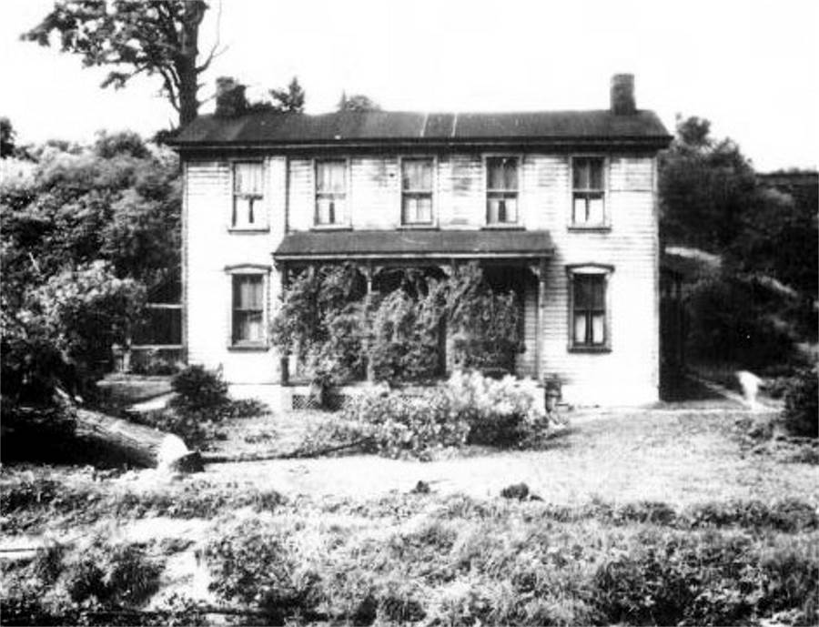
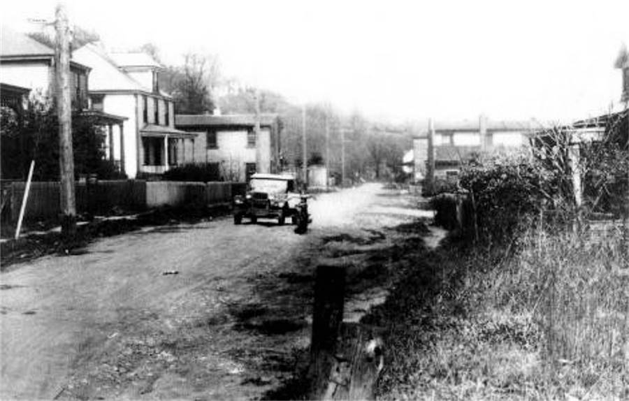
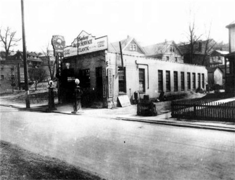
Saw Mill Run At The Turn-Of-The-Century In the early 1900s Saw Mill Run as a roadway was nothing more than a patchwork of interconnecting dirt roads leading south along the Saw Mill Run corridor from Crane Avenue in West Liberty Borough to near Provost Road in Fairhaven (Overbrook).
Beginning at the Crane Avenue railroad tunnel, the roadway merged onto Quay Avenue and continued along the creek to Warrington Avenue. Warrington at that time extended beyond West Liberty Avenue to High Bridge Station (Bausman), where it became an improved township road extending to Edgebrook Avenue in the village of Reflectorville. After passing along Second Avenue through the small village and reaching a junction with Nobles Lane. The Library Road Extension then led the rest of the way to the town of Fairhaven and the intersection with the present-day end of Library Road. The path followed Fairhaven Road for a short time to Provost.
Rapid Development Of The South Hills By the dawn of the 20th Century's second decade, business was booming in the South Hills, with new residential and commercial building proceeding at a record pace. With the population growing steadily, the existing road network was soon out of date. Traffic flow to and from Pittsburgh from the South Hills became an issue that only worsened with time. Automobiles were the new rage, and the need arose for high-speed traffic arteries linking the many southern communities with the city. During an initial push for a boulevard in 1912, a survey was made by W. E. Gelston and U. N. Arthur. Considering that almost the entire route of the roadway was within the boundaries of Pittsburgh, the plan was presented to the city, who failed to act.
In 1920, after nearly a decade of inactivity by city officials, the Allegheny County Commissioners adopted the Saw Mill Run project, citing the far-reaching benefits of the boulevard to constituents living not only in the city, but throughout the region. The planned boulevard would complement the Liberty Tunnels, another county construction project scheduled for completiond in 1924. Together, the two transportation improvements would help transform the Saw Mill Run Valley. The project would take another decade to complete, but by 1930 a four-lane highway stretched from Stewart Avenue in Overbrook all the way to Woodruff Street in Mount Washington. Soon the road would extend to the Banksville Traffic Circle and on to the West End. Additional construction in the 1950s extended the boulevard from the Traffic Circle to the West End and West Carson Street. The purpose of this photo essay is to present the pursuit of that process in detail.
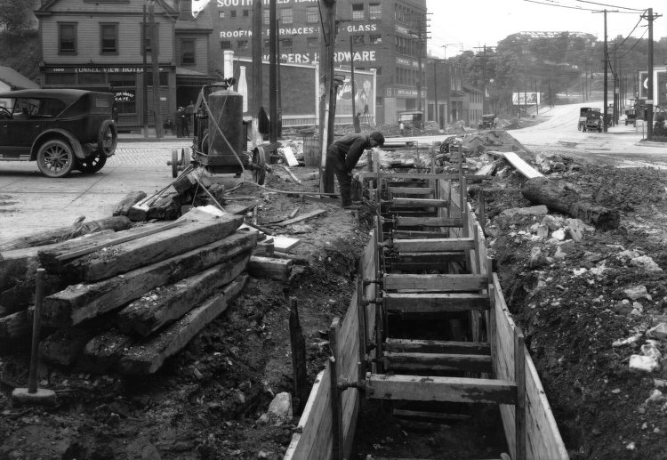
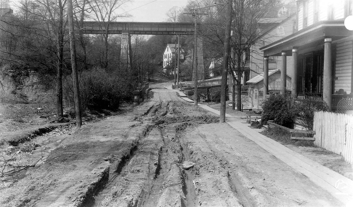
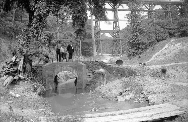
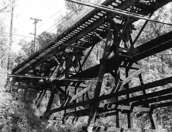
Preparations For A Modern Roadway Begin In 1925 In anticipation of the construction of a major roadway through the Saw Mill Run Valley, and the urgencies created by the rapid residential and commercial development of the nearby area, construction of a forty-two inch sewer line from the West Liberty Avenue extension to Bausman Street and along the Saw Mill Run Valley to Warrington Avenue began in June 1925. The modern sewer line and other infrastructure improvements laid the groundwork for future construction.
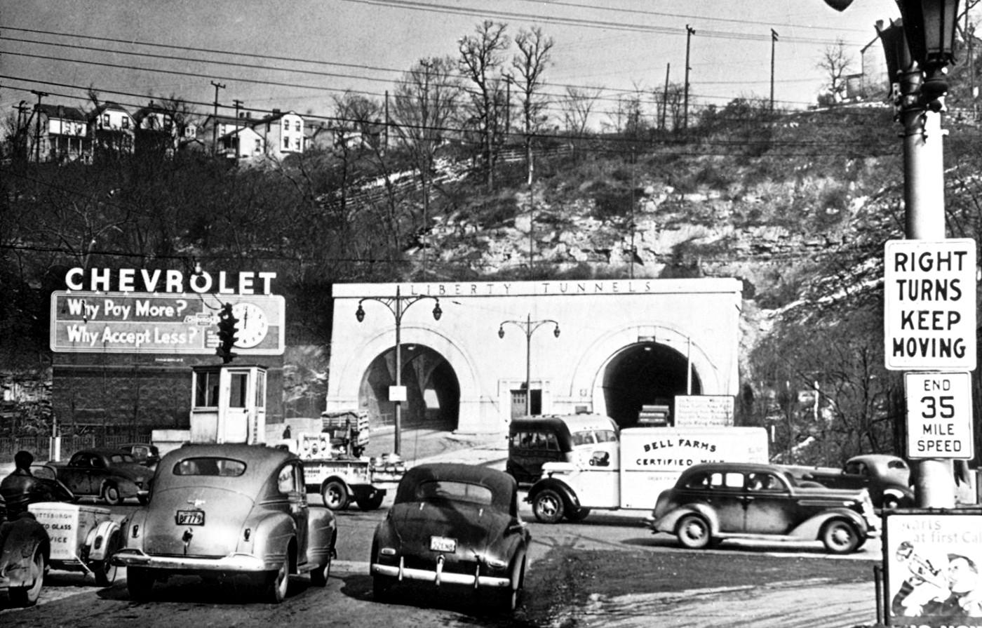
"City Beautiful" Bond Issue - 1928 Saw Mill Run Boulevard was created as part of the 1928 Allegheny County "City Beautiful" bond issue. The bonds resulted in the creation of Saw Mill Run, Ohio River, Allegheny River and Mosside Boulevards. After the completion of the Liberty Tunnels in 1924, the city of Pittsburgh became easily accessible to the South Hills area.
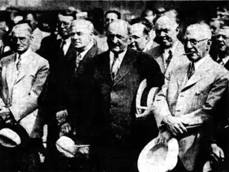
As the southern communities grew, county and city planners looked for a roadway that would connect eight important throughway and improved roads (Library Road, Nobles Lane, West Liberty Avenue, Banksville Road, Washington Pike, Noblestown Road, Steubenville Pike and Carson Street.) It was also viewed as a way to bring the cities of McKeesport, Clairton and Duquesne closer to Pittsburgh. Construction - The Library Road Extension - 1929/1930 Phase One Construction began quickly. Ground was broken on May 13, 1929. County Commissioner Joseph G. Armstrong officiated the ceremony which officially opened the work on Saw Mill Run Boulevard. Among the dignitaries attending were Commissioner E. V. Babcock, Pittsburgh Mayor Charles H. Kline, Council President James F. Malone, Councilman John S. Herron and Castle Shannon resident Henry Meuschke, one of the first advocates of the project back in 1912.
The first phase of construction would be the section that ran from the Library Road Extension to Reflectorville, then on towards the Warrington Avenue extension (formerly Kaiser Avenue) that ran past the Liberty Tunnels to the Warrington/West Liberty Avenue intersection in Beltzhoover. Many engineering challenges laid along the chosen path.
One major engineering design challenge was the intersection at Library Road (Route 88). This heavily traveled interchange lay in the heart of Overbrook Borough, seven individual roads all converged on one location. In addition to the roads, there was the confluence of the Clairton Run Creek and the Saw Mill Run Creek, through both of which flowed a substantion amount of water. Library Road, Ivyglen Street, Hillview Avenue, Stewart Avenue, and Glenbury Street all had to be merged with Saw Mill Run Boulevard. The resulting interchange consisted of a concealed system of five bridges with tunnels to channel the water.
Another engineering difficult was overcoming the multiple road network near the Whited Street (Oak Street) intersection. This would require a complete reconfiguration and reconstruction, as there was no single intersection or actual through road at this point, just a merging of several different streets.
Engineers designed the layout of the boulevard to follow the existing Library Road Extension from Route 88 to Whited Street, then follow Second Avenue through Reflectorville (Overbrook) to near Edgebrook Avenue. The roadway would then veer towards Ensign Avenue and proceed for a short distance. From there a path was cut until the boulevard merged with the existing Warrington Avenue extension. Creating a straight path for the roadway from Edgebrook to Warrington Avenue was another challenge. The fast-flowing waters of Saw Mill Run followed in an uneven pattern through this part of the valley. Rather than build an additional two bridges, the creek was diverted so that it flowed along just one side of the roadway until a point near the Liberty Tunnels.
After nearly seven months of hard work, the first phase in the construction of Saw Mill Run Boulevard was completed on December 1, 1929. Prior to the grand opening, City Planners considered changing the name of the roadway from Saw Mill Run Boulevard to Liberty Boulevard, but this proposal never gained momentum.
The dedication ceremony was scheduled for December 14, but was delayed a day by bad weather. To the delight of residents in Carrick, Overbrook, Whitehall and Brookline, the new highway was a significant improvement for motorists and spurred further development in their districts, both residential and commercial.
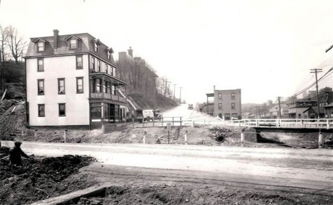
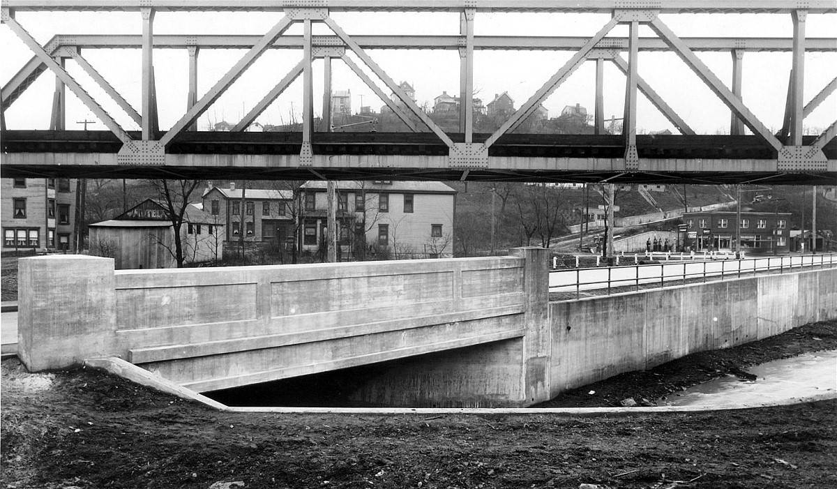
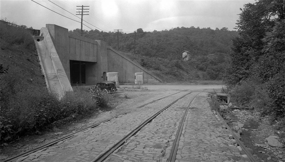
Construction - Warrington To Woodruff - 1930 Phase Two During the next phase of construction, the boulevard was extended from Warrington Avenue to Woodruff Street. Some of the necessary infrastructure work had been going on for months during the First Phase of construction and, in the case of the sewer line, since 1925. This enabled the Second Phase of construction to be completed in the late-Summer of 1930. With the exception of a dirt pathway from Warrington Avenue to Crane Avenue, this was all new roadway. The major challenges were creating a cut through the rocky hillside between Crane Avenue and Woodruff Street, and the construction of a new portal bridge over which ran the freight trains of the Wabash Terminal Railway from it's hub in downtown Pittsburgh. This second stretch of roadway opened on September 9, 1930.
From its' terminus at Woodruff Street, inbound motorists either turned right and headed up narrow Woodruff and over Mount Washington to McArdle Roadway, or they turned right and followed the paved Pittsburgh Railways streetcar line to Woodville Avenue and on towards the West End and West Carson Street. With the pending improvements to Banksville Road and other transportation initiatives looming in the near future, these were a short-lived alternatives. The first two phases of the project were built by the John F. Casey Company. The original bid was $848,541, but by the completion date the price had risen to $1,500,000, due to the extensive cut and fills necessary during the second phase. Over 500,000 cubic yards of rock were removed in making the 135 foot deep cut. On the plus side, the project was completed sixty days ahead of schedule.
On Dedication Day, a caravan of city and county officials passed along the completed roadway to Woodruff Street. County Commissioner Joseph G. Armstrong presided over the dedication ceremony, along with special guests Commissioner Charles C. McGovern, Prothonotary John Vogt, Chief Engineer Charles M. Reppert of the city's public works department, Council President John S. Herron, Public Safety Director James M. Clark, City Solicitor Charles A. Waldschmidt, Police Superintendent Peter P. Walsh and Public Works Director Edward G. Lang.
* Thanks Tim Killmeyer for many of the Phase I and Phase II images *
Banksville Traffic Circle - 1931/1932 With the rapid development of the South Hills area, including Banksville and Greentree, it was apparent from the start of the Saw Mill Run project that it was necessary for the boulevard to connect with Banksville Road and Woodville Avenue.
Construction began on this 3/4 mile extension in late-1931. Built at a cost of $300,000, it would facilitate traffic to the West End and fit in nicely with long-range traffic management plans that had been sitting idle for several years.
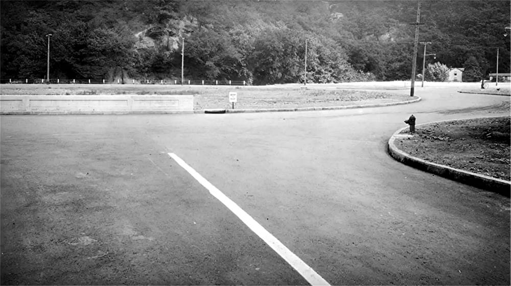
The extension led to the creation of the Banksville Traffic Circle, a large looping turn-around at the end of Banksville Road that connected with Saw Mill Run Boulevard and Woodville Avenue. Construction of the circle was completed in 1932 and it provided some relief with the traffic flow on the southern side of Mount Washington.
Improvement Plans - What Might Have Been - 1934 The next step in the improvement of the South Hills transportation network was something that had been in the minds of planners since the 1910s, when planning for the Liberty Tunnels was underway. These plans included the improvement of Banksville Road to a four-lane boulevard and the construction of another South Hills tunnel and bridge to downtown. The Fort Duquesne Tunnels and Bridge was under serious consideration in 1934. The $8,000,000 project would start at the Banksville Traffic Circle and include Twin Tubes, 3,750 feet in length, and a bridge over the Monongahela River that connected to Water Street, Liberty Avenue and the existing Point and Manchester Bridges.
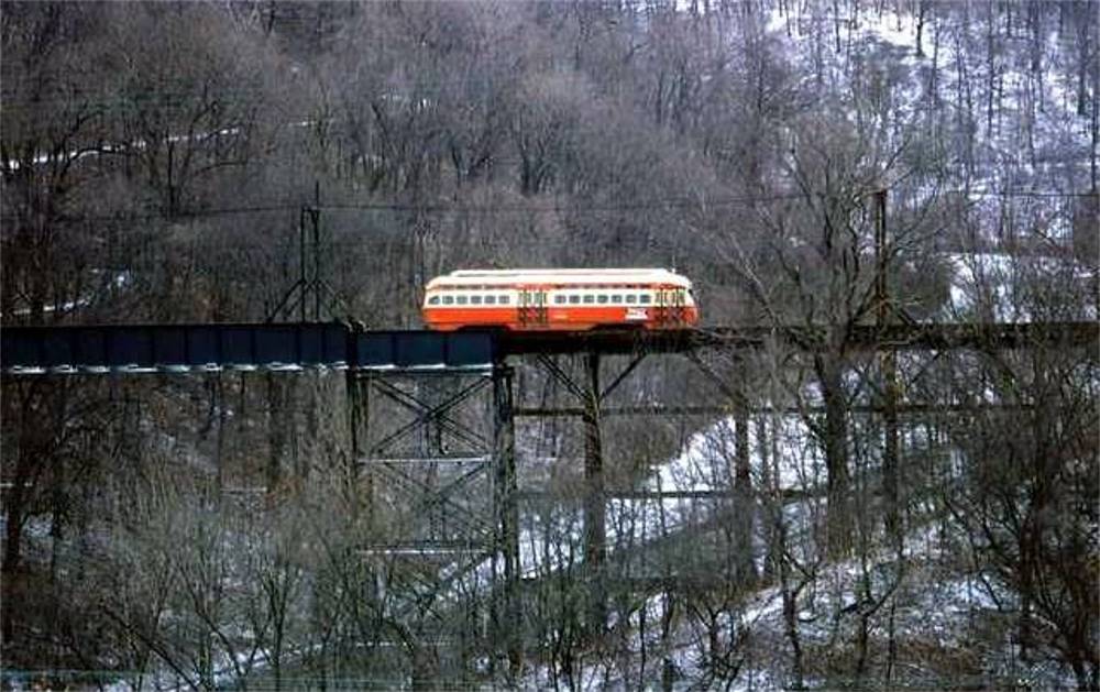
Funding for these two projects, along with the Woodruff Street improvement, were to come from a mixture of federal Works Project Administration dollars and imposing tolls on motorists passing through both the Liberty Tunnels and, when complete, the Fort Duquesne Tunnels. After much debate, these plans were eventually scrapped. Woodruff Street and Banksville Road were improved with federal funding, but the tunnel and bridge project were shelved. Woodruff/Merrimac Street Improvement - 1935 Another addition to the growing South Hills transportation network that followed the extension of the boulevard was the Woodruff and Merrimac Street Improvement project. The two roadways were regraded and widened to four lanes at a cost of nearly $400,000. This new route over Mount Washington provided another reliable alternative for the ever-increasing amount of vehicular traffic from the South Hills to downtown Pittsburgh. During the project, trolley rails were removed from Woodruff Street. These rails belonged to West End Traction Company and were part of the first electrified trolley service on Mount Washington. Dating back to 1898, the line began at the Castle Shannon Incline terminals at Bailey Street, the followed a path along Boggs, Wyoming and Virginia Avenues to Woodville Avenue (Woodruff Street) and on to the West End.
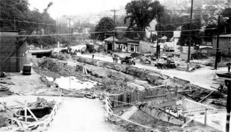
On October 19, 1931, by agreement between the Pittsburgh Railways Company, the West End Traction Company, the Pittsburgh & West End Railway Company and the City of Pittsburgh, the streetcar route was abandoned. This was a significant development because, as originally planned, these rails were to be relaid along Saw Mill Run Boulevard from Woodruff Street to the traffic circle, where they would meet with the existing transit rails along Woodville Avenue. Construction - The West End Bypass - 1949/1951 Phase Three The reconstruction of Banksville Road in 1938 was the last in the long series of South Hills traffic improvements for ten years. During this time, the City of Pittsburgh hired famed planner Robert Moses to design a far reaching transportation initiative that would solve Pittsburgh's traffic nightmares for years to come.
In 1939, he submitted the extensive "Moses Plan", which, if implemented in it's entirety, would finally bring Pittsburgh into sync with the ever-expanding age of the automobile. In the South Hills area. this plan included construction of the Saw Mill Run Extension, better known as the West End Bypass, the Parkway West and the Fort Pitt Tunnels and Bridge. Approval for construction of $900,000 West End Extension was given in February, 1941, and bids went out in September, but the project was delayed by the onset of World War II. The project was revisited in 1949, and the cost estimate had risen to $3,000,000.
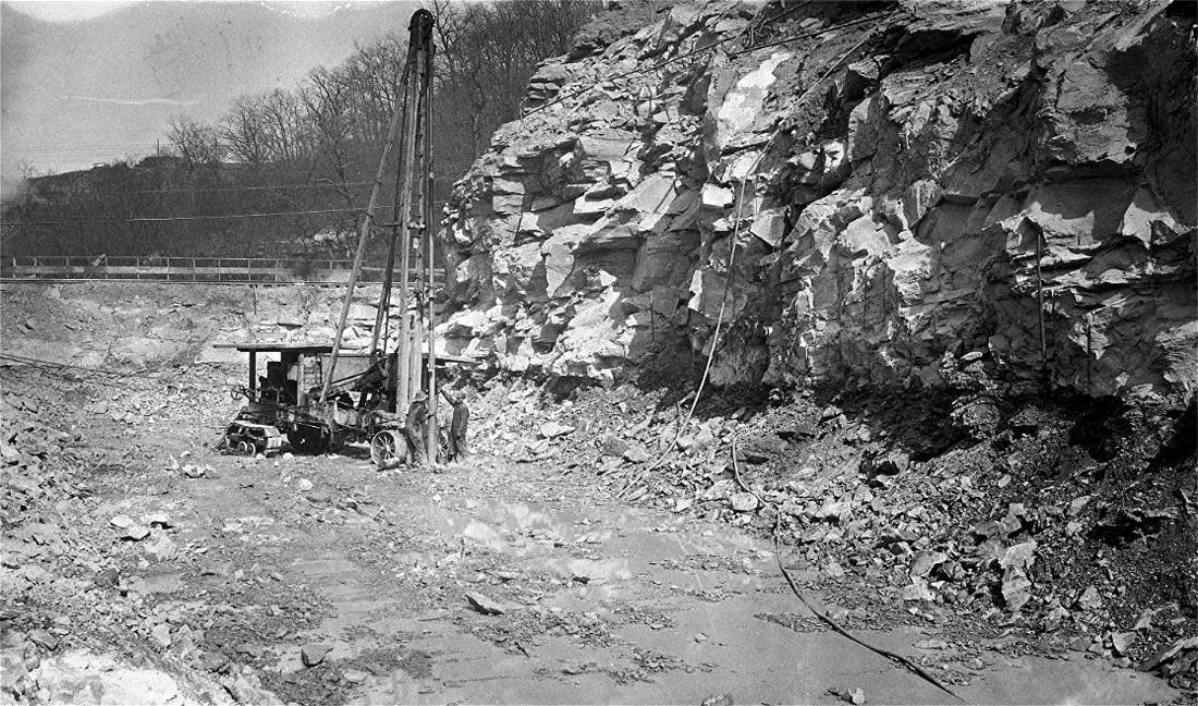
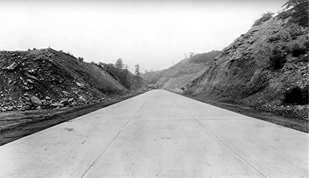
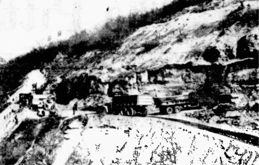
Construction finally began in October 1949. The modern four-lane expressway, a little over a mile in length, would extend along the Mount Washington hillside from the Banksville Traffic Circle to West Carson Street. The biggest engineering challenge was the extensive excavation of the hillside to accomodate the roadway.
It took over a year of blasting to remove the one million cubic yards of rubble needed to accomplish the task. Trucks carried away the mountains of soil, 5000 cubic yards a day, in convoys to locations along Greentree Road and near Langley High School to make land for athletic fields. Another challenge for the contractor, Harrison Construction Company, was the creation of a long ramp from Steuben Street to link outbound motorists with the new expressway. When the project was completed in the Spring of 1951, South Hills motorists could now zoom from the Traffic Circle to Carson Street without having to pass through the West End Business District. What once took up to one half hour or more now was a matter of a few minutes or less.
Construction - The Fort Pitt Tunnel Interchange - 1952/1957 Phase Four The final piece of the Saw Mill Run Boulevard construction project occured between 1952 and 1957. This entailed the removal of the Banksville Traffic Circle and replacing it with a modern interchange that would connect Saw Mill Run Boulevard, the West End Bypass, Banksville Road and Woodville Avenue with the soon-to-be-constructed Fort Pitt Tunnels, Fort Pitt Bridge and Parkway West (I279). Aside from the challenge of building the multi-ramp interchange, engineers faced with another extensive hillside excavation in order to make the necessary room for the tunnel entrance and the interchange. The West End Bypass began a three-month closure in May 1952 and the task of removing the mountain of rock began.
Aside from the excavation of 710,000 cubic yards of earth and rock from the 259-foot hillside, the $4.5 million project required reconfiguring two railroad bridges and the replacing of sewage facilities. Then came construction of the highway, tunnels and accompanying bridge over the Monongahela River, which followed the same path as the Fort Duquesne Bridge plan from 1934.
The debris from the hillside went to construct the portion of the Parkway West known as Greentree Hill. By July 1953, the Traffic Circle was removed and a temporary restricted roadway was built to link Saw Mill Run with the West End Bypass. The remainder of the interchange project took five more years to complete.
It was a further three years before the Parkway East and West (Penn-Lincoln Parkway), Fort Pitt Tunnels and Fort Pitt Bridge were all linked together with Saw Mill Run Boulevard, and another decade until the Fort Duquesne Bridge was complete. Never-the-less, the twenty-eight year Saw Mill Run Boulevard and West End Expressway projects were instrumental components in modernizing the road network of the South Hills to meet the transportation needs of the future. Their completion meant that, transportation-wise, Pittsburgh had truly entered the twentieth century.
Boulevard Upgrades In the early 1950s, upgrades were made to
Saw Mill Run Boulevard, between the tunnels and Edgebrook Avenue, for both safety
purposes and in an effort to alleviate the congestion approaching the busy tunnel
intersection. In the late summer of 1952 a divider was placed between the northbound
and southbound lanes from Edgebrook Avenue to Bausman Street.
Then in the summer of 1954, the bridge over
Saw Mill Run Creek between Bausman and the tunnel intersection was widened to create
an additional turning lane for tunnel traffic. These measures helped in the short-term,
but did little to solve the overall need for a new, streamlined interchange. That would
not happen for another forty-five years.
The other increasingly dangerous traffic
bottleneck was at the busy interchange at Library Road in Overbrook, on the southern
end of the boulevard. Here, several smaller roadways also merged onto the main roadway.
It would not be until 2013 that this problem was properly addressed. Major Landslide - February 17, 1983 Landslides have been a persistent problem along
some stretches of Saw Mill Run Boulevard, especially between Crane Avenue and Woodruff
Street, and along the West End Bypass, where deep cuts into the hillside were made
during boulevard construction. Many are minor slides that cause a temporary disruption
to traffic, but some can be large and have tragic consequences. One such tragic occurrence took place on February
17, 1983, when nearby blasting caused a forty-foot section of the rock face, 100 yards
east of Woodruff Street, to break loose, dumping over 500 hundred tons of rock
and mud down upon Saw Mill Run Boulevard. A construction worker clearing blast debris
and a passing motorist were killed, and one truck driver injured, by the sudden
landslide. Hoping to prevent a landslide, Ram Construction
had been under contract with the city to clear away loose rock from the 150 foot hillside.
Traffic had been stopped during a blast. Twelve minutes after a string of seventeen
ammonia-nitrate charges had been detonated, a seismometer showed no movement in the rock
formation. The roadway was reopened to traffic, which was
confined to the two lanes furthest from the hillside, shielded by jersey barriers.
Unfortunately, an undetected mud seam running through the rock formation had loosened a
sizeable portion of the rock face. The blast further weakened the unstable rock. It was
then that what Carnegie-Mellon geologists called a "rock topple" occurred. Cleanup of the debris pile took over a month.
Workers first had to stabilize the multi-fractured hillside and blast away any loose
rock. Once this work was completed, a rock-basket retaining wall was placed along
the hillside and road repairs made. One of the rocks from the fall was placed at the
bottom of Woodruff Street along with a memorial plaque to honor the victims of the
tragedy. Liberty Tunnels South Interchange
- 1998/1999 After sixty years of service, Saw Mill Run Boulevard
began to see improvements made during the 1990s and 2000s. In the early 1990s median barriers
were installed from Whited Street north to the Parkway West interchange. In 1998 work began
on a new traffic design where Saw Mill Run meets West Liberty Avenue and the Liberty Tunnels. The heavily-traveled interchange, which handles over
100,000 vehicles per day, had been a bottleneck for years. Plans were in place in 1957 for
a design change, but they were never put into action. Finally, in 1999, the new interchange
was completed and has been hailed as a major improvement by almost everyone who lives in the
South Hills. The West End Circle Interchange
- 2005/2010 Construction of a new traffic design pattern at the
equally-crowded Northern Terminus of Saw Mill Run Boulevard, approaching Carson Street
and the West End Bridge, began in the mid-2000s. An additional lane was added to the
highway and the hillside was stabilized. The intersection at the West End Circle was
redesigned, with the construction of a third tunnel to allow a more coordinated traffic
flow. The project was completed in 2010. The new interchange was welcomed by motorists
as another major improvement. The Route51/Route 88 Interchange
- 2013/2015 The next improvement was made at the southern
edge of the Boulevard, where a complete rehabilitation of the overcrowded Library Road (State Route 88)
intersection took place from
2013 through the fall of 2015. The heavily traveled interchange had become a serious
chokepoint for traffic and a dangerous safety concern. In the works since the late 1990s, initial
improvement plans favored a design similar to the interchange at the Liberty Tunnels.
However, after over a decade of deliberation and delays, new plans were introduced in
October of 2010, approving a jughandle design. Construction of the new interchange began in
late-2013. Over the next several months, severan decaying bridges along the construction
path were rebuilt. Utilities and traffic signals were improved. The roadway was completely
rebuilt. At a cost of slightly over $20 million, the
construction project was completed in November 2015. South Hills motorists cheered the new
interchange, which dramatically improved the flow of traffic and safety at this major
Pittsburgh crossroads. Additional Boulevard
Improvements - 2017 In 2017, PennDot contracted Gulisek
Construction to perform a $4.32 million improvement project on the Liberty Tunnels
South Interchange. The project ran from March to July, and included concrete patching,
an asphalt overlay, bridge preservation, drainage improvements, ADA curb cut ramp
installation, signage and signal upgrades, ramp reconstruction, and other miscellaneous
construction activities. Seasonal flooding is another problem
associated with Saw Mill Run Boulevard. Many homes and businesses located along
the low-lying areas near the Saw Mill Run Creek have been the victims of frequent
flooding during periods of heavy rains. This has been a nagging issue since the
boulevard opened in 1929, most notably near the Rt 51/Rt 88 interchange, between
Whited Street and Edgebrook Avenue, and between Crane Avenue and Woodruff
Street. Dredging and flood control measures by
the Army Corps of Engineers have somewhat eased the problem. In the late 1990s,
many structures along the flood plain were demolished to create an upstream
watershed. Despite these efforts, the prospect of
seasonal flooding will always exist, and a strong rainstorm will bring the water
to dangerous levels, often overflowing onto portions of Saw Mill Run Boulevard.
The year 2018 was a record year for precipitation and also a record year for
flooding, with some of the worst recorded flooding all along the Saw Mill Run
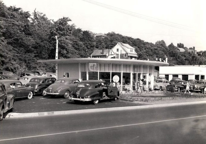
Corridor, from Castle Shannon all the way to the West End. Photos of Locations Along Saw Mill Run
Boulevard For More Pictures Of
Saw Mill Run Boulevard |