|
The Boulevard of the Allies runs from Commonwealth Place, near Point State Park in downtown Pittsburgh, all the way to Schenley Park. The route takes motorists past the towering PPG complex in the heart of the city, along the scenic Bluff (Boyd's Hill), looking down at the Monongahela River and South Side, then through the heart of southern Oakland to the park entrance. The Most Expensive Roadway in the World Constructing the Boulevard of the Allies was a monumental task. The entire roadway was built in a succession of construction phases, over a ten-year period, beginning in 1920.
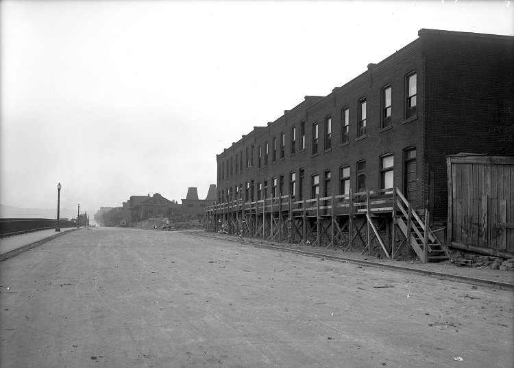
The first phase was the widening of Second Avenue from Liberty Avenue, near the Point, to Ross Street. The road was expanded to a width of seventy feet, and included the installation of an interconnected traffic signal system, one of the first of its kind in the country. This experimental system was installed and operational by November 13. This initial roadwork was completed in August, 1921, leading to the start of Phase Two, which would extend the boulevard from Grant Street, along the Bluff, to Forbes Avenue in Oakland.
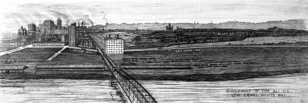
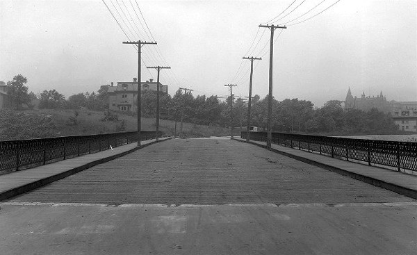
Two plans were presented for this section. The first was a low-level route, paralleling Second Avenue, that gradually rose along Boyd's Hill towards Oakland. The second proposal, or high-level route, became the accepted design. This plan featured a steeper rise to the Bluff near Duquesne University and incorporated part of Bluff Street. This route included extensive excavating, the erection of large retaining walls and the construction of two lengthy steel and concrete viaducts.
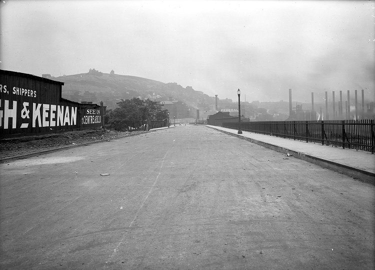
Excavation and shoring up of the cliffside along the Bluff began immediately. The walls were constructed and a path carved from Magee Street downward along the cliff to a point where the roadway would meet Viaduct #1, which rose in the opposite direction from Grant Street. Atop the hill, Bluff Street was widened to four lanes, and buttressed by massive concrete walls along the length of the hillside.
Viaduct #2 carried the roadway over the Brady Street Bridge to a junction with Forbes Avenue near the old Children's Hospital at Ophelia Street. From there, the Boulevard extended along Forbes until it's temporary terminus at Craft Street.
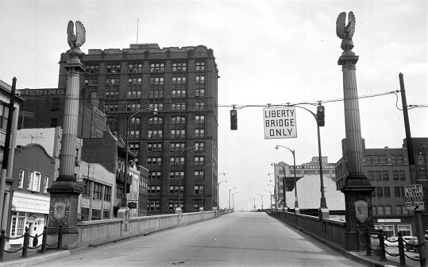
This second phase of construction was completed in a little over a year. On October 2, 1922, the Boulevard of the Allies was opened to traffic. The expressway was officially dedicated on November 11, 1922. At a cost of $1.6 million per mile, it was the most expensive road in the world at the time. Monongahela Boulevard Originally conceived in 1913 and named Monongahela Boulevard, the re-designation to Boulevard of the Allies was the idea of long-time city councilman Robert Garland, who envisioned a Grand Memorial Way, complete with statues commemorating the leading figures in the Great War, such as General Pershing, commander of the Allied Expeditionary Force, and Marshal Foch of France. The name Boulevard of the Allies was adopted, but the grand statuary never materialized. Large pillars topped with eagles, and finely carved artwork along the bases, located at the lower entrance to Viaduct #1, along Grant Street, were the extent of the ornamentation.
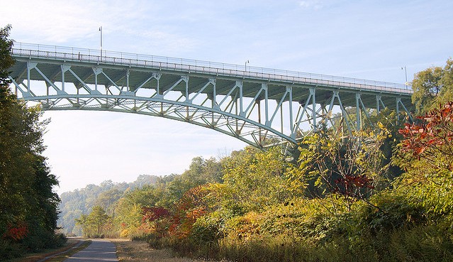
Boulevard of the Allies Extension Planning for the extension of the boulevard further eastward began immediately. Traffic congestion at the crowded Forbes Avenue junction also posed a growing safety concern. A bond issue in 1926 secured the financing to proceed with the next phase of construction. During Phase Three, a third viaduct was built over a realigned Forbes Avenue, allowing for free flow of traffic past that junction and on to the intersection of Craft and Emily streets.
This completed section of the Boulevard of the Allies was dedicated on November 1, 1928. City officials proudly proclaimed, "Motorists can now make the entire trip from downtown to Schenley Park without traveling over any streets that include trolley tracks."
While this work progressed in the east, closer to town the Liberty Bridge intersection was taking shape, with off and on ramps connecting to the boulevard and some other modifications of Viaduct #1 to accommodate the lower approach ramp from Forbes Avenue. The fourth phase of construction saw the widening of Emily and Wilmot streets through to the Wilmot Street Bridge, which carried motorists over Panther Hollow into the park. This final section of the Boulevard of the Allies was dedicated on September 19, 1930.
The Lincoln Highway
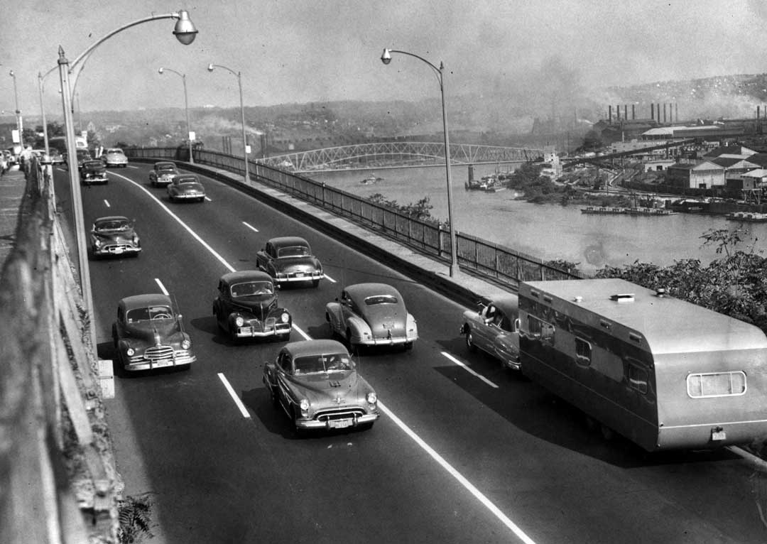
The roadway itself did not end there. Once in Schenley Park, the street name changes to Panther Hollow Road, which continues through to Squirrel Hill. The Boulevard of the Allies was soon one of the heaviest traveled arteries in Pittsburgh. From 1926 until the completion of the Penn-Lincoln Parkway in the late-1950s, the Boulevard of the Allies was incorporated into US Route 22/US Route 30, and part of the national Lincoln Highway. Improvements and Enhancements to the Grand Boulevard Since the boulevard was completed in 1930, it has undergone a few significant changes. In 1931, the Horace Street Ramp was constructed near the Try Street Terminal downtown as a connection to the Liberty Tunnels or Forbes Avenue. The 1930s also saw the installation of crash-proof rails were installed along the Bluff and viaducts to prevent the growing number of accidents involving vehicles tumbling over the hillside. The two-lane Wilmot Street Bridge, built in 1907, was replaced, in 1940, by the four-lane Charles Anderson Memorial Bridge.
In 1954, work began on the connecting ramps from the Boulevard of the Allies to the new Penn-Lincoln Parkway. These ramps would be located at the Brady Street Bridge. The interchange was completed and open to traffic in September 1956.
The Horace Street Ramp was removed in 1959, replaced with new on and off ramps connecting the Liberty Bridge and Crosstown Boulevard. Finally, in 2007, work began on a new interchange at Forbes Avenue. Viaduct #3 was replaced and an updated ramp design facilitated traffic flow between the Boulevard, Forbes and Fifth Avenues. This final enhancement to Pittsburgh's Grand Memorial Way was completed in May 2009.
Re-Dedicated to the Ideals of Peace The Boulevard of the Allies was rededicated on June 29, 2008 as part of the celebration of Pittsburgh's 250th anniversary. In a grand ceremony, attended by ambassadors and other dignitaries from eleven of the thirty Allied nations from World War I, over 1,500 people gathered along the Boulevard to honor freedom, and celebrate the ideals of peace and the people who helped end the Great War of 1914-1918.
Today, the Boulevard
of the Allies remains one of the heaviest
|