|
West Liberty Avenue has undergone many changes in the last century. Today, it is a four-lane, heavily traveled roadway lined with various businesses that carries travelers to Brookline, Beechview, Dormont, Mount Lebanon and beyond. West Liberty Avenue forms Brookline's western border and is a major hub for car dealerships serving the South Hills area. Things were much different back in 1912.
Back in the early years of the twentieth century, travelers on West Liberty Avenue navigated a two-lane dirt roadway, bisected by single trolley line. It was more of a residential roadway, with two-story family homes marking the way. Vehicular traffic was still mostly horse-drawn, with an occasional automobile. The streetcar was one of the best options to get from one place to another. The Pittsburgh Railways trolley tunnel at the South Hills Junction, built in 1904, made traveling to-and-from downtown Pittsburgh a convenient fifteen minute ride, and spur lines ran throughout the city.
After passing the Junction (left), a passenger on the 39Brookline trolley car, returning from downtown Pittsburgh, would head eastward until they pass the Bell House Tavern (right), approaching the intersection of Warrington Avenue and West Liberty (pictured at top). Today this is a major interchange where Warrington, West Liberty and Saw Mill Run meet at the entrance to the Liberty Tunnels. Back then, Saw Mill Run was little more than an dirt road, riddled with wagon ruts, running towards Overbrook/Fairhaven. The tunnels did not exist. At the intersection of Warrington and West Liberty the trolley would turn right and begin the ride south. Follow along, from Warrington Avenue to the intersection of Brookline Boulevard, as the photos below show many of the homes and small businesses that dotted the trail to the city's southern limits. Click on images for larger pictures
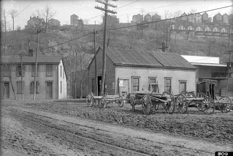
Left - Contractor's buildings stand at the intersection of West Liberty Avenue and Saw Mill Run Road to the right, where a lumberyard is located. In ten years, the Liberty Tunnels will be bored through the hill to the rear of the buildings; Right - A blacksmith shop owned by Peter Schaffner.
Left - Peter Schaffner's home at the corner of Pioneer Avenue and West Liberty Avenue, with the Castle Shannon Railroad bridge high above; Right - Another view of the Schaffner home looking north from Pioneer Avenue towards downtown Pittsburgh and the future site of the Liberty Tunnels.
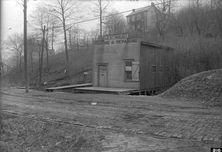
Left - The homes of J. Vallor and J.A. Talbert on the east side of West Liberty Avenue. In the distance is the railroad bridge and Pioneer Avenue heading uphill to the right; Right - J.E. Sill Roofing and Repairing on the west side of West Liberty Avenue.
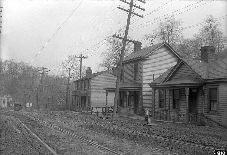
Homes along the east side of West Liberty Avenue near Brookside Avenue.
Left - Property of the American Mechanics Association on the east side of West Liberty Avenue at the intersection with Cape May. This building was once a school and was also used as a church; Right - The Luffey and Watson properties further south between Cape May Avenue and Stetson Street.
Left - Homes on the east side of West Liberty Avenue between Cape May Avenue and Stetson Street; Right - The Central Meat Market owned by William G. Dooley at the corner of West Liberty Avenue and Stetson. The Paul Plan of homes on Plainview Avenue stands on the hillside above.
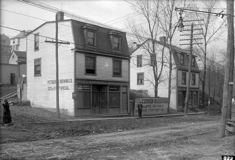
Left - A townhouse on the west side of the intersection of West Liberty and Stetson Street; Right - Two business establishments at the busy corner of Curran Hill Avenue and West Liberty Avenue, across from Capital Avenue.
Left - One of the Beltzhoover properties at the corner of West Liberty and Capital Avenue. Capital begins its wind up towards Pioneer behind the Beltzhoover home; Right - The property on the opposite side of West Liberty offering stabling.
Left - The Beltzhoover's well-maintained family home, nestled between Capital Avenue and West Liberty Avenue; Right - The home of Estella M. Flanders on the opposite side of West Liberty, north of the Beltzhoover home, with bright laundry hanging to dry. Their are several homes heading north towards Curran Hill Avenue with well-manicured yards.
Left - A property owned by Estella Flanders up the road from the family home; Right - A view of Estella Flander's property, her stables housing two garaged carriages and a wagon drawn up to her General Store. The stables carry many posts and advertisements, but the Ward's Bread artwork is the eye-catcher.
Left - The home of William Abbot on the west side of West Liberty Avenue; Right - A large home at the corner of West Liberty Avenue and Pauline Avenue, up from the Abbot home. The area going up Pauline towards Beechview has seen heavy residential development.
Left - The J.B. Knowlson property on West Liberty Avenue, on the west side looking south towards the bend that will take you to the intersection with Brookline Boulevard; Right - The J. Claude Grocery Store and several family homes above the hillside on the east side of West Liberty Avenue, near the intersection with Bell Isle Avenue. There are several advertisements for Old Dutch Cleanser adorning the storefront.
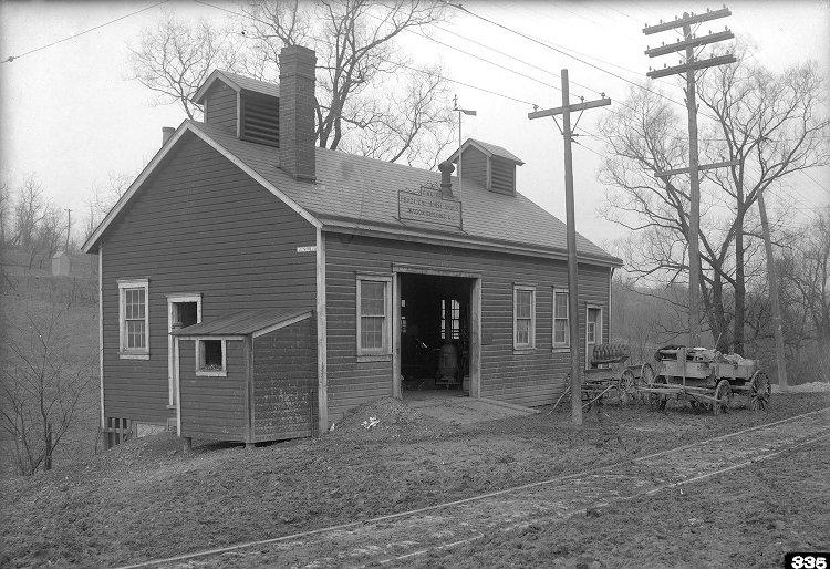
Left - The property of J. Hailey on the east side of West Liberty Avenue; Right - The G.M. Kerr blacksmith shop at the corner of West Liberty Avenue, Wenzel Avenue and Brookline Boulevard, on the west side where the present day McDonalds stands. The Kerr's had been blacksmiths since the earliest days of South Hills development. It is here that a passenger on the 39Brookline trolley would veer left onto the Pittsburgh Railways right-of-way that would take them to Brookline.
Left - The property of F. C. Beinhauer on West Liberty Avenue, at the intersection with Wenzel Avenue and Brookline Boulevard, opposite from the Kerr blacksmith shop. The signs on the building advertise L. Beinhauer and Son, Funeral Directors, and L. Beinhauer and Son, Livery and Sale Stables. The stables may be gone, but Beinhauer's funeral home is still a fixture at that corner of West Liberty Avenue a century later. In the distance you can see the Kerr family home on the other side of Wenzel Avenue; Right - The home of William Hall stands further south, neighboring the Beinhauer lot, with the Kerr home in the distant right. From the Beinhauer property to the city line at the intersection with Pioneer Avenue, the trolley line was single track. The same can be said for the line running spur line running towards Brookline. Not until 1915 were these lines upgraded to double track.
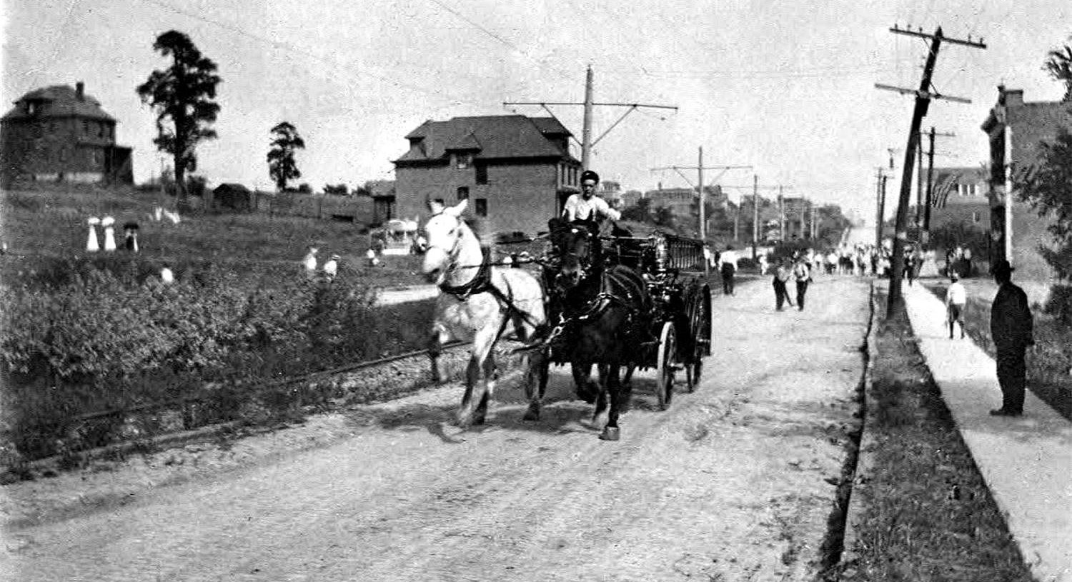
At the intersection with Brookline Boulevard (left) the trolley switched onto the Brookline spur line. The Pittsburgh Coal Company would be on the right and Brookline Boulevard would curve up the hill to the left. The trolley would wind up the right-of-way and intersect Brookline Boulevard at Pioneer Avenue. The photo on the right is looking down Brookline Boulevard towards the West Liberty Avenue intersection, taken in 1909. The trolley line and right-of-way are located in the center moving to the left.
Once onto Brookline Boulevard the trolley would take the passenger all the way through the heart of Brookline to Breining Street and on to a loop near Witt Street. From there it was back along the route to downtown Pittsburgh. For a detailed description of a trolley ride in the early 1900s, read this first-hand account that was featured in an edition of the Brookline Journal. |