|

This historical essay attempts to explore
the history of the South Hills region known as Brookline, formed in 1905. Actually,
this area has a rich history dating back much further, to the 1750s and the days
when taxes were paid to the King of England
Much of the information presented here
was retrieved from old Brookline Journal articles, the University of Pittsburgh Online Digital Archive, including the Pittsburgh City Photographer
Collection, and articles retrieved from the search engine at newspapers.com.
Our story has been supplemented over the
years by personal recollections of long-time Brookline residents, bits and pieces
from individual scrapbooks and plenty of additional research. Much of this research,
data and images has been merged into this essay, a comprehensive look back in
time.
Explore the highlighted links below, along
with additional links located throughout the text, for more detailed information
on the history of the Brookline community. For a supplemental resource, visit
our Brookline Connection facebook page.

* Last Updated: December 18, 2023 *
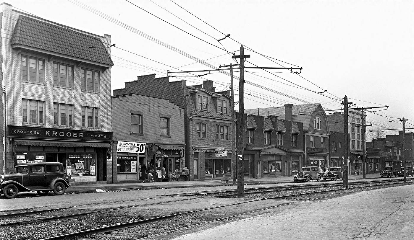
Brookline Boulevard, near the intersection with Glenarm Avenue, in 1933.
Prior to 1900, Brookline Boulevard was a
dirt roadway, known as Hunter Avenue (from West Liberty to Pioneer)
and Knowlson Avenue (from Pioneer to
Whited), that connected the many family owned farms that made up the
Brookline countryside.

The Beauty Of A Morning Sunrise In Brookline

It seems like all the colors in the visual
spectrum are captured in this Christopher Jamison
picture of "A Sunrise Over Brookline," taken on January 25, 2017.
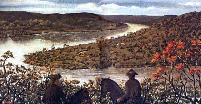
A Great City Will Grow
On November 23, 1753, George Washington, a twenty-one year old major in the British Colonial Army,
surveyed the land surrounding the junction of the Monongahela River
and the Belle Riviere. The young major predicted that on this spot
there would someday grow a great city. He recommended that militia by
dispatched with all haste to construct a fort.
Due to the strategic significance of
the land now known as "The Point", the junction was a prized possession to
any occupying force, offering control of all river traffic to the western
frontier. The French needed dominance over the Ohio River Valley to
consolidate their colonial interests in Canada (then known as New France)
and Louisiana. The British had other designs for the region. The crown and
increasing numbers of colonial settlers were looking to expand their
territorial boundaries beyond the Appalachians.
The French insisted that they had
claim to the region by right of first discovery. The British countered
that the land fell under their control by virtue of a treaty with the
Five-Nation Iroquois Confederacy. Both empires felt that their claims were
justified, and each expended great manpower and resources to gain dominance
over this advantagious location.
The British and The French
Heeding Washington's advice,
the British rushed a small garrison to the river junction and constructed a
small stockade called Fort Prince George. The French responded by sending
strong force, including many of their indian allies, that overwhelmed the vastly
outnumbered British. The garrison surrendered on April 17, 1754 and began the
long march back to Virginia. A new, much larger French outpost was built on the
spot, named Fort Duquesne.
In the meantime, Major Washington
had been dispatched with a regiment of Virginians to reinforce the garrison.
Washington's troops first encountered the French at a skirmish known as the
Jumonville Affair. The french patrol was routed and their commander killed.
On July 4, 1754, the French counterattacked in force. Washington and his
militiamen were beseiged at Fort Necessity and compelled to
surrender.

These local events marked the formal
beginning of the French and Indian War. To the chagrin of the British, the
empire of France now had complete control over the region and, most
importantly, the river junction.
In February of 1755, General Edward
Braddock was sent with two colonial regiments and 500 British
regulars, including artillery, to evict the French force. On July 8, 1755,
the British column was ambushed as it approached Fort Duquesne and suffered
another serious setback. Now a colonel, George Washington was present for
this monumental defeat. After the death of General Braddock, Washington took
charge and led the retreat back to Virginia.
The defeat at the Battle of the
Monongahela reverberated throughout the British Colonial Empire. Stung by
this loss, and determined to regain control of the region, the British struck
back three years later. On November 25, 1758, General John Forbes and an
army of 6000 British and Colonial troops forced the French to burn their
fort and retreat north. Forbes and his men had claimed
the river junction for the British Empire once and for all.

General Forbes ordered the
construction of a much larger and stronger fort. It was built over the
ruins of Fort Duquesne and named Fort Pitt. Forbes christened the area
Pittsborough. The village was chartered in 1759, named in honor
of the Prime Minister of England, William Pitt.
The colony at Pittsborough grew
rapidly around the fort, which was one of the largest British strongholds
in North America. Settlers and traders began to migrate to the surrounding
areas, including the rolling hills to the south of Coal Hill.
These early pioneers provided goods and services for the many British
troops and the growing frontier population.
Indians on the Warpath
By 1763, the final year of
the French and Indian War, the British had control of much of northeastern
North America. Most of the native Indian tribes were displeased by their
treatment from the British occupiers. The main concern of the Indians was
the continued settlement of people along the western frontier, which in
1763, included the Ohio River basin.
An Indian leader named Pontiac began
organizing many Indian tribes together to rebel against the British.
Pontiac's force included groups from the Delaware, Huron, Illinois,
Kickapoo, Miami, Potawatomie, Seneca, Shawnee, Ottawa, and Chippewa tribes.
An Indian War, known as Pontiac's War, began in 1763.
Pontiac wanted to drive the British
back to the eastern side of the Appalachian Mountains. Many small British
outposts were overrun and the Indians were on the verge of total victory.
The only remaining outposts west of the Appalachians were at Fort Detroit,
Fort Pitt, Fort Ligonier and a handful of other outposts.

The Siege of Pittsborough lasted
eighty-six days from May to August 1763.
In May of 1763, the Indians attacked.
Their assault began in the north and swept south towards the village of
Pittsborough. The natives burned all cabins and massacred all of the white
settlers in the outlying areas. Only those fortunate enough to find sanctuary
inside the fort survived. From May 27 to August 9, Pontiac's warriors laid
seige to Fort Pitt. During this time they made several unsuccessful attempts
to storm the fort.
British Colonel Henry Bouquet led
a relief expedition, which was ambushed as they approached the village.
Bouquet's force successfully counterattacked during the Battle of Bushy Run and defeated the natives. This victory
effectively lifted the seige of Pittsborough. Without the assistance of the
French, who were near surrender themselves, the Indians were soon forced to
abandon their campaign to drive the British from their lands. The frontier
was now open to westward colonial expansion and settlement.

Colonel Bouquet's Highlanders defeat
Pontiac's warriors at the Battle of Bushy Run.
Settlers once again began to migrate
into the area, and Pittsborough again began to build and expand. The restless
natives, now settled in Ohio, remained a deterent to further westward
expansion. Sporadic hostilities continued off and on for three years.
Fort Pitt became a staging area for
several military expeditions against the native tribes. Not until 1766 was
a formal treaty signed. Despite the agreement, conflicts persisted along the
upper Allegheny River until 1779, and Fort Pitt remained a valuable military
bastion.
Control of the fort passed to the
colonial militia in 1772. The British garrisons abandoned the area never
to return. During the War of Independence, there was very little activity
in the western part of Pennsylvania. The majority of the conflict was
fought in the eastern coastal theatre.
In 1783, that conflict ended and a
new nation was born, the United States of America. Fort Pitt remained a
United States Army facility until permanently decommissioned in 1797. The
fort was dismantled and the materials used in local construction
projects.
Rapid Development of Pittsburgh
After the end of the Revolutionary War,
the borough of Pittsburgh began to expand at a more rapid pace. After years
of being a garrison town, the town now found a new identity. With frontier
expansion booming, Pittsburgh soon became known as the "Gateway to the
West."
The discovery of valuable natural
resources and reliable river passages made Pittsburgh an important stop
for migrant settlers on their journey west. It also became a valuable hub
for commerce and shipping.
This fueled the expansion and growth
of industry in Pittsburgh. Gristmills, print shops, glassworks, ship building
and the iron
industry flourished. By
the dawn of the 19th century, millions of people heading west traveled through
the area. The City of Pittsburgh was officially chartered in 1816.

The Carnegie Steel Works in Homestead. The
iron and steel industry flourished throughout the Pittsburgh area.
The abundance of coal in the
nearby hills led to the rapid development of the coal industry, which fed
the fires of the expanding industrial base, not to mention the home heating
needs of the growing local population. Numerous mining
ventures moved into the
lands east and south of the city.
The rolling, well-watered lands to
the south of Coal Hill were also considered prime farmland. Family farms
were a common site throughout the South Hills, including West Liberty Borough
and the present-day Brookline area.
Early Settlement of the South Hills
After the American Revolution, soldiers
of the Pennsylvania Militia were granted land by the State Legislature in lieu
of payment in gold and silver for their services during the War of Independence.
These veterans filed their claims in Philadelphia and became the first official
American settlers in the South Hills. A track of 395 acres, patented in 1786 to
David Strawbridge, in pursuance of the Virginia Certificate, was called "Castle
Shanahan."

David Strawbridge's 1786 land grant
that later became the municipality of Castle Shannon.
Another former militiaman, Joseph
McDermutt, filed his claim for 240 acres along Oak Hill. His land was
called "The Hermits Cell" and occupied much of the present-day 19th Ward
of Brookline.
<Survey Maps and Deeds of Original South Hills
Land Grants>
A search of old records reveals the
family names of Strawbridge, McKee, Shawhan, Kennedy, Fleming, Hunter,
Hayes, McDermutt, McDowell, Hughey, Broddy, and Brison. In the 19th
Century, we find such families as Espy, Plummer, Paul, Lang, Schaffner,
Kerr, Sylvester, Fetterman and Knowlson. The area became a prosperous farming
district.
Prior to the erection of Allegheny
County in 1788, the Pittsburgh district was part of Westmoreland and Washington
Counties. Civic-minded citizens had to travel long distances over poor roads in
order to cast their ballot on election days.
The earliest voting place was at
Shawhen's Square (later Colonel Espy's Tanyards) at Pioneer and West Liberty
Avenues. After 1788, they voted at Obey's Place on Carson Street, where the
Pittsburgh and Lake Erie Railroad Company station now stands.
St. Clair Township, named in honor of
General Arthur St. Clair, was a massive township stretching fifteen miles to the
south and varying in width from six to ten miles. The northern township border
was the Monongahela River, between the mouths of Chartiers Creek and Streets Run
Creek. The township was as large as many counties in other parts of the
state.
Formation Of Allegheny County
Allegheny County was formed on September
24, 1788. The county was made up of land previously a part of Westmoreland and
Washington Counties. It was formed due to pressure from settlers living in the
area around Pittsburgh, which became the county seat in 1791. Allegheny County
originally extended north to the shores of Lake Erie. It was reduced to its
current borders by 1800.
Many of Brookline's earliest landowners
were signatories on the initial petition for the creation of the new County. At
that time of the county's formation, what would become the Brookline area was
sparsely populated fertile land located in the lower district of
St. Clair Township.

<1787 Petition with Signatories for
the Creation of Allegheny County>
Signatories include Joseph McDermutt,
David Kennedy, Joseph McDowell, Robert Shawhen and John McKee,
all prominent landowners of property that make up the boundaries of
present-day Brookline.
Upon the erection of Allegheny County
the court proceeded to divide the county into three distinct districts. The
first included the townships south and west of the Ohio and Monongahela Rivers.
The second district was located between the Monongahela and Allegheny Rivers,
and the third included land north of the Allegheny and Ohio Rivers.
The first section included three
townships: Moon, St Clair and Mifflin. At that time, St. Clair Township
was made up of the southeastern corner of present-day South Fayette Township,
part of Snowden Township, the whole of Baldwin, Scott, Bethel, Upper and Lower
St. Clair Townships. In 1805, Nathaniel Plumer, who resided in land that is
now part of present-day Brookline, was named as one of the three township
commissioners.
Lower St. Clair Township
In 1806, deemed too large to adequately
maintain, St. Clair Township was divided into the separate municipalities of Upper
and Lower St. Clair. Within the boundaries of Lower St. Clair Township were the
present-day communities of West End, Mount Washington, South Side, Beechview,
Brookline, Banksville, Beltzhoover, Mount Oliver, Bon Air, Knoxville, Allentown,
Carrick, Overbrook and St. Clair Village.
In the 1830s, the main population centers
were along the Monongahela River, where factory production and coal mining were
booming in the areas of Temperanceville, South Pittsburgh, Birmingham and East
Birmingham. These heavily populated and industrialized areas soon left the township
to form their own boroughs. Another significant parcel of territory was ceded in 1844,
when Baldwin Township was chartered.

Map from 1850 showing Upper and Lower
St. Clair Townships. The original St. Clair Township included
both Upper and Lower St. Clair as well as the whole of Baldwin Township and
part of Snowden.
The Road from Washington is present-day West Liberty Avenue from the southern
border
of Lower St. Clair to Saw Mill Run Creek. It was then known as Plummer's Run.
To the south of Coal Hill, the rolling
terrain of West Liberty and the other nearby communities along Saw Mill Run were
what remained of Lower St. Clair Township. Despite the losses, in 1860 the population
of the township ranked fifth in the county at 4,617. That number grew to 5,322 by the
end of the decade.
In 1860, the South Hills terrain was still
a predoninantly agricultural region. In the Brookline area, the largest of these were
operated by John and Elizabeth Paul, Richard Knowlson, Ephraim Hughey, David Hunter and Philip Fischer and David McKnight. These families lived off the
land and sold their surplus crops at the markets in Pittsburgh.
The coal industry began to move into the
South Hills in the mid-1860s, leading to a significant population increase as
laborers began migrating to mining villages with their families. In 1870 the value
of farms in the county was over $56,448,818, more than several states, and the
mineral resources almost incalculable. As the population and wealth increased,
emerging communities in Lower St. Clair Township began the process of forming
separate municipalities.
♦ Saint Clair Village (1951-2010) ♦
(The final section of Lower St. Clair Township)
William Dilworth
A notable early settler in Lower St.
Clair Township was William Dilworth. William was born in 1791 when Pittsburgh was
still a straggling village connected by row boat ferries with the nearby
settlements of Allegheny (North Side) and Birmingham (South Side). His father
was an early entreprenuer in the local coal industry.

Coal mining was the first major
enterprise in the South Hills.
At age 21, Dilworth joined
General William Harrison's army during the 1812 campaign against the British
and Indians. After the war, William settled on Mount Washington. He opened
some of the first mines to supply Pittsburgh with coal. He was married in 1817
to Elizabeth Scott, daughter of Colonel Samuel Scott of Ross Township.
Dilworth built what may have been the
first school house in Lower St. Clair Township to give free schooling to the
children of the miners in his employ. He paid the teacher out of his pocket
and purchased books for the pupils. The school building was erected in 1820
near the present-day South Portal of the Liberty Tunnels.

William Dilworth paid $15 per acre for
the coal lands he purchased south of Pittsburgh. During the the latter part
of his life he sold parcels of the same land for $3000 per acre. In the mid-1830s
he was instrumental in building a court house and jail in Pittsburgh, and later
built the piers of the old Monongahela Bridge, which was destroyed in
the Great Fire of April 10, 1845.
In 1847, Dilworth was elected to the
Legislature and served one session. Later, in 1859, he had a church built,
possibly the first in the area, near the old school house at the junction of
West Liberty Avenue and Warrington Avenue.
West Liberty Borough
West Liberty Borough was incorporated on March 7, 1876. The borough boundaries were
drawn from the western part of Lower St. Clair Township, with Saw Mill Run
Creek being nearly identical with the eastern and northern boundaries. The
village proper was described as a small hamlet on the old Pittsburgh and
Washington road.
Elections were held on March 24
for the new borough officers, resulting in the following choices:
Justice of the Peace - John Curran;
Judge of Elections - John W. Patterson; Inspectors of Elections - James Curran,
Warren W. Patterson; Burgess - John W. Patterson; Council - William Hughes,
John Paul, Thomas Curran, George C. Becker, Thomas Hughes and Thomas Knowlson;
School Directors - James Gibson, William Haas, Chris Wilhelm, George R. Fisher,
Joseph Hughes and William Robinson; Registration Assessor - William Haas;
Principal Assessor - John B. Knowlson; Assistant Assessors - R. R. Bell,
William Robinson; Auditor - A. J. Oyer; Constable - W. J. McIlvaine.

An 1876 map of the Pittsburgh area
showing the City of Pittsburgh and West Liberty Borough.
While the adjacent areas of Mount
Washington and the countryside along the line of the Pittsburgh and Castle
Shannon Railroad, such as the village of Fairhaven, were comparatively thickly
settled, West Liberty was sparsely populated.
Most of the land was made up of
farms, with some residential areas that were principally occupied by men
employed in the numerous coal mines owned by William Dilworth.
 
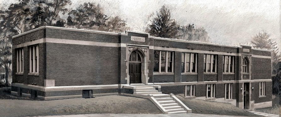
The home of George and Mary Beltzhoover along
the 1900 block of West Liberty Avenue (right), which
served as the Fetterman District Post Office from 1876 to 1907, and
the original West Liberty
Elementary School, shown here in 1912. It was the borough schoolhouse until
1898.
The population of West Liberty Borough
was 865 in 1880. The Fetterman Post Office district that covered the borough
boundaries was established in June 1876. Mary Beltzhoover, who resided along
West Liberty Avenue, just south of Capital Avenue, was the postmaster.
About this time, the first West Liberty
Elementary School was built along West Liberty Avenue at the bottom of Cape May
Avenue. This two room facility served the borough's children until 1898 when
a modern schoolhouse was built along Pioneer Avenue.

Map from 1876 showing West Liberty
Borough.
The surface of West Liberty Borough
was much the same as the rest of Allegheny County, hilly and broken.
Numerous small streams flow through it and springs are exceedingly abundant,
thus affording plenty of water and power for manufacturing purposes. Coal
was the staple production of the township, although agricultural pursuits
were extensively carried on.
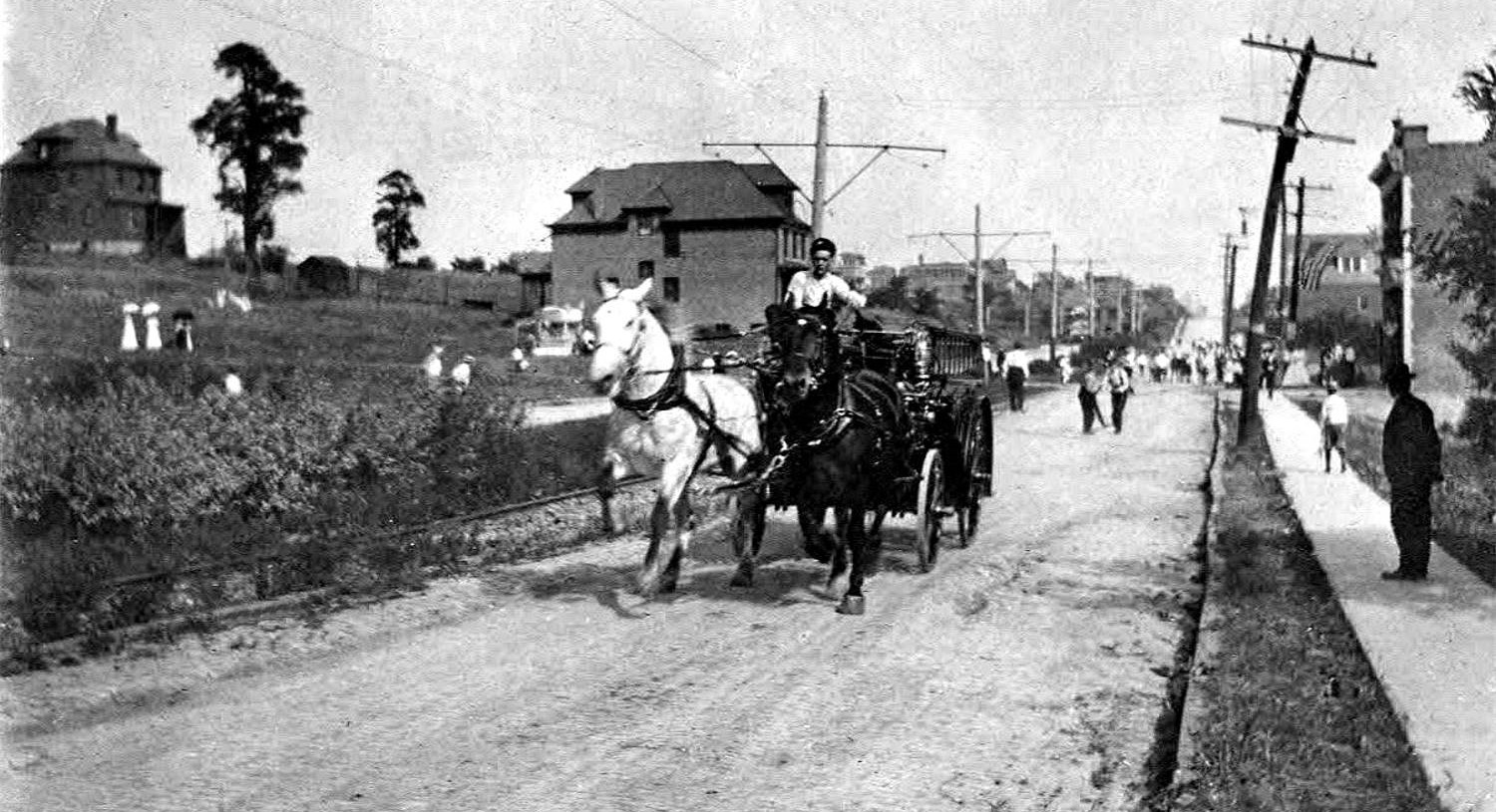
By the dawn of the 20th century, mining
was still prevalent along the valley floors, with the remainder of Oak Hill
practically all farms. It was then a common sight on summer mornings to
see a procession of market wagons on their way to the city with produce,
then returning later that afternoon.

In 1890, John Price was elected to the
West Liberty Borough Council. This well-known resident was often referred to as
"the town's honest old patriot." When Price assumed his council role, the
borough was $14,000 in debt and had a total land valuation of $286,000. A man
with a vision, John Price worked tirelessly for the betterment of the
borough.
Price pointed out the possibilities of
the South Hills long before the Mount Washington Trolley Tunnel had been built
and was successful in securing rights of way for the traction lines where
others had failed. When the tunnel became a reality in 1904, he was proven
right and the borough prospered.
Residential and commercial development
began quickly and continued unabated. By the time of annexation in 1908, West
Liberty Borough was a growing municipality with a treasury balance of $8,000
and a land valuation of $3,687,0000. On the 27,000 acres of borough land there
were 2,000 homes and a population of 10,000.

In addition there were fifteen miles of
modern sewers and three and one-half miles of paved roads. Both Brookline and
Beechwood had modern boulevards ready for further development, and upcoming
improvements and expansions in the traction lines guaranteed that this real
estate boom would bring further millions in the near future.
January 6, 1908 was a great day for
Pittsburgh and the residents of West Liberty Borough, signalling the birth
of the Brookline, Beechwood and Bon Air communities.

It is interesting to note that in the
above article Beechview is referred to as Beechwood. The reason is that West
Liberty Borough was split down the middle by West Liberty Avenue, seperating
the area of Brookline to the west and Beechwood to the east. The borough extended
eastward only to Broadway Avenue. The Borough of Beechview, an independent
municipality, stood between Broadway Avenue and Banksville Road.
The following year, in 1909, Beechview
Borough was also annexed, then merged with Beechwood to comprise one city
neighborhood. That community took the name Beechview. So, after only one year
on the books, the name Beechwood was relegated to the history books, with but one
reminder of that name still on record, Beechwood Elementary School
Click
here to learn more about
Beechwood, Beechview and ... Orvilla?
<><><><> <><><><>
<><><><> <><><><>
<><><><> <><><><>
Life in West Liberty Borough was not always
as lovely as a Norman Rockwell glimpse of Americana. This tiny borough just south
of Pittsburgh also had a dark side, one more foreboding than anyone would care to
imagine.
In a remote corner of the borough near the
borders with Montooth, Beltzhoover, Knoxville and Baldwin, along Saw Mill Run near
High Bridge Station and the McKinley Bridge was a place that, beginning around 1890,
became a mecca for all sorts of illegal gaming, sporting and drinking activities.
It was said to be as dangerous as the Wild West near High Bridge Station.

These activities caused severe consternation
amongst the local citizenry and borough officials, who seemed helpless in their efforts
to restore peace and order. Years of frustration boiled over on May 31, 1903, when
a horrifying riot occurred that resulted in the deaths of two men, several injured
individuals and a near hanging.
♦ Monte Carlo in West Liberty Borough (1890-1903) ♦
♦ Deadly Riot in West Liberty Borough - May 31, 1903 ♦
Birth of Brookline
In the earliest days of frontier
settlement, an old Indian trail ran roughly along the path of Pioneer
Avenue and Castlegate Avenue to a small farm and trading post run by
the McNeeley family. The outpost was known to the natives as Chimney Town,
and the trail was called the Chimney Town Road. This may well have been
the earliest known designation of the area that was to one day become
Brookline.
The South Hills area was settled prior
to 1800. Many of these early pioneers were veterans of the Pennsylvania Militia
who had served in the American Revolution under General Washington. These men
were issued land grants as payment in lieu of gold and silver for their services.
These hardy souls tilled the soil
and developed a prosperous farming district. Colonel Boggs Grist Mill, near
the northern end of Pioneer Avenue, ground their grain. Colonel Espy's Tanyards,
near the southern end of Pioneer, furnished the leather for their boots,
saddles and harnesses.

The Kapsch family lived at 1114 Milan
Avenue. Joseph and Amelia Kapsch both immigrated from Austria and
settled in Brookline in 1906. They were farmers and the family was one of the
original twelve members
of Resurrection Parish. The picture shows some of the Kapsch children: Amelia,
Marie, Josephine,
Joseph and John, with their donkey in 1909. The family grew to eleven with the
addition of
Theodore, Leonard, Agnes, Lillian, Alfred and James. Agnes married Fred Daley
and
owned the Park Side Grill on Brookline Boulevard from 1948 to 1965.
Situated in Lower St. Clair Township,
the area we now call Brookline became part of the borough of West Liberty,
which also included much of present-day Beechview. From the colonial days until
the dawn of the 20th century, the area was sparsely developed.
The addition of trolley service to
the South Hills in 1901, followed by an electrical traction route the following
year and the Mount Washington Transit Tunnel opening in 1904 brought a new era
of prosperity to West Liberty Borough. Early lot plans like Fleming Place,
Hughey Farm and Paul Place brought investors and developers to the region and
soon the rural farming community began to take on a more urban
look.
The Birth of Brookline can be traced
to one defining moment, on March 12, 1905, when ten West Liberty farms on the
western side of the borough, comprising 500 acres, were sold to the West Liberty
Improvement Company. Farms belonging to Jane Reamer, David Hunter, William McNealy,
Dr. J.H. Wright, John Knowlson, Willison Hughey, Joseph McKnight, Philip Linn,
John Daube and Philip Fisher were now slated for residential and commercial
development.

The improvement company spent $700,000
on the farms, and invested a further $750,000 in grading and paving roads,
installing water and sewer line, and other infrastructure necessities to allow
for the immediate construction of homes. Pittsburgh Railways responded to the
news by immediately installing a service route into Brookline. The dye was cast
and the community of Brookline began to take on a life of its own.
Although originally intended as such,
Brookline was never incorporated as a separate and distinct municipality. It
was merged with the City of Pittsburgh on January 6, 1908, and made part of the
original 44th Ward. By the mid-1900s, it comprised the 21st to the 27th election
districts of the 19th Ward.

A 1905 Freehold Real Estate advertisement
showing Brookline's proximity to Pittsburgh.
♦ Fleming Place/Hughey Farms Real
Estate Advertisements (1902) ♦
♦ Freehold Real
Estate Advertisements (1904-1916) ♦
♦ Freehold Real
Estate Brochures (1921-1926) ♦
♦ Freehold Real
Estate Advertisements (1930) ♦
Beechview/Dormont Real Estate Ads
(1901-1917)
NOTE: Brookline now comprises part of the
19th and 32nd Wards of the City of Pittsburgh, and is made up of West Liberty,
Brookline, East Brookline (formerly part of Overbrook) and Ebenshire Village
(formerly part of Baldwin Township) - although the name "Brookline" is assigned
to the entire area.

See Maps Showing Brookline Subdivisions
Pioneer Avenue was a State Road
Pioneer Avenue was established in
1797 as the State Road from Pittsburgh to Washington. It was the only main
roadway to reach the city from the south. It was later known as the Upper
Road from Boggs Mill and also the Coal Hill and Upper St. Clair Turnpike
Road.
Until the 1830s Pioneer Avenue
remained an artery of major importance, connecting the old Township road
(now Warrington Avenue) with the Morgantown Road (now Banksville Road).
Much of present-day West Liberty Avenue (Washington Road) was considered
part of this intra-state thoroughfare.
Wenzell Avenue, which originally led from Pioneer Avenue
to Greentree Road, was laid out in 1832. Plummer's Run, now called West
Liberty Avenue, from the Bell House to Pioneer Avenue, was laid out in 1839.
Once established, Plummer's Run became the main north-south state roadway
and Pioneer Avenue was reduced to its present course and length.
Since the emerging southern communities
had no brick yards or saw mills, all builders' supplies had to be hauled over
these poor roads, with the wagons often sinking hub deep in mud.

West Liberty Avenue at the intersection
with Stetson Street in March 1915, before the roadway was widened.
When the original streetcar line
was installed along West Liberty Avenue in 1902, the road was paved with
Belgian block between the rails only. Off the narrow rail line the roadway
was dirt. It remained as such until 1915 when it was widened and improved.
Whited Street, Edgebrook Avenue
and Merrick/Breining/Glenbury Street were former Township Roads.
Brookline Boulevard existed as a narrow dirt path connecting the farms
east of West Liberty Avenue with these Township Roads. McNeilly Road
was another established Township Road.
With the exception of the
aforementioned streets, practically all other roadways in and around
present-day Brookline were created by virtue of lot plan developments,
principally by the West Liberty Development Company between 1905 and
1908.
Early Commercial Enterprises
Among the early commercial
enterprises were Espy's Tanyards, located at the southern end of Pioneer and
West Liberty Avenues, in present-day Dormont. Here, leather was supplied
for boots, saddles and harnesses.
Boggs Grist Mill and Schaffner's Wagon Building and Repair
Shop were situated at the
northern end of Pioneer and West Liberty Avenues.
At a later date, the Pittsburgh Coal Company's power plant, operated by the Hartley and Marshall
Company, was built at Wenzell Way and West Liberty Avenue. Across the road
was Kerr's Blacksmith and Horseshoe
Forge.

The Old Bell House Tavern, near West
Liberty Avenue and Warrington Avenue, in 1890.
Wilhelm's General Store, later known
as J. Claude Groceries was located across from Pauline Avenue on
West Liberty Avenue. The only other store was Algeo's, located further
south at Washington and Bower Hill Roads.
Food, drink, and lodging were to be had
at Beltzhoover's Tavern and the St. Clair Hotel, both located at
the foot of Capital Avenue. Hayes Tavern stood at the southern end of Pioneer
and West Liberty Avenue, and the Bell House Tavern and Hotel stood near the present-day Liberty Tunnels along Warrington Avenue.
Ways To Travel
Transportation from the South Hills
to Pittsburgh in the early days was slow and difficult. A long and arduous
wagon ride up Bausman Street and down Arlington Avenue was one alternative.
Another was to travel to Mount Washington and use
the inclines to traverse the hillsides.
Travelers that could afford a ticket
could reach the city by way of the narrow gauge Pittsburgh and Castle Shannon Railroad, which followed the general course of the
Shannon Drake streetcar line. Passengers would take the Haberman Avenue Cable
Car up to Mount Washington, then down the Castle Shannon Incline to Carson
Street. From there they traveled by horse car into the city.
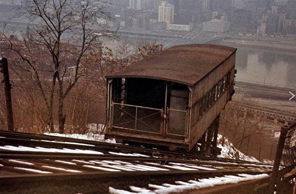
The Pittsburgh and Castle Shannon Incline
was in operation from 1890 to 1964.
Most of the coal mined around
Brookline was hauled on the P&CSRR through a Mount Washington tunnel, The
portal of the old coal tunnel was at the curve in Sycamore Street, directly
above the present-day transit tunnel. Once in Pittsburgh, the coal was
lowered to the factories along Carson Street using an incline.
By 1902, a horse-drawn streetcar line
was extended along the length of West Liberty Avenue to Mount Lebanon. This
single-track line passed the Brookline Junction at West Liberty and Hunter Avenue
(Brookline Boulevard). This line was soon electrified and extended to Castle
Shannon, making travel easier for South Hills residents, but there was still
no direct link to the city, except for the long trip over Mount
Washington.
Within a few short years, man made
huge strides in transportation. In 1903, the Wright Brothers historic
flight and Henry Ford's first automobile were actualities. The Mount
Washington Transit Tunnel through Coal Hill opened in 1904.

The South Hills Trolley Junction in 1906.
Note the billboard advertising homes in Brookline. On the hillside
above is a train of the Pittsburgh and Castle Shannon Railroad heading outbound
towards Overbrook.
The transit tunnel was a phenomenal
breakthrough for the South Hills. The Pittsburgh Railways Company soon
upgraded trolley service throughout the South Hills, with extensions built
to connect the many developing neighborhoods, along with an interurban
line to Charleroi.
These improvements shortened the trip
to Pittsburgh by miles and hours. It gave impetus to the West Liberty Development
Company and other real estate firms, from 1904 to 1908, to lay out streets and lots
in the portion of West Liberty Borough which was to become Brookline.
All Dirt Roads
At the turn of the 20th century all
roads were dirt and there were no sidewalks. The heavy traffic, which was
mostly horses and wagons, cut deep ruts into the roads so that in wet
weather the mud was often axle deep. Pedestrians fared no better.
Finally, Reverend Jones of
the Knowlson Methodist Church, located at the Brookline Junction with West
Liberty Avenue, with the help of a friend, secured funds to purchase
boards for a boardwalk. With the help of the community, the boards were
laid from the city line to the Old Bell House at
Saw Mill Run and West Liberty Avenue. This was the first public improvement
in the area.

A view of Rossmore Avenue, as seen from Pioneer
Avenue, in 1925.
The West Liberty Development Company began
laying out lots in the Brookline area in 1905. This new residential suburb attracted
so many people that, in February of 1907, West Liberty Borough voted for annexation
into the City of Pittsburgh.
On the first Monday of January, 1908,
the borough was annexed into the city as the 44th ward. Brookline and Beechview
became the 19th ward in 1910, when the City of Allegheny also became a part of the
growing metropolis.

A family in their horse and buggey approach
the intersection of Woodbourne and Sussex Avenue in 1924.
The paving of Brookline streets began
shortly after annexation. Some of the original roads to be paved were
Brookline Boulevard and streets nearby, like Berkshire, Bellaire and
Chelton.
These streets were covered with either
paving bricks or belgian block. Streets like Rossmore, Gallion, Woodbourne and
much of Pioneer Avenue were not paved until the mid-1920s. Parts of Berwin
Avenue remained unpaved until the 1950s.

Many Brookline streets were covered in
paving bricks, like Berkshire Avenue, shown here in 1923.
Other local streets were covered in larger, granite belgian blocks. Unlike todays
asphalt
covered roadways, these durable bricks were installed to stand the test of
time.
<><><><> <><><><>
<><><><> <><><><>
<><><><> <><><><>
Are They Called
Cobblestones or Belgian Blocks?
There is some debate over the
proper term for the stones that were used to pave
many of Brookline's streets, like Rossmore, Flatbush, Capital and Birchland.
Were they called "cobblestones" or "belgian block."
The answer is belgian
block.
The official terminology
might sound a bit strange:
 
Setts, or Belgian Blocks (left) and
Cobblestones (right).
A SETT, usually referred to in the
plural and known in some places as a Belgian block, is a broadly rectangular
quarried stone used for paving roads. Formerly in more widespread use, it is
now encountered more as a decorative stone paving in landscape
architecture.
Setts are often idiomatically referred
to as "cobbles", although a sett is distinct from a cobblestone by being quarried
or shaped to a regular form, whereas the latter is generally of a naturally
occurring form. Setts are usually made of granite.
For a more detailed history
of setts, visit Wikipedia (Setts).
 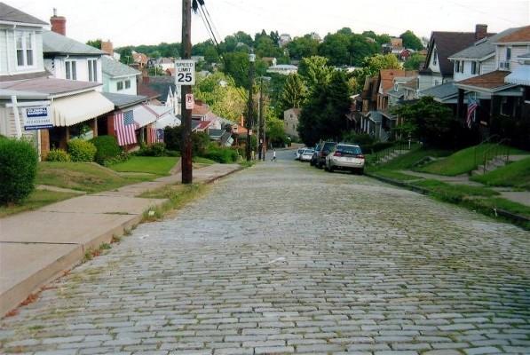
Workers cutting belgian block for use along
West Liberty Avenue in 1915 (left) and Rossmore Avenue in 2004.
The belgian block on Rossmore Avenue was put down in 1925.
<><><><> <><><><>
<><><><> <><><><>
<><><><> <><><><>
Street Paving
In Pittsburgh
Well into the 19th century, Pittsburgh
roads were mostly unpaved. Early efforts at providing a durable surface on
roadways included using wood blocks, round cobblestones and crushed rock.
These methods were unreliable, and often deteriorated quickly.
Other, more expensive alternatives were
the use of vitrified paving bricks, belgian block or sheet asphalt. As the
years passed and the benefits of a smooth, reliable surface became evident,
these three options became the standard for Pittsburgh streets.
As the city grew, there also arose a
demand for better roads. Only a few main streets were paved with municipal
funds. The cost of paving all streets, however, was well beyond the limits
of the city coffers.
On April 2, 1870, the Pennsylvania
Legislature passed the Penn Avenue Act, which assessed a tax on abutting
property owners to pay for street paving. After this, the practice of
paving roadways became standard in middle to upper-class neighborhoods,
but was mostly rejected by the residents of working-class
communities.

West Liberty Avenue, looking north from the
Brookline Junction in June 1916, covered in belgian block.
When Pittsburgh roads were paved,
the cheapest method brick and belgian block. This was due to the paving
bricks being forged in foundries close to the city, and the block being
easily obtainable from nearby quarries.
Up until the 1930s, the granite
belgian block was preferred for use on heavily traveled roadways and also
on hilly streets because it provided better traction. Paving bricks were
selected for mostly level street surfaces that saw moderate traffic usage.
Outside the city limits, asphalt was the primary choice.
Due to the abundance of hills,
Pittsburgh was well-known for its belgian block roadways. In 1916,
the city ranked third in the nation with over 230 miles of block-covered
streets. The top two cities were Philadelphia and New York, both with
over 400 miles of roads covered in belgian block.

Berwin Avenue is covered in red paving bricks
and Beaufort Avenue in Belgian Block - April 2014.
Here in Brookline, most streets
were paved in either paving bricks or belgian block. The ratio or brick to
block was close to 50/50. Some streets with a mix of level and hilly stretches
were paved with both brick and block. Asphalt, and later concrete, were used
sparingly in Brookline until the 1940s.
Today, most streets throughout the
city are covered in asphalt or concrete. Vintage brick and block roadways have
diminished dramatically in number. As a testament to their durability, these
old road surfaces often provide the solid base for the smooth black
top.
The same can be said for the streets
in Brookline. However, there are still several brick and block streets that
have stood the test of time, providing motorists with a historic, and often
rumbling, reminder of Pittsburgh's past.
<><><><> <><><><>
<><><><> <><><><>
<><><><> <><><><>
Where Did Brookline's Paving
Bricks and Belgian Block Come From?
During some water line repair work on
Freedom Avenue, a section of red paving bricks were removed and stacked
along the sidewalk. Once the utility line was back in service and the hole
filled, the paving bricks would be put back in place. This was one of the
main benefits of using the bricks.
The bricks that sat along the side
of Freedom Avenue were stamped "C.P. Mayer Co. - Bridgeville." As it turns
out, the C.P. Mayer Company provided the majority of the pavers used on
Brookline streets.
 
The brick works was founded in 1903 by
Casper Peter Mayer, a Bridgeville industrialist. The C.P. Mayer Company supplied
the majority of paving bricks used for roads in the South Hills. The dense and
durable pavers were so well made that, after a century, they can be removed from
present-day road surfaces, cleaned and put back in place as good as
new.
Our Belgian Block came from a bit further
away. In the 1890s, the city contracted with Keeling, Ridge and Company for the
granite blocks used for curbs and street paving. They obtained their product from
a quarry near Connellsville. From 1899 to 1950, Booth and Flinn, Ltd. was one of
the primary contractors for streets and other city infrastructure projects. Booth
and Flinn obtained their granite from their own quarry located west of Ligonier
at Longbridge, along the Ligonier Valley Railroad.

Workers at Booth and Flinn's granite
quarry near Ligonier, Pennsylvania.
The Pittsburgh Post-Gazette on June 17,
1978, noted that because of the location of the Booth and Flinn quarry, granite
paving blocks laid in the 1900s are, here in Pittsburgh and Western PA,
officially refered to as, not Setts or Belgian Block, but "Ligonier
Blocks."
It is a shame that, over the years, so
many of the roads paved in Mayer bricks were not well maintained and eventually
paved over. If more of these road surfaces had been kept in service, the city
would have much less of a burden when it comes to asphalt road
resurfacing.
<><><><> <><><><>
<><><><> <><><><>
<><><><> <><><><>
Street Sweepers
- The Hokey Man
Looking back through old photos of brick
and block streets, one thing always seems to be present, dotted in small clumps here
and there. Horses had no pride when it came to taking a dump. Anywhere was convenient
for those beasts of burden.
Who cleaned up all that mess on
a daily basis? The Hokey Man, that's who.

A Hokey Man, shown in 1916, cleaning some
waste off of a block roadway in Pittsburgh.
Where the name "hokey" came from is a mystery,
but these street sweepers were quite important municipal employees. With their push
cart, shovel and broom, these men toiled daily to keep the roadways clear of trash
and other waste. The companies that owned the city's toll bridges employed their own
hokies to keep the wooden roadbeds free of debris.
Street Car Service
The first streetcar railway south of
the Monongahela River was a horse-drawn car line, which operated from Carson
Street to Thirtieth Street. In the winter the floor was covered with straw
to keep the passengers feet warm. Horse-drawn rail traffic was established
in the South Hills in the early 1800s, but there were only a few routes
available.
The first electric cars were used
in this part of the city in 1890 and were controlled by the Pittsburgh and
Birmingham Traction Company. The cars seated twenty-five people. One such
route extended from Warrington Avenue south along West Liberty Avenue
to Mount Lebanon.

West Liberty Avenue at the junction with
Brookline Boulevard in 1915.
A single=track line was laid along West
Liberty Avenue in 1901 as part of the Charleroi Electric Short Line Railway.
The streetcar tunnel through Mount Washington opened on December 2, 1904,
bringing quick and reliable service to the South Hills.
In the spring of 1905 a double-track
line was constructed through Brookline from Kerr's Blacksmith Shop on West
Liberty Avenue (the Brookline Junction) to a dead end at Fairhaven Road
(Merrick Avenue). In 1910, the service was extended into East Brookline to
a trolley loop near Witt Street.

A trolley car heading inbound approaches
Pioneer Avenue in 1918.
Five years later, in 1915,
the entire West Liberty Avenue line was reconstructed. The modern trolley
service led to a dramatic surge in residential and commercial construction,
and a corresponding population boom.

An inbound 39-Brookline passes Birchland
as it approaches Breining Street after making the loop.
For six decades, streetcar traffic in Brookline remained a reliable transportation alternative. The Pittsburgh rail
network could get a passenger anywhere in the city. It was the prefered choice
for commuters traveling to work downtown, and students at South Hills High School
were issued passes for the trip to and from the South Hills Junction.
Pittsburgh Railways route 39-Brookline
remained in operation until September 1966, when the line was discontinued in
favor of Port Authority bus service. The route was renamed 41-Brookline. Although
they lack the nostalgia of the traditional streetcars, the bus service in
Brookline, and throughout the city, is still affordable and reliable. In 2011,
the Port Authority redesignated the Brookline
bus route back to the traditional 39-Brookline.

Light rail cars pass the Station
Square stop at Carson and Smithfield Streets.
For those who still enjoy riding the rails,
the Potomac Avenue "T" station in Dormont is a convenient nearby gateway to Pittsburgh's
modern light rail system. The "T" routes follow the old Mount Lebanon/Beechview and Shannon/Library
street car right-of-ways and connect to the downtown subway, then on to the North
Shore.
<><><><> <><><><>
<><><><> <><><><>
<><><><> <><><><>
Are They Called
Streetcars or Trolleys?

There is some debate over whether the
proper term for the vehicles that ran the rails on Pittsburgh streets were
called "Streetcars" or "Trolleys."
The answer is ... both!
The official
terminology might sound a bit strange:
A TRAM (also known as a tramcar; a
streetcar or street car; and a trolley, trolleycar, or trolley car) is a rail
vehicle which runs on tracks along public urban streets (called street running),
and also sometimes on separate rights of way. Trams powered by electricity,
which were the most common type historically, were once called electric street
railways. Trams also included horsecar railways which were widely used in urban
areas before electrification.
For a more detailed history of trams,
visit Wikipedia (Trams).

Two inbound 39-Brookline streetcars, heading north
on West Liberty Avenue, approach the Capital Avenue Car Stop.
A Ride On The Brookline Trolley In
The Early 1900s
This account was published by
Mr. Donald Hahn, an old Brookline resident. Mr. Hahn details what it was
like taking the 39-Brookline trolley from the South Hills Junction through
to the old trolley loop. It is a wonderful look back at what Brookline
was like around 1910. It was copied from a Brookline Journal
article.
We are now aboard a Brookline
trolley car (Toonerville) at the South end of the tunnel (South Hills
Junction), for the trip to Brookline. We swing and sway down through the
barn yard to its end, and the switch.
Here the conductor got out, threw
a switch, and pulled onto the single track cutoff that leads to Warrington
Avenue. The conductor threw back his switch, and threw the light giving
right of way to the single track at the Old Bell House Tavern.
The Bell House stood just across Saw
Mill Run. An old wooden bridge spanned the run. Here the conductor turned off
the single light. Double track started here and we turn onto West Liberty
Avenue.
Born's West Liberty Hotel was on one
corner and Elijah Lee's blacksmith shop was on the opposite corner. Gilfillan
and Orr Feed Company was next to the hotel, and a frame house owned by Peter
Schaffner was across the street. From there up to Cape May Avenue just
a few frame houses stood.

West Liberty Avenue near the junction
with Saw Mill Run and Warrington Avenue in 1915, looking south.
At Cape May Avenue was the old
frame school. Here was were the Mission and Brookline Boulevard United
Presbyterian Church originated. A few more scattered houses, then the
Paul Coal Company mine entrance, stable and loading bins at the corner of
Stetson Street.
From here on more scattered houses,
with Zehfuss Hotel near Capital Avenue, Wilhelm's country store at Ray Avenue
and Butcher Baker's meat market at the corner of Pauline.
Where the Evangelical Home
stands were the Knowlson and Millitzer Farms, and at the junction the
George Kerr and Sons blacksmith shop, with the big house on the hill
behind.
Before we start up the hill let's
look back on the south-east side of West Liberty Avenue. On the corner
was the old mine entrance, the pumping station and air shaft.
The street car wound its way over
a private right of way up the hill. In later years the right of way
was widened and paved, extending the Boulevard to the Junction. Present-day Bodkin
Street was originally Hunter Avenue, then renamed Brookline Boulevard until
the paving of the right of way, at which time it became Bodkin.
We will now travel down the
Boulevard. The car tracks were in the center, a private right of way unpaved, and set between
the tracks were wooden poles. Long cross-arms were mounted atop these poles, to
which were strung the trolley wires.
I should state that Pioneer Avenue
was originally Lang Avenue, named for William Lang. The Lang farm was located
near the bottom of Pioneer Avenue, alongside the railroad tracks. When Brookline
was annexed into the city, the steet name duplicated another Lang Avenue and
needed to be changed. The residents decided to call the street Pioneer
Avenue.
Doctor C.C. Lang had his home and
office on the corner where Myer's Gas Station now stands. When Mr. Myer's
put in his first station equipment the house was moved to its present
site at Pioneer and Berkshire Avenues.

Looking up the lower end of Brookline
Boulevard towards Pioneer Avenue and the home of Dr. C.C Lang.
The streetcar exited the right of way onto the boulevard near the small
building to the right.
Next was part of an old orchard,
then W.H. William's Grocery. At the West Point trolley car stop (Wedgemere
Avenue), was Hoot's Bakery. This building housed many business establishments
until 1920.
Brookline's first movie house was
an open-air theatre between a store and the engine house. Crossing Castlegate
was Dooley's Grocery and Meats. Joe Dooley also had his own ice
plant.
Further along the Boulevard we pass
more vacant lots and the remnants of an another old orchard, until we reach
"Heine" Melvin's Drug Store at the corner of Stebbins. From a point opposite
Flatbush Avenue, a path cut through the field on an angle, ending beside Ed
Cook's house on Berkshire Avenue.
Brookline Boulevard on July 4, 1911,
looking northeast towards Stebbins Avenue and on towards Chelton (formerly
Chelsea Avenue) in the distance. Melvin's Brookline Pharmacy
is the first building on the right.
From Stebbins Avenue, more open
fields to McNeilly's Grocery. This building, now owned by Melman's,
housed stores operated by Dean Rhodes and Stevens. Every one of these
Boulevard stores had a stable on the alley to the rear.
The next buildings erected were
an apartment and duplex near Queensboro, where Dr. O'Hagan, the school doctor,
lived, and Sam Gigliotti's building. This building had two store rooms with
living quarters above. Sam had his tailor shop in one store. and Nick Ermilino
had a shoe repair shop in the other. Another early building was Bob Hartman's
News Agency and Simon Zitelli's Barber Shop.
In the triangle stood the frame
building owned and occupied by the Freehold Real Estate Company. Between
the triangle and Breining Street, Oakridge Street and Merrick Avenue was
an old orchard.

Brookline Boulevard in 1913, showing
the Freehold Real Estate office in area where the cannon sits today.
Beyond Breining Street to the right
we ran into, what was called in the olden days, Anderson's
Acres farm and
woods. To the left of the tracks was the Hayes farm. The original East Brookline
was laid out in part from the Hayes farm.
At Breining, the conductor threw a
switch and proceeded on single track to the loop, where he got out and threw
another switch for the return trip back up the boulevard.
I might add that for a few years
before the loop was built the streetcar line continued through the woods
and past the old coal mine shafts in the valley. It passed under a railroad
tressel and met up with the Charleroi line, then followed Saw Mill Run to
back to town.
<Ride The 39-Brookline And
See The Sights Along The Way - 1912>
City Steps
Another tried and tested way
to get from here to there in the community of Brookline is on foot.
Brookline has always been a walking neighborhood. Children make
their way to school every day along the broad sidewalks. Shoppers
walk to and from the boulevard pick up groceries, and commuters make
their daily trek to the bus or streetcar stop.

The Stebbins Avenue steps rise from
Berkshire Avenue to Woodbourne in 1933.
With all of the hills in
Brookline there are several roadways that in places are just
"Paper Streets." They are on municipal maps, but are in fact
long sets of City Steps. These cement staircases vary in length
from short climbs to long, mountainous ascents.
Some city steps run alongside
steep roadways, like the Belle Isle Steps and the Stebbins Steps.
Others are extensions of existing streets, such as the Jacob Street
Steps. The Ray Avenue and Wedgemere Place Steps are somewhat unique,
standing alone from beginning to end yet still carrying a distinct
street designation.
 
Looking down from the Brookline side
of the Jacob Street Steps as two men return home from work in
1952 (left),
and the Glenbury Street Steps, located at the bottom of the hill near the
railroad tunnel, shown in 1970.
Other city steps
in Brookline that are extensions of actual roads are along Stetson
Street, Kenilworth Avenue and Ballinger Street. At the bottom of Edgebrook
is a set of steps that lead to the South Busway and Timberland
Avenue. Another short set of steps connects Bodkin Street with
Pioneer Avenue.
Many of these steps have been
in place for over seventy years. They were constructed over time as
the community grew and expanded. Although they are showing signs of
age, the steps are still maintained by the city and remain popular
pedestrian transit routes to this day.

The Belle Isle Steps rise from Plainview
Avenue, shown here on September 18, 1934.
With communities like Troy
Hill, Mount Washington and the South Side Slopes, it may come as
a surprise to some that, as of 2012, Brookline boasts the two
longest sets of city steps. Ray Avenue ranks #1 with 378 steps
and Jacob Street ranks #2 at 364.
Brookliners who used
these long stairways during their daily commutes will always
remember how easy it was to get from the top to the bottom, and
how exhausting the climb could be going up in the opposite direction.
They were definitely a great way to get your exercise, and will
always be a memorable part of growing up in Brookline.
<><><><> <><><><>
<><><><> <><><><>
<><><><> <><><><>
Brookline City Steps In 2013
Ray Avenue
 
The Ray Avenue Steps descend from Pioneer
Avenue all the way to West Liberty Avenue.
They are the longest municipal staircase in Brookline, with 378 steps in all.

A 1940 map showing the "paper street"
Ray Avenue.
 
The Ray Avenue steps stretch from West Liberty
Avenue at the bottom upwards to Woodward Avenue,
then through to Plainview, and finally to Pioneer Avenue at the
crest of the hill.
<><><><> <><><><>
<><><><> <><><><>
<><><><> <><><><>
Jacob Street
 
Looking down the Brookline side of the Jacob
Street steps in East Brookline.
 
Looking up the Overbrook side of the
Jacob Street steps. The steps connect the two sections of Jacob.
Taken as one complete set of steps, the Jacob Street steps rank #2
in the city, with 364 steps in all.
<><><><> <><><><>
<><><><> <><><><>
<><><><> <><><><>
Belle Isle Avenue
 
Two views of one section of the long Belle Isle
Steps that run from West Liberty Avenue to Plainview.
<><><><> <><><><>
<><><><> <><><><>
<><><><> <><><><>
Edgebrook To Ballinger Street
and Timberland Avenue
 
Steps going up from Edgebrook Avenue to
Ballinger Street (left) and the South Busway and Timberland Avenue.
<><><><> <><><><>
<><><><> <><><><>
<><><><> <><><><>
Wedgemere
Place
 
Looking at the Wedgemere Place Steps and
walkway from Gallion Avenue (left) and Berwin Avenue.
<><><><> <><><><>
<><><><> <><><><>
<><><><> <><><><>
Stebbins Avenue and Bodkin
Street
 
Looking up the Stebbins Avenue Steps from
Berkshire Avenue (left) and the Bodkin Street Steps.
<><><><> <><><><>
<><><><> <><><><>
<><><><> <><><><>
Stetson Street and Kenilworth
Avenue
 
A section of the Stetson Street Steps (left)
and the Kenilworth Avenue Steps leading to Aidyl Avenue.
<><><><> <><><><>
<><><><> <><><><>
<><><><> <><><><>
Stapleton Avenue and Repeal
Way
 
The Stapleton Avenue Steps off West Liberty Avenue
(left) and the Repeal Way Steps looking up from Glenarm Avenue.
<><><><> <><><><>
<><><><> <><><><>
<><><><> <><><><>
In Nearby Overbrook Along Glenbury:
Pinecastle Avenue and Fan Street
 
The Pinecastle Avenue steps at the bottom
of Glenbury Street, next to the railroad tunnel.
 
The Fan Street Steps that lead from the
intersection of Seldon Street and Seldon Place down to Glenbury.
<><><><> <><><><>
<><><><> <><><><>
<><><><> <><><><>
At one time, the City of Pittsburgh
had over one thousand sets of city steps dotting the urban landscape. In 1945
there were over fifteen miles of steps in service and the city employed an
Inspector of Steps.
As of 2012 there were 712 of these
staircases still in use. Some of the older steps that are no longer in
existence were much longer, and steeper, than any encountered in
Brookline.
The grand-daddy of all Pittsburgh
City Steps would have to be the 1000-step, mile-long Indian Trail Steps, shown below in 1910. The legendary wooden staircase scaled
the northern slope of Mount Washington from Carson Street to Duquesne
Heights from 1909 to 1935.

Freehold Real Estate Company
The Freehold Real Estate Company was
formed in 1904 after taking over the firm Haas and Lauinger, and was the
largest real estate vendor in Western Pennsylvania. H. P. Haas, president of
the company, which was headquartered on Fourth Avenue, Pittsburgh, was instrumental
in having a plan of lots laid out in West Liberty Borough, in 1905, which he
called Brookline. The family of H.P. Haas, a resident of the East End, enjoyed
the Brookline atmosphere so much that four brothers, Henry T., William F., C.A.
and George R., were some of the first lot buyers, with homes built along
Woodbourne Avenue.
The following farms were bought by the West
Liberty Development Company for this purpose: Jane Reamer, Willison Hughey, David Hunter, Richard Knowlson, Tom Knowlson, John Knowlson, William McNealy
(Chimney Town), Philip Fisher, Dr. J.H. Wright, Joseph McKnight, John H. Daub
and Philip Linn. The Paul Land Company developed over 140 acres of farmland owned
by Elizabeth Paul. H. P. Haas also handled the development of portions of the Ida
Fleming and Joseph Hughey estates as early as 1902 with Haas and
Lauinger.
The next problem was that of water
supplies. In 1905 the South Pittsburgh Water Company had a large wooden
tank supported high in the air near Neeld Switch. Pipe lines were laid from
this water tank. When the South Pittsburgh Water Company changed the
location of their water plant, the old tank stood for many years after its
abandonment and became sort of a land mark to the locals. The foundation
markings remain to this day. Street improvements and sewerage were provided to
take care of the influx of new residents.
 
The downtown Freehold Real Estate offices at
334 (left), in 1907, and later 311 Fourth Avenue, in 1915. These offices
handled many of the investment and home buying transactions for
Brookliners in the early days.
When the necessary infrastructure
was in place, the West Liberty Development Company began developing the
lots for the expected rush of new residents. The Freehold Real Estate Company
erected a small office at
the intersection of Brookline Boulevard, Chelton and Queensboro Avenues, on
the small triangular island.
From this central location, most real
estate transactions regarding Brookline properties took place.
Further development in East Brookline (Overbrook) kept the Freehold Real
Estate office busy for over two decades. The construction of
the Liberty Tunnels in
1924 led to another properous time for the company. New home sales hit record
highs.

Real Estate brochure from the
early-1920s.
The Great Depression caused a decline
in the housing market, forcing the Freehold Real Estate Company to close their
Brookline office in 1932. The company had overseen the development of the
community for over a quarter of a century. The triangle where the
office stood was later converted into a small park and the Brookline Veteran's Memorial.
First Churches
The first church in Brookline was
a stump church at the end of Brookline Boulevard. People gathered around the
preacher and sat on log stumps to hear his Gospel stories.
In 1868 the Knowlson Methodist Church
was constructed. This first church building stood near the present-day junction
of West Liberty Avenue and Brookline Boulevard. The property was donated by
Richard Knowlson.
In 1905 the church united with the
Banksville Methodist Church and Reflectorville Methodist Church. The congregation
formed the Brookline Methodist Church, chartered in 1913. Their church was constructed
along Brookline Boulevard, at Wedgemere Avenue.

The old Knowlson Methodist Church,
built in 1850 above the junction of Brookline Boulevard and West Liberty Avenue,
shown here in 1915. The church was used over the years by the Brookline Methodists,
the St. Mark's Lutherans,
and the Brookline Presbyterians, all of whom later relocated to larger churches
built along Brookline Boulevard.
A small group of United
Presbyterians had a
small house of worship, erected in 1902, near the Bell House on West Liberty
Avenue. In 1907, they moved to the West Liberty Elementary schoolhouse
on Pioneer Avenue, then to the old Knowlson Church for a few years.
The Presbyterians constructed a new
church at Queensboro and
Brookline Boulevard, dedicated on February 13, 1913. The church was enlarged
in 1924, and again in 1953.
Resurrection
Roman Catholic Church was
organized in 1909. Construction of a church and school along Creedmoor Avenue
began in 1910. The original building was completed in 1912, then enlarged in
stages through 1928.
Masses were held in the basement of the school building from 1910 through 1939, when a separate church was built next door. Over
the years, the congregation at Resurrection grew to such proportions that four
individual spinoff parishes were formed, including St.
Pius X on
Pioneer Avenue near McNeilly Road, and Our Lady of Loreto, on Crysler Street near Moore Park.
Other spinoff congregations include St. Bernard's in Mount Lebanon
and St. Norbert's in Overbrook.
Resurrection Church in 1910, the year that
the new church and school building was completed.
St. Mark
Evangelical Lutheran Church was organized in 1906 as a mission in a small
chapel on Bodkin
Street (formerly Brookline Boulevard) with a membership of only twelve people.
It's congregation flourished, and in 1928 a new
church was constructed at
the corner of Glenarm Avenue and Brookline Boulevard. The church was enlarged
in the early 1960s.
The Pittsburgh Baptist Church is located on Pioneer Avenue near McNeilly Road and is home
to Pittsburgh's Southern Baptist community. The congregation has been in existence since
1958 and have been holding services in the old Brookline church since April of
1959. The church building itself was originally known as the Grace
Lutheran Church, home the Missouri Synod congregation. The inner sanctuary
is steeped in Lutheran symbolism. The building dates back to the early
1900s.

The Episcopal Church of the Advent, with
its conical bell tower, stands atop the high ground along Pioneer
Avenue at Waddington. The large home is the Fleming estate. Ida Fleming helped
to form the church
along Pioneer in 1904. The homes in the foreground of this 1935 photo are
along Aidyl Avenue.
The Church of the
Advent Episcopal was
organized in 1904 and a small church built on Pioneer Avenue, near the
intersection with McNeilly Road. Additionally, there was the Paul Presbyterian Church, built in 1923 at Dunster Street and Pioneer Avenue on land donated
by Elizabeth Paul.
In the 1960s, a new denomination moved
into Brookline. The Kingdom Hall of Jehovah's Witnesses built a house of worship
along the lower part of Brookline Boulevared, at the intersection with Witt
Street. The Jehovah's left at the start of the 21st Century. Since then the
small church has served non-denominational Christians. It was briefly called
the Agape Church, GracePointe and Upper Room Worship. Today it is home to
Sion Iglesia Christiana.
Educational Institutions Formed
The first log school house was built in
1807, located near the Lutheran Church in Baldwin Township. The oldest school in
the Brookline area, according to Professor Joseph F. Moore, was situated on Pioneer Avenue near Ray and
Holbrook Avenues. Another was located at the corner of Cape May and West Liberty
Avenue (the original West Liberty School).
A third was the East Side School, a frame
building on Edgebrook Avenue, and the fourth was a private school at the south
end of the present Liberty Tubes, built in 1820 by Mr. William Dilworth, an early
coal mining entrepreneur, for the children of the coal miners he
employed.

The second West Liberty Elementary School
building, built in 1898, is shown here in 1941
after it was converted to Elizabeth-Seton High School.
In 1898, a modern four-room schoolhouse,
called West Liberty Elementary School was erected on Pioneer Avenue near the intersection with Capital.
Avenue. Known as the "Little Red School House", the building was enlarged in
1906 to eight classrooms.
Soon, overcrowding at West Liberty
Elementary compelled the Pittsburgh Public School Board to build Brookline Elementary School, located at Pioneer and Woodbourne Avenues. The original four-room
building was dedicated on July 4, 1909. Six additional classrooms were added
in 1913, followed by six more in 1920. Another wing, including nine rooms and
other amenities, was constructed in 1929.

The Brookline Elementary School basketball
team in 1913.
In addition to the public schools,
parochial school children could attend Resurrection Elementary School, which was constructed between 1909 and 1911. The school, located on
Creedmoor Avenue, opened for students in the fall of 1912. Overcrowding at Resurrection led to the formation of St. Norbert's parish
in Overbrook (1914) and St. Bernard's parish in Mount Lebanon (1919).
Alice
M. Carmalt Elementary School was
built in 1937, along Breining Street, and expanded in the 1950s. Continual population
increases led to several expansions of Resurrection, and the formation of two other
Brookline parish schools, St. Pius X in 1955 and Our Lady Of Loreto in 1961, both located along Pioneer Avenue.
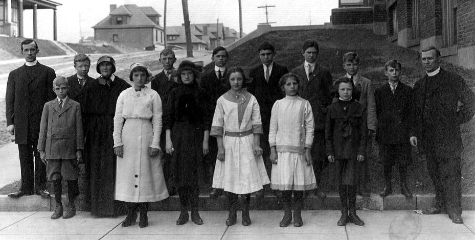
The Eighth Grade graduating class from the
1913-1914 school year at Resurrection Elementary.
Other educational institutions
included DePaul Institute, built
in 1910 for the hearing impaired, Toner Institute, a
military type training academy for orphans that was chartered in 1941,
and Pioneer School,
constructed in 1958 and operating as a special education facility to meet the
needs of the physically challenged.
The old West Liberty School was sold
in 1938 to the Catholic Diocese for use as a girl's high school,
called Elizabeth Seton High School. A newly constructed school building, the third version of West
Liberty School opened at Crysler and LaMoine Streets in 1939.
The school was expanded in 1959. West Liberty School was again closed in 1979,
then reopened in 2000, after an additional wing was built.

West Liberty Elementary School in 1959,
after an expansion of the school building.
In 1996, in response to the financial
difficulties in supporting three aging schools, and a overall drop in enrollment,
the Catholic Diocese merged the three local parochial elementary schools,
Resurrection, St. Pius and Loreto. Located in the old St. Pius school building,
the school was called Brookline Regional Catholic from 1996 to 2014. It was
designated as Saint John Bosco Academy in 2014 and closed in June 2019.
High Schools For
Brookliners
Beginning in 1900, students graduating
from West Liberty Elementary School were permitted to attend Knoxville Union
High School at no charge, largely due to Professor Moore's efforts in obtaining
the right of West Liberty Borough children to free public education.
Beginning in August 1917, most Brookline
students attended South Hills High School, located in Mount Washington, for their secondary
education. South Hills High School served local students for sixty years. In 1977,
Brookline students were transferred to the newly constructed Brashear High School
in Beechview.

South Hills High School, shown here in
1939, served Brookline students from 1917-1977.
For a parochial secondary education, from
1912 through 1934, Resurrection Elementary also offered high school classes to
parish graduates. From 1935 to 1991, girls could attend St. Francis Academy in
Castle Shannon. Beginning in 1941, another alternative for the ladies was
Elizabeth-Seton High School on Pioneer Avenue.
For the boys, South Hills Catholic
High School, located on McNeilly Road, opened in 1960. The institution merged
with St. Francis and Elizabeth-Seton after the completion of the 1979 school
year to form the present-day Seton-Lasalle High School.
Rumble Of The Railroad
Just like the steel mills and factories
that lined the Three Rivers in the 19th and 20th Centuries, Pittsburgh was also
synonymous with the railroad industry. Local small-guage coal railroads were
active in the South Hills as early as 1861. The Pittsburgh and Castle Shannon Railroad operated continuously along Saw Mill Run
from 1871 to 1912.
In the city, the nation's larger railroads
were one of the major industries in the city. The Pennsylvania Railroad, the
Pittsburgh & Lake Erie Railroad and the B&O Railroad all had huge facilities
within the Golden Triangle competing for their share of the lucrative passenger
and freight business.
Workers working on the West Side Belt
Railway line, part of the Wabash Pittsburgh Terminal Railroad,
near Timberland and Cadet Avenues in 1909 (left), and the rails
as they
pass under the Timberland Avenue Bridge in 1918.
Another major railroad that was
once a part of Pittsburgh's heritage was the Wabash Pittsburgh Terminal Railway. The Wabash was built to compete with
the Pennsylvania Railroad for the lucrative steel hauling business. It
opened in 1904 and went bankrupt in 1908.
Part of the Wabash network was the
old West Side Belt Railway line that skirted the border of Brookline,
heading along Saw Mill Run valley, then following the Library Road
corridor through Castle Shannon and continuing west. Although the Wabash
was in receivership, this spur line was upgraded in 1909 and
continued to be a profitable freight-hauling venture.
 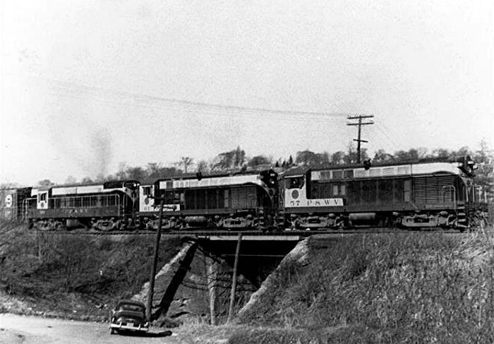
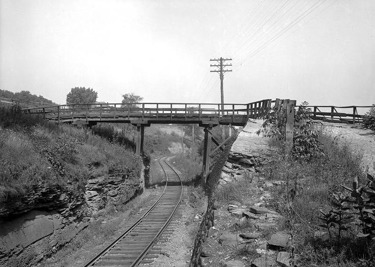
Pittsburgh & West Virginia Railroad
train at Elm Street in Castle Shannon in 1940 (left) and
crossing the tressel at Whited and Jacob Streets in Brookline, March
1957.
In 1928 the line was purchased by
the Pittsburgh and West Virginia Railroad. P&WVRR locomotives passed
along the outskirts of Brookline for the next forty-eight years, until
the railroad was purchased by Norfolk and Southern in 1964. It was then
sold to the Wheeling and Lake Erie Railway in 1988 and has carried that
designation ever since.
For over a quarter century, the
W&LERR has remained a profitable local carrier. The railroad and has
seen a recent upsurge in traffic with the emergence of the Marcellus
Shale natural gas operations in southwestern Pennsylvania. Six to
eight trains now pass through Brookline on an average day.
 
Wheeling & Lake Erie Railroad trains
passing over the tressel at Edgebrook Avenue in Brookline, 2014.
For those who have lived in the
community of Brookline, the rumbling sound of the locomotives and the
distant whistle as they pass by Brookline is something that will always
remain in our conscious memories of home, especially those nearest the
tracks along Timberland, Cadet, Ballinger and Jacob streets.
The sound of the passing train
seems most evident at night, when all is quiet. For miles one can hear
the rumbling of the engine, the screach of the rails and the frequent
whistle blows echoing through the valleys. Depending upon the direction
of travel, the distant rumble can be heard all the way from Greentree
and Bethel Park. It gradually grows as it nears Brookline, then slowly
fades away.

Heading down to the bottom of
Edgebrook, Whited, Glenbury or McNeilly roads to watch the train go
by is something most local residents have experienced and will remember
fondly as a part of growing up here in Brookline. Many still have the
smashed pennies, nickels and dimes that so often became souvenirs
of the visit.
♦ Walk the W&LERR Route Through Brookline ♦
West Liberty Avenue to Jacob Street
♦ History of the West Side Belt Railroad ♦
 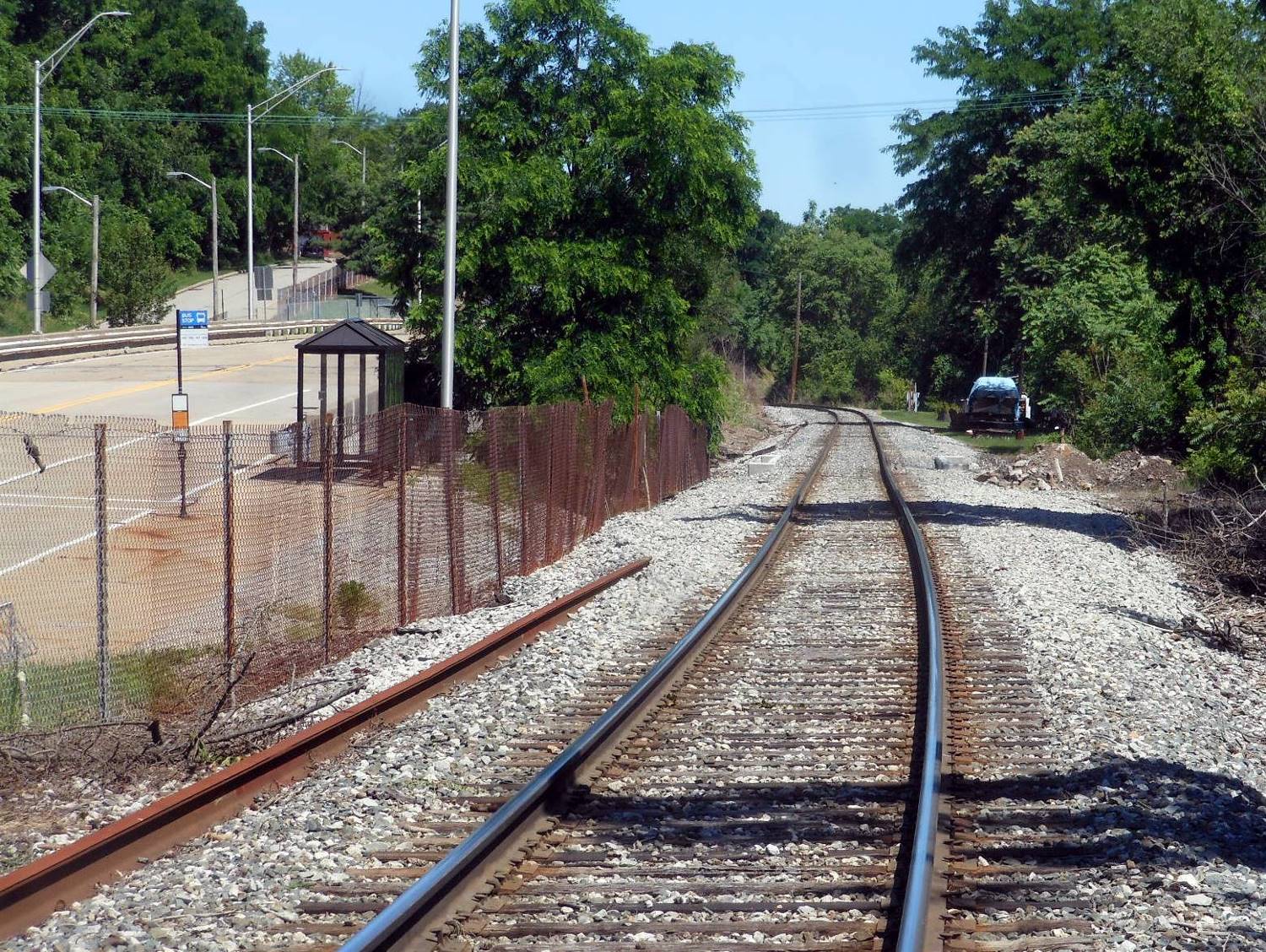
The W&LERR tracks at the West Liberty Avenue
Bridge (left) and at the Jacob Street Busway Stop.
Coal for Heating in High Demand
In February, 1909, the Paul Coal
Company was established at the corner of Summerhill (Stetson Street) and
West Liberty Avenue. Residents could obtain coal on a very short notice.
Robert McKinley, J.C. Crawford and J.C. Davis chartered the company after
purchasing the large tract of coal lying beneath the Paul Place plan of lots,
and the adjoining property owned by Mrs. Elizabeth Paul.
The main mine entrance was located
near Stetson Street. The Paul Place plan of lots would include
the homes on Plainview, Woodward and Pioneer, north and south of Capital
Avenue. The Paul Farm, located across Pioneer Avenue atop the hill, eventually
became the Moore Park and Our Lady of Loreto Church grounds.
 
The Paul Coal Company mine located along
West Liberty Avenue and a Fairbanks scale.
A fairbanks scale was placed
within easy access of West Liberty Avenue, where the public was able to
use it for a nominal price. An electric machine of the Jefferson type was
installed for the digging of coal. Power was supplied by the Pittsburgh
Railways Company. The electric machine was the first of its kind in use
within the city limits and the easy access to coal for heating homes in
the South Hills area was a great improvement to local
homeowners.

A horse-drawn wagon, loaded with coal, stands
at the intersection of Freedom Avenue and Merrick Avenue in 1924.
There had been mining in West Liberty
Borough since the mid-1800s. The Pittsburgh and Castle Shannon Railroad began as a Coal Railroad that operated
along the Little Saw Mill Run corridor in Banksville and the Saw Mill
Run corridor through to Castle Shannon. There were branch lines that
ran into the Brookline valleys, with maps showing them along Edgebrook
Avenue and into the Paul property, near present-day Moore Park.
In the early 1900s, the main mining
operations, like the Pittsburgh Coal Company, had exhausted their claims.
Other local companies, like the South Hills Coal Company along McNeilly Road, and the Castle
Shannon Coal Company on Library Road continued operating well into the
late 1930s. These local companies became the primary source of coal for
residential heating until their claims were exhausted.

Richard Dunn and Donald Fornear in 1943
shoveling coal along Woodbourne Avenue.
Through the mid-1940s, most Brookline
homes were heated with coal furnaces. First by horse-drawn wagon, then
by motorized transport, home coal deliveries were made several times a year along the
neighborhood streets and alleys. Most of the time, the coal was dumped on
the sidewalk or along the back edge of the property.
Residents would have to haul the coal
to the house, often one bucket at a time, and drop it into a coal shute, which
led to the coal cellar off the main basement. Most homes converted to natural
gas furnaces in the 1940s and 1950s. There were still a few homes receiving
coal deliveries as late as 1970.

For neighborhood children, Coal Delivery
Day was a big deal, and a chance to play for a while with the black gold.
Here, young Joe Sabash, his sister and a friend gather near a recently
delivered load in 1944. Parents, on
the other hand, weren't so happy about having to clean their filthy
hands and clothes afterwards.
Oak Mine Under Brookline
Brookline sits atop what was known
as the Oak Mine. There were actually a series of Oak Mines stretching
from Brookline along the Saw Mill Run corridor to Castle Shannon. Underneath
the heart of Brookline are the subterranean passages of Oak Mine #1.
Owned by the Pittsburgh Coal Company,
the mine ran the length of Brookline, from east to west. The coal was part of
the Pittsburgh Coal Seam. Stretching from Pittsburgh southwest into
Ohio and West Virginia, it was the largest coal deposit in the Eastern
United States.

Scenes like this were commonplace
along the valleys of Brookline in the early 1900s.
Underneath Brookline, coal was mined
using the traditional room and pillar system, whereby rooms are cut into the coal
bed leaving a series of pillars, or columns of coal, to help support the mine roof
and control the flow of air. Generally, rooms are twenty to thirty feet wide
and the pillars are up to 100 feet wide.
As mining advances, a grid-like pattern
of rooms and pillars is formed. When the shaft reaches the end of a panel, retreat
mining begins. Workers mine as much coal as possible from the remaining pillars
until the roof begins to collapse. When retreat mining is completed, the area
is abandoned and sealed off.

Undated photo showing an Engine
House, Maintenance Shed and Coal Tipple
at the Pittsburgh & Castle Shannon Railroad's Oak Mine.
In West Liberty Borough, mining operations
along Saw Mill Run Creek started in the mid-1800s. By the early-1870s, the mining
had progressed into the eastern boundaries of present-day Brookline, then referred
to as the Oak Hill section of West Liberty.
The Oak Mine in West Liberty was the first
in a series of mine along the Saw Mill Run corridor, located in the villages of
Reflectorville, Fairhaven and Castle Shannon.
The mine shafts began in the valleys
along Saw Mill Run and extended deep into the hills. The coal was extracted using
dynamite, picks and shovels, then transported to the mills along the Monongahela
River via the Pittsburgh and Castle Shannon Railroad.

A donkey pulls a loaded car out of one of the
pit mouths in the early-1900s.
There were four separate small-gauge
P&CSRR spur lines that ran along Brookline's valley floors to the main pit
openings. These were located in the valley behind Moore Park, along Edgebrook
Avenue, along Whited Street and in the ravine behind Brookline Park.
Inside the mines, mules were used to pull
the coal cars along the dark passages. Near the pit mouths were large fields
where the animals were brought to rest and graze in the sunlight.

The Pittsburgh Coal Company power
station and mine shaft at the Brookline Junction in 1909.
The eastern part of Brookline's Oak
Mine, along Saw Mill Run, was mined out by the early-1900s. By then, work had
begun tunneling under the western section of Brookline, from West Liberty Avenue
east to Merrick Avenue.
Near the turn of the century, the
Pittsburgh Coal Company built a power station, mine ventilation shaft, holding
tank and storage barn next to the Brookline Junction, at the intersection of
Brookline Boulevard and West Liberty Avenue. The power station was in operation
approximately fifteen years.
During a widening of West Liberty Avenue in
1915,
the power station and out buildings were removed and relocated to Elwyn Street.
A large silo-like ventilation shaft remained at the Brookline Junction until the
early-1940s.
 
A mine shaft along Elwyn Street/McNeilly
Road in 1931 (left) and an abandoned shaft along Edgebrook in 1937.
The Oak Mine in the Brookline area was
completely mined out by 1941. The numerous shafts along West Liberty
Avenue, the Saw Mill Run Corridor and the Elwyn (McNeilly Road) Street valley
were boarded up. The mining companies dismantled their buildings, sealed the shafts
and moved on to the abundant coal fields further south.
Over time, most vestiges of the
once bustling local mining industry disappeared. Occasionally, an
abandoned mine shaft is uncovered during construction. More often the
reminders of Brookline's mining past come in the form of mine subsidence.
Underground collapses can cause damage to ground-level infrastructure and
homes as the earth settles into the void.

A 1910 photo of miners working in one of
Pittsburgh's many coal mines.
Abandoned mine shafts, which once
dotted the hillsides around the community, were still being found as late
as the 1980s. Landslides and shifting earth along the hills have been known
to expose these openings.
As recently as October 2007, a mine shaft was
unearthed during the reconfiguration of Library Road in Overbrook, near the
intersection with McNeilly Road. We caution anyone that stumbles upon one of
these hazards to stay out!

This abandoned mine shaft was unearthed
along Library Road during construction in 2007.
<Photos of the Uncovering/Sealing of the
Elwyn Mine Shaft in 2007>
The Brookline community has been 95%
undermined. If you own a home it's a good bet that there is a room, or
an aging pillar, underneath your land. For all Brookline property owners,
we offer three important words, Mine Subsidence Insurance. It is offered by the State of Pennsylvania
and it is affordably priced.
<><><><> <><><><>
<><><><> <><><><>
<><><><> <><><><>
Mine Rescue Training At Brookline's Oak Mine
The September 9, 1913 edition of the
Pittsburgh Gazette Times featured an article about a ten-day conference
on mine rescue maneuvers held in Pittsburgh by the Bureau of Mines. The
field training was held at Oak Station, the busy mining center located
near the bottom of Whited Street in East Brookline. The article is reprinted
below.
MINE RESCUE MEN
SHOW THEIR SKILL
Delegates To 10-Day
Conference Hasten
To Oak Station For Real Work
TO TEST FIRST
AID SYSTEM
Canaries Are Part
Of Equipment For Detecting
Dangerous Gases Under Ground
Mine rescue workers and first-aid men,
representing the federal and state governments and private mine corporations,
in conference yesterday morning at the Bureau of Mines Station, Arsenal Park,
were told by Engineer James W. Paul, that a disaster had taken place at the
Oak Mine, owned by the Pittsburgh Coal Company and located at Oak
Station.
Trained to receive such news complacently
and with reserve, the workers adjourned the session and met informally to formulate
plans of action in the care of the supposed dead and injured. Later they made a
hurried trip in a special car to the mine, where they found the specially-equipped
rescue car of the Bureau of Mines standing on a railroad siding, and a small crew
of smiling first-aid men.
It was the opening day of a 10-day mine
rescue maneuver to be conducted at that mine, which was abandoned temporarily one
and one-half years ago. Mining engineers and rescue workers from all the coal regions
in the country east of the Mississippi River will come to the camp to participate
in the elaborate demonstration of mine rescue methods.
James W. Paul, head of the rescue
department, with headquarters in this city, will direct the maneuvers. He will
be assisted by a corps of engineers and mine foremen from various mining districts
throughout the east.
First Aid To Be
Tested
Five crews, consisting of five men
each, and each under the supervision of a mining engineer, will operate in the
Oak Mine in day and night shifts. The work will be continuous throughout the
ten days. The crews will work in two-hour shifts, and at the end of the maneuvering
it is estimated the mine will be put back into condition for operation.
This work will be the beginning of a
series of campaigns to be held in various parts of the country. Similar experiments
will be performed in a camp at Trinidad, Colorado, the latter part of this
month.
It is the aim of the authorities to
establish rescue work in the mines on a definite basis of cooperation between the
mine operators, the state mine inspectors, and the rescue workers. The efficiency
of first-aid methods will be tested, and the apparatus in vogue will be given
severe trials.

Helmeted miners exiting Brookline's Oak
Mine after training.
It is understood that the Oak Mine
contains a large quantity of black damp and gas, and the officials consider it
an excellent place to perform an extensive experiment.
For rescue operations the mine operators
will be required to furnish one or more trained crews, and a full set of breathing
apparatus. Sufficient supplies to maintain the apparatus for a continuous period
of forty-five hours will be necessary.
Canary Birds To Be
Used
The government car at the Oak Mine is
fully equipped with helmets, safety lamps, oxygen tanks, stretchers, pulmonators,
bandages and medicines. Every man in the crew is trained to meet any emergency
that might arise at a disaster.
A host of canary birds, used in testing
the amount of poisonous gas in the confines of mine shafts, is an important part
of the equipment. The birds are taken down into the mine in cages. When they
become exhausted, the bearer of the cage knows that he may venture further into
the mine safely, but he must not remain there no longer than eight or nine minutes.
At that time the worker must leave the mine. The bird is placed in an air-tight
oxygen box and resusitated.
It is estimated that the present rescue
organizations have decreased death rolls in mining regions more than 200 men each
year since their organization. It is said that a life is saved every day through
the efforts of the first aid teams in the mines.
The officials of the maneuver and their
subordinates will not leave the camp until the experiment is closed. A.A. Krogdahl,
first aid miner, of Ironwood, Michigan, who will participate in the experiment, was
awarded medals by the Red Cross and the Carnegie Hero Fund commission, before he
entered the service of the Bureau of Mines, for saving the lives of fellow miners.
He has since rescued men from mines, but his official position has barred him from
further awards.
The men at the Oak Mine are: James W. Paul,
G.H. Deike, assistant engineer, of Pittsburgh; Edwin Higgins, of Ironwood, MI,
Charles Enzian, of Wilkes-Barre, PA, R.Y. Williams, of Urbana, IL, J.M. Booher,
Edward Evans, of Pittsburgh, W.J. German, of Kingston, PA, G.T. Powell, of Evansville,
IN, Edward Steidle of Pittsburgh, Jesse Henson, of Huntington, WV, W.W. Sullivan,
of Ironwood, MI, A.A. Krogdahl, of Ironwood, MI, W.A. Raudenbush, C.O. Roberts,
of Pittsburgh, A.I. Young and A.J Strane.
The September 10, 1913 edition of the
Pittsburgh Gazette Times printed the following update on the
maneuvers.
RESCUE MEN ENTER
MINE IN REAL DISASTER STYLE
Maneuver Of Federal,
State and Corporation
Teams Proceeds At Oak Station
Five teams consisting of federal, state
and private mine corporation rescuers, first aid men and mine officials, entered
the Oak Mine of the Pittsburgh Coal Company at Oak Station yesterday as the first
work of a ten-day mine rescue maneuver that is being carried out in connection
with the conference of mine rescue workers from various parts of the country
at the Bureau of Mines in Arsenal Park. The work is under the direction of
James W. Paul.
The teams entered this abandoned,
dangerous and gaseous mine by three different entrances just as they would had
a real disaster occurred. They were fully equipped with the apparatus for
artificial breathing and everything required in their work.
They found much water in the mine
and heavy "falls" from the roof, but they managed to penetrate some distance.
When the men emerged from their dangerous task they were individually
examined by Dr. James M. Bocher, of the Bureau of Mines. He found all of them
in good condition, prescribed the diet for each, after so much artificial
respiration and ordered them six hours rest, after which they entered the
mine again.
There will be a meeting at the Bureau
of Mines of the American Mine Safety Association, consisting of the mine
rescuers and engineers and officials of private companies September 22, 23
and 24. H.M. Wilson, engineer of the local Bureau of Mines, will
preside.
The September 12, 1913 edition of the
Pittsburgh Gazette Times printed another short blurb on the mine rescue
training.
MINE PRACTICE
CONTINUES
Rescue Workers
Proceed With Annual
Maneuvering At Oak Station
Mine rescue maneuvers, being
conducted in the abandoned Oak Mine of the Pittsburgh Coal Company at
Oak Station, by the Department of the Interior, Bureau of Mines, continued
in one of the remote rooms of the mine yesterday. A fire was started in
the mine in order to give the men forty-eight hours experience in fighting
a mine blaze.
Among the new arrivals in connection
with the maneuvering were: G.S. Rice, chief mining engineer of the Bureau of
Mines, who returned yesterday from the Pacific coast; J.W. Koster, mine foreman
from Illinois' fields; J.C. Roberts, district engineer of the Rocky Mountain
region; R.Y. Williams, of the central states, and J.J. Rutledge, of
Oklahoma.
Oak Station
Oak Station was one of the primary mining
locations along the Saw Mill Run Corridor, which was dotted with operational mine
shafts all the way to Bethel Park. In addition to the Pittsburgh and Castle
Shannon Railroad spur line that looped through the Whited Street valley, there
was a also small rail hub and loading facility.

The Oak Station mining offices and tipple
near the bottom of Oak (Whited) Street,
and several loaded coal cars awaiting transport (circa 1910).
This part of the mine was opened
in 1902. Most of the nearby coal was mined out by 1910. From the Oak Station
pit mouth, long shafts led to the west and south, connecting to other sections
of the mine, forming a vast underground labyrinth stretching out beneath the
entire Brookline community, and points beyond. The Oak Mine maps that
are shown below give a good glimpse of this subterranean world.
What is
Blackdamp?
The Oak Mine was chosen as a test
location for the mine rescue teams because of the abundance of blackdamp, an
odorless and highly toxic gas. The mixture of nitrogen, carbon monoxide and
water vapor forms when exposed coal begins absorbing oxygen. It is difficult
to detect and can incapacitate an individual in a matter of moments. Wikipedia: Blackdamp.
Since the nearby rooms and shafts had
been abandoned for over a year, pockets of the deadly gas had built up in
various locations, thus making this section of the room and pillar mine an
ideal environment for detection and rescue training.
 . .
A Miner's Best
Friend
The only way to combat blackdamp and the
other toxic and flammable gases that formed during the mining process was with
proper ventilation. Even then, it was possible for pockets of blackdamp to
form in certain areas. Because it had no odor, miners could not tell when they
were encountering the gas.
Canaries where used as a warning device
to detect when oxygen levels reached a low level. The birds would pass out when
deprived of oxygen. A human's threshold was much higher, thus the eight to nine
minute time-interval between the canary collapsing and the miners having to exit
the mine.
After their perilous life and death
experience, the birds were duly resusitated in an oxygen rich environment,
then sent back to the pit mouth for another trip into the dark underverse.
Unfortunately, many of the birds perished in the line of duty.
It's difficult to estimate the number
of miners that were saved by these fearless canaries. But, it is safe to say
that until more efficient detection methods were introduced, these little birds
truly were a miner's best friend.
The use of canaries in the United States
coal mining industry, was phased out in the late-20th century.
<><><><> <><><><>
<><><><> <><><><>
<><><><> <><><><>
Locations Of Brookline's Oak Mine Entrances
Click on image to enlarge
 
One of the earliest parts of the Oak
Mine was this PCSRR spur line and entrance along Timberland Avenue. First
shown on 1876 and mined out by 1890. By 1896 the West Side Belt
Railway had laid their tracks along
the Brookline side of Saw Mill Run, utilizing a portion of the
old spur line route.
 
Oak Mine entrances along Edgebrook Avenue,
shown on an 1876 map and still active in the 1900s. The tracks
ran underground to another mine shaft entrance along Whited Street.
Near present-day Hartranft Street
was a large opening in the woods known as the Donkey Field, where
the mules were brought to graze.
 
An Oak Mine entrance along Whited Street
with a spur line running to the PCSRR tracks, shown on a 1905 map.
This line was Brookline's main coal hub for some time, known
as Oak Station.
 
A spur line running to mine entrances in
the valley behind present-day Brookline Park, shown on an 1882 map.
 
The Pittsburgh Coal Company power station
and ventilation shaft that fed the Oak Mine, shown on this 1905 map.
The power plant was removed in 1915, but the ventilation shaft was moved to
a nearby location and remained
until the early 1940s. On the map, Hunter Avenue was redesignated as Brookline
Boulevard in 1908.
Later, in 1935, the road became Bodkin Street when the boulevard was
rerouted.
 
The Paul Coal Company mine shaft entrance
along Stetson Street, shown on a 1916 map. This mine was used
to provide residential heating coal for Brookline and Beechview residents
in the early 1900s.
 
A Pittsburgh Coal Company entrance
to the Oak Mine southeast of Creedmoor Avenue, shown on a 1916 map.
The shaft opening is across the street from the present-day car wash and
auto dealership.
 
Pittsburgh Coal Company entrances to
the Oak Mine near present-day Creedmoor Avenue, shown in a 1934 map.
 
The South Hills Coal Company mine entrance
and Coal Tipple located near the railroad tunnel along McNeilly Road,
shown on a 1934 map. Coal extracted from this mine shaft was used for
residential heating.
<><><><> <><><><>
<><><><> <><><><>
<><><><> <><><><>
Maps Of Brookline's Oak Mine
Click on image for a larger map
 
A 1905 Map (left) showing the proposed path
of the streetcar line next to the Pittsburgh Coal Company mine shaft,
and a 1929 map showing the main shafts of the Oak Mine extending eastwards
from the Brookline Junction.
Below are a series of maps
showing the layout of the room and pillar mines underneath Brookline. Together,
the maps form a 3-by-3 grid that show the status of the Oak Mine in the late-1940s.
The maps are coded with letters (A, B, AB, AC, etc) and include dated entries that
detail the years that those areas were in operation.
There is an accompanying
Pittsburgh Coal Company log detailing the code letters and years that
correspond to the map entries, showing when specific areas were mined.
The log and maps show that mining in Brookline ended in 1941. The dated
codes continue through 1980, as mining operations lasted another forty
years in the abundant deposits to the south.
These maps show how extensive the
mining operations were underneath the community of Brookline, as well as
Beechview, Dormont and Overbrook. It really does look as though Brookline
is 95% undermined, supported by an aging network of rooms and
pillars.


Interactive Overlay Map Showing Part Of Brookline's
Oak Mine
The last recorded mining of the Pittsburgh
Coal Seam in Brookline's traditional 19th Ward took place in the area underneath
Rossmore, Gallion and Berwin Avenues in early-1936. The South Hills Coal Company,
which mined the area in the 32nd Ward underneath Ebenshire Village, closed their
Saw Mill Run Mine shaft, located along McNeilly Road between Creedmoor Avenue
and the railroad tunnel, in 1941.
The map below is from the early 1900s
and gives a bit more detail to the mining operations in the eastern section of the
Oak Mine. Many of the street names still carry old West Liberty Borough designations.
Some of these are Oak (Whited), Warwick (Wareman), Clifton (Clippert),
Chelsea (Chelton), Putnam (Edgebrook), Glenarm (Trenton), Flatbush (Winchester),
Wedgemere (West Point), Rossmore (Cromwell) and Gallion (Monitor).

The drawing below shows the property lines
of James Gordon when the mining rights to his land were acquired by the Pittsburgh
and Castle Shannon Railroad. The document is dated April 22, 1904. The pit
mouth shown is located near Marloff Place. It extends into the Oak Mine and
proceeds directly under present-day Brookline Memorial Park (Anderson
property).

Shown below is a newspaper clipping
from 1902 disclosing the purchase of the mining rights to 113.059 acres of
land bordering Gordon's to the south. It documents the rights of the company
to mine all of the coal in the underlying area and the terms and cost for
any surface damage relating to the mining operation.

 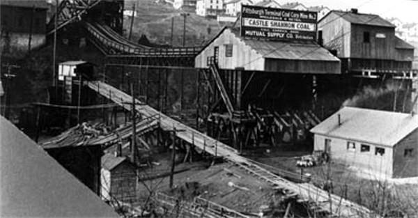
The South Hills Coal Company on McNeilly Road
in 1930 (left), and the Castle Shannon Coal Company along
Library Road in 1931. These companies operated Oak Mine #2 and Oak Mine #3
from 1902 to 1941.

On the site of the former South Hills Coal
Company is the equipment lot of Facchiano Construction Company. In 2015
they dug into the hillside to expand the lot and exposed a clearly visible
line of coal from the Pittsburgh Coal Seam.
The Town
Of Reflectorville
(1890-1920)
The exact year that the small town of
Reflectorville came into being is not known. The hamlet was located on Oak
Hill between the lower end of Whited Street and Edgebrook Avenue, along Saw
Mill Run Creek. Using real estate advertisements and old maps as a reference,
we can assume that it was approximately 1890.
This part of present-day Brookline was
then situated in the northern tip of Baldwin Township, along the border of West
Liberty Borough and Carrick Borough. Part of the Reflectorville area spread
north of the border into the nearby boroughs, along the Saw Mill Run corridor.
To the south was the neighboring township mining settlement of
Fairhaven.
Thomas Bailey And David
Moon
Much of the land that comprised
Reflectorville was owned and developed by Thomas Flanner Bailey and David G.
Moon, the president and treasurer of Pittsburgh's highly successful Bailey
Reflector Company. Their business is the origin of the town's unique
name.
The Bailey Reflector Company was located
in Pittsburgh, on Second Avenue, and manufactured ornamental oil, glass and
kerosene silvered lighting fixtures and chandoliers that were popular in churches
and commercial establishments throughout the United States. Bailey Reflectors
also found a market for their products as far away as Japan.

In the 1880s, with the mining industry
venturing into the region south of Pittsburgh, the two businessmen acquired a
substantial land tract along the Saw Mill Run corridor with the purpose of
creating a residential development in the rural South Hills suburbs.
Construction of Reflectorville began
in 1890 and continued for the next thirty years. As Pittsburgh expanded through
a series of annexations, the small town was eventually absorbed into the city
limits.
By that time, the men who had orchestrated
the birth of Reflectorville had long since passed on. David Moon died in 1906, at
age seventy-three. Thomas Bailey, aged seventy-seven, followed in 1915. The Bailey
Reflector Company was sold by the Bailey family in June 1916.
Housing For Mining And
Railroad Families
In the 1890s, coal mining was the primary
enterprise along the Saw Mill Run corridor. There were several active Oak Mine shafts
in operation. On either side of Reflectorville were the mine entrances along
Hughey Road (Edgebrook) and Oak Street (Whited). The Oak Street Station was
one of the largest in the valley and included a small rail yard.
The vast majority of those who settled
in Reflectorville were the families of the men who worked in the mines, along
with a number of railroad employees.

On September 12, 1892, an ad was placed
in the Pittsburgh Press for lots in Reflectorville. Just two and one half miles
from downtown, these lots were ideally located along the Pittsburgh and Castle Shannon Railroad, which offered passenger service to and from the
city.
The advertisements proclaimed that lots in
Reflectorville had excellent drainage and unsurpassed views of the Saw Mill Run
valley. They also provided a clue pointing to the year to when construction of the
village began, stating that since 1890 the number of homes built had risen from
eight to seventy-two.
Reflectorville In
1896
Reflectorville first appeared on plot maps
in 1896. The hamlet consisted of the housing tracts known as the Bailey and
Moon #1, Bailey and Moon #2, Magaw/Goff and Zimmerman Plans. Bailey and Moon also
had a third small tract of homes across the border in West Liberty and the
Zimmerman Park Plan also stood slightly north of the border in Carrick.

An 1896 map showing the town of
Reflectorville, built on Oak Hill along the Saw Mill Run corridor.
The layout of the Reflectorville streets
in many ways mirrors the present-day road network. The exception was
the streets along valley floor. These stood between the tracks of the West Side Belt Railroad and those of the Pittsburgh and Castle Shannon
Railroad, running respectively on the western and eastern hillsides along the
broad corridor.
Where Saw Mill Run Boulevard runs today
was a gridlike network of streets, including First and Second and Third Avenue,
which followed the course of present-day Ballinger Street. Intersecting these roadways
was the Township Road, or the Warrington Avenue Extension, which ran north towards
West Liberty Avenue and Pittsburgh. To the south was the Library Road Extension
that led to Fairhaven.

Oak Elementary School, shown here in
1930, was built in 1908. It was originally called the Reflectorville
Public School and replaced a small schoolhouse that was built in the
early-1890s.
Along Third Avenue was a small
school house, called the Reflectorville Public School, for the children of the miners. At the corner
of Elm Street (Zimmerman) and Walnut Street (Hallowell) stood a Methodist Church.
This was the forerunner of the Brookline United Methodists, who in 1907 moved to
a stone chapel located at Brookline Boulevard and Wedgemere Avenue.
One can assume from the number of buildings
shown that the area was served by a variety of merchants and markets that catered
to the needs of the growing Reflectorville population.
Part Of Overbrook
Borough
The town of Reflectorville continued
to develop during the early years of the 20th Century. Nearby mining operations
went on for another decade and the population more than doubled. By the time
the shafts had been mined out, this tiny corner of Baldwin Township had
evolved into a thriving community.
In 1908, West Liberty Borough was
annexed into the City of Pittsburgh. Reflectorville was now bordered to
the north and west by the emerging neighborhood of Brookline.
In 1912, there was a proposal put forth by
officials from the town of Fairhaven to break away from Baldwin Township
and form a new borough that would include Reflectorville, Fairhaven and Castle
Shannon. The measure was put to a vote and failed due to objections from the
residents of Castle Shannon, who prefered to form their own independent
municipality.
While the issue of creating a new
borough remained in the news for the next several years, home construction
in Reflectorville continued. When the Pittsburgh Railways Company established their high-speed traction line along the P&CSRR right-of-way,
the quick and reliable public transporation brought a surge of
development.
Finally, in 1920, Reflectorville became
the First Ward in the newly formed Borough of Overbrook, which extended from
the city line at Edgebrook Avenue along the Saw Mill Run and Library Road
corridors to the border of Castle Shannon.
Added To Brookline
Census Tract
The most comprehensive developmental
change to occur within the borders of the former town came in 1929,
when Saw Mill Run Boulevard (PA State Route 51) was built. Many of the homes lying along the
valley floor were razed to clear a path for the broad four-lane highway.
The following year, in 1930, the Borough
of Overbrook voted for annexation into the City of Pittsburgh. The adjacent
Borough of Carrick had been annexed three years earlier, in 1927. After this
southward expansion, Pittsburgh City Council instituted some territorial
adjustments to the borders of these new municipal wards.
The majority of Overbrook's First Ward
(former Reflectorville), was added to the census tract of the Brookline
community. This included all of the land east of Saw Mill Run Boulevard.
The property to the west of Saw Mill Run Boulevard was assigned to the Carrick
neighborhood.
A Lasting Reminder
Of Reflectorville
It has been nearly a century since the
small village of Reflectorville became a part of the distant past. The town's
brief thirty year legacy will, however, be remembered in the naming of one of
the bridges along Saw Mill Run.
The Reflectorville Viaduct was originally
constructed over Edgebrook Avenue in 1872 by the Pittsburgh and Castle Shannon
Railroad. Reflectorville Station was a stop along the line. The bridge
and car stop became part of the Pittsburgh Railways transit line in
1909.
 
The Reflectorville Viaduct, across Saw
Mill Run from Edgebrook Avenue, shown here in 1929.
The bridge was replaced in 1929 and
remained in service until decommissioned in 1993, with Reflectorville Station as
a popular stop along the way. The bridge was rebuilt once more in 2004 for
the modern light-rail transit line and is still referred to as the Reflectorville Bridge. The car stop
was eliminated.
Ironically, the bridge that memorializes
the name Reflectorville, was always located just outside of the town's traditional
borders, in the Borough of Carrick.
<><><><> <><><><>
<><><><> <><><><>
<><><><> <><><><>
Some Old Photos Showing
The Reflectorville Area

A 1928 photo showing homes along the lower
end of Edgebrook Avenue. Beyond the bridge is Beech Street, which leads
into Reflectorville. For a fair distance after the bridge, Edgebrook formed the
northern boundary of the town.
The homes to the immediate right were in Carrick Borough, but still considered
part of Reflectorville.
 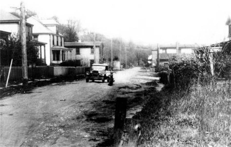
Reflectorville homes along Ensign Avenue
(left) and Second Avenue, shown in 1928.

The same Second Avenue homes, shown in 1929.
Some to the right that stood in the path of the highway were razed.
 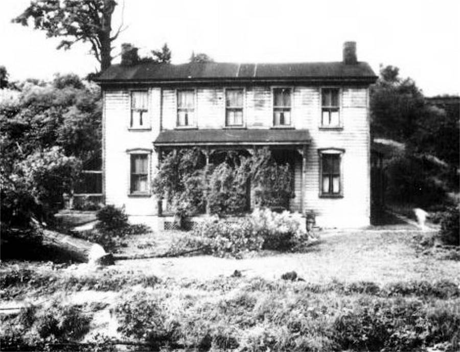
Looking under the Oak Viaduct (left photo)
and over the Charles Street (Colerain) bridge, in 1928, at the intersection of
Second Avenue and Oak Street in Reflectorville. This is the present-day junction
of Whited Street and Saw Mill Run
Boulevard. The right photo shows a home along Oak Street located
where the Jack Maggs Agency stands today.
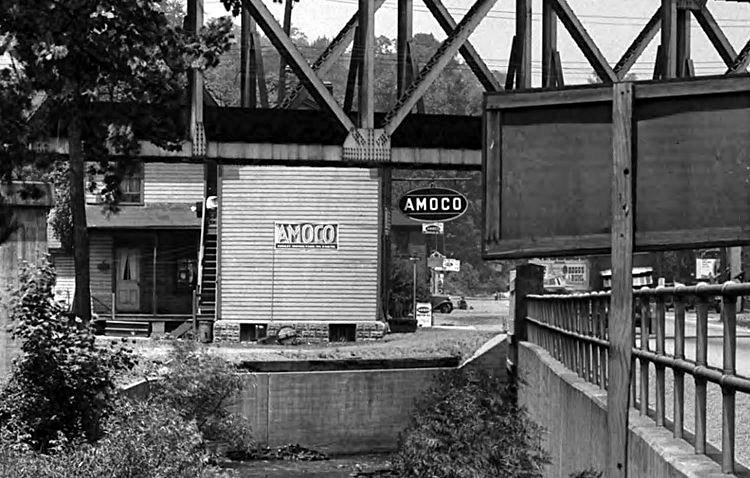
The Saw Mill Run Creek bridge and the
Oak Street home shown above, now a Brookline residence, in 1934.
 
Two photos from the late-1930s looking past
the Oak Viaduct into the former town of Reflectorville.
In 1930, all land shown to the left of Saw Mill Run Boulevard became part of
Brookline.
<><><><> <><><><>
<><><><> <><><><>
<><><><> <><><><>
1905 Reflectorville Plot Map

<><><><> <><><><>
<><><><> <><><><>
<><><><> <><><><>
Google Aerial
Images Of Reflectorville in 2014
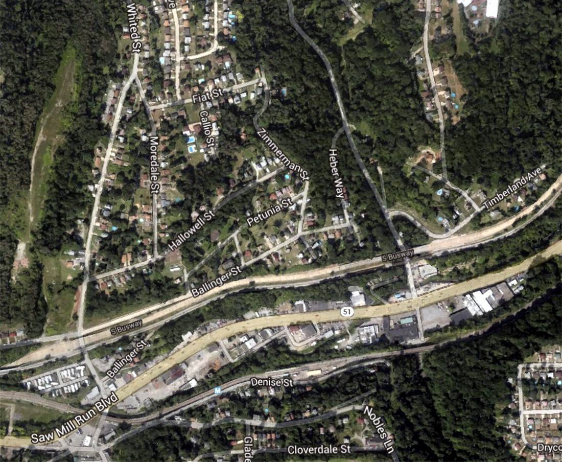
Liberty Tunnels Benefit South Hills
Once development in the South Hills
began in earnest, planners noted the need for a tunnel through Mount Washington
to the city that would further the growth of these communities. Many options
were considered. The first attempt at building a tunnel was made in 1915. Work
on the Neeld Tunnel,
located below Warrington Avenue in the vicinity of the South Hills Trolley Barn
near the Trolley Junction, began in July and was discontinued in the fall
of 1915.

Work began on the Neeld Tunnel in July of 1915.
Located just below Warrington Avenue, it was the first
attempt at building a vehicular tunnel connecting the South Hills area and downtown
Pittsburgh.
Contentious debate over the location of
the tunnels delayed the resumption of the project until 1919. By then the Neeld
Tunnel proposal was permanently abandoned in favor of the present-day location at
the northern end of West Liberty Avenue near Saw Mill Run Creek. Work began on the
Twin Tubes in 1919. Delayed once more due to an economic recession the following
year, construction began in earnest in 1921.

The intersection of West Liberty Avenue and
Warrington Avenue in 1918 before the Liberty Tunnels.
The Liberty
Tunnels, constructed
at the intersection of West Liberty Avenue and Warrington (later Saw Mill Run Boulevard), provided easy access between Pittsburgh and the fast-growing
South Hills communities. Slightly more than a mile long and build at a cost
of $6 million, they were the first artificially ventilated tunnels ever built
in this country or abroad for the accomodation of automobile traffic. The tunnels
officially opened in January 1924.

Construction work on the Southern Portals of
the Liberty Tunnels by Booth & Flinn in 1921.
The completion of the Liberty
Tunnels had a very marked effect on realty values in the South Hills
district. There was a large appreciation in the value and volume of sales
of unimproved property. A lot on Pioneer Avenue that sold for $300 in the
early 1900s was going for over $2000 in the mid-1920s. A number of high
class realty developments were made and an enormous volume of building,
principally of residential character, took place shortly after the
completion of the new tunnels.

A postcard image of the Liberty
Tunnels in 1928.
Although the construction of the
tubes came at a time when real estate values all over the country were
increasing, there's no doubt that a large portion of the increase in value
and development in the South Hills was directly due to this great improvement.
This was especially true in Beechview and Brookline, as well as Dormont and
Mount Lebanon. These neighborhoods outran all other sections of the city in
the number of building projects in 1925.

This real estate boom in the
South Hills resulted in the improvement of Brookline as we know it
today. (NOTE: Among the farming property parceled into lots were those of:
Fleming, Goettle, Hughey, Knowlson, Paul, Stillwagon, and in East Brookline,
Anderson). Brookline Boulevard was widened
and improved in 1935.
Practically all other streets were paved.
Recreational Provisions
Every year the Brookline Board of
Trade carried on a big Fourth of July celebration featuring baseball
games, races, a band concert and refreshments. In 1925, through the
kindness of Walter Fleming, the Fleming grounds were used for this
purpose.
Before Brookline had a real movie
theatre, films were shown on a big screen made of several big sheets sewn
together and stretched between telephone poles directly across from the
Stebbrook Pharmacy (now Fox Pizza), then known as Alm's Pharmacy. This
was only done for the Fourth of July celebration.
Occasionally, on warm summer nights,
an improvised theatre was set up in the field taking in the area from the
laundry store to the house near Flatbush (formerly occupied by Dr.
McCombs - a dentist) and going from Brookline Boulevard to Bellaire Avenue
was vacant. The movie projector was placed somewhere in the center of the big
field, and the movie operator was Robert Byrnes Sr.
Finally, in the days before the movie
theatre was opened on Brookline Boulevard, selected movies were shown at
Resurrection church auditorium.

Brookline's 1914 sandlot team won the
City championship. Their home field was located on a plot of land
located between Rossmore, Gallion and Wedgemere Avenues. There was also
a children's playground
there. The Brookline Elementary school garden was located next to the baseball field.
The first playground that Brookline ever
had was located between Berkshire and Woodbourne Avenues, below Castlegate Avenue.
Later three more playgrounds were established. They were located (1) between
Gallion, Rossmore and Wedgemere Avenues, (2) Between Fordham and Norwich Avenues,
and (3) at the corner of Aidyl and Pioneer Avenues. Residents were permitted to
use these plots for playgrounds through the kindness of the owners.
There was also a field between
Whited Street and Milan Avenue (laying between Gallupe and the other side
of Milan) that used to be a recreation park in the summer for the kids.
There was a big sand box, swings and slides, as well as volley ball, with
teachers in attendance to monitor the activities.

A model of Brookline Elementary School
in 1919 showing a proposed playground.
At Brookline School, the adjacent
ground was leased for five years and then purchased in 1923. This land was
to be used as a playground. Unfortunately, much of this property was
used in the 1929 school expansion and the scattered plots of land in the
community were sold off for development and the kids were left without any
public place to play. A baseball field was built along Pioneer Avenue at
the bottom of the hill below West Liberty School on land provided by
the Paul family.
Another alternative was in the Big Woods
bordering LaMarido Street and Eathan Avenue, there was a large open area
called the Donkey Field. Neighboring groups of kids created a truce-like
schedule-of-sorts for field usage. Also, for many years there were tennis
courts located at the corner of Beaufort Avenue and Metz Way. For those that
enjoyed golf, there was a driving range located across from Stetson Street
along Pioneer Avenue.

A ballfield stands across from Stetson
Street along Pioneer Avenue in April 1933.
This lack of public playground options
for kids led Professor Joseph F. Moore, in order to further the recreational activities of the youth in the Brookline district, and as chairman of the
Playground Committee of the Brookline Board of Trade, to become interested in
acquiring and developing a plot along Pioneer Avenue as a
playground site.
This dream became a reality when
the Council of the city of Pittsburgh passed an ordinance which acquired
and developed this land as a playground which is now known as the Moore
Recreation Center, which opened in August 1940.

A aerial image showing Moore Park
construction in May 1939.
As Brookline grew and developed,
the need for further recreational facilities arose. The Brookline Community
Center Association was chartered in 1945, and their primary goal was to
acquire and develop land in East Brookline to be used as a Community
Center.
In May 1947 the 20-acre
Anderson Farm in East
Brookline was put on the market. The land was purchased by the
Community Center Association for a little under $20,000. Located between
Breining Street and Brookline Boulevard, the newly acquired land was in
a central location and perfectly suited for development into a
park.

A 1939 aerial view showing the Anderson
Farm in East Brookline.
Work was begun immediately on
excavation of the hilly terrain, and in 1952 the Brookline
Little League began their
inaugural season on the new Community Center baseball field. The old farmhouse
was renovated and the surrounding acreage became the site of frequent carnivals and
other recreational activities.
In 1966, the land was sold to the
city for $1 with the promise
that it would be developed into a
city park. Forty years and
several million dollars later, Brookline Memorial Park is one of Pittsburgh's finest community recreation
facilities. Moore Park has also undergone some major renovations in the past
two decades.
The Fourth of July Parade
The inaugural Brookline Independence Day
Celebration, took place on July 4, 1907. The day-long festival, sponsored by the
Brookline Board of Trade was held along Brookline Boulevard. The first parade
and festival was held in 1914, with a large procession traveling from the boulevard
triangle at Queensboro Avenue to the community's new park at Gallion, Rossmore and
Wedgemere Avenues.
According to the Pittsburgh Post,
day-long festivities in 1914 began at 9am with the parade, followed at 10am by a
baseball game between the Brookline sandlot team and the Y.M.H.A's.

The Brookline Independence Day Parade
procession turns onto Wedgemere Avenue in 1916.
Following the game, several open athletic
activities were planned, including 50-yard dashes for boys and girls, 25-yard
dashes for children under age eight, stout men and lady's races, a married lady's
race, exploding bag races, skipping rope races for girls, potato, sack, shoe and
lemon races for kids, a baseball throwing contest for women and pegging the ball
and circling the bases for boys and men. Prizes were awarded after each event.
After these contests, at 4pm, was another baseball game featuring the same two
Brookline teams as before.
Refreshments were provided all day long
at stands located near the ballfield. Children were provided with complimentary
food tickets. Hardies band was provided by the City of Pittsburgh to entertain
the crowd at the ballfield during the afternoon.
As the day turned to night, the festivities
moved from the ballfield to the boulevard, where Hardies band played more music
from 7pm until 8:30pm in the open field across from Melvin's Drug Store at Stebbins
Avenue. After the concert, a large sheet was strung between two pools and motion
picture entertainment was shown. The Grand Jubilee ended with a magnificent fireworks
display.

Parade-goers gather near Glenarm Avenue
on July 4, 1920.
One of Brookline's elder statesmen shared
their memories of the Fourth of July parade. The account was printed in an old
edition of the Brookline Journal. Most of that article is reprinted
here.
"Things sure have changed as the years
went by. Take, for instance, the Fourth of July celebration. In the good
old days things sure did hum on this patriotic day."
"In the morning, about 8:30, the kids
would head for Berkshire Avenue and Castlegate. There they would line up for
the big parade. They each received a crepe paper hat and a nice American flag
on a stick."
"In those days there was no canned music.
There was a uniformed band, and they played off and on all day."
"The first place they held the celebration
was in the big area that lay between Rossmore and Gallion Avenues and Wedgemere
Avenue. There was a nice ballfield there, too. The community would gather and
watch the ballgames, especially on the Fourth of July. Some of the player's names
who played for the Brookline team were Joe
Power, Ick Dooley, and
Jimmy Carl."

Flags were waving at the Independance Day
Parade, July 4, 1929.
"Over the years, the Fourth of July
celebration was held at several different places. It was first held at the area
between Rossmore, Gallion and Wedgemere; then it was held up on Fordham Avenue,
between Queensboro and Stebbins Avenue. This location was used only once. It was
a failure through no fault of its own. The year it was held there, the Fourth of
July was so cold people didn't turn out. They didn't care much for ice cream
cones either. Hot dogs would have been more welcome."
"Next, the celebration was held in the
ballfield next to Brookline Elementary School. The band sat under the big tree
next to the school building, and played all day long. The only problem there was
not enough seats for the people who watched the ballgames."
"One nice thing they did when it was held
at Brookline School; there were Brentwood Motor Coach buses that rode along the
Boulevard all day long and picked up people who wanted to come to the celebration.
There were no parking problems. Everybody rode the buses. The kids would ride up
and down the Boulevard just for the fun of it."
Fred Proie remembers the good times at
Brookline School during the 1930s:
"At that time, Mr. Moore was the President
of the Brookline Bank, located near the Brookline Movie Theatre. Moore Park and
pool were named after him and what a grand old gentleman he was. Mr. Moore was
responsible, as we were growing up, for the Fourth of July celebrations. All of
the residents in Brookline were given tickets, free of charge. With these tickets,
families could purchase treats and games at Brookline School field, where movies
were shown on a large outdoor screen in the evening, after fireworks."

The Independence Day Parade on Brookline
Boulevard - July 4, 1954.
Finally, when Moore Park opened in 1939,
the festivities moved there. The 1959 exhibition baseball game featured stars from the Brookline Little League
Association and was played to a 5-5 tie. The park was bustling with other activities
and games, while the evening fireworks always drew big crowds.
After six decades as
a yearly happening in the community of Brookline, the Independence Day Celebration
was discontinued in the late-1960s. In lieu of the Fourth of July Parade,
Brookline still boasts a Memorial Day
Parade, the Little
League Parade and
the Halloween Parade.
The Community Picnic
Dating back to the early 1900s, the
West Liberty School Board, Brookline Board of Trade, Brookline Business Men's
Association, and later the Chamber of Commerce, sponsored the annual School and Community Picnic. Complimentary tickets were passed out at the local schools and more
were generally purchased at the amusement park. It was a grand day to get out,
have some fun on the rides, and mingle with friends and neighbors from the
community.
An aging veteran of many picnic days
remembered:
"The community picnic has remained a feature
in Brookline to this day, but it has lost a little of the luster of the old days,
when picnic day was generally the only day of the year that families would make
the trip to the amusement park.
"In the old days, most people didn't have
their own cars, or if they did the husbands used them to go to work. Families
would meet on picnic day at one of the designated stops and board the streetcars
for the long trip to the park.
"One of the big stops was Creedmoor. There
would be hundreds of folks gathered there, all dressed up in summer clothes and
carrying big baskets of picnic lunches.
"The first picnic Brookline ever had was at
Kennywood Park. The only trouble with that was that it was so late for the kids
getting home on the specials. By the evening, almost all the kids were tired
but no one was crying, because a young fellow named Joe Butch got up in the front
of the street car and sang song after song. After that first attempt, the picnics
were all held at West View Park."

West View Park was the site of the annual
community picnic until 1979, when the festivities moved to Kennywood Park.
The picnics continued at West View Park
until that park closed in 1977. Many Brookliners will remember The Dips or the
Racing Whippet. There was the Alpine Sky Ride that ran the length of the park,
and it was a good way to relax and get a good look around. Kiddieland was a big
hit with the little ones, and older folks loved the big band sounds in Danceland.
There was also a bar at the entrance to the park, and often times that parents
would get tired and end up at the bar while the kids ran on adrenaline from one
ride to another.
After West View Park closed in 1977, the
picnic moved back to Kennywood Park and remained there for thirty-eight years.
There are no more free tickets, but reasonably priced discount tickets were available
at most Boulevard stores prior to picnic day. The picnic was held yearly every
June from 1910 to 2015, when discontinued due to high costs.

Kennywood Park is well-known for it's exciting
thrill rides, and fries from the Potato Patch are a must.
It's hard to beat Kennywood for roller coaster
excitement. There's the Thunderbolt, Jack Rabbit, Racer and Phantom's Revenge.
The Exterminator will move the weak stomach and the Lil' Phantom is great
for the kids. Every couple years the park management installs a new thrill ride.
Kennywood is steeped in tradition and the Old Kennywood section features may historic
favorites, like The Whip and the Pittsburg Plunge. Just because the Chamber of Commerce
no longer sponsors a yearly picnic, Kennywood Park is still just a short drive away
and reasonably priced.
Doctor Lincoln Oldshue
Brookline has had its share of prominent residents
over the years. One of those was Dr. Lincoln Oldshue, a highly-esteemed practitioner of
Eclectric Medicine, who owned a fifty acre tract of land roughly bordering present-day
LaMarido Street, Metz Way, Eathan and Edgebook Avenues. This land was known at one time
to kids in the area as The Big Woods.
The doctor established a highly-successful medical
practice in downtown Pittsburgh, located at Grant Street and Webster Avenues. To add to
his mystique, Dr. Lincoln Oldshue shared a common name with his first cousin, Abraham
Lincoln, the 16th President of the United States of America.*

Abraham Lincoln, cousin of Brookline's
Dr. Lincoln Oldshue.
Dr. Lincoln Oldshue was born in Indiana in 1820.
An exeptional student, he studied medicine and received his diploma from the medical
college in Rochester, NY. In 1841, he moved to Pittsburgh, where he set up a general
practice using the most progressive medical techniques of the time.
He was known for watching closely and adopting
the latest improvements and discoveries made by science. Soon he was one of the most
esteemed physicians in the city of Pittsburgh. Although not inclined towards politics,
Dr. Oldshue took a deep interest in public affairs.
* Source: Pittsburgh Press -
August 19, 1903; Pittsburgh Daily Post - August 11, 1917.
Settled in Lower St. Clair
Township
Dr. Oldshue was married in the mid-1840s and had
two sons, Thomas Lincoln Oldshue and Louis Lincoln Oldshue. His wife passed away and he
soon met and courted Mrs. Martha Ann West, daughter of Thomas West of Mifflin Township.
The two were married in 1855 in Westmoreland County, then shortly after purchased a
fifty acre plot of mostly-wooded land in rural Lower St. Clair Township, just south
of Pittsburgh in present-day Brookline.

Lincoln and Martha Oldshue had eight children:
John Alfred, John West, Mary A., Anna L., Martha A., Ida H. and Francis J., who lived
in the Oldshue estate home, located near the present-day interection of Wolford and
Metz Way, with the doctor’s older sons Thomas Lincoln and Louis Lincoln. The Oldshues
were converts to Roman Catholicism and worshiped at St. Brigid’s Church on Enoch
Street.

An 1890 map showing the location of Dr. Oldshue's
downtown office.
In the 1860s, Dr. Oldshue set up his practice in
132 Grant Street, at the corner of Webster Avenue next to the Grace Reform Church. By
the 1870s he had been joined by his sons Thomas, Louis, and John West, all medical school
graduates. The doctors became experts in the practice of diagnosing acute or chronic
diseases by the examination of urine.

The cost of physical exams and scientific testing
at their office ranged from $3 to $10. Their practice was so well-known throughout the
region that their office location at Grant and Webber became known as Oldshue Corner.
Dr. Lincoln Oldshue was also the editor of the popular publication "Pittsburgh Medical
News."
Dr. James Alfred Oldshue
Perhaps the most well-known of the Oldshue family
of doctors was Lincoln’s son James Alfred Oldshue. Born in 1858, James Alfred graduated
from St. Vincents College at age 18 and received a Master of Arts two years later. After
further schooling he returned to Pittsburgh and joined the staff at the Mercy
Hospital.
In 1883, Dr. J. A. Oldshue became the first police
surgeon in the city of Pittsburgh. He instituted and trained the initial first-responders,
making sure all policemen were trained in the administering of basic medical attention
and that all squads carried a kit equipped with a number of life-saving
instruments.

Known for his innovative techniques in the field of
emergency medicine, James distinguished himself with his tireless and diligent life-saving
work giving aid to the victims of the Willy Disaster and the Johnstown Flood.
The young Dr. Oldshue was also friend to the orphans,
and paid daily visits to St. Paul's Orphan Asylum. When the scarlet fever epidemic raged
among the children of Pittsburgh's Italian colony, he worked day and night, saving many
lives. Sadly, Dr. James Alfred Oldshue died from complications of severe over-exhaustion
on February 8, 1890.
The Oldshue Estate
The land owned by Dr. Oldshue sat atop the rich
coal deposits of the Oak Mine. He soon sold mining rights and also leased a several of
his wooded acres to the mining company for use as a supply, storage and logistics camp.
A few outbuildings were constructed and stables for the mine mules. Roughly in the center
of the Big Woods was an open field known as the "Donkey Field." Every day the donkeys that
worked in the mines would be brought up for some fresh air and sunlight.
On March 13, 1886, Dr. Lincoln Oldshue, first
cousin of former President Abraham Lincoln, prominent Pittsburgh physician and wealthy
Brookline landowner, died at age sixty-six. Pneumonia was the immediate cause of
death.
Dr. Oldshue’s will, dated July 3, 1877, decreed
that his estate be left to Charles B. Kenny, in trust, the income to be paid to his
widow Martha A. Oldshue for her maintenance and the education of the minor children.
Upon Mrs. Oldshue’s death the property would be equally divided between children John
W. Oldshue, Anna L. Owens, Martha A. Stillwagon, Ida H. Oldshue, James A. Oldshue and
Frances J. Oldshue, and son Louis Lincoln Oldshue.
Mrs. Martha Ann Oldshue, widow of Dr. Lincoln
Oldshue, died of old age on August 18, 1903 at the age of seventy-nine. At the time of
her death she was survived by three daughters – Anna, wife of W. C. Stillwagon, a
well-known Pittsburgh attorney; Mrs. C. E. Owens, Mrs. Frederick Robertshaw and one
son, Dr. John West Oldshue, all of Pittsburgh.
The W. C. Stillwagon Plan
In February 1905, the Grant Street holdings of
Dr. Oldshue’s estate were sold for $52,000. Then in March 1909, six years after Martha
Oldshue’s death, the Brookline estate of Dr. Lincoln Oldshue, now measuring nearly 46
acres, was finally sold to W. C. and Anna Stillwagon. The Post-Gazette, on July 8,
1909, printed a short article noting that the Stillwagons had the land surveyed for
development.
Blue prints of the Oldshue Farm adjoining Paul
Place showed plans for over 200 large-sized lots, all fronting wide streets that
conformed to the existing Brookline road network. These ambitious plans never
materialized. It wasn’t until the 1950s that the homes in the W. C. Stillwagon Plan
were built, including the homes along the Beaufort extension, Hartranft, Elmbank and
Perrilynn Streets.

Property Boundaries of the
Oldshue Estate (in Surveyors Terms)
Beginning at a pin 7 feet east of the east
side of a butternut tree at the side of a lane leading to the Washington Road and
on the line of John Paul’s land; thence south 84 degrees east 137.85 perches to a
stone at the corner of the lands of John Paul and Wagner; thence south 8 3/4 degrees,
east 8 8/10 perches to an ironwood tree; thence south 35 3/4 degrees west 40 1/2
perches across the Township Road to a pin; thence south 36 3/4 east 28 1/2 perches
along Marloff’s line to a pin; thence south 64 degrees 85 min. west 21 perches along
Marloff’s line to a post; thence north 48 degrees west along the line of Charles
Allwes and Langford 55 perches to a pin; thence south 23 drgrees 25 min west along
the Langford and Green’s line 31.07 perches to a pin on Joseph Hughey’s line; thence
north 71 degrees 10 min. west along said Joselph Hughey’s line 30.60 perches to a
pin; thence north 16 degrees 10 min. west along said Joseph Hughey’s line 67.82
perches to a pin at place of beginning. Containing 45 858-1000 acres, on which is
erected a two story frame house, stable and outbuildings.
* Thanks to Doug and Mike
Brendel for helping with this research. *
The Big Woods
When speaking of recreational opportunities,
one must take into consideration the ability of children to improvise and adapt to
their immediate surroundings. Using their imagination and ingenuity, the kids that
lived in the various areas of Brookline often created their own forms of recreation,
playing street games like hopscotch, release and tag. With expansive wooded areas in
abundance along Brookline's rolling hills and valleys, exploring the brush was an
experience that created another exciting list of things to do.
One such area was the large wooded patch
of land that stood between LaMarido Street, Berwin Avenue and Edgebrook Avenue.
Throughout the 1800s these woods, the property of prominent Pittsburgh
physician Doctor Lincoln Oldshue, were dotted with mines, and there were many
reminders of that distant past scattered about. The dawn of the 20th century
brought residential housing development, which created a border around the
wooded greenspace. Henceforth, the land became known to the children that lived
in homes along the nearby streets as the Big Woods.
The following recollections of the Big
Woods are from a group of kids collectively known as the Shortcut BBB gang.
They all lived on Berwin, Beaufort or Birtley Avenues in the late-1930s and
early-1940s, and were entering their adolescent years. Some of the Shortcut
members were the Selvig, Sayenga, Rosfeld and Addis children. The group name
was derived from their favorite stomping grounds, and prefered short cut, the
cement pathway from Birtley to Gallion Avenues.
The Big Woods were a mystery that most
youngsters that age felt compelled to explore. Once familiar with the various
pathways and destinations the woods became their unique playground, a gathering
place full of fun, adventure and sometimes peril. The well-trodden pathways were
also convenient short cuts heading in all directions.
There were several ways into the woods.
One was the dirt alley behind Lamarido Street, down Metz Way from the Little
Store, which was the easiest way in. Another was down Metz Way a bit further,
closer to Wolford, which was often a prefered entrance as it was secluded and
out of the view of neighbors. There was another gateway along Eathan Street
and a main path that began at the intersection of Gallion and Wolford, which
crossed Berwin at the bottom of the hill. Others were located at the
bottom of Starkamp Street and along Edgebrook Avenue.

Which path was chosen often depended
upon which "tribe" of kids one belonged to. There were the tough guys from
LaMarido that hung around near their back alley entrance, and another group
of heady teenagers that gathered near Eathan Street. The Shortcut BBB gang
prefered the entrance near Wolford, which was the safest way in and out, being
closest to their homes. Within the woods for some distance from the main
entrances were vague tribal boundaries, with each group claiming their own
territory.
Once inside the woods, all paths led
to a central location, a large open space called the Donkey Field. The clearing
was named as such because, back in the mining days, this is where the donkeys
that worked underground were brought to graze in the sunshine and
rest.
To one side of the Donkey Field were two
large oak trees. One of the trees had a platform built about thirty feet off the
ground. Railroad spikes were driven into the trunk for climbing up. A test of
boyhood was to become big enough and strong enough to climb the spikes up to
the platform. The oak trees were a also a great place to climb away from tribal
danger. The platform was a fine place to watch for anyone following you.
A tenuous truce existed between the
tribes with regards to the Donkey Field. It was shared by everyone and often
used for playing ball. Members of the BBB gang, and even the tough guys from
LaMarido, rarely ventured beyond the Donkey Field, as that would constitute a
violation of sorts and possibly provoke an encounter with the Eathan-Wolford
gang. The paths leading towards Edgebrook, however, were generally safe for
exploration, but not recommended for the younger kids.
Off to the side of the paths leading
to the Donkey Field were plenty of blackberry vines and other kinds of
underbrush, mostly elderberry and dense ragweed thickets. In the springtime
the woods were covered with May Apple plants that grew about a foot high.
This dense undergrowth made a great place to play and also a fine place
to hide when being pursued.
Sometimes if one strayed too far they
risked getting captured. This meant spending some uncomfortable time being
heckled, and possibly being hauled off to the tribal base as a prize.
The entire experience, at least for the Little Kids, wasn't all that bad.
The wasted time and embarassment were hard on one's ego. Oftentimes, these
relatively harmless instances with the Little Kids led to altercations
between the protective Bigger Kids.

An aerial view of the Big Woods from
May of 1939. The Donkey Field is clearly visible in the center.
Along the path leading to Edgebrook
Avenue were thick vines rising into the trees that were called Monkey Vines.
These vines would be cut off about four feet from the ground, then used to
swing perilously out over the steep hillside. The vines were quite sturdy
and aptly suited for this Tarzan-like activity.
There were two main clear water streams
that ran along the outer edges of the woods, and two ponds where the creeks had
been dammed. One pond was near the end of Wolford and the other was along
Edgebrook Avenue, called the Duck Pond. These were nice places to get wet but
not deep enough for swimming. Searching for crawdads and playing in the streams
was a fun way to pass the day.
Other interesting features inside the Big
Woods included a one-room cabin by the creek near the end of Birtley Avenue,
and the Crater, a depression eight feet deep and nearly fifty feet square on
top of a small hill. No one knew what caused the crater. It was assumed that
it was a mine shaft that was covered over or maybe the fondation of an old
home.
There was also Junk Hill, a steep hillside
along Edgebrook Avenue where all sorts of garbage was dumped. Further down
Edgebrook was the old coal mine entrance. A stream of yellow sulfur water
constantly ran from the entrance, and kids would often venture inside on a
dare. The old mine was spooky, but not as feared as the phantom that haunted
the woods at night. The ghostly apparition was called the Blue Hood. If it was
encountered, one was advised to run like crazy to the nearest exit.
Then there was Snake Hill, a large
heap of stones that was home to many varieties of garter snakes and other
critters. Finally, there was the Watermelon Farm located up the hill from
Edgebrook. Snatching a watermelon on a dare was only for the brave at heart
as the farmer often guarded his prize melons with a shotgun full of rock
salt.
Most of the time, the Big Woods were just
a perfect place to play games like Cops and Robbers, Cowboys and Indians, Rogers
Rangers, Northwest Passage or Last of the Mohicans. With unlimited potential for
an imaginative youngster, the woods often became a personal adventureland that
provided the backdrop for a myriad of lasting childhood memories.
In the 1950s, residential development
moved into the heart of the woods. A large section of the Big Woods is now
occupied by homes along extensions of Beaufort Avenue and LaMarido Street.
New streets include Perrilyn, Elmbank and Hartranft. Sections of the woods,
along Edgebrook Avenue, remain as they were long ago.
For an interesting site with
memories of the Berwin-Beaufort-Birtley,
or BBB Shortcut Gang, from the 1940s, visit The Short Cut,
a page built by BBB friends from that section of Brookline.
Brookline Institutions Chartered
* The Brookline Board of Trade, forerunner
to the Brookline Business Men's Association, was organized in 1907. The board
promoted the annual Independence Day (July 4th) celebration and were active
in the initial development of the Brookline community.
* DePaul Institute for the hearing impaired was chartered in 1908.
* Toner Institute for homeless or displaced boys was chartered in 1914.
* Business and financial interests were served by the Brookline Savings and Trust
Company, founded in 1926, and the Brookline Building and Loan Association. The
Savings and Trust was sold in the late-1960s. Since then it has been a branch
bank of Western Pennsylvania National Bank, Integra Bank, National City Bank and
Pittsburgh National Bank.
* The Joint Civic Committee was chartered in 1930. This group was responsible for
the many infrastructure changes and modernization projects that occured in the
1930s.
* The Brookline Branch of the Carnegie Library opened in 1930.
* Outstanding among the local civic and patriotic organizations is Brookline
American Legion Post #540, which was chartered in December 1934.
* The Kiwanis Club, the Lions Club and Women's Civic Club, all three of which are
no longer present in Brookline, were very active for many decades in community
affairs.
* The Brookline Business Men's Association was chartered in 1944. This group
promotes neighborhood activities, including the annual school and community
picnic, the Halloween celebration and other yearly events. The B.B.M.A. became
the present-day Brookline Chamber of Commerce.
* The Brookline Memorial Community Center Association was chartered in 1945. The
group was responsible for purchasing the Anderson Farm for use as Brookline
Park in 1947. They handled the maintenance and upkeep of the park until 1966.
They were the forerunner to the Brookline Area Community Council.
* The Brookline Little League Association was organized in 1951.
* The Brookline Area Community Council was chartered in 1966. The Community Council has
been active in civic affairs since their inception. The Council became involved
in all areas of community development. Among their many achievments were the
ongoing development of Brookline Memorial Park, the Parkview Terrace Apartments
and the Mazza Pavilion. From 1982 to 1986, the B.A.C.C. hosted a
yearly Junefest Celebration in Brookline Park. The Community Council continues to be an active voice
in community affairs.
* The Brookline Knights Football Association was organized in 1974.
* The Brookline Breeze 5K Fitness Run/Walk began in 1982.
* The Brookline Youth Soccer Association was organized in 1982.
* The South Pittsburgh Development Corporation (SPDC) was founded in the early 1990s. The group was
initially active in the preservation of greenway space and neighborhood development.
In 2001, S.P.D.C. merged with another community action group called the Neighborhood
Planning Initiative, which was involved in the effort to modernize Brookline
Boulevard. Together, they formed an organization that works with city and government
officials to coordinate the planning and implementation of various community
development projects.
* The Brookline DEK Hockey Association was organized in 2005. It's roots go back to 1990
and the Overbrook Hockey League.

Members of the Brookline Area Community Council
in 1982 looking over
an informational pamphlet on the Community of Brookline.
The Brookline Journal
In November 1931, Gene Potter and
Lloyd Greene had an idea to start a free weekly Brookline neighborhood newspaper,
one that would bring the events of Brookline home to the community residents and
support itself solely on advertisement revenue.
That month the two men made their
way around to the Boulevard merchants and within a few days had enough
contracts signed to print the inaugural edition of "The Brookline Shopper."
The first merchant to sign on as an advertiser was Melman's Super
Market.
The Brookline Shopper became an
overnight success, a popular publication with over three thousand subscribers
on the mailing list in the first year alone. It was supported by the Brookline
business community and a brisk classified ads section. The original owners of
the paper were Green, Jack Kennelty and Sam Selickson.
In 1942, due to the shortage of
paper and increased costs caused by America's entry into World War II and
the onset of rationing, the newspaper began to charge a one cent fee per
copy. By 1946 that fee had risen to two cents. Mail order subscription
also began in 1942, with several thousand subscribers signing on during
that first year.

The Brookline Shopper was in print
from 1931 to 1946. In 1947, the paper changed it's name to The Brookline
Journal. From 1947 to 1949 The Brookline Journal was printed at Franklin
Press on McNeilly Road. From 1950 onwards the paper was printed at Emerson
Press in East Liberty. Ernie Galko was the Linotype Operator, Hank Hunziker
was the Pressman and Dick Dobbs was the Floorman.
Read a 1951 Year In Review and
browse through a collection of 1951 Brookline Journals.
Read a 1952 Year In Review and
browse through a collection of 1952 Brookline Journals.
In 1956 C. Dale Noah purchased the newspaper and set up office in the basement of
Smith Realty, with a small entranceway between realty building and the
Brookline Savings and Loan, now PNC Bank.
The Brookline Journal office was later
relocated to 1049 Brookline Boulevard, across from Creedmoor Avenue. The office
remained there for the next twenty-six years.
Under Dale Noah's leadership the
Journal grew in popularity. His catchy caption "Do You Noah?" became a
memorable community phrase. The newspaper was a much anticipated Thursday
delivery that captured the true essence of Brookline.
Chip Gorski remembers Mr. Noah's
dedication to the Journal and the kindness he was shown as a child
interested in journalism and broadcasting:
I lived up in Brookline from 1968 until
1986. My parents, brother and sister still live in Brookline, so I am there
quite a bit. Mr. Noah gave me my start in journalism. I remember being about
age twelve and walking into the Brookline Journal Office. I asked Mr. Noah
if I could have a job as a reporter. Mr. Noah thought for a moment, then
asked me to write a weekly column called "Little Notes, by Little
People".
Today, some of these articles
evoke laughter, but people actually read them. I continued my column for
a couple years. Mr. Noah fueled my interest in journalism, and that simple
background helped get me into places like WTAE-TV, where as a teenager I
worked as an entry level desk assistant. Eventually, I got on the air at
WESA AM/FM (Charleroi) and then onto Newsradio 1410 KQV (Pittsburgh) as a
reporter/anchor. All of this because of the kindness of Mr. Noah.

After publication of The Brookline
Journal ceased in 1982, a South Hills newspaper located in Baldwin called
"The Journal" covered local news and events for the thoughout the remainder
of the 1980s. Then, for two years from 1993 to 1995, Brookliner Rob Frank
published "The Brookline News." For the next thirteen years, the community
did without a print publication.
In 2008, the South Pittsburgh
Development Corporation and editor Pam Grabowski began publication of "The Brookline". The newsletter covered local events and featured insightful
articles about Brookline's many merchants. It also highlighted many of
the activities going on throughout the community.

Over the years readership has
continued to grow. Pam Grabowski remained the chief editor until October 2014.
In March 2015 Dan Kaczmarski took over that position and held it through
December 2017. After a short break, the publication returned as a bi-monthly
issue with a new name "Brookline Now." It is administered to by the Brookline
Together community group.
<><><><> <><><><>
<><><><> <><><><>
<><><><> <><><><>
Editor's Note: In many ways the
Brookline Connection website was inspired by the efforts of Mr. Noah
of the Brookline Journal, and my grandfather Dan McGibbeny, who was
a Post-Gazette sportswriter and frequent contributer of youth sports
write-ups and other feature articles to the Journal.
Some of my favorite memories of
childhood were looking through the Journal and reading the write-ups on
the Brookline Little League, the Kennywood Picnic, school days and all
of the other activities that were going on in Brookline. Dale Noah also
had a weekly feature called "Do You Remember" where he presented a variety
of vintage historical community photos.


The front page of Brookline Journals from
the following dates:
May 9, 1947 - December 22, 1965 - August 6, 1970 - August 11, 1977
I can vividly remember my grandfather
staying up late on Mondays, typing away at the keyboard until the wee hours
of the evening to get the baseball write-ups, standings and stats
completed in time to make that week's Journal deadline. He wrote his
column under the name "Mas Neyrb."
Oftentimes I would help by proof
reading his work. Getting to see the articles a couple days early was
kind of like cheating, but it didn't dampen the excitement of seeing it
all again in print every Thursday.

When this website began back in
1998, one of the main goals was to capture as much of the photographic
history of the community as possible. Secondly, I have tried to carry
on my grandfather's vision of publishing write-ups on the various youth
sports activities in the neighborhood. The Brookline Little League and
Brookline Knights Football pages are my attempt to carry on that family
legacy.
Putting all of this history into
one big online scrapbook, which can be shared by everyone is quite an
enjoyable and enlightening experience. Thanks to all of you who visit
the Brookline Connection, and special thanks to Dale Noah for providing
the spark that started the fire.
Modern Stores in the 1930s
Back in the 1930s, the health of the
community was protected by six physicians and six dentists. There was a
chiropractor, a chiropodist, an optometrist, and two funeral directors. Along
the boulevard were modern stores, restaurants, bars, barber shops and much more.
There were also two movie theatres with bowling alleys downstairs, one
located at 732-734 and another at 808 Brookline Boulevard.
Transportation was mainly by bus or
trolley. Automobiles were available, but the majority of the population could
not afford the luxury. The Brookline Branch of the Carnegie
Library was opened in 1930.
It was originally located in the basement of the United Methodist Church. In
1942, the library moved to 730 Brookline Boulevard. It remained there for
nearly fifty years until 1991, when the library was moved to it's present
location at 708 Brookline Boulevard.

One of Brookline's long-serving businesses
along the boulevard was the Brookline Savings and Trust Company. Founded in 1926, the bank was instrumental in
the development of the community. In 1953, the bank building was enlarged and
remodeled with an ultra-modern facade and interior space. The building design
was far ahead of it's time, included many "green" features. The successful
bank was absorbed into other regional financial institutions and today is
a branch office of PNC Bank.
The first Post Office was established at an
early date in the Mt. Lebanon section near the present Bower Hill Road on the upper
Washington Road (West Liberty Avenue). A Brookline Post
Office substation was
established in 1935 at 740 Brookline Boulevard. Finally, in 1958, a
dedicated Brookline Branch Office was built at 612 Brookline Boulevard.

Dedication of the United State Post Office -
Brookline Branch in 1958.
Up until the mid-1970s, Brookline Boulevard
maintained the same kind of makeup as far as the types of stores in operation. There
were several hardware stores (Fred's, Nolan's, Bryant's, Sam's and
Jay's), the Town and Country women's store, the Boulevard Men's Shop, Tryson's
Shoe Store, The Sound Shed record store, three separate pharmacies (Charleson's,
Brookline Pharmacy and Stebbrooks), several individual doctor's offices, and
numerous other service oriented establishments.

The 1970s saw the rise of the suburban malls,
and the 1980s saw the rise of the superstore. These larger stores swamped the small
business owner, and caused quite a shift in consumer tastes. Many of the local
community shops went out of business as the public flocked to the new and larger
mega-stores and the comfort of the modern shopping malls.
Today, Brookline Boulevard is still a vibrant
commercial district, but the makeup of the stores that populate the boulevard has
seen many changes. Rather than hardware stores, there are pizza stores. Rather than
upscale clothing stores there are dollar stores.

Despite these changes, Brookline Boulevard is
still populated by businesses that offer a fine selection of goods and services. It
is still possible to find a great deal at shops like A-Boss Opticians and
Decio's formal wear. There are two banks, several barber shops, hair dressers,
bars and coffee shops.
You can stop for ice cream at Scoops on
the Boulevard or dine on fine cuisine at the Moonlite Cafe. Specialty markets
like Pitaland and Los Palmas offer a variety of goods, and for fresh baked treats,
there is the Party Cake Shop and Kribel's Bakery.
Rationing During World War II
Immediately following America's entry
into World War II, a rationing system was begun to guarantee minimum amounts
of necessities to everyone and prevent inflation. Tires were the first item
to be rationed, in January 1942, because supplies of natural rubber were
interrupted. Gasoline rationing proved an even better way to allocate scarce
rubber.
On October 28, 1942, the government
instituted a national speed limit of 35 mph. This was an effort to both
lessen fuel consumption and increase safety. Most Americans were allotted
a mere three gallons of gas per week and, due to rubber shortages, most
vehicles were driving on old, worn tires.

By 1943, consumers needed government issued
ration coupons to purchase typewriters, sugar, gasoline, bicycles, footwear,
fuel oil, silk, nylon, coffee, stoves, shoes, meat, cheese, butter, margarine,
canned foods, dried fruits, jam, and many other items. Some items, like new
automobiles and appliances, were no longer in production as U.S. factories
turned completely to wartime production. The rationing system did not apply
to second-hand goods, like clothing and used cars.
To get a classification and a book of
rationing stamps, one had to appear before a local rationing board. Each person
in a household received a ration book, including babies and children. When
purchasing gasoline, a driver had to present a gas card along with a ration book
and cash. Ration stamps were valid only for a set period to prevent
hoarding.
Families kept a close eye in their
ration booklets as they could not be replaced. When in need of a new pair
of shoes or a dress, parents would carefully collect the requisite number
of red or blue tokens and then redeem them, along with cash, for the
requested merchandise.


Here in Brookline, families tightened
their purse-strings and did their best to make do with less. The public
transportation network became a prefered method of travel, and car-pooling
became commonplace. Most homes grew Victory Gardens to help offset the
shortage of foodstuffs. Parents learned how to mend worn clothing and
repair broken appliances.
One thing that sticks out in most
people's mind from the war years is a white vegetable substance, called
Oleo Margarine, that became a common butter substitute. Many said that
it did not taste like butter at all, and had the look and consistency of
lard. In an effort to make the margarine look more palatable, there was a
capsule of yellow dye inside each package. The capsule was broken and the
dye kneaded into the oleo, making it look more like butter. The effort
provided some relief, but most kids still considered it quite gross.
War Bonds and Defense Stamps

Another thing that was commonplace
during the years 1942-1946 was War Bond Drives. In order to finance the
war effort, the United States government sold savings bonds. Because of
rationing, families often had more money than they could spend, so they
saved it, mostly by investing in these government bonds.
War Bond rallies were held in most
cities and communities, often featuring Hollywood film stars and war heroes
to help draw the crowds needed to make the program a success. The buyer paid
75% of the face value of a war bond, and received the full face value when
redeemed after a set number of years.

These uniformed pledge girls took orders for
War Bonds and Defense Stamps at a bond rally held in Brookline Memorial
Park on July 20, 1942. Left to right are Florence Bergman, Dorothy Williams,
Connie Adam and Martha Jane Tawney.
The rally was held by the Brookline Business Men's Association. This photo
appeared in the Pittsburgh Sun-Telegraph.
There were seven major War Loan
drives, including the Great Lakes War Bond Drive in 1945. Pittsburgh was
one of the stops along the way for LST-512, a D-Day landing craft that toured
the Great Lakes waterways. The vessel, loaded with war exhibits, was moored
along the Monongahela Wharf on October 17, 1945.

A defense stamp drive at Brookline Elementary School
in May, 1942.
Scrap metal drives and the sale of Defense Stamps were another option for the
government to raise capital with the help of the general public. Stamp
drives were a great way to get the nation's school children involved in
the homefront war effort. All public, private and parochial schools
participated in the Defense Stamp drives. Locally, among Pittsburgh Public
Schools, Brookline Elementary was the top seller of defense stamps in 1942.

The Stengel brothers, James Gillespie and
other members of James Cowan's Boy Scout Troop collecting
scrap goods and other items for the war effort along Norwich Avenue in
1945.
While the Little Kids spent their
time selling defense stamps, collecting scrap metal, drawing patriotic
posters in school and learning how to distinguish between American, German and
Japanese fighter planes and bombers, the Bigger Kids joined the military and
were sent overseas to fight the war.
Pittsburgh Press newspaper carriers, also
called Press Junior Merchants, also sold war stamps along their routes. The
Pittsburgh Press highlighted a Brookline boy, Robert E. Templeton, son of Mr.
and Mrs. R.J. Templeton, on January 28, 1944, as one of the leading carriers in
the sale of war stamps.

Templeton, a student at West Liberty School,
delivered along Lamarido Street, Fernhill Avenue and Pioneer Avenue. Up to that
date, he had sold 38,965 War Stamps to subscribers along his route, fourth highest
among all Press carriers.
Besides being a newspaper carrier, Robert
did odd jobs for neighbors and customers. With the money he earned, he bought War
Stamps and clothing. At school, arithmetic was his favorite subject and he had
ambitions of becoming an Aeronautical Engineer. As hobbies he built model
airplanes and played the trumpet. Football was his favorite sport.
Service Flags and Service Banners
Blue stars and gold stars began to
appear in many of the neighborhood windows. By 1945, it seemed as though
there were one or more stars displayed on every home in Brookline. Service flags,
or service banners, were an official banner that families of service members
could display in their front window. The flag or banner was adorned with a
blue star for each family member serving in one of the branches of the
United States Armed Forces. A gold star represented a family member that
fell in the line of duty.
Two such Brookline households that
hung Service Banners containing both blue and gold stars were the Reitmeyer
and Cullison families. At 530 Bellaire Place there was a banner with one
gold star and three blue stars for the sons of August and Rose Reitmeyer.
Their oldest son, Shipfitter 2nd Class John Reitmeyer, perished in the Naval Battle of Guadalcanal.
Two other sons, Leo and Ralph, also served in the Navy, while a fourth
son, Vince, served as a cook in the Army. Leo Reitmeyer
saw action during the December 7, 1941 attack on Pearl Harbor.

Another banner hung at home of Bill
and Mary Cullison at 2336 Birtley Avenue, containing one gold star and two
blue stars, similar to the one shown above. The Cullison's oldest son, Bill Jr.,
was in the Navy, and their youngest son, Richard, joined the Army Air Corps.
Their middle son, Lieutenant Thomas James Cullison, was an officer in General Patton's Third
Army. Tommy lost his life on September 10, 1944, fighting in the Battle
for the Dornot Bridgehead, a fierce engagement during the Army's Lorraine
Campaign in France.
Altogether, the Brookline community
lost forty-six sons during World War II. A list of these fallen heroes can be
seen on the Brookline Connection War Memorial page.
Vintage Americana - Growing Up In The 1940s
The following reminiscences come
from the notes of Don Sayenga and his younger sister Carol, who lived at
506 Berwin Avenue in the 1940s. This was a time when modern appliances
like the refrigerator brought delicacies such as cold drinks and ice cubes
into the common household. Their memories detail a simple lifestyle that
fits quite well into Norman Rockwell's vintage vision of
Americana.
Don Sayenga recalls:
We did not have a refrigerator when I
was small. We had something known as an icebox. Inside the house were two
of them, one upstairs and one downstairs. They did not have much room inside
because most of the space was occupied by a huge fifty pound block of ice.
The ice was delivered to our house by the iceman who came each week.
The ice melted away during the week,
with the water collecting in a tray which had to be emptied every day. We kids
weren’t allowed to handle the tray because it was rather cumbersome and the
adults didn’t want to risk a puddle on the wooden kitchen floor. There
was a sign we put in the front window if we needed fresh ice, and how
much we wanted.
 
A vintage ice box from the 1930s (left),
and an early General Electric refrigerator from the same time period.
Because there wasn’t much room in the
icebox, the only drinks I recall being put in there were milk, buttermilk
and beer, all of which were in glass bottles. The milk we drank was delivered
each day to our doorstep, including buttermilk and butter, by the milkman.
The milk was not homogenized, so cream would float to the top and we had
to shake the bottle before pouring.
We were encouraged to drink as much milk
as possible, and we drank it by the glassful during the daytime, always with
the understanding that enough had to be saved for breakfast the next morning.
As far as fruit juice is concerned, most people bought oranges at the grocery,
sliced them in half, then crushed the juice out using a special dish with a
ribbed cone in the center. It was drank immediately. Bread was another item
that was delivered to our doorstep.
There were no powder drinks in our
home except for Ovaltine. We mixed it with milk and drank it at bedtime.
We did not have soda pop in the icebox. When we came into the house thirsty
we drank water by the glassfull, or oftentimes by leaning over and drinking
directly from the tap. This drinking from the tap inside the house was
frowned upon because the suspected purity of the water. In the summertime,
however, there was always a rubber hose hooked up to an outside faucet,
and the kids drank from the hose without going into the house. We did this
without hesitation at any house where we were playing.

When we got a refrigerator my mother
started a new policy about pop. She was negative about drinks containing
caffeine (such as Coke, Pepsi, and Royal Crown) but she did favor a specific
kind of ginger ale known as Vernor’s. It had a different taste, unlike
regular ginger ale like Canada Dry. She would keep a six-pack of Vernor’s in
the house and there was always bottle or two cooling in the refrigerator.
We were allowed to drink from only one bottle at a time, and if it wasn't
empty we put a stopper in it.
There wasn’t much in the way of drinks
sold at grocery stores. After we got a refrigerator we had ice cubes for the
first time. Our mother made iced-tea half-and-half with orange juice and
that’s what we drank with supper. My father drank a glass of buttermilk
every night before he went to bed.
Carol Sayenga added:
I remember our grandmother having an
icebox. It was in a walk-in cupboard room upstairs. My dad had installed a
drainage pipe that ran through the wall to allow the melting ice water to
drain into the basement sewer pipe. I also remember with joy the days that the
ice man would bring his truck to the house. He would carry the big block of
ice into the house with his tongs. We kids always were out in the street
playing and we would get slivers of ice from the back of the truck to suck
on.
Deliveries from the milkman, the
mailman and the department store trucks were common place. We were also
visited by the umbrella repair man and the knife sharpening mans. I can
also remember that men sometimes came to our door and my mom would give
them some food. She said that these men were hungry and that they knew
which homes would help them.
There was a victory garden down at
Moore Park by the swimming pool. It was a plot of city ground that my father
and grandfather cultivated to grow additional food. Many people had victory
gardens during the war. There were two large gardens in our backyard. The one
closer to the house was my grandfathers and the one by the alley was my dad's.
We also had a big grape arbor. My friends and I often sat in it and ate the
grapes.

Our refrigerator could only hold two
trays of ice cubes so it was a rule to refill when one was emptied. Milk
only came in glass quarts then and we had seven quarts delivered every other
day. There was an insulated box on the front porch for the milk to be kept
cool.
It was 1960 before there was an
automatic washer/dryer in the house. Mom had a wringer washer and a copper
tub that sat on an old black stove in the basement. Water was heated there
and clothes were rubbed in the tub. Tongs were used to dip the clothes into
the hot water. There was no hot water in the basement bathroom, so mom kept
a bucket of water on the stove. Clothing, curtains and towels were always
hanging in the basement to dry. In the summer, the side yard would be
filled with clothes on the clothes line.
We walked to school, walked home
and back at lunch. We walked to the movie theater on the Boulevard. There
was a special, exciting way to walk home through vacant lots, down alleys
and through cement short cuts. There was never any fear. It was as though
we either knew who lived in many of the houses or we simply knew that,
if we needed help, almost any house would have a mother to help us.

Don and Carol Sayenga near the corner of
Berwin and Birtley Avenues in 1939.
Kids gathered on our street because
it was level in front of our house. In the day, we played softball or
football, later basketball with a basket hoop. In the evenings we played
release mostly, using about a four block area for hiding. We went home
when the streetlights went on. There would always be ten to fifteen kids
available. Everyone was included although we surely knew who could run
and hide successfully. It was such a status symbol for a Little Kid like
myself to be chosen early by one of the team captains, who were usually
Bigger Kids.
A Typical Andy Hardy
Place To Live
The following remembrances were shared
by Fred Proie. They're another great look back at what it was like for a child
growing up in Brookline in the 1930s and 1940s.
We moved to Brookline in 1934.
Our family lived on Templeton Street and my best girlfriend lived on Winterhill
Street. We walked the "Boulie", as we called it, almost every day, knowing
every store there. We shopped at Bisi's, the second little store on the
Boulevard, near Pioneer Avenue, and walked past Rudt's Tavern, where the men
standing outside talking would laugh at our little antics.
Gorski's was the place to go and eat a
meal with your parents on a special occasion. Kuntz's Bakery was the favorite
place to shop for breakfast sweets after church on Sunday mornings. Mr. Kuntz
was the sweetest man. He was always kind to children, asking in his German
accent "vould you like to have a cookie?"

Bisi's Market on Brookline Boulevard,
near Pioneer Avenue, in 1936.
Money was tight for everyone then and
when we went into World War II, so many of our friends and loved ones were lost.
My sister was engaged to Alfie Reeves, who lived in the little home next to the
Brookline Theater, with his brother, Fred Reeves, who later became the President
of the Brookline Bank. Alfie joined the Army and his brother joined the
Navy.
After D-Day, my sister got word from his
Mother that Alfie had been killed by a sniper in Normandy, France. He's buried
in Normandy. What a tragedy so many suffered, losing our brothers, fathers,
relatives and friends, but how eager the young men were to go and serve their
country. Patriotism was so high among all the people then.
On hot summer days, sitting now in my
air-conditioned home, I remember taking long walks with my girlfriend to the
Brookline News Stand, where the sign outside said the store was "air-conditioned".
We'd walk in there just to get cool. Sundays was always the day to go to the
afternoon movies. We'd save our ten cents just for that occasion. We would buy
a five cent candybar at the corner drugstore first, so that we could enjoy
it during the movie.

The Boulevard Theatre, open from 1937 to 1952, was a popular place for Sunday
afternoon movies.
This photo was taken after the Thanksgiving Blizzard of 1950.
I remember when a tax of one cent was put
on the ten cent fee. I'd spent my five cents on the candy bar, and had only ten
cents left. When I got in line, someone told me I needed eleven cents, so I ran
all the way back home to Templeton Street and got the extra penny.
Young people didn't have video games to
play, or television to watch. We amused ourselves during the summer by getting
up teams to play ball, or going on hikes to the woods on Plainview Avenue with
packed lunches. Many days were spent walking to Moore Pool. After swimming all
afternoon, we'd head home, anxious and hungry for a home cooked meal.After dinner
in the evenings, the neighborhood children would gather in the streets and we
would play hide and seek while our parents sat and talked on the front porch.
When the street lights came on, we all went home.
I always speak of Brookline, lovingly,
as the typical Andy Hardy type place to live.
For an interesting site with
memories of the Berwin-Beaufort-Birtley,
or BBB Shortcut Gang, from the 1940s, visit The Short Cut,
a page built by BBB friends from that section of Brookline.
Cold War "Duck And Cover" Drills
During World War II, in addition to
rationing, Defense Stamps, Bond Drives and Victory Gardens, there were some
other subtle changes that became a part of the daily lives of Brookliners.
These included blackouts and Air Raid Drills.
Although enemy bombers and missiles
never encroached upon the skies above Pittsburgh, the city conducted several
blackout drills during the war years. One reminder of this war time effort
is the paint that still covers the windows on the front of the Brookline
firehouse.

A blackout rolls down Fifth Avenue during
a drill on April 18, 1941 in downtown Pittsburgh.
Air raid drills were also conducted
on a regular basis in the local schools. Students and teachers practiced
moving in an orderly fashion to designated safe zones or, if there was no
warning, to "Duck and Cover." During a Duck and Cover drill, students were
instructed to position themselves under their school desk and assume a
protective posture.
After the threats of World War II
had come to an end, the United States was thrust into the Cold War with
the Soviet Bloc countries. The nuclear age was upon us and the possibility
of an attack with the atomic bomb became a clear and present danger.
In 1951, the Civil Defense Agency
published a series of pamphlets and videos featuring "Bert the Turtle" to
educate the public on how to find a safe place and then "Duck and
Cover."

<Watch The Civil Defense Video
"Duck And Cover">
The air raid drills once practiced
in the 1940s at local schools again became a regular occurance. Because of
the devastating nature of an atomic explosion, designated safe zones were
once again marked, but this time with a new and foreboding label, "Fallout
Shelters."
These shelters were often located
in the basement of large buildings, and stocked with Civil Defense supplies
designed to last for a few weeks. Whether the majority of these shelters
would provide protection from radiation exposure is doubtful, but they
did contain stocks of food, medical supplies and some basic
necessities.

Students were taught what to do in
case of an imminent attack or, under the worst case, a sudden exposion.
If advance warning was given, students followed their teachers
to safe areas or hallways and were instructed to lie down against a
wall and cover up.
Some students who lived within a
certain distance from the school had to go home quickly to their parents.
These children were timed and held responsible for being tardy. These
drills were taken very seriously.
Of course, if the attack was sudden
and unexpected, the students were instructed to crawl under their desks,
or "Duck and Cover." These Civil Defense exercises were conducted well into
the 1960s, a time of bitter Cold War tensions.
Oftentimes the younger children
looked upon the drill as an exciting break from the regular school routine.
Those who got to scurry home had the opportunity to leave school for a
brisk walk, and those who stayed had a chance to get out of the classroom
for a while.
For some kids, however, the spectre
of a sudden atomic blast could be quite overwhelming, and the practices
caused fear and apprehension.
 
Here in Brookline, former students
from that era remember what it was like when the warning sirens went off
and the children sprung into action:
"I remember going home during
what I was told were air raid drills in the late 50's early 60's. I lived
on Norwich and made it there in fifteen minutes. I did stay one time and
they made us sit in the cafeteria, which was under the church at
Ressi." - Sarah B.
"It was during the Cold War. We had
to try to get under our desks. The Sister told us to pray so we would go to
heaven. Duck and cover was post-WWII during the atom bomb fear. It's when
the bomb shelters were built. Sister Esmerelda was principal."
- Fred P.
"If you lived close to the school
you had to rush home. Your mother had to time you and report back to the
school how long it took you to get there!" - Kathy F.
"You were supposed to hunker down
against a curb if you were caught outside when the atomic bomb went off.
Imagine that." - Linda D.
"If you could walk home in fifteen
minutes (you weren't allowed to run, but I definitely walked fast), you didn't
have to take shelter under your desk." - Ann C.
"I could make it home in fifteen
minutes. I lived on Whited Street. Those who stayed had to do duck and cover.
This was in the mid 1950's." - Bill M.
"We lived outside the perimeter for
going home, but my mother insisted that we be together if there was an attack,
so we ran like the devil to get home." - Nancy S.

"I remember at Brookline Elementary, in
1970 and 1971, we went in the halls to crouch in front of the lockers. It didn't
make sense to me then. Like the lockers were really gonna save us."
- Ellie S.
"I went to Brookline Elementary during
the 1960s and I remember Duck and Cover. We would crouch down along a wall
in the hallway, and were told to hold a book over our heads. I remember
thinking that the book would probably not protect me from a bomb!"
- Susie A.
"I went to West Liberty and do remember
the Duck and Cover drills. I also remember the Civil Defense supplies in the
school basement." - Henry C.
"I remember going to West Liberty
School and in the 1970s being taken down to the basement, which doubled as a
bomb shelter, and remember the fallout shelter signs in the stair wells going
down there." - Scott P.
"I remember hiding in the dark
hallways at Carmalt Elementary in kindergarten, and remember rushing home
from Resurrection, and having our moms time us." - Peggy Z.
"They had us scared to death."
- Linda M.
"I remember a homework assignment.
We had to go home and find a spot to hide if the Soviets marched down our
street. I remember finding out that my brother's cupboard had an extra
shelf. I could climb up there and hide under the sheets and blankets. Then I
realized that I wouldn't be able to get rid of the chair that I used to climb
up. I still remember the fear instilled in me by a very stupid homework
assignment." - Sarah Q.

A Fallout Shelter sign on the Post Office
on Grant Street in downtown Pittsburgh.
Duck and Cover rehearsals, and air raid
drills, seem to have ended by the early-1970s, and students were left with the
ocassional fire drill to break the monotony of the average school day.
With the threat of nuclear attack diminished, many of the Civil Defense
Shelters have been either decommissioned or have fallen into a state of
unpreparedness. In 1978, there were 2207 fallout shelters in Allegheny
County. Today they number in the hundreds.
In any case, if one day we see the
blinding light and notice two suns in the sunset, remember the wise words
of Bert the Turtle ... "Duck and Cover!"
Snowball Battles - Dan Beard's Rules
Winter in Brookline can be a difficult
time for the older folks, having to commute back and forth to work on slippery
roads. For the kids, it's more of an adventure. One of their favorite winter
pasttimes is having snowball battles.
Often times snowball fights take place
out on the front street, dodging in and out of the parked cars for protection.
Some kids get a bit more creative, and build snow forts, then take turns
attacking and defending it. This was often done in the hilly front yards,
with the defenders in a fort at the top of the rise near the porch, and
the attackers having the disadvantage of fighting an uphill battle.
This brings us to a frontier legend
named Daniel Carter Beard, who lived from 1850 to 1941. Dan Beard was raised
in Covington, Kentucky. As he grew older, Beard became aware that the boyhood
pasttimes and skills he had learned in the wooded countryside were not being
passed on to boys who were growing up in the urban areas, where open woods
no longer existed.

Dan Beard made numerous sketches showing
these outdoor activities, and recorded details about these skills. One of the
first books he published, in 1882, was called The American Boys Handy Book.
His books sold well, and in 1906 he created an organization called the
"Sons of Daniel Boone" to teach these skills. This group was the forerunner to
the modern-day Boy Scouts.
Daniel Beard became known to the Cub Scouts
of Pack 18 at the United Presbyterian Church in 1941. Informational pamphlets
given to the scouts contained many of Beard's sketches. Some of these dealt with
snowball battles, which led one inquisitive youngster to research Beard's American
Boys Handy Book and learn more.
What the young scout discovered was that
there really are defined rules for snowball engagements, and that these rules had
been on the books since 1882. After carefully reading the guide, he discovered
that, despite having spent his entire life without the benefit of frontier
knowledge, he and his friends knew how to put on a proper snowball battle.
With minor exceptions, the rules laid down by Dan Beard were basically the
same that had been passed down from generation to generation, from the Big
Kids to the Little Kids.
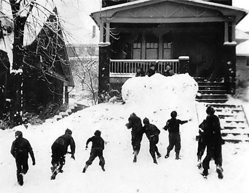
Defenders and attackers having a snowball
battle in the front yard at 2414 Beaufort Avenue in 1940.
Defending the fort are brothers Norm, Bob and Art Rosfeld.
Dan Beard's official rules of warfare
governing a snowball battle are as follows:
* Sides are divided by Patrols. The
defenders of the fort it being supposed that one-third behind fortifications
are equal to two-thirds outside. One Patrol might defend the fort, while two
Patrols can join forces to attack. The Patrol Leaders decide, by lot, the
choice of position. Only the attacking party is allowed shields and
ammunition sleds.
* At least thirty yards from the fort
a camp must be established by the outsiders or attacking army, and stakes
driven at the four corners to locate the camp. Imaginary lines from stake
to stake mark its limits. Each party will have its Patrol Flag which it
carries with it in the assault. The defenders of the fort must see to it
that all damages to the fortifications are promptly repaired.
* Any soldier from the fort who shall
be carried off within the limits of the camp becomes a prisoner of war, and
cannot leave the camp until rescued by his own comrades.
* Any one of the attacking force pulled
into the fort becomes a prisoner of war, and must remain in the fort until it
is captured. Prisoners of war cannot be made to fight against their own side,
but they may be employed in making snowballs or repairing damages to
fortifications. Any deserter recaptured must suffer the penalty of being made
to work with the prisoners of war.
* When the outsiders, or attacking army,
can replace the enemy's colors with their battle-flag, the fort is captured
and the battle is won by the attacking party; all fighting must then
immediately cease.
* But if, in a sally, or, by any means,
the soldiers of the fort can take the colors of the opposite party from the
camp and bring them inside their fortifications, they have not only successfully
defended their fort, but have defeated the attacking army; and this ends the
battle, with double honors to the brave defenders.
* No water-soaked or icy snow-balls are
allowed. No honorable boy uses them, and any one caught in the ungentlemanly
act of throwing such "soakers" should be forever ruled out of the
game.
* No blows are allowed to be struck by
the hand, or by anything but the regulation snowball, and, of course, no
kicking is permitted.
For an interesting site with
memories of the Berwin-Beaufort-Birtley,
or BBB Shortcut Gang, from the 1940s, visit The Short Cut,
a page built by BBB friends from that section of Brookline.
Sled Riding In A Winter Wonderland
Snowball battles were just one of the
many fun things to do when the white flakes of winter covered the streets and
turned Brookline into a winter wonderland. Sled Riding was another favorite
pasttime for anyone who has grown up near the steep streets along the
hillsides. Throughout the neighborhood there are many notable hills that
were turned into sledding slopes, some of which rivaled those of the Seven
Springs resort.
Capital, Rossmore, Queensboro and
Castlegate Avenues are a few of the many fine streets
for sledding. In the days before it became necessary to salt every road
in the city, these steep hills were generally ignored. Occasionally a
vehicle would try to make it up or down, often getting stuck. As long as
the snow lasted, these streets belonged to the kids.

Danny McGibbeny and Clint Burton sledding
on Birchland in 1965.
One legendary slope was Birchland
Street, a monster hill in East Brookline that descended from Milan
Avenue past Bellaire Place to Brookline Boulevard. The hill was alive with
children riding their red flyers, toboggans and saucers from morning to
night. The Red Flyer sleds, with the steel rails, would spark over the
Belgian Blocks that made up the road surface.
The adventurous few began at
Milan and sped down the first three sections of the hill, baling out
along the fourth, near the bottom approaching busy Brookline Boulevard. Often
a snow wall was built to keep out cars and stop runaway sleds. Building
jumps at Bellaire was a thrilling way to leap over the tire ruts and
continue down the hill. There were enough kids going up and down the hill
that there was always someone to watch for cars coming down
Bellaire.

Birchland Street, looking up from
near Brookline Boulevard towards Milan Avenue, in December 2012.
It seems like the best snow days of
all were the ones when school was cancelled due to a storm. Everyone was
outside playing and the snow was packed firmly from all the activity. Coming
back home after a few hours, cold and wet, and having mom make some hot
chocolate was the greatest. After warming up and putting on dry clothes,
it was back out for some more fun throwing snowballs and sledding
down Birchland Street.
Another fun thing to do was to adorn the
front yard with a snowman. Rolling the snow into three balls and placing them
on top of each other, biggest to smallest, made the body. Adding the accessories
was the best part. Stones, sticks, scarves, carrots, hats and gloves
turned Frosty into something special. If the weather stayed cold he could
last for a week or two. These snowmen came in many different shapes and
sizes. They were all special parts of what made Brookline a Winter
Wonderland for the neighborhood kids.
 
Delivering The Morning Paper
For many Brookline boys and girls, their
first real job was delivering newspapers for the Pittsburgh Press or the
Pittsburgh Post-Gazette. Back in the old days there was also the Pittsburgh
Sun-Telegraph.
These were mostly grade school students
who had to get up in the early hours of the morning (rain, snow, sleet or heat),
pick up their bundles and get the job done quickly so they could make it to
school in time. Many routes covered several streets, many with a high and
low side, meaning lots of steps!

Some walked with their delivery bag,
some pulled a wagon and some rode their bikes. Then, in the evening hours
they had to go around to their customers and collect payment. A large ring
held cards for all the accounts, and after each payment a small stub was
given as receipt.
Being assigned a route was a prestigious
job, and a great way to get to know the neighbors, but it wasn't easy. No
matter what the weather, the papers needed to be delivered in time and as
requested in order to get good tips.

<><><><> <><><><>
<><><><> <><><><>
<><><><> <><><><>
The following is an
article by Steve Weitzenkorn about being a paperboy for the Pittsburgh
Press entitled "My First Big 'Growing Up' Experience."
When I started sixth grade, I signed
up to be a future paperboy for the Pittsburgh Press, the afternoon newspaper.
I expected to get the route in two years when the current paperboy, David Sales,
would be ready to move on to something else. David just started high school
and began delivering papers that September. His parents and mine were
friends.
Then tragedy struck. David had an
epileptic attack in the high school swimming pool and drowned. It was a very
sad day for our neighborhood. A day I’ll never forget.
The route manager for the Pittsburgh
Press now had an unexpected problem. As saddened as he was about David’s death,
he also had to find someone to deliver the papers. He learned of the tragedy
when he was unloading the bundles of papers at David’s house. He threw them back
in the truck and drove to our house. I was considered too young to be a paperboy
but he had no other choice at that moment.
Without any training or time to prepare,
I started my first real job on a moment’s notice. I was given seventy-six papers
to deliver and a ring of receipt stubs with names and addresses. I loaded the
papers into a wagon and a satchel and set out. It took me over two hours to
deliver the papers, an hour longer than normal since I was figuring things out
as I went. Plus I began nearly an hour late because of the
circumstances.
So customers were complaining my first
day on the route. “Where have you been?” “Why is the paper so late?” “The paper
should have been here two hours ago!” Then when I took a minute to explain, I was
even later for the next customer. In the end, customers were understanding and
sympathetic.
I got better and faster at delivering
the paper over the next week, which turned out to be quite rainy. Then I had to
go around to each house and collect money for the prior week’s paper. Most people
paid weekly. Some paid every two weeks. One paid monthly. And several were a few
weeks in arrears. Collection time was also complaint and special request
time.

Steve Wetzenkorn in 1962
Mrs. Brown wanted her paper under the
mat so it would not blow away, as it did earlier in the week, and did not want
it folded and tossed. Mr. Spanelli’s paper the day before got wet. His house was
up two flights of concrete stairs and he instructed me to make sure the paper
was placed at least three feet from the edge of his porch so it would stay dry
when it rained or snowed. Mrs. Jackson wanted her paper in the milk box which
meant I couldn’t toss it from the curb and had to walk up several steps to her
porch. Mr. Anderson wanted his paper inside his storm door and he promised me a
25 cent weekly tip if I did. In 1962, that was worth it.
Tips were how customers told me in
tangible terms if I was doing a good job. Most gave me a dime and considered
it generous. Christmas tips were the best. I knew how well I was doing by the
money left over after I paid the route manager the “wholesale” cost of the
paper.
The daily paper cost seven cents in
those days. The Sunday paper was a quarter. So from most customers I was collecting
55 cents a week. I needed to collect about $50 and then pay the route manager
about $34 and I made $16 plus about $7 in tips if everyone paid. The job required
about fourteen hours per week, so I was earning roughly $1.65 an hour.
The best news is that I gained a lot
more from the experience. I learned many things that have helped me throughout
my life and career:
- I had to set priorities ... which meant I had to stop playing with friends when
the paper truck showed up at 4:30.
- I had to take care of customers and honor their special requests – tips
depended on it.
- I needed to have “get up and go”— that was a choice I had to make every day
– rain, shine, snow or freezing temperatures.
- I learned how to increase my efficiency and quality of service.
- I learned how to handle and keep track of money. It was a tutorial in business
finance on a small scale.
- Most of all, I learned how to take on responsibility.
<><><><> <><><><>
<><><><> <><><><>
<><><><> <><><><>
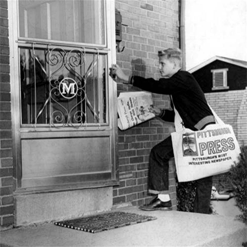 
What's In A Name? - Brookline Streets
Prior to 1905, Brookline Boulevard
was known as Knowlson Avenue, from Pioneer Avenue to its terminus at Whited
Street. The same can be said of many of Brookline's back streets. Old street
maps, provided by Jim Moran, document the rapid changing of street names when
the Brookline section of West Liberty Borough was annexed into the City of
Pittsburgh.
Prior to annexation, Bellaire Avenue
was known as Beacom and Bellaire Place was Beverly. Whited went through a
series of changes, from Weston to Brocton to Knowlson to Oak. Milan was called
Belmont. Merrick was known as Whited, and Oakridge as Ormond. Bodkin Street was
known as Hunter Avenue, and from 1908 to 1935 as a part of Brookline Boulevard.
Pioneer Avenue was known for some time as Lang Avenue, and West Liberty Avenue
was Plummers Run.
Other tracts of present-day Brookline
were part of Overbrook Borough and Baldwin Township and carried distinct
names for those municipalities, such as Chelton Avenue once being called
Chelsea and Creedmoor known as Carlton.

<View Old Brookline Street Maps>
A list of Brookline streets and
their former borough and township names:
Alwyn - Bronx, Ardsley - Auburn, Ballinger - Third
(also Sycamore and Beach), Bayridge - Sumner, Beaufort - Oxford, Bellaire Avenue - Beacom,
Bellaire Place - Beverly, Bellbrook - Benkerd, Belle Isle - Boyer, Berwin - Cambridge,
Birchland - Birchwood, Birtley - Beverly,
Breining - Richmond and Fairhaven Road, Brookline Boulevard - Hunter and Knowlson Avenue,
Bodkin - Hunter (also Brookline Boulevard).
Cadet - Carlton, Capital - Oakwood,
Castlegate - Concord (also Cranford), Chelton - Chelsea, Creedmoor - Carlton,
Crysler - Clermont, Dunster - Denton, Eathan - Salem, Edgebrook - Putnam,
Elmbank - Elmore, Fallow - Fern, Ferncliff - Crescent, Fernhill - Siebert,
Fiat - Cherry, Flatbush - Winchester, Fordham - Brynmawr.
Gallion - Glendale (also Monitor),
Glenarm - Trenton, Hallowell - Walnut, Hartranft - Handem, LaMarido - Stang,
Leavitt - Lester, Lineal - James, Lynnbrook - Lynnwood, Mayville - Centre,
Merrick - Whited, Midland - Merton (also Merrimac), Milan - Belmont,
Moredale - Chestnut, Norwich - Lexington.
Oakridge - Ormond, Parquet - Polland,
Pioneer - Lang, Plainview - High (also Highland, Frew and Lennox), Queensboro - Marlboro,
Rossmore - Cromwell, Stapleton - Sturgiss, Starkamp - Stanford,
Stebbins - Sherwood, Stetson - Summerhill, Timberland - Valley.
Wedgemere - West Point,
West Liberty Avenue - Plummers Run, Whited - Oak (also Weston, Brocton and Knowlson),
Winterhill - Willison, Wolford - Winthrop (also Walden), Woodbourne - Bunker Hill,
Woodward - Hughey (also Willoughby), Zimmerman - Elm.
Brookline, Massachusetts
The community of Brookline stands
1250 feet above sea level. Once refered to as Oak Hill, the lush, rolling
landscape in and around Brookline was once covered in tall White Oak, Ash
and Birch trees, quite a contrast to the dingy urban atmosphere only a
couple of miles away in the industrial city of Pittsburgh,
Pennsylvania.
The same can be said for Brookline,
Massachusetts, a lush,
well-watered farming community in New England, located not far from the
bustling port city of Boston. The notable exception would be that Brookline,
Massachusetts stands only fifty feet above sea level.
The earliest recorded settlers in the
South Hills were Pennsylvania Militiamen that received land grants from the
State Legislature after the American Revolution in lieu of payment in gold
and silver for their wartime service. Their surveyed claims are documented in
a collection of 1787 Warrantee Maps.

<><><><> <><><><>
<><><><> <><><><>
<><><><> <><><><>
In the mid-1800s (prior to 1850), Richard
Knowlson and his wife Lydia Barry Knowlson, along with sons John, Thomas and Isaac,
and daughter Elizabeth, migrated to the Pittsburgh area. Richard was born in England
and Harriette was originally from eastern Pennsylvania.
The Knowlsons had ties to the New England
town bearing the name Brookline, Massachusetts. The couple lived there for a
short time with relatives before relocating to Lower Saint Clair Township, just
south of the city of Pittsburgh. Richard, Harriette and their children settled in
and began cultivating their 170-acre Knowlson Farm.
Richard felt that their new surroundings
here in the South Hills were very reminiscent of the Massachusetts they had left
behind, and he began referring to their little piece of southwestern Pennsylvania as "Brookline."
Richard Knowlson was a prominent
figure in the formation of West Liberty Borough. He provided land for an
orphanage along Hunter Avenue (Bodkin Street) and for a church that bore
his name, the Knowlson Methodist Church, built in 1868 along West Liberty
Avenue.
 
The boundaries of Knowlson Farm, shown on
an 1886 map (left), and outlined on a 2013 map of Brookline.
Richard's wife Lydia passed away on October
27, 1860. He remarried Harriet Foster, and the couple spent their remaining days
together. Richard passed away on January 30, 1895 and Harriet followed on
January 12, 1907. Richard and Lydia are interred at Allegheny Cemetery while
Harriet rests in Saint Clair Cemetery in Mount Lebanon.
<><><><> <><><><>
<><><><> <><><><>
<><><><> <><><><>
The Knowlson Family
According to the 1880 census, the
following Knowlsons lived in West Liberty Borough:
- Richard (75) and wife Harriet F. (60). Richard's occupation was listed as farmer.
Household members included Elizabeth A. Fleming (43-daughter), David Fleming
(22-grandson), Richard K. Fleming (21-grandson), Walter R. Fleming (6-grandson),
Lydia Fleming (4-granddaughter), Margaret Ott (21-servant) and Annie
Weaver (15-servant).
- Thomas L. (45) and wife Annie (35). Thomas' occupation was listed as farmer.
Household members included Richard Knowlson (11-son), Jane Knowlson (8-daughter),
Lydia Knowlson (5-daughter), John Knowlson (3-son) and Ellen Knowlson
1-daughter).
- John Barry (41) and wife Mary Ann (33). John's occupation was listed as farmer.
Household members included Isaac Knowlson (15-son), Mary Knowlson (12-daughter),
Thomas Knowlson (9-son) and Annie Knowlson (6-daughter).
- Isaac L. (38) and wife Ellen (30). Isaac's occupation was listed as brick maker.
Household members included William Knowlson (11-son), Ira Knowlson (8-daughter)
and George Knowlson (2-son). The couple had another daugher, Isabella, born in
1881.
<><><><> <><><><>
<><><><> <><><><>
<><><><> <><><><>
Stayed Close To Brookline
In the 1890s, some of the Knowlson land
was deeded to the Flemings, Fisher and the Gutbub family. At the turn of the
century, when residential development came to the South Hills, most of the
remaining Knowlson land was sold to the West Liberty Improvement Company. The
land comprised most of the First and Third Ward plots in the emerging community
of Brookline.
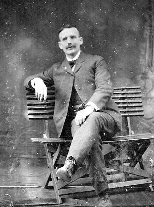
Richard Knowlson, son of Thomas, circa
1900.
Many of the Knowlson family members
remained close to the Brookline area for many years. Thomas Knowlson's
son Richard, a successful Pittsburgh businessman, retained a sizeable
plot of land along Pioneer Avenue. Some of this was purchased by the
Pittsburgh Public School Board for the construction of Brookline
Elementary School in 1909. Additional land adjacent to the school
was made available in 1923 for a playground and future school
expansion.

Thomas B. Knowlson, age 52, clearing the
yard at 965 Berkshire Avenue, home of his sister Mary,
on July 25, 1923. The steps in the foreground lead to Tom's home next
door at 967 Berkshire.
<><><><> <><><><>
<><><><> <><><><>
<><><><> <><><><>
Isaac Knowlson's Bumper Crop of Hay
When the Knowlson property was parceled
out for development in 1905, Isaac Knowlson and his wife Ellen moved into a home
at 2817 Pioneer Avenue and also retained a four acre plot along Pioneer Avenue
where Brookline School is located today. True to their farming heritage, the
couple grew some crops on their land.

In 1907, Isaac Knowlson's hay crop was
noted in the Pittsburgh Post-Gazette as having the heaviest yield per acre of
any crop of hay in Western Pennsylvania. This record was confirmed by experts in
the farming industry.
The following year Isaac sold a parcel of
that property to the Pittsburgh School District for the construction of Brookline
School. Four additional lots were sold off individually for new home buyers. A few
years later, then in his seventies, Isaac sold the remainder of the property to the
School District.
In his later years, Isaac and Ellen moved into
a nearby cottage at 2801 Pioneer Avenue. Isaac Knowlson, the brick maker who grew
a bumper crop of hay in 1907, passed away on December 10, 1927, at the age of
eighty-five. His wife Ellen, aged ninety-five years, followed on February 15, 1944.
The couple are buried in Mount Lebanon Cemetery.
Note: When the Brookline
School garden was forced
to move in 1922 due to development along Rossmore and Gallion Avenues, Isaac
Knowlson permitted the school to use his fertile land for a new garden location,
that is until future school expansions eliminated this open land.
 
<><><><> <><><><>
<><><><> <><><><>
<><><><> <><><><>
Knowlson Avenue
When the West Liberty Improvement
Company laid out the road network of Brookline's First Ward, they named
one tree-lined avenue Knowlson Avenue, in honor of the pioneering family
that long ago laid the seed that led to our neighborhood's official
designation, "Brookline."
Another lasting legacy of the Knowlson
family lies in the names of the many of the streets that made up the First
and Third Wards of Brookline carry Bostonian designations. Avenues like
"Dorchester", "Fordham", "Woodbourne", "Berkshire", "Norwich", "Bayridge",
"Castlegate", "Ardsley", "Queensboro" and "Sussex" are in keeping with our
Brookline MA connection.

Much of Brookline's Knowlson Avenue still
has that early-20th century red-brick, tree-lined appearance.
The present-day Knowlson Avenue was
not the first street to carry the family name. During the West Liberty
Borough days, prior to 1905, the roadway now known as Brookline Boulevard
was called Knowlson Avenue. Beginning in 1905, the street now known as
Kenilworth Avenue was called Knowlson Avenue.
That soon changed when the Fleming
property between Pioneer Avenue and McNeilly Road was developed. The main
road cutting through that section of housing, a tree lined avenue covered
in red paving bricks was aptly designated Knowlson. The street originally
stretched from McNeilly Road to Aidyl Avenue, but was later extended to
Midland Avenue.
<><><><> <><><><>
<><><><> <><><><>
<><><><> <><><><>
The Five Brooklines
Just like there are twenty separate Pittsburghs, or Pittsburgs, there are five distinct Brooklines within the borders of
the United States of America. The most well-known, and largest, of the Brooklines is
located in Massachusetts. Brookline MA is a town in Norfolk County, part of the
Greater Boston area. The town was settled as a hamlet of Boston in 1638 and chartered
as an independent municipality in 1705. Birthplace of President John Fitzgerald Kennedy,
the population was 58,732 in 2010.
Brookline, New Hampshire is a town in Hillsborough
County, chartered in 1769, with a population of 4991 in 2010. Brookline, Vermont is a
town in Windham County, chartered in 1794, with a population of 467 in 2000. Brookline,
Missouri is a former village in Greene County, chartered in 1971, with a population of
326 in 2000. This small Missouri town was consolidated with the City of Republic in 2005
yet retains its distinct name of Brookline.

And then there is our Brookline, nestled in the
South Hills of Pittsburgh, Pennsylvania. Once part of West Liberty Borough, Brookline was
founded in 1905 and became a distinct city neighborhood in 1908. The population of
the Brookline community was 13214 in 2010.
What a strange feeling it would be for a
Pittsburgh Brookliner to be driving down a Massachusetts avenue and encounter a sign
that says "Entering Brookline."

Brookline Maps
The following maps show the transition of
Brookline from rural West Liberty Borough (1876), through the first residential growth
phase (1910) to modern-day Brookline (1997), with it's current borders and street
layout. The maps show a great deal about the development of the
community.
In the 19th century, West Liberty Borough,
which also included Beechview, was dominated by farms and mining ventures.
Scattered homes and a few commercial properties dotted the landscape. As late as
1905, Brookline Boulevard was listed as Knowlson Avenue and housing development
had only begun, with just the Paul Place, Hughey Farms and Fleming Place Plans
on the map. By 1910 the community had been annexed into the city of Pittsburgh
and the rural landscape began to take on a more urban look. This development
continued through the 1970s.
♦ Colonial Survey Maps of Land Grants
in the South Hills ♦
♦ Original Brookline Landowners
Baundary Overlay Map ♦
♦ Brookline Map
1851 ♦ ♦ Brookline Map
1862 ♦
♦ Brookline Map
1876 ♦ ♦ Brookline Map
1886 ♦
♦ Brookline Map
1896 ♦ ♦ Brookline Map
1905 ♦
♦ Brookline Map
1910 ♦ ♦ Brookline Map
1916 ♦
♦ Brookline Map
1926 ♦ ♦ Brookline Map
1934 ♦
♦ Brookline Map
1997 ♦ ♦ Brookline Map
2003 ♦
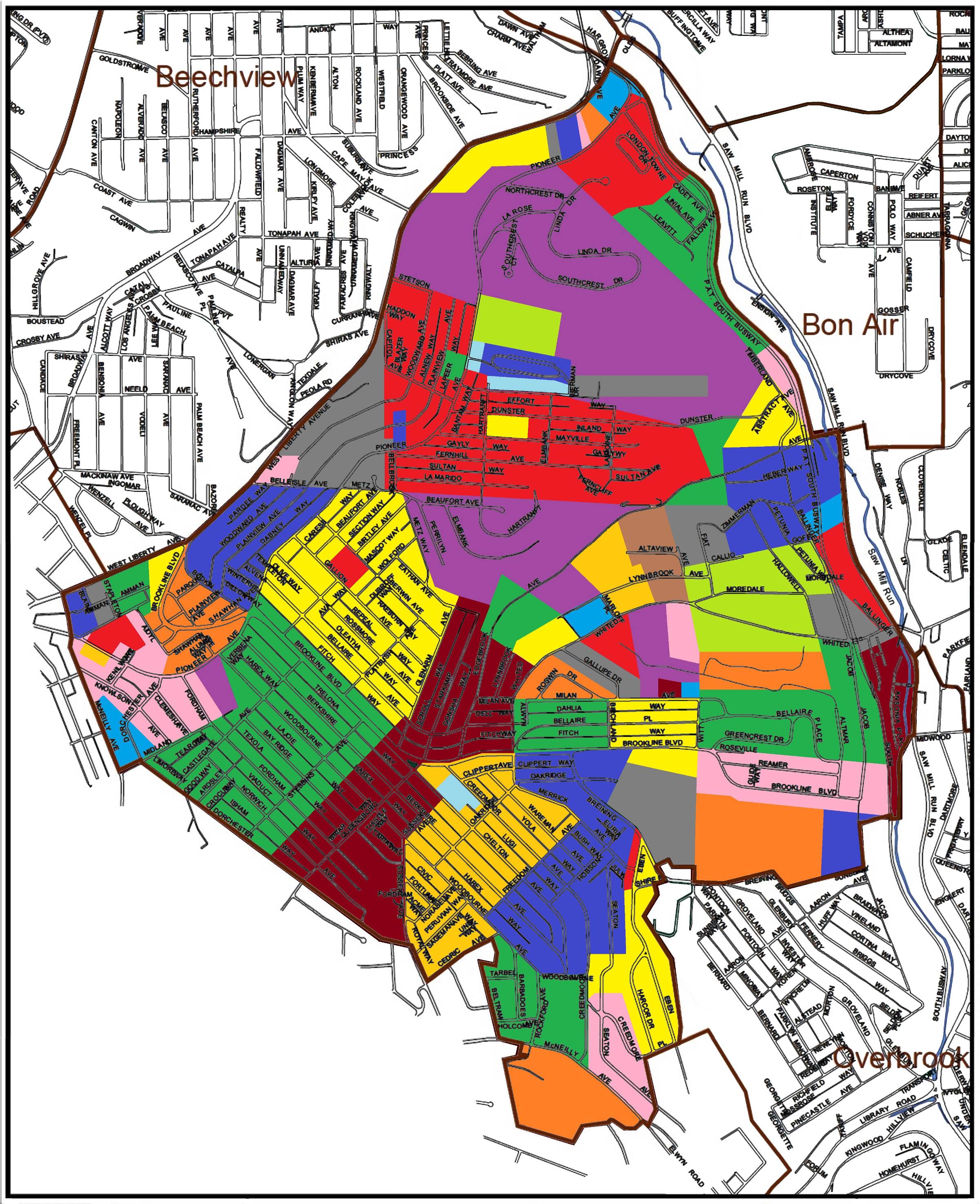
♦ Map Of 72 Brookline Developmental
Subdivisions ♦
♦ Original West Liberty Borough
Boundary Overlay ♦
♦ Map Showing Growth Of
Brookline ♦
♦ Map Showing Brookline
Voting Wards ♦
♦ Old Maps of Brookline's Oak
Mine ♦
♦ Brookline Geodetic and Topographic Maps
1927-1955 ♦
♦ Hopkins Map Collection 1872-1939 ♦
♦ Pittsburgh Historic Maps (Interactive) ♦
Brookline Aerial Views
The following images give a bird's eye
view of Brookline from 1939 through 2006. These aerial views show how the community
developed over that sixty-eight year time frame.
♦ 1939 ♦ ♦ 1957 ♦ ♦ 1967 ♦
♦ 1993 ♦ ♦ 2005 ♦ ♦ 2006 ♦ ♦ 2015 ♦

A 2011 satellite image of the intersection
of Brookline Boulevard and Pioneer Avenue.
♦ Brookline As Seem From Above -
Fall 2014 ♦
* Photos and Short Video by Matt Lackner *
♦ Google Brookline - 2014 Satellite
Images ♦
Lost Subdivision Of Brookdale
Take a ride up Breining Street,
past Carmalt School. Once past the school, rather than continue onto Glenbury
and down to Route 51, turn to the left onto what appears to be a side street.
This is actually a continuation of Breining Street. Head down the short hill
and around the bend to the right. After the turn the street designation changes
to Briggs Street. Continuing straight leads to the intersection with
Aaron Street.
At the turn, on the left side of the road
sits an inconspicuous set of jersey barriers along the edge of the woods. Unless
one lived in Brookline prior to 1980, they might not realise it, but they had
just passed what was, at one time, the entrance to a long-forgotten sublplot
of homes known as Brookdale. A left turn would have taken a traveler onto an
extension of Briggs Street that stretched deep into the wooded valley,
intersecting with Daleview Street and Oakridge Street.

During the East Brookline construction
boom in the mid-1920s, this wooded section of Brookline (then still considered
a part of Overbrook Borough) was slated for residential development. An entire
network of roads and home lots was planned, beginning at Breining Street and
covering thirty acres. The Brookdale development, when completed, would have
drastically altered the East Brookline landscape.
When the Brookdale subplot was originally
laid out, developers also had an eye on the adjacent twenty acre Anderson Farm, which
stood to the west between the existing section of Oakridge Street and the Oakridge
extension in Brookdale, and the ten acre Hays Estate to the east.

Advertisment for the Brookdale development
project that ran in the Pittsburgh Press on March 15, 1925.
Briggs Street was intended to continue
through the farm property to a proposed junction with Brookline Boulevard near
Birchland Street. More ambitious plans included widening Brookline Boulevard
to four lanes at Breining Street and diverting the main avenue through the
valley to a major intersection with Saw Mill Run Boulevard near Overbrook
School.
In 1925 lots were made available for
purchase and the Brookdale Improvement Company began laying out the streets in
the thirty acres adjacent to the farm. In 1930, Overbrook Borough was annexed
by the City of Pittsburgh. At that time the homes in East Brookline, including
the Brookdale subdivision were added to the Brookline census tract. Only a small
triangular section of Brookdale, just south of Breining Street, between Briggs
Street and Glenbury Street, remained part of the new Overbrook
community.

The Great Depression stalled building
plans for a few years. Residential construction began in the late-1930s and, by
1942, five homes had been built in the Brookdale project. With an eye towards the
future, in 1945 the Brookline Joint Civic Committee presented a plan for the
boulevard realignment. The key to the successful implementation of this plan and
the further development of Brookdale depended upon the acquisition of the
Anderson property.
Unfortunately, the winds of change blew
in a different direction. In May of 1947, the Anderson family sold their
twenty-acres to the Brookline Memorial Community Center Association to be
turned into a neighborhood park. The Anderson home was used as a Recreation
Building and the surrounding land was converted into ballfields and other
outdoor recreation facilities.
The Brookline Memorial Community Center was a great addition to the community, but
it had disastrous effects on the pending Brookdale proposal. With the park land
now off limits to development, the connecting roadways along Brookline Boulevard
and Oakridge Street could not be built. This left the housing plan isolated with
only one way in and out, the intersection of Briggs and Breining.

1644 Oakridge Street, seen here from Daleview
Street, was one of four homes built on the Oakridge extension.
Over the next forty years, only four more
homes were built, one on Oakridge and three along Breining Street (one in Brookline
and two across the street in Overbrook.) Altogether, four homes were constructed on
Oakridge Street, two on Daleview Street and three on Breining. Other Brookdale roads
laid down were a section of Cortina Way and a short alleyway between Oakridge and
Daleview, called Don Way. The rest of the ambitious Brookdale housing development
was never completed.
One of the homes in Brookdale was a two
story brick house at 82 Daleview Street, three lots east of Briggs Street. It was
built in 1941 by Nettie B. and Elmer J. and Hadley, a long-time employee of Duquesne
Light Company. The home at 82 Daleview eventually passed to Elmer's daughter, Sara
(Sally) Hadley-Aul. Sally had three children, Robin, Robert and Randy, who remember
Brookdale as a wonderful, peaceful place to live.
 
Sally Hadley outside her home at 82 Daleview
Street in 1947 (left) and a snowy day in Brookdale.
Growing up in the woods, with monkey vine
swings, deer, pheasants, and other wild animals made for a unique lifestyle. The
lack of autmobile thru traffic was a rarity in busy Brookline, and living so
close to a public park, with a swimming pool, ballfields and other attractions
was an added bonus. Along with the Hadleys, some of the other families that built
homes in Brookdale were the Gessips, Pilarskis and Millers, all of whom lived on
Oakridge Street.
 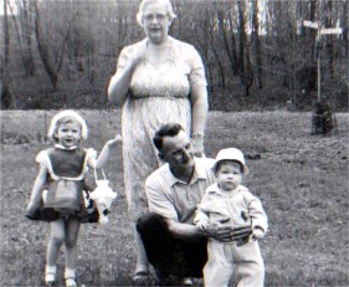
Elmer and Nettie Hadley with granddaughter
Robin in 1958 (left) and with Robin and Robert in 1960.
The signpost in the background is the intersection of Briggs Street and Daleview
Street.
In 1969, the thirty acres of Brookdale,
that which was part of Brookline, were acquired by the city of Pittsburgh, along
with the ten remaining acres of woodland (tax delinquent property of the former
Hays estate), stretching east to the railroad abutment, as part of a forty
acre enlargement of Brookline Memorial Park. The homes were taken over by the
Urban Redevelopment Authority and used as rental property. By a special lease
agreement, Mrs. Aul was able to remain in her home on Daleview.
 
The home at 82 Daleview Street (left) and
a winter view from Daleview up Briggs Street towards Breining.
 
Sally Hadley-Aul in the early-1970s (left) and
Randy Aul at the corner of Daleview and Briggs Street in 1979.
Now rental properties, the homes along
Oakridge became run down and were vacated. The same for the home at Daleview
and Cortina Way. One by one they were demolished. Ten years later, only the Hadley
house on Daleview remained. In 1982, Sally Hadley-Aul moved out and turned the
property over to the city. The Hadley home was razed in 1985, and the jersey
barriers were placed at Briggs and Breining Street, marking the final chapter
in the history of main portion of the Brookdale subdivision.
<><><><> <><><><>
<><><><> <><><><>
<><><><> <><><><>
A Tiny Part Of Brookdale Lives On Today
In our Brookdale history story above,
it was noted that three homes were built along Breining Street. This is the
short stretch of Breining that lies between Glenbury Street and Briggs Street.
A home at 1688 Breining was built in 1945, followed by another was in 1950 at
1665 Breining. The last was constructed at 1670 Breining in 1975.
All three of these homes still stand,
and the one at 1665 Breining stands on Brookline soil, marking the sole survivor
of Brookline's lost subdivision of Brookdale.

The home at 1665 Breining Street
is the only remaining Brookline-Brookdale home.
 
The Overbrook-Brookdale homes at 1670 (left)
and 1688 Breining Street.
<><><><> <><><><>
<><><><> <><><><>
<><><><> <><><><>
Jacob And Milton Hays
Jacob and Jane Hays, whose estate sat
near the lower end of Whited Street, once owned the majority of property in East Brookline. He sold the
mining rights, and over the years parceled off much of his estate to farming
families or to his family heirs. In 1874, his son Milton Hays, owner of the
Pittsburgh and Castle Shannon Railroad, still had the deed to sixty acres near
Oak Station (Overbrook School). That same year, Milton sold twenty of those
acres to James Anderson, who started the Anderson Farm.

This first image is from a 1905 map showing
the landowners and boundaries present at that time. In 1905, this was
part of Overbrook and land was made up of a few farms and woodlands. An old coal
railroad spur line extended
from the P&CSRR tracks into the valley. When Brookline's trolley line was first
laid down that same year,
it was a single track line that ran from West Liberty Avenue and connected to the
old railroad line.
By the turn of the century, Milton
still owned the thirty acres adjoining the Anderson Farm, and his children
owned the remaining ten acres up to the West Side Belt Railway line. Hays
eventually sold his thirty acres to the Brookdale Improvement Company for
housing development. When Overbrook School was built in 1928, two sets of
city steps were constructed on the remaining Hays property.
The steps descended from each end of
Jacob Street, a roadway that was interrupted by the steep valley. They led to
a walkway that went through the railroad tunnel to the new school. Since this
was part of Overbrook Borough at the time, the steps were necessary for public
school children in East Brookline, who were sent to Overbook schools. The steps
were also a convenient way for local commuters to access the Pittsburgh Railways
Castle Shannon and Overbrook streetcar lines.
In 1969, the remaining ten acres of
the East Brookline property owned by the Hays family was ceded to the city in
lieu of back taxes. The former Milton Hays estate now makes up the sixty acre
recreation facility and greenway of Brookline Memorial Park.
<><><><> <><><><>
<><><><> <><><><>
<><><><> <><><><>
Aerial Views Of Brookdale

An aerial view of the Brookdale subplot
in 1939. Four homes are built and another going up on Oakridge Street.
Acquiring the Anderson Farm to the left is the key to the further
development of the Brookdale property.

An aerial view of the Brookdale subplot
in 1957. The Anderson Farm is now The Brookline Memorial Community Center.

An aerial view of the Brookdale subplot
in 1967. A sixth home now stands near the intersection of Oakridge and Briggs.

An aerial view of the abandoned Brookdale
subplot in 2012. Still visible through the trees is the outline of the roads.
Also visible at bottom are the three remaining Brookdale homes along Breining
Street.
<><><><> <><><><>
<><><><> <><><><>
<><><><> <><><><>
Photos Showing Remnants Of Brookdale
Today, only bits and pieces of the
Brookdale subplot exist. After two decades of neglect, most of the land has
become overgrown, reclaimed by the trees and shrubs. The roads have reverted
back to dirt paths best suited for off road dirt bikes.
Exploration of the forty acre greenway
revealed an old home foundation, a set of steps, a disabled fire hydrant and
some slabs of asphalt and concrete. The city steps between the two sections of
Jacob Street are still there, as well as the railroad tunnel, which leads to
the Port Authority South Busway. These photos below were taken in 2013,
thirty-one years after the Brookdale streets were abandoned.

The entrance to Brookdale at the
intersection of Breining and Briggs Streets.
 
Entering Brookdale from Breining
Street and looking along Briggs Street.
 
Some cement slabs near
intersection of Briggs and Daleview Street.
 
An abandoned fire hydrant
near the intersection of Briggs and Oakridge Street.
 
The foundation and steps of the
home that stood near Daleview and Cortina Way.
 
A sidewalk leading towards
the Jacob Street city steps (left) and a view from the
Overbrook side of the valley along the steps to the Brookline side.
 
Looking up the steps towards
Overbrook (left) and the pathway leading to the South Busway.
 
A view from inside the railroad tunnel
looking west towards Brookdale (left) and a closer view of the fire hydrant.

The railroad tunnel was built in 1909 during
a major upgrade of the old West Side Belt Railway line.
The Wheeling & Lake Erie Railroad still uses the tracks above to transport coal
and natural gas.
<><><><> <><><><>
<><><><> <><><><>
<><><><> <><><><>
Brookline Street Map - 1940
Brookline Street Map - 1997
Final Note: The 1940 map shows the
Pittsburgh Railways right-of-way that ran east to west through the wooded valley
floor to a connection with the main rail network that ran along the Saw Mill Run
Corridor. In 1905 a single-track line was laid along this path, connecting
to a discontinued coal railroad spur line that extended into the valley. The old
railroad line was part of the Pittsburgh & Castle Shannon Railroad.
The extended trolley service lasted only
a couple years. The track was abandoned beyond Edgebrook Avenue in 1909. Later,
it was brought back into East Brookline, with a turnaround loop along the 1400
block of Brookline Boulevard. Although no longer in use, the Port Authority retained
ownership of the valley floor right-of-way until 1969, when the land was
acquired by the City of Pittsburgh.
Thanks to Randy Aul,
Robin Aul, Mike Brendel and Doug Brendel for providing
photos and information on the Brookdale area.
<><><><> <><><><>
<><><><> <><><><>
<><><><> <><><><>
Every Picture Tells A Story - Here Is A
Brookdale Story

This picture from Shannon Barkley was taken
down by the Jacob Street Steps and shows the W&LERR railroad abutment, the 1909
pedestrian/trolley tunnel and the location of the now former Brookdale pond. It
looks as though the city has drained the swamp and gotten the stream diverted into
the sewer. That creek had once gone through a pipe to Saw Mill Run, but that pipe
had long since clogged and the stagnant swamp had been there for many, many years,
and had, in some ways, become the stuff of legend.
Anyhow, this is one of those pictures that
tells a story that dates back to the 1870s, when the Pittsburgh and Castle Shannon
Coal Railroad expanded into Baldwin Township and began mining operations in this
remote valley along Saw Mill Run Creek. The coal outcrop extended deep into what was
then known as Oak Hill. This was land owned by the president of the P&CSRR, Milton
Hays< the son of Jacob Hays who lived in the Larry's Roadhouse mansion at Whited Street.
The stream itself, back at the turn of the
20th Century, was much larger, fed by numerous fresh water spouts that fed the fields
of the nearby Anderson Farm, and no doubt cleaned the filth from the miners and
watered the donkeys that labored in the mines. Most of those fresh water spouts have
since been diverted into the sewer system.
Looking at the railroad abutment and tunnel,
it is hard to imagine it looking any other way ... but try to picture a wide open
valley entrance with the busy coal railroad line passing by and the stream flowing
to Saw Mill Run. A narrow gauge rail spur line cuts off the main line into the valley
and proceeds a couple hundred yards to two different mine entrances. Near the valley
entrance is a maintenance shed. Coal operations run daily at this busy mining station.
Donkeys were regularly bringing carts full of coal out of the mines to be loaded onto
rail cars that were towed away later. Coal trains were coming and going. The
accompanying images give an idea where the mining occurred.
In 1895, the West Side Belt Railroad was formed
and the line rain past the valley entrance, higher up on the hill than the smaller coal
railroad. It became part of the infamous Wabash Railroad, carrying freight cars loaded
at the Wabash Terminal in downtown Pittsburgh. The West Side Belt Railroad built a long
wooden trestle that spanned the valley entrance. The coal operations continued, and the
stream flowed, underneath the supports of the trestle at the now busier and more congested
valley entrance.
A spur line running to mine entrances in
the valley behind present-day Brookline Park, shown on an 1882 map.
Mining operations ended in the valley in 1902.
Beginning in 1905, the new 39-Brookline trolley line ran down through the valley, using
the path of the former spur line. These trolleys connected to the P&CSRR railroad line,
which had been converted for both train and trolley use. From there it followed the
line to town, then came back along West Liberty Avenue and Brookline Boulevard, always
a one-way loop. This one-way looping trolley traffic through the valley and under the
trestle to town continued until 1909.
In 1909 the West Side Belt Railroad began
modernizing their line for heavier freight traffic. Trolley traffic was temporarily
rerouted (outbound cars stopped at Edgebrook, flipped the cable in the other direction,
and returned back along the Boulevard to West Liberty and to town. The wooden trestle
was torn down and the railroad abutment built, along with the tunnel, which was meant
for both pedestrian and streetcar traffic. The tunnel was never used by trolleys due
to the installation of the trolley loop along the lower end of Brookline
Boulevard.
During the year that the 39-Brookline route
altered, trolleys for the first time went bi-directional along the boulevard. Residents
preferred that to the one way downtown loop that existed before. Known as the Wabash
Tunnel #2, when Overbrook School was built on the other side along Route 51 the tunnel
became known as the Overbrook Tunnel. It is now 111 years old.
When the railroad abutment was built, the creek
was diverted through a pipe to Saw Mill Run. In the late-1930s, the Hays estate sold
the land to developers who called their planned subdivision "Brookdale." There were big
plans for the area. Streets were laid out. A few homes were built. Designs called for
Brookline Boulevard to be rerouted down along the valley floor, beginning at Birchland
Street, and heading through a bigger tunnel and on to an interchange at Route
51.
Those plans fell through when the Anderson
Farm, vital to integrating Brookdale streets with the existing roadways, was sold
to the community and designated a park. This cut Brookdale off, with only Briggs
Street as access. Interest in the area waned and no more homes were built. One by
one those homes began to disappear. The city steps and walkway remained highly
trodden paths to the Shannon trolleys that ran on the other side of the
tunnel.
The area gained some notoriety in the 1950s
when a thief was hiding out in a cave, the entrance to which was concealed by thick
tree roots. He also attacked a few women. His apprehension was front page
news.
In 1982 the former Hayes land was taken over
by the city in lieu of back taxes and turned into a greenway, which extends from
Brookline Park to the Jacob Street Steps. The land between the Jabob Street Walkway
bridge, that spans the creek, and the railroad abutment is owned by the Wheeling
and Lake Erie Railroad.
And now here is the tunnel and railroad
abutment today over a century after the valley was sealed. The tunnel provides
pedestrian access to the PAT South Busway. W&LERR trains pass by daily carrying
natural gas to Ohio. Their horns can be heard approaching from Greentree, then
passing by on their way to Castle Shannon and points beyond. Other than that,
not much happens down on the this tiny fringe of Brookline, except dog walking
and curious folks like Shannon who want to learn a little bit about the lost
subdivision of Brookdale.
Heck, even the infamous swamp is
gone!
Other Forgotten Subdivisions
When West Liberty Borough was formed in
1876, there was already a substantial number of homes, along with several
merchant establishments located along West Liberty Avenue from Warrington
Avenue south to the borough line near upper Pioneer Avenue.
In the 1890s, when the Pittsburgh Coal
Company expanded their mining operations along the Saw Mill Run corridor, the
population of the borough began to increase at a rapid pace. Along Saw Mill Run,
several new housing developments first appeared on the maps.
The Boggs Place (Cadet, Lineal, Leavitt),
Zimmerman Park (Timberland), and Bailey and Moon (Abstract) plans ran along the
western hillside, running parallel to the West Side Belt Railroad tracks above
Saw Mill Run Creek.
Along the lower end of West Liberty Avenue,
plot maps from 1896 also show two new residential tracts, between Cape May and
Pioneer. These were the C. Sauter and the Lewis/Garrigan plans. These small
clusters of homes were built at the base of the hillside. At the turn of
the century there were seven homes constructed in the Sauter development and
five in Lewis/Garrigan.

A 1916 map showing the C. Sauter and the Lewis/Garrigan
Housing Plans.
In 1940, the number of homes in
Lewis/Garrigan had risen to six. By that time, West Liberty Avenue had
evolved into more of a commercial roadway. The undeveloped plots in that
plan were occupied by the Manos Baking Company, a Tile and Mantel Outlet
and several smaller businesses.
As the years passed and the real estate
values along West Liberty began to rise, the homes in the Sauter and Lewis/Garrigan
plans were razed in favor of further commercial development. The Matthews Bronz
complex now stands in place of the seven homes in the Sauter Plan. Just to the
south, five businesses and the Dean Technical Institute occupy the former
Lewis/Garrigan property.
Below are some photos of the homes in
the long-forgotten C. Sauter and Lewis/Garrigan plans.
<><><><> <><><><>
<><><><> <><><><>
<><><><> <><><><>
C. Sauter Plan

A signpost along West Liberty Avenue
that reads "Sauter Place."
 
The homes of J. Vallor and J.A. Talbert
standing along West Liberty Avenue in March 1912 (left) and in October 1915.
When the street was widened to four lanes the front porches were removed to
accomodate the expanded roadway.

Three of the homes in the Sauter Plan,
standing at the base of the Pioneer Avenue hillside.
 
A view of the homes at the base of the
hillside on Sauter Place in 1915 (left) and in 1924.
<><><><> <><><><>
<><><><> <><><><>
<><><><> <><><><>
J.L. Lewis, J.E & M.P.
Garrigan's Plan

Looking south at the cluster of West
Liberty Avenue homes just north of Brookside Avenue in March 1915.
 
The homes of P. Parker and T. Beal standing
along West Liberty Avenue north of Brookside Avenue in 1912.

Looking north from the intersection of West
Liberty Avenue and Brookside Avenue in 1915.
For more photos of Brookline
homes and businesses that are no longer standing,
visit our page on Lost Brookline.
Pittsburgh and Brookline Population
The population of the Brookline area
remained small throughout the 18th and 19th century. The first real boom
came in 1900, when the Fleming Place and Hughey Farms housing developments
were built. In the next ten years, the population grew from the hundreds
to the thousands. This growth continued unabated for the next fifty
years.
According to 2010 census results,
the population in the neighborhood of Brookline now stands at 13,214,
down over 7,000 since residency peaked at 20,381 in 1960. Brookline
now ranks as the third most populous community in the City of Pittsburgh,
behind Squirrel Hill South (15,110) and Shadyside (13,915).
The City of Pittsburgh's total
population was recorded at 305,704 in 2010, ranking 59th on the list of
United States cities, down over 50% from it's peak number of 676,806 in
1950.
After the 2010 census was taken,
the population of the City of Pittsburgh and the Community of Brookline
have seen a modest increase.

|
Pittsburgh
2010 - 305704
2000 - 334563
1990 - 369879
1980 - 423938
1970 - 520117
1960 - 604332
1950 - 676806
1940 - 671659 |
Brookline
2010 - 13214
2000 - 14316
1990 - 15488
1980 - 17231
1970 - 20336
1960 - 20381
1950 - 16559
1940 - 14721 |
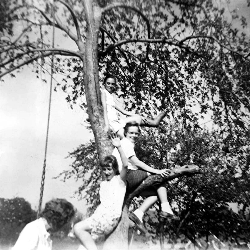
Nancy Joyce Fenton and friends play in a
tree off Eben Street in 1959.
Some Random Notes on Brookline's Past
* In the wintertime there was always
sled riding on the city streets. There was a dandy sled track on Bellaire
Avenue from Flatbush Avenue toward Wedgemere. There were manhole covers that
always seemed to be bare of snow, and they would always cause sparks to fly.
Other good tracks were Castlegate and Starkamp. Those in East Brookline
would gather on Milan Avenue or the cobblestone hill called
Birchland.
<><><><> <><><><>
<><><><> <><><><>
* Down from the Little Store on Pioneer
Avenue, at the bottom of Metz Way, their was a small clearing that was used
by the Steiner family for picnics. The Steiners lived in the last house on
the lower end of Birtley. On summer weekends during the 1930s, they held
German-style parties. They would drink beer, play the accordion, and sing
German songs. After Germany declared war on the United States, the parties
continued, but the family sang only American songs.
<><><><> <><><><>
<><><><> <><><><>

A Slag Train preparing to dump it's molten
slag over the hillside in West Mifflin.
* When we were little kids growing up
in the 1960s, our parents would take us out to Brown's Dump, near the present-day
Century III Mall in West Mifflin, to watch the slag trains dump their molten
cargo over the hillside. They would park the car on the other side of Saw Mill
Run Boulevard and we would just sit and wait for the next train. They ran
all night and all day. When one would appear, we would all eagerly watch
as the red hot liquid would roll down the hill like lava from a volcano.
It was quite a spectacle. These were highly anticipated trips, and something
that Brookline parents had been treating the neighborhood kids to for decades.
The dumping in West Mifflin stopped in the late 1960s. There are three slag
heaps in West Mifflin, and they are the highest man-made mountains in
Pennsylvania.
<Learn More About Brown's Dump>
<><><><> <><><><>
<><><><> <><><><>
* Brookline School used to have a big plot
of ground for their use as a school garden. It was located between
Gallion and Rossmore Avenues, near Pioneer. The kids were assigned plots and planted,
weeded and hoed their own garden. In fact, this practice started with Brookline
School and was so successful that it spread to other city schools.
Brookline's West Liberty School also had their own gardens. The produce supplied
the children with fresh vegetables for lunch and the surplus was sold at the local
stores.

The Brookline Elementary School gardens in
1916. The students tended the crops during recess.
The vegetables were used during school lunch and the excess sold to
Boulevard merchants.
Behind the young farmers is Gallion Avenue and Beaufort Avenue heading up
the hill.
<><><><> <><><><>
<><><><> <><><><>
* Resurrection Church used to be in the
basement of the present school building. After a particularly damp spell, the
floor (which was laid on the ground) would buckle and everyone would have to watch
their step so they wouldn't trip. At Father Quinn's request, some of the men of
the parish volunteered their services, and took up the whole wooden floor, put
down a concrete floor and relaid the wooden floor. Father Quinn worked right along
with the men, wheeling concrete in a wheelbarrow.
<><><><> <><><><>
<><><><> <><><><>
* There were hundreds of mules that used to
work in the coal mines behind Edgebrook Avenue. During the days the mining company
would bring the mules to a large open field (called the Donkey Field) that stood
in the center of the large patch of woods that stood between LaMarido Street and
Edgebrook Avenue. The mules would graze their and rest peacefully in the sunshine.
It was a nice break from their usual routine, which was pulling rail cars loaded
with coal out of the mine, then back again for another load.
<><><><> <><><><>
<><><><> <><><><>

A view of the open lot between 956
and 962 Brookline Boulevard, taken from the back alley.
* Between the businesses at 956 and 962
Brookline Boulevard is an open space, listed as Lot#1546 on city planning maps.
This is near the Cannon Memorial, and for decades there has been a billboard
standing between the two buildings. This lot was never developed, other than
constructing the billboard, and up until the mid-1980s the walkway in front
of the sign was made of wood. It was known locally as the boardwalk. The reason
for the boardwalk and lack of development is that a natural spring emerges
on this spot and the constant flow of groundwater made it impractical to build on
this spot. When the boardwalk was finally replaced with a concrete sidewalk, a large
drainage pipe was placed underneath so that the seepage could drain down the
hillside towards the alleyway.
<><><><> <><><><>
<><><><> <><><><>

The "Little Store," shown here in 1924, stands
to the left on Pioneer Avenue at Metz Way.
* Back in 1924, the Pioneer Quality Market,
or "Little Store," on Pioneer Avenue was owned by a family named Fyke. A few years
later it was taken over by the Nefts, who turned it into a full-fledged grocery
store, with a fresh meat counter, and delivery service. Mr Neft had a number of
young people as part-time help, including Bud and Ruth Morehead, who lived on
Pioneer Avenue just past Ray Avenue, and Tom Hillgrove, who drove the delivery
truck. Mr. Neft was a member of the tennis club, who played on two tennis courts
down the alley (Metz Way) behind the store. Mr. Neft had a heart attack and dropped
dead on the court. Another tennis club member was Mr. McKinley, who was a fireman
at the Brookline engine house. As for the Pioneer Quality Market, it was eventually
taken over by the Lagattuta family, who ran it for several decades. During that
time it acquired another nickname, "Moms."
<><><><> <><><><>
<><><><> <><><><>
* Along Pioneer Avenue, across the street
from the Little Store at Metz Way, was a family named the Lambs. There was a
large open field next to their property that was good for playing ball or
riding bikes. It was called Lamb's Field.
<><><><> <><><><>
<><><><> <><><><>

Children gather around a traveling
Merry-Go-Round on Chelton Avenue in 1946.
<><><><> <><><><>
<><><><> <><><><>
* There was a spring at 725 Berkshire Avenue,
and one at what is now the intersection of the lower end of Bodkin Street and
Brookline Boulevard. A brook flowed adjacent to Edgebrook Avenue. In addition to
Saw Mill Run Creek, a creek also flowed along West Liberty Avenue which was known
as Plummer's Run. A duck pond was located in the area near McNeilly Road. The area
to the left of Edgebrook Avenue was also a pond (Luppy's Pond) until it was drained
after World War II to permit residential development. Throughout the community
there are still several spots were ground water flows to the surface.
<><><><> <><><><>
<><><><> <><><><>
* There was a fad in the late-30s for boys
to wear hats made by cutting the crown out of a discarded man's felt fedora hat,
scalloping the edge, turning it up, and then festooning the whole thing with bottle
caps from pop bottles which were attached to the hat by prying out the cork seal,
then forcing it back into the bottle cap from inside the hat (with the bottlecap
on the outside). These hats were called "beanies."

Beanie Caps were a popular choice for kids
in the 1940s.
<><><><> <><><><>
<><><><> <><><><>
* Birtley Avenue was a dirt road in the
mid-1930s, as was Berwin Avenue beyond the intersection with the southern end
of Birtley Avenue. The shortest way to get to the foot of hill at Wedgemere
Avenue, at the intersection with Gallion, was a pathway known as the Short Cut.
It had three sets of steps connected by walkways. Originally, the walkway was
made of wood planks. Eventually the short cut was paved with concrete. Near
Gallion it was divided into circular form with a small tree in the middle and
a wooden bench around the tree. Learning to use the Short Cut was a lesson in
a much larger body of knowledge that the Little Kids acquired from the Big Kids
in the neighborhood. There were many other complicated pathways to Brookline
Boulevard, also refered to as short cuts. Kids could use alleys or trespass
on private property, a process called "cutting through". There was a kind of
obligation to pass on this special knowledge to future generations.
<><><><> <><><><>
<><><><> <><><><>
* Growing up on the 1300 block of Bellaire
Place in the 1960s, there was a brown dog, a boxer named Sparky, who was well
known throughout the area. Sparky would tag along with the boys to Brookline
Park, walking along the pipe and scaling fences to keep an eye on her friends.
Sparky had a thing for fresh baked goods. She was often caught sneaking off
with a pie that was cooling on a nearby windowsill, and once brought a fully-cooked
turkey home for Thanksgiving. Whenever a neighbors child would wander away,
they were often found with Sparky, who had a knack for leading them home and
away from danger. Sometimes refered to as Spark Plug, she had a thing for
motorcycles. Whenever one would come rumbling down the street she would take
off like a greyhound, often chomping at the riders legs until they sped away.
Satisfied that she had done her duty she trotted back home to await a new
adventure. It was a dog's life to be sure, and those who knew her will always
miss her.

Sparky the brown boxer and some of her
Bellaire Place friends.
<><><><> <><><><>
<><><><> <><><><>
* Back in the 1930s and 1940s, not many
people would have recognized the name Earl Ebersole, although it seemed that
everyone knew him. He was refered to as either "Cowboy" or "Indian." He never
appeared in public except in costume. Earl lived on Dunster with his family.
He walked everywhere in Brookline and was instantly recognized on the street.
He wore very elaborate costumes, and often wore a pair of high boots that laced
up to the calf. Although not a policeman or traffic guard, Earl often stood in
the middle of the intersection and directed traffic at the corner of Pioneer
Avenue and Brookline Boulevard. Sometimes he would do this along Pioneer at
the entrance to Moore Park, and he was really good at it. Aside from the zany
costumes and strange antics, Earl the Indian, or Cowboy depending on his
costume of the day, was a very nice guy. It was rumored that he had been gassed
in WWI and had lost part of his identity, which became fused into the Cowboy and
Indian characters.
<><><><> <><><><>
<><><><> <><><><>
* There was a milkman, ages ago, named Johnny
Haigle, and old Grandpa Marloff, who used to come around with these huge containers
of milk to deliver. Then, there was Mr. Catterall, who sang at many of the weddings
at Resurrection Church. Finally, there was the large, jolly cop who walked the beat
on Brookline Boulevard named Officer Hogel. The kids loved him.

Long-time Brookline Police Officer
Alex Hogel.
<><><><> <><><><>
<><><><> <><><><>
* There is a section of Woodward Avenue,
just to the left of Belle Isle Avenue, where there is a break in the roadway.
Woodward begins at Capital Avenue and stretches all the way to Bodkin Street,
with the exception of this small area that is blocked off from traffic, which in
effect breaks the avenue into two distinct sections. The reason that Woodward
Avenue is blocked at this point is because of an old cemetery plot from the 1800s
that is located on this spot. The graves could not be moved, by law, for 100
years. When that time had elapsed, the plot of land was left as is. Up until
the 1970s, there were still grave markers on the grounds. One of these was
for a horse. In the 1980s the markers were moved, but the plot remained open
ground. It is told that there are still family descendants that visit the
plot from time to time to pay their respects. Although the stones were moved,
some of them still lie unattended on the land. Time has worn away the names
and dates on these markers.
<><><><> <><><><>
<><><><> <><><><>
* Every Christmas the boulevard is
decorated with lighted wreaths that adorn the light poles along Brookline
Boulevard. Back in the 1970s, the wreaths were a bit larger and more elaborate,
including stars, candy canes, trees and round wreaths, with one on every pole.
There was also a long, lighted holiday banner that hung across the intersection
of Brookline Boulevard and Pioneer Avenue that read "Season's Greetings." In 1983,
the Chamber of Commerce sold decorative christmas tree bulbs.

<><><><> <><><><>
<><><><> <><><><>
* For many years there was a crossing guard
stationed at Creedmoor Avenue and Brookline Boulevard. She was as well-known to
the students at Resurrection Elementary as Sam Bryen was to Little League players.
Both before and after school, she would wait until a group had gathered, then
stride out to the middle of the boulevard crosswalk, one hand out-stretched to
ward off traffic, and the other waving for the students to begin crossing.
"Ok, Honeys, Let's Go!" was her invitation. It was pure Norman Rockwell. She knew
all of our names, and also the names of our brothers, uncles, aunts and at times
our parents. She was always there, and a friend to generations of adults and
children. Her name was Sue Moyer.
<><><><> <><><><>
<><><><> <><><><>
* One day at the now-forgotten Foodland at
McNeilly and Sussex, I ran into a portly man, one who inspired both frustration
and determination throughout the many years that he taught at South Hills Catholic High
School and Seton-LaSalle. He taught advanced English, as well as drama and theatre.
He was my English teacher, and was without a doubt the hardest teacher I ever had.
Making the grade was very difficult and his was the one class I dreaded most.
Inside the store, I approached him and introduced myself, then proceeded to tell
him that despite being the teacher that I feared the most, in retrospect he was
the best I had ever learned from. He taught me to appreciate literature and written
skills. He taught me that with hard work, success is always a possibility. His
name was Ted White.
<><><><> <><><><>
<><><><> <><><><>

For over forty years the Dairy Dan truck
traveled Brookline streets selling ice cream treats.
* As children in the 1970s, there was a
special treat on hot summer days that just couldn't be beat. No matter what we were
doing, when we heard the sound of the Dairy Dan Ice Cream truck coming down the
street, we instantly ran for mother to get a dime so that we could by all meet
back on the street corner and get a snack. Sometimes mom would make us find the
change purse, causing some stress as we thought we might miss our treat. The delay
wasn't really a problem. There was always a line at the Dairy Dan truck so we had
time to get there. My favorite was the ice cream sandwich. If we were being bad
that day mom would correct us by threatening a ban on Dairy Dan. That was strong
medicine. The Dairy Dan Ice Cream truck worked the Brookline streets for over forty
years, finally retiring in 2012. The truck itself is not in Texas. The photo above
shows the famous truck as it was being set to leave Pittsburgh.
<><><><> <><><><>
<><><><> <><><><>
* Off of Edgebrook Avenue, to the left in
the woods was Luppy's Pond, where kids used to damn up the stream to create their
own pool of water. In the same area as Luppy's Pond, up the hill a bit in the
woods, were some really old pioneer gravestones. One of the tombstones was etched
with the name of Mary Boggs.
<><><><> <><><><>
<><><><> <><><><>

The Cunocar truck, parked on the boulevard
outside St. Mark Church in 1946.
* Cunocar was a traveling accounting and
bookkeeping service run by Robert Rebel and Gerald Wickman. The business was
located at 908 Brookline Boulevard, in an office above Brookline News. Both Robert
and Gerald got their start working as tellers at the Brookline Savings and
Trust.
<><><><> <><><><>
<><><><> <><><><>
* On July 27, 2007, Brookline was the scene
of a massive water main break that sent a 150 foot geyser of water and debris
into the air along the 1000 block of Bellaire Avenue. The break was in the
alleyway along Fitch Way, behind DeBor Funeral Home and the Bellaire Avenue
homes. At least ten houses suffered structural damage and basement flooding
from the persistent waterfall. Several cars were submerged and water teamed down
Starkamp Street like a rushing river. Pennsylvania American Water took responsibility
for the disaster and worked with homeowners on cleanup and restoration
efforts.
 
The scene along Bellaire Avenue during the
water main break on July 7, 2007.
<><><><> <><><><>
<><><><> <><><><>
* On July 30, 1929, the Common Pleas Court
handed down a decision outlawing the erection of chicken coops in Brookline.
The decision by Judge Ambrose B. Reid stated that no more chicken coops would
be permitted to be built in this section of the city, and when the present
coops have outlived their usefulness they could not be replaced. A losing fight
was waged by Geary E. Carson of 808 Bellaire Avenue, who was refused a permit
to build a coop in the rear of his home. The court held that "a chicken coop is
not an accessory use of property permitted there by the zoning commission.
Another vestige of Brookline's rural past was gone. Mother hen
and rooster were no longer welcome in Brookline.
<><><><> <><><><>
<><><><> <><><><>
 
The concrete foundation of the Kund and Eiben
Incline, abandoned in 1929 after operating for fifteen years.
* The historical standard here in the
'Burgh is that there have beem twenty-three inclines dotting the hillsides around
the city and surrounding area. We believe that the historians got it wrong, and
that there was a twenty-fourth, and it was located right next to Brookline, along
Saw Mill Run Creek. The Kund and Eiben Incline, built in 1915, was a short incline
owned by the K&E Manufacturing Company. It was located along Saw Mill Run, just
across the railroad tracks in Bon Air. K&E operated a Wood Planing Mill and a
concrete fabrication plant alongside the creek near Bausman Street. The hoist
moved materials to and from the P&WVRR freight cars atop the hill. The incline
was in operation for nearly fifteen years, dismantled in 1929 after the
construction of Saw Mill Run Boulevard. The large concrete foundation has
remained abandoned along the hillside. Normally covered in dense foilage, the
foundation is quite visible in the winter months. The dates for operation of the
incline are estimates and based on the maps and information available.

Map from 1916 showing the position of the Kund
and Eiben Incline along Saw Mill Run
in Bon Air. The little-known incline was in operation for nearly fifteen
years.
<><><><> <><><><>
<><><><> <><><><>
* The photo below appeared in the February
11, 1974 edition of the Brookline Journal. This was during the 1973 Oil Crisis
(October 1973-March 1974), when OPEC made severe output cuts as a show of discontent
for U.S. support of Israel during the Yom Kippur War. Buying gas became quite a
challenge, and at the Mobil station at Glenarm and Brookline Boulevard, it was by
appointment only. Another crisis in 1979, during the Iran-Iraq War, forced gas
shortages that resulted in the odd-even day system (based on license plate numbers)
and the limit of $5 per purchase along the PA turnpike.

Gas was hard to come by in Brookline during
the 1973-1974 oil crisis.
<><><><> <><><><>
<><><><> <><><><>
* Many Brookliners have wondered why the
lower end of Chelton Avenue ends at Woodbourne and does not continue south to
the intersection with McNeilly Road. On August 20, 1952, the City Council
Committee on Public Works handed down a decision to table a proposed paving
project that would have provided direct access to McNeilly for Chelton Avenue
residents. Despite neighborhood demands, the plans were tabled due to the high
cost of the extension. Obstacles included the steep slope and the extensive
regrading necessary to extend the roadway. The improvement effort did have
some lasting benefit. A few years later, in 1960, the lower ends of Chelton,
Berkshire and Woodbourne Avenues were graded, paved in concrete and curbed,
including the installation of new sidewalks, eliminating what residents considered
"dangerous" conditions for vehicles and pedestrians.
<><><><> <><><><>
<><><><> <><><><>
* On February 18, 1941, an article appeared
in the daily news detailing an incident on Brookline Boulevard at Starkamp Street
where dog-catchers were rounding up a pack of stray dogs. A gunshot was fired.
For many years, beginning in the 1930s, roaming packs of stray dogs were common
place in the South Hills and a concern to residents. Efforts were made to clean
up overgrown vacant lots where the dogs gathered, but in the end it was the duty
of the dog-catchers to go in the field and round up the animals. The lethal force
used caused concern among eyewitnesses.

<><><><> <><><><>
<><><><> <><><><>
* For several decades, beginning in the 1940s,
there was a bakery located at the corner of Brookline Boulevard, Chelton and
Queensboro Avenues, known as Kuntz Bakery. Mr. Kuntz hailed from Germany, and
had a beautiful wrought-iron railing imported that adorned the front of the
bakery at 972 Brookline Boulevard. The decorative railing featured images of
a baker holding a cake. Kuntz Bakery closed in the late-1960s, but the railing
remained for another forty-odd years. In 2013, during the reconstruction
of Brookline Boulevard and the adjoining sidewalks, the railing was removed
and placed in storage. There were no plans for the fence to be put back.
The community rallied for the historic Bakery Fence to be placed somewhere
along the boulevard when construction was completed. Finally, in the Fall
of 2014, portions of the fence were put up along the railing in front of the
Brookline Dance Studio, who now occupies the former Kuntz Bakery
building.
 
The Baker's Railing that stood outside the
building at 972 Brookline Boulevard for over seventy years was taken
down in 2013. Parts of the historic fence were put back along the new railing
a year later.
<><><><> <><><><>
<><><><> <><><><>
* In City Council chambers on March 6, 1962,
Will Axmacher, president of the Brookline Chamber of Commerce, citing twenty-five
years of infrastructure neglect by the City of Pittsburgh, proposed fifteen
improvements that the Chamber deemed necessary for the community. At the time,
three members of City Council, Thomas Gallagher, Charles McCarthy and Council
President Patrick Fagan, were all residents of Brookline. The fifteen projects
recommended to Council included construction of a parking plaza on Brookline
Boulevard; repaving of Pioneer Avenue from West Liberty Avenue to Southcrest Street;
widening of Brookline Boulevard from Breining Street to Reamer Street; improvement
of Breining Street; razing the firehouse and construction of a parking
lot on the site; construction of a combined police-fire building; improvements to
the Moore Park Recreation Center; improvement of streets having ditches and open
drains; improvement of Whited Street; widening and paving of Edgebrook Avenue;
repair of sewers along Brookline Boulevard; widening and paving of Metz Way; use
of parking tokens for Brookline shoppers; a shopper's bus in Brookline; and the
creation of more parkland at the Brookline Community Center.
<><><><> <><><><>
<><><><> <><><><>
* In 1955, former Life magazine photographer
W. Eugene Smith was hired by author Stefan Lorant to provide pictures for a book
entitled, "Pittsburgh - The Story of an American City". Afterwards, Smith stayed
in Pittsburgh for the following two years creating a photo documentary of life in
the Steel City. Along with city-scapes and industrial scenes, Smith also traveled
the various city neighborhoods taking pictures of everyday life. Among these photos
were pictures of street signs with names like "Friendship", "Unity" and
"Dream".

A mailbox and car parked outside 1517 Dream Street.
This image was captured in 1956 by photographer W. Eugene Smith.
The picture appears on the front cover of his photo documentary book entitled,
"Dream Street - The Pittsburgh Project".
The roadway called Dream Street was a short
stretch that ran adjacent to Abstract Street, near the lower end of Edgebrook Avenue,
in the Bailey and Moon #3 plan. The street was laid out in the 1890s and originally
called "Ridge Street", then part of West Liberty Borough. In 1908, when the land
was annexed into the city of Pittsburgh, the street name was changed from Ridge to
Dream Street. There was one home along the short road, at 1517 Dream Street, a
two-story wood dwelling with detached garage, owned by R. Yanda.

Plot map showing the location of Brookline's
"Dream Street".
In 1974, the land was purchased by the
Port Authority of Allegheny County during the South Busway construction project.
Today, Dream Street exists only on real estate plot maps, one of many paper streets
that dot the Pittsburgh landscape. As for the Eugene Smith photo of the 1517 mailbox,
parked car and "Dream" street sign, this obscure image inspired the title for
his photo documentary, called "Dream Street - The Pittsburgh Project".

<><><><> <><><><>
<><><><> <><><><>

Starkamp Street at Brookline Boulevard in
2019.
* Starkamp Street, originally called Stanford
Avenue, used to extend only from Eathan to Bellaire Avenue. Not until 1929 was the
street extended up to Brookline Boulevard. Shown here are the homes on either side of
Starkamp Street at the boulevard intersection. On the left is 1025 Brookline Boulevard,
once the offices of doctors and dentists. On the left is 1033 Brookline Boulevard, for
many years the home of the McGaffin family, owners of a prominent construction company
that built several large buildings in the area.

1910 map showing Starkamp Street ending at Bellaire
Avenue.
The city purchased lot #1465 along Bellaire Avenue
from William and Alma Jones, and lots #1522 and part of #1521 along the boulevard from
George Miller, to construct the Starkamp extension.
<><><><> <><><><>
<><><><> <><><><>
* In the early-1920s, extensive grading was
done along the rear of Brookline Boulevard property that stood between Starkamp Street
and Edgebrook Avenue. This was to facilitate construction of new homes along Bellaire
Avenue.

The rear of 1049 Brookline Boulevard (with barn
style roof/third from left)
can be seen in this 1927 photo, showing the sliding land behind the building.
Cutting into the hillside caused the property
in the rear of the home, and grocery market, at 1049 Brookline Boulevard, owned by Minna
Neuser, to begin to slide. After litgation, a settlement with the city awarded Neuser
$2500, which was used to build a retaining wall behind the her lot. Later, the wall
was enlarged and extended to cover the rear of all the buildings along that stretch
of the boulevard, bordering the alleyway behind the Bellaire Avenue homes.

1049 Brookline Boulevard, formerly Neuser's
Market.
<><><><> <><><><>
<><><><> <><><><>
* On the day of Brookline's Halloween Parade, Mr.
Melman used to walk along the line of march and throw apples to the spectators.
Today, Brookline still holds the annual parade on the last weekend on October.
Fine costumes decorate both children and adults alike. In good weather or bad,
several hundred people are in attendance. The parade is sponsored by the Chamber
of Commerce. Although Mr. Melman is no longer around to throw apples to the
spectators, there are snacks available and prizes awarded for the best
costumes.
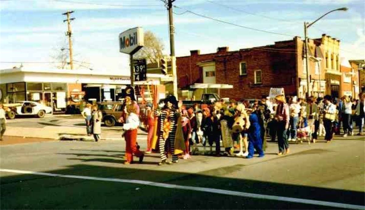
The Brookline Halloween Parade (mid-1980s). The
parade is an annual October tradition.
<><><><> <><><><>
<><><><> <><><><>
* When the reconstruction of Brookline
Boulevard in 1935 was only months from beginning, a series of city ordinances
were drafted to delineate the new dimensions of certain streets that were in
the path of the reconstruction effort. Along with the new direction of
the boulevardn, streets like Jillson Avenue, Shawhan Avenue and Edgevale Street
were all officially redefined by the city. One ordinance, No. 148, enacted on May
29, 1935, dealt with the soon to be abandoned stretch of the boulevard between
Pioneer Avenue and West Liberty Avenue. It was ordained in City Council that the
name of the portion of Brookline Boulevard, formerly Hunter Avenue, as laid out
in the Recorder's Office of Allegheny County, would hereby be changed to Wenzell
Avenue. Later, that ordinance was redacted and another written, changing the name
to Bodkin Street.
<><><><> <><><><>
<><><><> <><><><>
* President John Fitzgerald Kennedy was in
Pittsburgh on October 12-13, 1962 to attend a political rally in town and visit several
locations around town to deliver speeches. The main rally was held on the 12th at the
William Penn Hotel. After spending the evening in town, Kennedy's procession took off on
October 13 for a speech in McKeesport. His route took him along Saw Mill Run Boulevard
(Route 51). The President's motorcade skimmed along the edge of Brookline, between
Edgebrook Avenue and Whited Street. Some Brookliners took the time to line the route
to get a glimpse of the popular leader. Only two days later, the Cuban Missile Crisis
began and John F. Kennedy was faced with the biggest challenge of his presidency. In
a twist of fate, President Kennedy was born in Brookline, Massachusetts.
Listen To Kennedy's William Penn Speech On October 12
Listen To Kennedy's McKeesport Speech On October 13

President John F. Kennedy and his motorcade pass
along Route 51 near the intersection with Glenbury Street
on October 13, 1962. This photo was taken only three days before the start of the
Cuban Missile Crisis.
<><><><> <><><><>
<><><><> <><><><>
* The Pittsburgh Press on May 29, 1952,
ran a story about horse thieves in Brookline. John and Annabelle Demetrius, age
4 and 5 respectively, of 1450 Breining Street, owned a gentle colt named Topper.
On the morning of the 28th, Topper was abducted by horse thieves, leaving the
Demetrius children in disbelief and praying for the return of their beloved pet.
Apparently, the horse was too much for the abductors to handle, and they abandoned
the young colt not far from the scene of the crime. Neighborhood kids located
Topper, unharmed and wandering alone in the nearby woods. They notified the
Demetrius family, much to the delight of John and Annabelle. It was the first
recorded horse theft in Brookline since the McKinley administration.

John, Annabelle and Topper were reunited
after their stolen horse was found and returned home.
<><><><> <><><><>
<><><><> <><><><>
* Most people would not think there was
a Brookline Connection between the Honus Wagner Statue at PNC Park and our
community, but Mike O'Toole knew differently, and reported that fact. The statue
was originally unveiled in 1955 and stood at Forbes Field and Three Rivers
Stadium before being moved to PNC Park. It shows the "Flying Dutchman," one
of the greatest to ever play the game, swinging a bat. The Brookline Connection
come during the making of the iconic statue. Due to Wagner's poor health at the
time the statue was being worked on, Julius "Moose" Solters, a Pittsburgh native,
Major League power hitter and friend of Wagners, posed for the statue. Solters
later lived in Brookline, from the early 1960's until his passing in 1975. To
learn more about Moose Soulters, click here.

The Honus Wagner Statue in 1996.
* From the Pittsburgh Press - July 13,
1973 - The day before, two major water line breaks, one alone Whited Street in
Brookline, and the other McNeilly Road in Dormont, caused quite a disturbance
in the South Hills. Here in Brookline, damage along the lower end of Whited Street
was extensive, including a 20' across by 25' deep crater in the road and a mound
of debris along Saw Mill Run Boulevard. In neighboring Dormont, water from the
McNeilly Road break, near Midland Avenue, cascaded downhill towards Arkansas Avenue,
forming a waterslide and small pond that delighted the local kids.

Fast-Food Restaurants
West Liberty Avenue has the dubious
distinction of being the Auto Dealership Capital of Pittsburgh. It also
is the scene of the local fast-food franchise wars. Wendy's opened across
the street from Belle Isle Avenue, in 1974, and McDonalds followed at the
corner of Wenzell Avenue in 1981.
Although both restaurants are located
on the Beechview side of West Liberty Avenue, the fast-food giants have been
doing battle for the hearts and pallates of Brookliners for over thirty years.
Aside from a Hardees that had a brief run along Saw Mill Run Boulevard in the
1970s, Wendys and McDonalds have been the only two national fast-food burger
joints within walking distance of Brookliners.
A Double with cheese, Fries and a Frosty ... or
a Quarter Pounder with Fries and a Coke?
To the disdain of some and the delight
of others, the community of Brookline has never fallen prey to the franchise
wars, unless you consider the inordinate amount of Wendy's and McDonalds paper
trash that persistently litters our streets. If you want a good burger right
here in Brookline, try the Moonlite Cafe or the Boulevard Lounge.
That's the ticket!

Brookliners may have an aversion to allowing
fast food into the local market, but the All-American
Oscar Mayer weiner is a completely different matter. Pass the ketchup and
mustard, please.
The Pothole and The Potty
Google lists the definition of
a MEME as:
MEME - noun: meme; plural noun: memes
- an element of a culture or system of behavior that may be considered to be passed
from one individual to another by nongenetic means, especially imitation.
* a humorous image, video, piece of text, etc., that is copied (often
with slight variations) and spread rapidly by Internet users.
Here is the story of the Pothole and the
Potty, two pictures snapped here in Brookline that have become Pittsburgh Memes.
These pictures first appeared right here on the Brookline Connection website and
the associated facebook page. Through the beauty of the internet, they have been
copied and propogated to the point where they are now culturally significant. The
only problem is that the original photographers are never given credit. This fact
is being rectified here for all eternity!
<><><><> <><><><>
<><><><> <><><><>
<><><><> <><><><>
THE POTHOLE: On April 7, 2014, during the
reconstruction of Brookline Boulevard, Clint Burton was walking along the boulevard
past the cannon, when he noticed a huge pothole, nearly five inches deep, that
showed the original red bricks and a piece of streetcar track at the bottom. He
did not have his camera handy, but vowed to return soon to capture this classic
look back in time.
Later that evening, after work, he started
walking back up to the boulevard, heading to the Presbyterian Church for an SPDC
board meeting. Along the way he met up with Amy Fisher, who was going to the same
meeting. Along the way, he realised that he again forgot his camera and asked Amy
if she had her phone, which could take photos. He told her about the huge pothole
and the need to get a picture soon, before it was covered in quick patch.
After the board meeting, with daylight waning,
Clint convinced a skeptical Amy to hurry over to the cannon to get the picture. With
traffic whizzing by, he went out into the road, knelt down and quickly started
removing the grimy dirt and asphalt chunks from the hole to better reveal the prize
bricks and rail that lie beneath. A couple cars beeped at him while he knelt out
in the road but, undetered, he completed his task.
 
The original Amy Fisher photograph and the
Pittsburgh Meme version.
Once the hole was cleared, Amy came out and
took the picture. It all happened rather quickly and then they went home. Amy vowed
to email the image to Clint when she got home, which she did. It turned out to be a
great picture, a true classic just as he had envisioned, and he immediately posted
it to the facebook page and added it to the website.
Not long after that, Pittsburgh Meme, another
facebook page, altered the photo and added the image to its' cache of memes. It has
been posted and reposted several times. It has become so popular that it has been
shared on virtually every Pittsburgh facebook page at one time or another. The only
problem is that Amy Fisher is NEVER given any credit for the photo.
She has attempted to contact Pittsburgh Meme,
asking that they please give her photography credit. Here requests were ignored. After
several attempts, their response was to block her from their facebook page. Well, I
suppose there is nothing to do about that except to bask in the knowledge that, along
with a little prodding from Clint Burton, she took what has become one of the most
classic pothole pictures in Pittsburgh, one that will stand the test of time and be
reposted ad infinitum on popular Pittsburgh Meme pages.
<><><><> <><><><>
<><><><> <><><><>
<><><><> <><><><>
THE POTTY: Another classic Brookline picture
that has been reproduced time and time again is, in Clint's mind, rather hilarious,
and although he, like Amy, never gets credit for the photo, loves the idea that it
is now a culturally significant Pittsburgh Meme.
This picture, taken on April 11, 2010, was the
result of research into the time-honored local phenomenon known as the Pittsburgh Potty. Many
older Brookline homes have one, and that can be said for homes across the 'Burgh.
Clint found an old magazine article about the Pittsburgh Potty and copied it for
inclusion on the Brookline Connection website. Since the article did not come along
with a photo, he quickly went down into his basement and took a picture of his
Pittsburgh Potty.
 
The original Clint Burton photograph and the
'Burgh Classics version.
It was the home's original toilet, a 1927
model that was moved to the basement in the 1960s when the upstairs bathroom was
remodeled. The old commode sat in the corner next to the laundry tubs, always ready
for the moment when it would be called into use. It was one of those heavy-duty
flushers that was great for disposing quickly of heavy-duty loads. Over the past
half century or so it has provided valuable service to the entire family.
Shortly after the image was posted online and
on the website it began showing up on facebook pages as another classic Pittsburgh
Meme. This time it was posted as one of the "'Burgh Classics." Every so often Clint
would see it pop up on his timeline and snicker. It was never that important that he
was NEVER given photo credit. He knew full well who's toilet it was, and also some
of the memorable, or maybe not so memorable, things it has witnessed over the
years.
And thus you have it ... the story of the
Pothole and the Potty, two Brookline pictures that have become cultural icons and
will be posted over and over ad infinitum, sans credit.
<><><><> <><><><>
<><><><> <><><><>
<><><><> <><><><>
ONE MORE FOR THE ROAD: One last photo that was
taken by Clint Burton and has shown up several times on facebook pages as a Pittsburgh
Meme is one that he took on March 16, 2015, during the reconstruction of the
Route 51/Route 88 interchange. Standing over by Saint Norberts Church, he noticed
a classic Sea of Signs along the Jughandle that seemed all too confusing, yet nobody
seemed to be confused. Motorists knew just where to go. He snapped the picture and
later that night posted it on the Brookline Connection facebook page and added it to
the website.
 
The original Clint Burton photograph and the
'Burgh Classics version.
It wasn't long before the picture started
showing up on other facebook pages as another one of the "'Burgh Classics." Again,
he just snickered and wondered why he, and Amy, and anyone else for that matter,
is NEVER given credit for taking these photos that are used by third parties to
further their own interests and gather more facebook LIKES!
Urban Legends:
Ghost Stories and Religion - Separating Fact From Fiction
The Miracle On Pioneer
As with every community, there are certain
tales that inspire the imagination of the curious few, and over time these stories
can become larger than life ... legends so-to-speak. Some deal with religion,
the search for faith, and miracles of a heavenly nature. Others delve into the
darker reaches of the mind, conjuring up visions of hauntings and eerie creatures
stalking the back roads of Western Pennsylvania.
 
One such tale deals with the sudden
appearance of a feint vision of the Blessed Mother that mysteriously illuminated
on a closet door in the home at 2070 Pioneer Avenue back in April of 2001. There
were two other distinct symbols of a supposedly religious significance along with
the Blessed Mother.
Visitors from far and wide flocked to the
home to witness the "miracle", which appeared only after dark, turning the quiet
Brookline residence into a sort of religious shrine for a couple weeks until the
curiosity ebbed away. See Post-Gazette Article dated April 14, 2001.
<><><><> <><><><>
<><><><> <><><><>
<><><><> <><><><>
The Haunted Mansion
At the corner of Whited Street and
Ballinger, originally addressed as 1766 Ballinger Street and now listed as
1900 Whited Street, next to the one-time West Side Belt Railroad tracks,
sits an old mansion that has been converted into a restaurant. It is also
rumored that it was once the site of a brothel and has reportedly been the
seen of several hauntings over the years.

The home at 1900 Whited Street, pictured
here in the 1920s. Some say
the 160-plus year old building is haunted.
The home was built in the 1850s and was
the home of Jacob and Mary Smith-Hays. Jacob was a prominent landowner and the
father of Milton Hays, owner
of the Pittsburgh & Castle Shannon Railroad. Milton's biological mother was Jacob's first wife,
Jane, who passed away when he was just a child. The three photos below show some of
the inside of the Hays home and are shown here courtesy of Jacob Hays'
great-great-great grandson Tim Harrison.
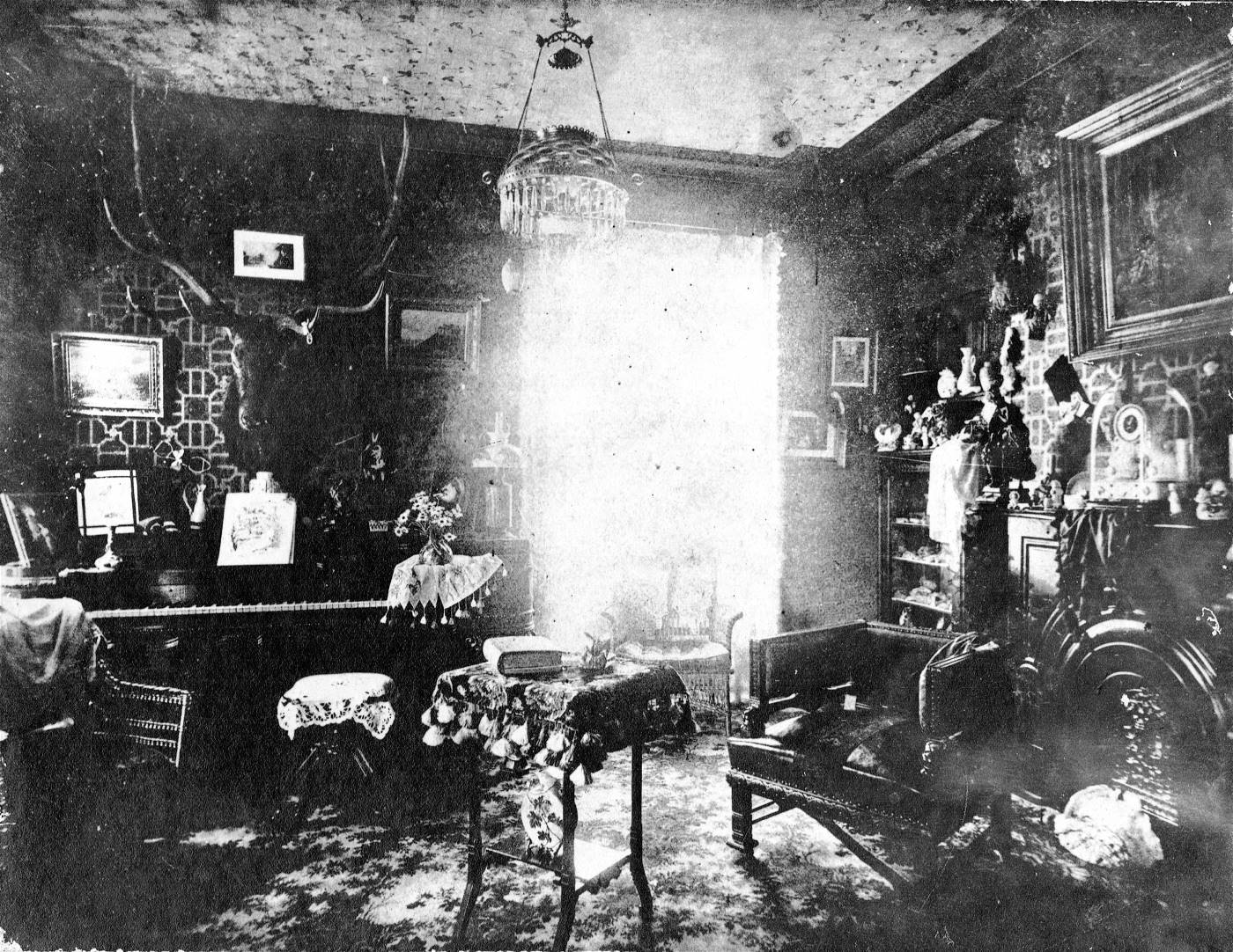
The Parlor in the Hays home at 1766
Ballinger Street.

The Parlor in the Hays home at 1766
Ballinger Street.

The Library in the Hays home at 1766
Ballinger Street.
The stately home was once a rest
stop along the railway line for passengers heading to downtown Pittsburgh,
and also a place to rent carriages for funerals.
There have been more than a few deaths
that have occured here over time. A judge once hanged himself on the third
floor, another patron mysteriously fell from a third floor window, and a
pregnant woman tumbled to her death on the second floor steps. The home was
also the residence of the mother of renowned Pittsburgh psychic Mr. Charles.
She passed away inside the home.
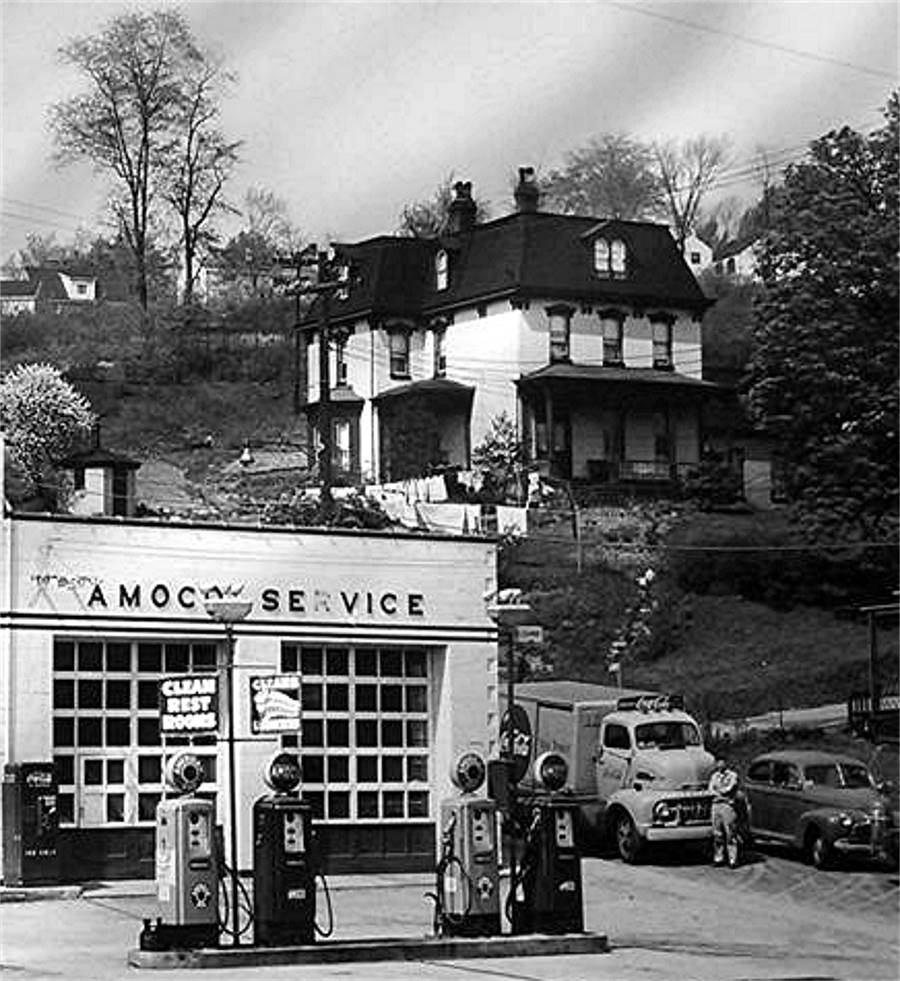
The home at 1900 Whited Street in
1950.
In more modern times, several families
lived in or rented space in the home, and each has their own special memories
of their time in the old Hays home. Others used to marvel at the mysterious
mansion, some refering to it as the "Munster House." Without a doubt it built
up quite a reputation as one of the unique residences in well over a century
as private living quarters.
Purchased and renovated by restaurateur
and saloon owner Larry Vichie in 1984, the building was home to Larry's
Roadhouse for thirty years until closing in 2013. Employees who worked there
were oftentimes witness to strange occurances, such as objects disappearing,
electrical disturbances, footsteps being heard and apparitions being sighted.
One waitress saw the shimmery figure of a Victorian woman on the steps which
eventually faded from view. Others, after filling candy dishs, returned to
find the candy scattered on the floor, although the dishes remained in place
on the counter.

The building in 2014 shortly before the
reconstruction effort began.
An employee of America's Security
Choice, an alarm dealer that had the contract to put in an alarm system for
the place reported a series of odd knocks on wall's, strange shadows and the
sound of doors slamming as he installed the system. He was apparently pretty
spooked by it and was no longer interested in returning.
In 2014 the building was sold to an
investment group and and the new owners began an extensive remodeling effort.
Their plan was to open a restaurant, banquet and meeting hall. The results were
stunning until one day in 2015 their funds ran out and the remodeling stopped.
Whether they plan on continuing at a later date or selling the partially
completed building remains to be seen.

The building in the fall of 2014 with the
remodeling effort well under way.
It also remains to be heard whether
construction workers may have witnessed any strange phenomenon within the
building's 160 year old walls. Maybe the ghosts of the past wish to remain
undisturbed. Only time will tell.
<><><><> <><><><>
<><><><> <><><><>
<><><><> <><><><>
The Green Man and Green Man's Tunnel
Another tale, one of a more macabre nature,
deals with a "monster" known as "The Green Man" who, some say, haunts the roadways
of rural South Park in the late evenings. First witnessed back in the 1940s, it
has been said that the so-called monster was struck by lightning or shocked by a
downed power line.
Others suggest he was a factory worker
splashed with acid. Whatever the cause, all agree that the accident turned his
skin green and melted his facial features together. Legend has it that this
hideous creature of the night has been seen as far away from his usual stalking
ground as the back roads of Brookline.
Fear and the imagination can become quite a
pair, but we're pretty sure that the Green Man never made it as far north as
Brookline. There is, however, some truth in the tale of this scary individual.
Learn the haunting but true story of the Green Man in this Post-Gazette Article
dated October 31, 1998.
For fifty years, right up till the 1980s,
Raymond Robinson used to walk a lonely stretch of road between Koppel and New
Galilee for exercise. He did this under cover of at night because of what happened
to him way back in the summer of 1919.
On a dare, nine-year-old Raymond climbed
up the pylon that held the 1,200 volt power lines for the Harmony Line trolley and
a 22,000 volt electrical line on the Morado Bridge. A bird had built a nest there
and his buddies wanted to know if there were any eggs in it. Ray never saw the nest
... or anything else again. He came in contact with the power lines and was
horribly injured.
He lost both eyes in the accident, so he
never got to see the Beaver Falls newspaper headline about what happened up that
pylon: “Morado Lad, 8, Shocked By Live Wire, Will Die.” He was suffered facial
disfigurations and other ghastly wounds. But, in defiance of doctor's expectations,
he did prove the headline writer wrong. Two months later, the Daily Times reported
“In spite of all his affliction, the boy is in good humor.”

Ray Robinson, or Charley No-Face.
After a lengthy recuperation, Ray Robinson
was released, with a prosthetic nose connected to a pair of dark glasses that
concealed his empty eye sockets. He passed his days listening to the radio,
reading Braille, and making belts and wallets out of leather. He mowed the lawn
with a manual mower. And at night, he went for walks along route 351.
Word soon spread about the disfigured
night hiker. Local teenagers began calling him Charlie No-Face; people from
further afield called him the Green Man. People began driving to the area just
to meet him. Some nights, there was such a flow of traffic to the road that
the police would be there to move things along.
Generally, Ray would hide when
he heard traffic approaching, because of a few disrespectful types. But some
curiosity seekers befriended him and he came to appreciate their company.
They’d give him cigarettes and beer, and sometimes snap pictures with
him.

Ray Robinson, known as Charlie No-Face, or
the Green Man, with teenage curiousity seekers.
After being struck by cars more than
once, Ray stopped his walks during the last years of his life. He retired to
the Beaver County Geriatric Center, where he died on June 11, 1985, at the age
of seventy-four.
In death as well as in life, as the years
went by, the stories of the Green Man became more exaggerated as they were told
and retold. They are still being recanted to this day, even though Ray Robinson
died more than thirty years ago.
Another interesting part of the Green
Man story is the legend of the Green Man's Tunnel. Many different locations
have been identified as the site of Green Man’s Tunnel. The most popular
is Piney Fork Tunnel in South Park Township, just off Snowden Road. The
abandoned railroad tunnel stands along Piney Fork Creek and it is presently
used by the township for storing rock salt.

Piney Fork Tunnel, located in South Park
Township, is known as "Green Man's Tunnel."
As stories of the Green Man and the
Green Man's Tunnel goes, here is one for the ledger:
According to Keith Klos, "On August 4,
1969, around 9 PM, we were at hamburger row near the entrance of Allegheny
County’s South Park. A new girl was there, and we decided that Green Man’s
Tunnel was just the ticket to get her interested. In the twenty minute drive
to the tunnel, we told her about the Green Man and how he had been electrocuted
and turned a shade of green."
"The tunnel is about twenty-five foot
wide and thirty feet high. The Montour Rail Road constructed it in 1934. You
cannot see through the tunnel because of the bend. Next we heard a train noise
coming from the tunnel. Not just a normal, diesel train, but a steam locomotive.
I watched for the engine’s headlight, but saw nothing."
"The train noise was getting
louder and changing pitch, as if coming through the tunnel. The train was getting
closer and changing pitch again, coming out of the tunnel. Then all we could hear
was the creaking and clickety-clack of the rail cars on the rails. Two days later,
Jack and I talked with the South Park Township Police at their station. They had
quite a large file on the incidents."
The truth is that back in the 1930s, a man
killed his wife and child in that tunnel with a hatchet. Then the man jumped in
front of the train. Since then, people have reported seeing a hatchet flying at
them and hearing strange crying sounds when visiting the tunnel at
night.
Somehow over the years this horrible
act and the legend of the Green Man have become intertwined, hence the tunnel
being called Green Man's Tunnel. Whether the tunnel is haunted or not is for
others to decide, but we are sure that the murder was not committed by
Ray Robinson.
The Beauty Of An Evening Sunset In Brookline

"Red Sky At Night, Sailor's Delight." That
says it all in this lovely picture of
"A Sunset Over Brookline," taken on August 14, 2013.
|


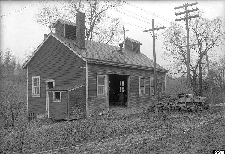