|

Scenes like this were commonplace
along the valleys of Brookline in the early 1900s.
The South Hills area, once the picturesque
rural breadbasket of the city of Pittsburgh, was also well known at one time as
a major source of coal to fuel the city's industry base. West Liberty Borough
(Brookline, Beechview, Bon Air) and other South Hills neighborhoods and municipalities,
are situated atop the former "Oak Mine".
There were actually a series of Oak Mines
along the Saw Mill Run corridor through to Castle Shannon and beyond. Underneath
the heart of Brookline are the subterranean passages of Oak Mine #1. Owned by the
Pittsburgh Coal Company, the mine ran the length of West Liberty Borough, east to
west. The coal was part of the historic Pittsburgh Coal Seam, the largest single, continuous coal deposit in
the Eastern United States.
Underneath Brookline, coal was mined
using the traditional room and pillar system, whereby rooms are cut into the coal
bed leaving a series of pillars, or columns of coal, to help support the mine roof
and control the flow of air. Generally, rooms are twenty to thirty feet wide
and the pillars are up to 100 feet wide.

A donkey pulls a loaded car out of one of the
pit mouths in the early-1900s.
As mining advances, a grid-like pattern
of rooms and pillars is formed. When the shaft reaches the end of a panel, retreat
mining begins. Workers mine as much coal as possible from the remaining pillars
until the roof begins to collapse. When retreat mining is completed, the area
is abandoned and sealed off.
In West Liberty Borough, mining operations
along Saw Mill Run started in the mid-1800s. By the early-1870s, the mining had
progressed into the eastern boundaries of present-day Brookline. Shafts began in
the valleys and extended deep into the hills. The coal was extracted using dynamite,
picks and shovels, then transported to the mills along the Monongahela River via
the Pittsburgh and Castle Shannon Railroad.

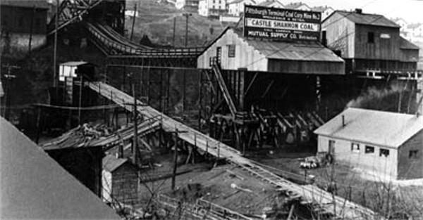
The Pittsburgh Coal Company power
station and mine shaft at the Brookline Junction in 1909.
There were four separate small-gauge
P&CSRR spur lines that ran along Brookline's valley floors to the main pit
openings. These were located behind Moore Park, along Edgebrook Avenue,
Whited Street and in the greenway behind present-day Brookline Park.
Inside the mines, mules were used to pull
coal cars along dark, dimly-lit passages. Near pit mouths were fields where the
animals were brought to rest and graze in the sunlight. One such "donkey field" was
located in a clearing on the hilltop above Edgebrook Avenue. That forested area
was then known as the "Big Woods". Today it would be in the vicinity of Perrilynn
Avenue.
 
A mine shaft along Elwyn Street/McNeilly
Road in 1931 (left) and another abandoned shaft, shown in 1937.
The portions of Brookline's Oak
Mine along Saw Mill Run were mined out by the early-1900s. By then, work had
begun tunneling under the heart of the community, from West Liberty Avenue
east to Merrick Avenue. In 1905, the Pittsburgh Coal Company built a power station,
mine ventilation shaft, holding tank and storage barn next to the Brookline Junction,
at the intersection of Brookline Boulevard and West Liberty Avenue. The power station
was in operation for ten years.
During the West Liberty Avenue Improvement
Project, in 1915, the power
station and storage barn were removed and relocated to Elwyn Street. The ventilation
shaft was relocated away from the roadway and remained near the Brookline Junction
until the early-1940s.
The Oak Mine in the Brookline area was
mined out by 1941. The numerous shafts along West Liberty Avenue, Saw Mill Run
and Elwyn Street (McNeilly Road) were boarded up. The mining companies dismantled
their buildings, sealed their shafts and moved on to the abundant coal fields
further south.

A 1910 photo of miners working in one of
Pittsburgh's many coal mines.
Over time, most vestiges of the
once bustling local mining industry disappeared. Occasionally, an abandoned
mine shaft is uncovered during a construction project. More often the
reminders of our mining past come in the form of mine subsidence.
Underground collapses can cause damage to ground-level infrastructure and
homes as the earth settles into the void.
Long-abandoned shafts, which once
dotted the hillsides around the community, were still being found as late
as the 1980s. Landslides and shifting earth along the hills have occasionally
exposed these openings.
As recently as October 2007, a shaft
opening was unearthed during the reconfiguration of Library Road in Overbrook,
near the intersection with McNeilly Road. We caution anyone that stumbles
upon one of these hazards to stay out!
♦ Photos of the Library Road Elwyn Mine Shaft
in 2007 ♦

This abandoned mine shaft was unearthed
along Library Road during construction in 2007.
<><><><> <><><><>
<><><><> <><><><>
<><><><> <><><><>
Mine Rescue Training At Brookline's Oak Mine
The September 9, 1913 edition of the
Pittsburgh Gazette Times featured an article about a ten-day conference
on mine rescue maneuvers held in Pittsburgh by the Bureau of Mines. The
field training was held at Oak Station, the busy mining center located
near the bottom of Whited Street in East Brookline. The article is reprinted
below.
MINE RESCUE MEN
SHOW THEIR SKILL
Delegates To 10-Day
Conference Hasten
To Oak Station For Real Work
TO TEST FIRST
AID SYSTEM
Canaries Are Part
Of Equipment For Detecting
Dangerous Gases Under Ground
Mine rescue workers and first-aid men,
representing the federal and state governments and private mine corporations,
in conference yesterday morning at the Bureau of Mines Station, Arsenal Park,
were told by Engineer James W. Paul, that a disaster had taken place at the
Oak Mine, owned by the Pittsburgh Coal Company and located at Oak
Station.
Trained to receive such news complacently
and with reserve, the workers adjourned the session and met informally to formulate
plans of action in the care of the supposed dead and injured. Later they made a
hurried trip in a special car to the mine, where they found the specially-equipped
rescue car of the Bureau of Mines standing on a railroad siding, and a small crew
of smiling first-aid men.
It was the opening day of a 10-day mine
rescue maneuver to be conducted at that mine, which was abandoned temporarily one
and one-half years ago. Mining engineers and rescue workers from all the coal regions
in the country east of the Mississippi River will come to the camp to participate
in the elaborate demonstration of mine rescue methods.
James W. Paul, head of the rescue
department, with headquarters in this city, will direct the maneuvers. He will
be assisted by a corps of engineers and mine foremen from various mining districts
throughout the east.
First Aid To Be
Tested
Five crews, consisting of five men
each, and each under the supervision of a mining engineer, will operate in the
Oak Mine in day and night shifts. The work will be continuous throughout the
ten days. The crews will work in two-hour shifts, and at the end of the maneuvering
it is estimated the mine will be put back into condition for operation.
This work will be the beginning of a
series of campaigns to be held in various parts of the country. Similar experiments
will be performed in a camp at Trinidad, Colorado, the latter part of this
month.
It is the aim of the authorities to
establish rescue work in the mines on a definite basis of cooperation between the
mine operators, the state mine inspectors, and the rescue workers. The efficiency
of first-aid methods will be tested, and the apparatus in vogue will be given
severe trials.

Helmeted miners exiting Brookline's Oak
Mine after training.
It is understood that the Oak Mine
contains a large quantity of black damp and gas, and the officials consider it
an excellent place to perform an extensive experiment.
For rescue operations the mine operators
will be required to furnish one or more trained crews, and a full set of breathing
apparatus. Sufficient supplies to maintain the apparatus for a continuous period
of forty-five hours will be necessary.
Canary Birds To Be
Used
The government car at the Oak Mine is
fully equipped with helmets, safety lamps, oxygen tanks, stretchers, pulmonators,
bandages and medicines. Every man in the crew is trained to meet any emergency
that might arise at a disaster.
A host of canary birds, used in testing
the amount of poisonous gas in the confines of mine shafts, is an important part
of the equipment. The birds are taken down into the mine in cages. When they
become exhausted, the bearer of the cage knows that he may venture further into
the mine safely, but he must not remain there no longer than eight or nine minutes.
At that time the worker must leave the mine. The bird is placed in an air-tight
oxygen box and resusitated.
It is estimated that the present rescue
organizations have decreased death rolls in mining regions more than 200 men each
year since their organization. It is said that a life is saved every day through
the efforts of the first aid teams in the mines.
The officials of the maneuver and their
subordinates will not leave the camp until the experiment is closed. A.A. Krogdahl,
first aid miner, of Ironwood, Michigan, who will participate in the experiment, was
awarded medals by the Red Cross and the Carnegie Hero Fund commission, before he
entered the service of the Bureau of Mines, for saving the lives of fellow miners.
He has since rescued men from mines, but his official position has barred him from
further awards.
The men at the Oak Mine are: James W. Paul,
G.H. Deike, assistant engineer, of Pittsburgh; Edwin Higgins, of Ironwood, MI,
Charles Enzian, of Wilkes-Barre, PA, R.Y. Williams, of Urbana, IL, J.M. Booher,
Edward Evans, of Pittsburgh, W.J. German, of Kingston, PA, G.T. Powell, of Evansville,
IN, Edward Steidle of Pittsburgh, Jesse Henson, of Huntington, WV, W.W. Sullivan,
of Ironwood, MI, A.A. Krogdahl, of Ironwood, MI, W.A. Raudenbush, C.O. Roberts,
of Pittsburgh, A.I. Young and A.J Strane.
The September 10, 1913 edition of the
Pittsburgh Gazette Times printed the following update on the
maneuvers.
RESCUE MEN ENTER
MINE IN REAL DISASTER STYLE
Maneuver Of Federal,
State and Corporation
Teams Proceeds At Oak Station
Five teams consisting of federal, state
and private mine corporation rescuers, first aid men and mine officials, entered
the Oak Mine of the Pittsburgh Coal Company at Oak Station yesterday as the first
work of a ten-day mine rescue maneuver that is being carried out in connection
with the conference of mine rescue workers from various parts of the country
at the Bureau of Mines in Arsenal Park. The work is under the direction of
James W. Paul.
The teams entered this abandoned,
dangerous and gaseous mine by three different entrances just as they would had
a real disaster occurred. They were fully equipped with the apparatus for
artificial breathing and everything required in their work.
They found much water in the mine
and heavy "falls" from the roof, but they managed to penetrate some distance.
When the men emerged from their dangerous task they were individually
examined by Dr. James M. Bocher, of the Bureau of Mines. He found all of them
in good condition, prescribed the diet for each, after so much artificial
respiration and ordered them six hours rest, after which they entered the
mine again.
There will be a meeting at the Bureau
of Mines of the American Mine Safety Association, consisting of the mine
rescuers and engineers and officials of private companies September 22, 23
and 24. H.M. Wilson, engineer of the local Bureau of Mines, will
preside.
The September 12, 1913 edition of the
Pittsburgh Gazette Times printed another short blurb on the mine rescue
training.
MINE PRACTICE
CONTINUES
Rescue Workers
Proceed With Annual
Maneuvering At Oak Station
Mine rescue maneuvers, being
conducted in the abandoned Oak Mine of the Pittsburgh Coal Company at
Oak Station, by the Department of the Interior, Bureau of Mines, continued
in one of the remote rooms of the mine yesterday. A fire was started in
the mine in order to give the men forty-eight hours experience in fighting
a mine blaze.
Among the new arrivals in connection
with the maneuvering were: G.S. Rice, chief mining engineer of the Bureau of
Mines, who returned yesterday from the Pacific coast; J.W. Koster, mine foreman
from Illinois' fields; J.C. Roberts, district engineer of the Rocky Mountain
region; R.Y. Williams, of the central states, and J.J. Rutledge, of
Oklahoma.
Oak Station
Oak Station was one of the primary mining
locations along the Saw Mill Run Corridor, which was dotted with operational mine
shafts all the way to Bethel Park. In addition to the Pittsburgh and Castle
Shannon Railroad spur line that looped through the Whited Street valley, there
was a also small rail hub and loading facility.
This part of the mine was opened
in 1902. Most of the nearby coal was mined out by 1910. From the Oak Station
pit mouth, long shafts led to the west and south, connecting to other sections
of the mine, forming a vast underground labyrinth stretching out beneath the
entire Brookline community, and points beyond. The Oak Mine maps that
are shown below give a good glimpse of this subterranean world.
What is
Blackdamp?
The Oak Mine was chosen as a test
location for the mine rescue teams because of the abundance of blackdamp, an
odorless and highly toxic gas. The mixture of nitrogen, carbon monoxide and
water vapor forms when exposed coal begins absorbing oxygen. It is difficult
to detect and can incapacitate an individual in a matter of moments. Wikipedia: Blackdamp.
Since the nearby rooms and shafts had
been abandoned for over a year, pockets of the deadly gas had built up in
various locations, thus making this section of the room and pillar mine an
ideal environment for detection and rescue training.
 . .
A Miner's Best
Friend
The only way to combat blackdamp and the
other toxic or flammable gases that formed during the mining process was with
proper ventilation. Even then, it was possible for pockets of blackdamp to
form in certain areas. Because it had no odor, miners could not tell when they
were encountering the gas.
Canaries where used as a warning device
to detect when oxygen levels reached a low level. The birds would pass out when
deprived of oxygen. A human's threshold was much higher, thus the eight to nine
minute time-interval between the canary collapsing and the miners having to exit
the mine.
After their perilous life and death
experience, the birds were duly resusitated in an oxygen rich environment,
then sent back to the pit mouth for another trip into the dark underverse.
Unfortunately, many of the birds perished in the line of duty.
It's difficult to estimate the number
of miners that were saved by these fearless canaries. But, it is safe to say
that until more efficient detection methods were introduced, these little birds
truly were a miner's best friend.
The use of canaries in the United States
coal mining industry, was phased out in the late-20th century.
<><><><> <><><><>
<><><><> <><><><>
<><><><> <><><><>
Locations Of Brookline's Oak Mine Entrances
Click on image to enlarge
 
One of the earliest parts of the Oak
Mine was this PCSRR spur line and entrance along Timberland Avenue. First
shown on 1876 and mined out by 1890. By 1896 the West Side Belt
Railway had laid their tracks along
the Brookline side of Saw Mill Run, utilizing a portion of the
old spur line route.
 
Oak Mine entrances along Edgebrook Avenue,
shown on an 1876 map and still active in the 1900s. The tracks
ran underground to another mine shaft entrance along Whited Street.
Near present-day Hartranft Street
was a large opening in the woods known as the Donkey Field, where
the mules were brought to graze.
 
An Oak Mine entrance along Whited Street
with a spur line running to the PCSRR tracks, shown on a 1905 map.
This line was Brookline's main coal hub for some time, known
as Oak Station.
 
A spur line running to mine entrances in
the valley behind present-day Brookline Park, shown on an 1882 map.
 
The Pittsburgh Coal Company power station
and ventilation shaft that fed the Oak Mine, shown on this 1905 map.
The power plant was removed in 1915, but the ventilation shaft was moved to
a nearby location and remained
until the early 1940s. On the map, Hunter Avenue was redesignated as Brookline
Boulevard in 1908.
Later, in 1935, the road became Bodkin Street when the boulevard was
rerouted.
 
The Paul Coal Company mine shaft entrance
along Stetson Street, shown on a 1916 map. This mine was used
to provide residential heating coal for Brookline and Beechview residents
in the early 1900s.
 
A Pittsburgh Coal Company entrance
to the Oak Mine southeast of Creedmoor Avenue, shown on a 1916 map.
The shaft opening is across the street from the present-day car wash and
auto dealership.
 
Pittsburgh Coal Company entrances to
the Oak Mine near present-day Creedmoor Avenue, shown in a 1934 map.
 
The South Hills Coal Company mine entrance
and Coal Tipple located near the railroad tunnel along McNeilly Road,
shown on a 1934 map. Coal extracted from this mine shaft was used for
residential heating.
<><><><> <><><><>
<><><><> <><><><>
<><><><> <><><><>
Maps Of Brookline's Oak Mine
Click on image for a larger map
 
A 1905 Map (left) showing the proposed path
of the streetcar line next to the Pittsburgh Coal Company mine shaft,
and a 1929 map showing the main shafts of the Oak Mine extending eastwards
from the Brookline Junction.
Below are a series of maps
showing the layout of the room and pillar mines underneath Brookline. Together,
the maps form a 3-by-3 grid that show the status of the Oak Mine in the late-1940s.
The maps are coded with letters (A, B, AB, AC, etc) and include dated entries that
detail the years that those areas were in operation.
There is an accompanying
Pittsburgh Coal Company log detailing the code letters and years that
correspond to the map entries, showing when specific areas were mined.
The log and maps show that mining in Brookline ended in 1941. The dated
codes continue through 1980, as mining operations lasted another forty
years in the abundant deposits to the south.
These maps show how extensive the
mining operations were underneath the community of Brookline, as well as
Beechview, Dormont and Overbrook. It really does look as though Brookline
is 95% undermined, supported by an aging network of rooms and
pillars.


♦ Interactive Overlay Map Showing Part Of Brookline's
Oak Mine ♦
The last recorded mining of the Pittsburgh
Coal Seam in Brookline's traditional 19th Ward took place in the area underneath
Rossmore, Gallion and Berwin Avenues in early-1936. The South Hills Coal Company,
which mined the area in the 32nd Ward underneath Ebenshire Village, closed their
Saw Mill Run Mine shaft, located along McNeilly Road between Creedmoor Avenue
and the railroad tunnel, in 1941.
The map below is from the early 1900s
and gives a bit more detail to the mining operations in the eastern section of the
Oak Mine. Many of the street names still carry old West Liberty Borough designations.
Some of these are Oak (Whited), Warwick (Wareman), Clifton (Clippert),
Chelsea (Chelton), Putnam (Edgebrook), Glenarm (Trenton), Flatbush (Winchester),
Wedgemere (West Point), Rossmore (Cromwell) and Gallion (Monitor).

The drawing below shows the property lines
of James Gordon when the mining rights to his land were acquired by the Pittsburgh
and Castle Shannon Railroad. The document is dated April 22, 1904. The pit
mouth shown is located near Marloff Place. It extends into the Oak Mine and
proceeds directly under present-day Brookline Memorial Park (Anderson
property).

Shown below is a newspaper clipping
from 1902 disclosing the purchase of the mining rights to 113.059 acres of
land bordering Gordon's to the south. It documents the rights of the company
to mine all of the coal in the underlying area and the terms and cost for
any surface damage relating to the mining operation.

Another interesting anecdote regarding
local coal mining involves the construction of Carmalt Elementary School in
the 1930s. Complications arose during construction of the school involving
coal mining beneath the spot where the building would be erected.
There was approximately 15,000 tons of
coal located 200 feet below the school's foundation and owned by the Pittsburgh
Coal Company. In order to assure that the coal would not be mined, which could
threaten the stability of the building, the school board had to pay $5390,
thirty-six cents per ton, for the rights to the coal.
A similar situation occurred with
the former DePaul Institute along Dorchester Avenue. An agreement with the
Diocese of Pittsburgh specified that no mining would take place under the
grounds of the once-remowned school for the hearing impaired.
The South Hills Coal Company on McNeilly Road
in 1930 (left), and the Castle Shannon Coal Company along
Library Road in 1931. These companies operated Oak Mine #2 and Oak Mine #3
from 1902 to 1941.

On the site of the former South Hills Coal
Company is the equipment lot of Facchiano Construction Company. In 2015
they dug into the hillside to expand the lot and exposed a clearly visible
line of coal from the Pittsburgh Coal Seam.
Coal for Heating in High Demand
In February, 1909, the Paul Coal
Company was established at the corner of Summerhill (Stetson Street) and
West Liberty Avenue. Residents could obtain coal on a very short notice.
Robert McKinley, J.C. Crawford and J.C. Davis chartered the company after
purchasing the large tract of coal lying beneath the Paul Place plan of lots,
and the adjoining property owned by Mrs. Elizabeth Paul.
The main mine entrance was located
near Stetson Street. The Paul Place plan of lots would include
the homes on Plainview, Woodward and Pioneer, north and south of Capital
Avenue. The Paul Farm, located across Pioneer Avenue atop the hill, eventually
became the Moore Park and Our Lady of Loreto Church grounds.
 
The Paul Coal Company mine located along
West Liberty Avenue and a Fairbanks scale.
A fairbanks scale was placed
within easy access of West Liberty Avenue, where the public was able to
use it for a nominal price. An electric machine of the Jefferson type was
installed for the digging of coal. Power was supplied by the Pittsburgh
Railways Company. The electric machine was the first of its kind in use
within the city limits and the easy access to coal for heating homes in
the South Hills area was a great improvement to local
homeowners.

A horse-drawn wagon, loaded with coal, stands
at the intersection of Freedom Avenue and Merrick Avenue in 1924.
There had been mining in West Liberty
Borough since the mid-1800s. The Pittsburgh and Castle Shannon Railroad began as a Coal Railroad that operated
along the Little Saw Mill Run corridor in Banksville and the Saw Mill
Run corridor through to Castle Shannon. There were branch lines that
ran into the Brookline valleys, with maps showing them along Edgebrook
Avenue and into the Paul property, near present-day Moore Park.
In the early 1900s, the main mining
operations, like the Pittsburgh Coal Company, had exhausted their claims.
Other local companies, like the South Hills Coal Company along McNeilly Road, and the Castle
Shannon Coal Company on Library Road continued operating well into the
late 1930s. These local companies became the primary source of coal for
residential heating until their claims were exhausted.

Richard Dunn and Donald Fornear in 1943
shoveling coal along Woodbourne Avenue.
Through the mid-1940s, most Brookline
homes were heated with coal furnaces. First by horse-drawn wagon, then
by motorized transport, home coal deliveries were made several times a year along the
neighborhood streets and alleys. Most of the time, the coal was dumped on
the sidewalk or along the back edge of the property.
Residents would have to haul the coal
to the house, often one bucket at a time, and drop it into a coal shute, which
led to the coal cellar off the main basement. Most homes converted to natural
gas furnaces in the 1940s and 1950s. There were still a few homes receiving
coal deliveries as late as 1970.

For neighborhood children, Coal Delivery
Day was a big deal, and a chance to play for a while with the black gold.
Here, young Joe Sabash, his sister and a friend gather near a recently
delivered load in 1944. Parents, on
the other hand, weren't so happy about having to clean their filthy
hands and clothes afterwards.
The Town
Of Reflectorville
(1890-1920)
The exact year that the small town of
Reflectorville came into being is not known. The hamlet was located on Oak
Hill between the lower end of Whited Street and Edgebrook Avenue, along Saw
Mill Run Creek. Using real estate advertisements and old maps as a reference,
we can assume that it was approximately 1890.
This part of present-day Brookline was
then situated in the northern tip of Baldwin Township, along the border of West
Liberty Borough and Carrick Borough. Part of the Reflectorville area spread
north of the border into the nearby boroughs, along the Saw Mill Run corridor.
To the south was the neighboring township mining settlement of
Fairhaven.
Thomas Bailey And David
Moon
Much of the land that comprised
Reflectorville was owned and developed by Thomas Flanner Bailey and David G.
Moon, the president and treasurer of Pittsburgh's highly successful Bailey
Reflector Company. Their business is the origin of the town's unique
name.
The Bailey Reflector Company was located
in Pittsburgh, on Second Avenue, and manufactured ornamental oil, glass and
kerosene silvered lighting fixtures and chandoliers that were popular in churches
and commercial establishments throughout the United States. Bailey Reflectors
also found a market for their products as far away as Japan.

In the 1880s, with the mining industry
venturing into the region south of Pittsburgh, the two businessmen acquired a
substantial land tract along the Saw Mill Run corridor with the purpose of
creating a residential development in the rural South Hills suburbs.
Construction of Reflectorville began
in 1890 and continued for the next thirty years. As Pittsburgh expanded through
a series of annexations, the small town was eventually absorbed into the city
limits.
By that time, the men who had orchestrated
the birth of Reflectorville had long since passed on. David Moon died in 1906, at
age seventy-three. Thomas Bailey, aged seventy-seven, followed in 1915. The Bailey
Reflector Company was sold by the Bailey family in June 1916.
Housing For Mining And
Railroad Families
In the 1890s, coal mining was the primary
enterprise along the Saw Mill Run corridor. There were several active Oak Mine shafts
in operation. On either side of Reflectorville were the mine entrances along
Hughey Road (Edgebrook) and Oak Street (Whited). The Oak Street Station was
one of the largest in the valley and included a small rail yard.
The vast majority of those who settled
in Reflectorville were the families of the men who worked in the mines, along
with a number of railroad employees.

On September 12, 1892, an ad was placed
in the Pittsburgh Press for lots in Reflectorville. Just two and one half miles
from downtown, these lots were ideally located along the Pittsburgh and Castle Shannon Railroad, which offered passenger service to and from the
city.
The advertisements proclaimed that lots in
Reflectorville had excellent drainage and unsurpassed views of the Saw Mill Run
valley. They also provided a clue pointing to the year to when construction of the
village began, stating that since 1890 the number of homes built had risen from
eight to seventy-two.
Reflectorville In
1896
Reflectorville first appeared on plot maps
in 1896. The hamlet consisted of the housing tracts known as the Bailey and
Moon #1, Bailey and Moon #2, Magaw/Goff and Zimmerman Plans. Bailey and Moon also
had a third small tract of homes across the border in West Liberty and the
Zimmerman Park Plan also stood slightly north of the border in Carrick.

An 1896 map showing the town of
Reflectorville, built on Oak Hill along the Saw Mill Run corridor.
The layout of the Reflectorville streets
in many ways mirrors the present-day road network. The exception was
the streets along valley floor. These stood between the tracks of the West Side Belt Railroad and those of the Pittsburgh and Castle Shannon
Railroad, running respectively on the western and eastern hillsides along the
broad corridor.
Where Saw Mill Run Boulevard runs today
was a gridlike network of streets, including First and Second and Third Avenue,
which followed the course of present-day Ballinger Street. Intersecting these roadways
was the Township Road, or the Warrington Avenue Extension, which ran north towards
West Liberty Avenue and Pittsburgh. To the south was the Library Road Extension
that led to Fairhaven.

Oak Elementary School, shown here in
1930, was built in 1908. It was originally called the Reflectorville
Public School and replaced a small schoolhouse that was built in the
early-1890s.
Along Third Avenue was a small
school house, called the Reflectorville Public School, for the children of the miners. At the corner
of Elm Street (Zimmerman) and Walnut Street (Hallowell) stood a Methodist Church.
This was the forerunner of the Brookline United Methodists, who in 1907 moved to
a stone chapel located at Brookline Boulevard and Wedgemere Avenue.
One can assume from the number of buildings
shown that the area was served by a variety of merchants and markets that catered
to the needs of the growing Reflectorville population.
Part Of Overbrook
Borough
The town of Reflectorville continued
to develop during the early years of the 20th Century. Nearby mining operations
went on for another decade and the population more than doubled. By the time
the shafts had been mined out, this tiny corner of Baldwin Township had
evolved into a thriving community.
In 1908, West Liberty Borough was
annexed into the City of Pittsburgh. Reflectorville was now bordered to
the north and west by the emerging neighborhood of Brookline.
In 1912, there was a proposal put forth by
officials from the town of Fairhaven to break away from Baldwin Township
and form a new borough that would include Reflectorville, Fairhaven and Castle
Shannon. The measure was put to a vote and failed due to objections from the
residents of Castle Shannon, who prefered to form their own independent
municipality.
While the issue of creating a new
borough remained in the news for the next several years, home construction
in Reflectorville continued. When the Pittsburgh Railways Company established their high-speed traction line along the P&CSRR right-of-way,
the quick and reliable public transporation brought a surge of
development.
Finally, in 1920, Reflectorville became
the First Ward in the newly formed Borough of Overbrook, which extended from
the city line at Edgebrook Avenue along the Saw Mill Run and Library Road
corridors to the border of Castle Shannon.
Added To Brookline
Census Tract
The most comprehensive developmental
change to occur within the borders of the former town came in 1929,
when Saw Mill Run Boulevard (PA State Route 51) was built. Many of the homes lying along the
valley floor were razed to clear a path for the broad four-lane highway.
The following year, in 1930, the Borough
of Overbrook voted for annexation into the City of Pittsburgh. The adjacent
Borough of Carrick had been annexed three years earlier, in 1927. After this
southward expansion, Pittsburgh City Council instituted some territorial
adjustments to the borders of these new municipal wards.
The majority of Overbrook's First Ward
(former Reflectorville), was added to the census tract of the Brookline
community. This included all of the land east of Saw Mill Run Boulevard.
The property to the west of Saw Mill Run Boulevard was assigned to the Carrick
neighborhood.
A Lasting Reminder
Of Reflectorville
It has been nearly a century since the
small village of Reflectorville became a part of the distant past. The town's
brief thirty year legacy will, however, be remembered in the naming of one of
the bridges along Saw Mill Run.
The Reflectorville Viaduct was originally
constructed over Edgebrook Avenue in 1872 by the Pittsburgh and Castle Shannon
Railroad. Reflectorville Station was a stop along the line. The bridge
and car stop became part of the Pittsburgh Railways transit line in
1909.
 
The Reflectorville Viaduct, across Saw
Mill Run from Edgebrook Avenue, shown here in 1929.
The bridge was replaced in 1929 and
remained in service until decommissioned in 1993, with Reflectorville Station as
a popular stop along the way. The bridge was rebuilt once more in 2004 for
the modern light-rail transit line and is still referred to as the Reflectorville Bridge. The car stop
was eliminated.
Ironically, the bridge that memorializes
the name Reflectorville, was always located just outside of the town's traditional
borders, in the Borough of Carrick.
<><><><> <><><><>
<><><><> <><><><>
<><><><> <><><><>
Some Old Photos Showing
The Reflectorville Area

A 1928 photo showing homes along the lower
end of Edgebrook Avenue. Beyond the bridge is Beech Street, which leads
into Reflectorville. For a fair distance after the bridge, Edgebrook formed the
northern boundary of the town.
The homes to the immediate right were in Carrick Borough, but still considered
part of Reflectorville.
 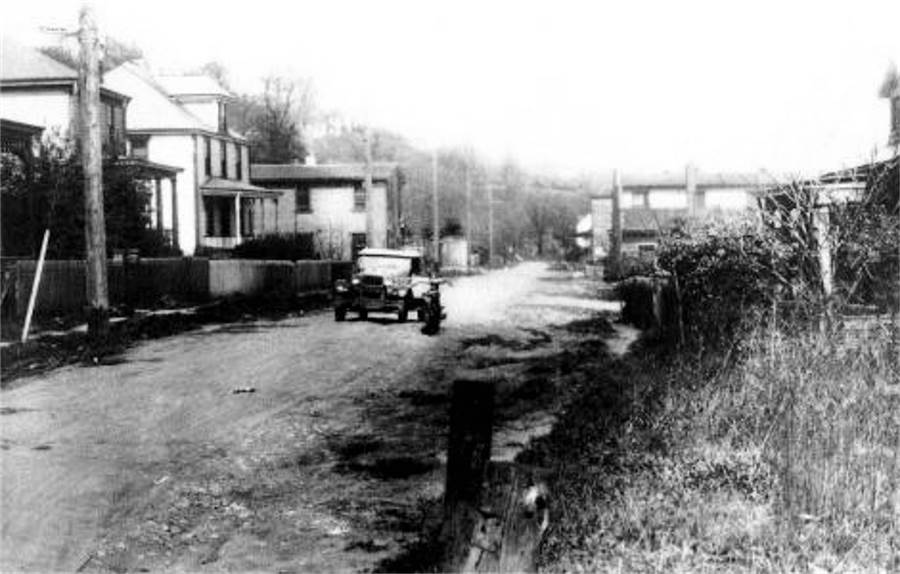
Reflectorville homes along Ensign Avenue
(left) and Second Avenue, shown in 1928.

The same Second Avenue homes, shown in 1929.
Some to the right that stood in the path of the highway were razed.
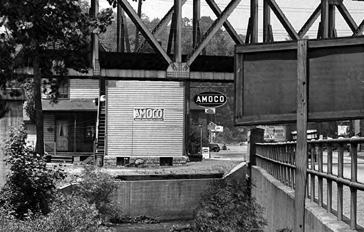
Looking under the Oak Viaduct (left photo)
and over the Charles Street (Colerain) bridge, in 1928, at the intersection of
Second Avenue and Oak Street in Reflectorville. This is the present-day junction
of Whited Street and Saw Mill Run
Boulevard. The right photo shows a home along Oak Street located
where the Jack Maggs Agency stands today.
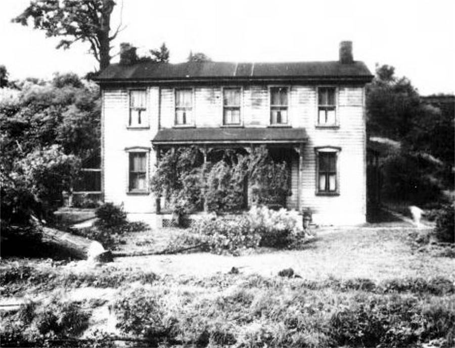
The Saw Mill Run Creek bridge and the
Oak Street home shown above, now a Brookline residence, in 1934.
 
Two photos from the late-1930s looking past
the Oak Viaduct into the former town of Reflectorville.
In 1930, all land shown to the left of Saw Mill Run Boulevard became part of
Brookline.
<><><><> <><><><>
<><><><> <><><><>
<><><><> <><><><>
1905 Reflectorville Plot Map

|


